


Why visit Woolpit
Townapedia lists 4 museums and landmarks, 4 parks and trails and 13 places to eat in and around town.
Highlights include Woolpit & District Museum, Black Bourn Valley and Norton Wood.
Weather in Woolpit
Forecast from MET Norway (CC BY 4.0). Full forecast
About Woolpit
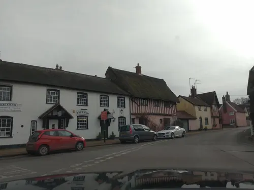
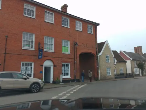
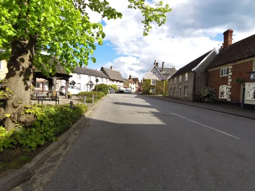
Woolpit is a village in the English county of Suffolk, midway between the towns of Bury St. Edmunds and Stowmarket. In 2011 Woolpit parish had a population of 1,995. It is notable for the 12th-century legend of the green children of Woolpit and for its parish church, which has especially fine medieval woodwork. Administratively Woolpit is a civil parish, part of the district of Mid Suffolk.
From the Wikipedia article Woolpit (this version), under CC BY-SA 4.0.
Museums and landmarks4

Parks, trails and playgrounds4

Black Bourn Valley
Park · 2.7 mi
Suffolk Wildlife Trust nature reserve



Restaurants and cafes13
Greggs
Fast food · Sandwich, Bakery · 0.6 mi
Mo-Fr 05:30-18:00; Sa 06:00-18:00; Su 07:00-17:00



1 more on the map.
Churches and places of worship7
Church of St Mary, Woolpit
Church
Church in Woolpit, Suffolk, England, UK


History
The village's name, first recorded in the 10th century as Wlpit and later as Wlfpeta, derives from the Old English wulf-pytt, meaning "pit for trapping wolves".
Before the Norman Conquest of England, the village belonged to Ulfcytel Snillingr. Between 1174 and 1180, Walter de Coutances, a confidant of King Henry II, was appointed to Woolpit. After his "death or retirement" it was to be granted to the monks of Bury St Edmunds Abbey. A bull of Pope Alexander III likewise confirms that revenues from Woolpit are to be given to the abbey.
In the 15th century and for some time afterwards, two fairs were held annually. The Horse Fair was held on two closes, or fields, on 16 September. The Cow Fair was held on its own field on 19 September; here toys, as well as cattle, were sold.
Sir Robert Gardiner, Lord Chief Justice of Ireland, was Lord of the Manor from 1597 to 1620. He founded an almshouse for the care of the poor women of Woolpit and nearby Elmswell. The Gardiner charity still exists. Woolpit passed at his death to his grandnephew, Gardiner Webb, who died in 1674.
From the 17th century, the area became an important manufacturing centre for "Suffolk White" bricks, but today only the pits remain.
Woolpit is in the hundred of Thedwestry, 8 miles (13 km) southeast of Bury. The area of the parish is 2,010 acres (8.1 km2); the population in 1831 was 880, less than half agricultural.
Read more of the history
Mill Lane marks the site of a post mill which was demolished in about 1924. Another mill, which fell down in 1963, stood in Windmill Avenue.
The village contains one pub, The Bull, two tea rooms, estate agents, a grocers, hairdressers, a fish and chip shop, Palmers Bakery, a dentist and Woolpit Interiors within the village and two industrial estates containing more larger businesses as well as a health surgery and school.
From the History section of Woolpit on Wikipedia, under CC BY-SA 4.0.
Shopping1
Gas and EV charging2
Schools, colleges and libraries3
Healthcare2
Map of Woolpit
36 places. The map loads OpenStreetMap tiles when you open it.
Getting there and nearby towns
RAF Honington (BEQ) is the nearest airport with scheduled flights listed in OpenStreetMap, 9 miles away.
- Stowmarket 5 mi southeast, about 8 min by car
- Bury St Edmunds 8 mi west, about 12 min by car
- Bildeston 8 mi south, about 13 min by car
- Sudbury 14 mi southwest, about 23 min by car
- Diss 14 mi northeast, about 23 min by car
- Thetford 15 mi northwest, about 23 min by car
- Scole 15 mi northeast, about 24 min by car
- Ipswich 16 mi southeast, about 26 min by car
- Mildenhall 18 mi northwest, about 29 min by car
- Kesgrave 19 mi southeast, about 30 min by car
Drive times are estimates from straight-line distance, not routes.
Towns near Woolpit


Keep exploring
Local news
Headlines from INDB.
Reviews, tips and questions
Loading what members have shared...
Sources and licences
- GeoNames (CC BY 4.0): population, coordinates, regions and time zone
- Mapillary (see each image): photos
- OpenStreetMap contributors (ODbL 1.0): places, airports, map data
- Wikidata (CC0 1.0): elevation, founding date, time zone, website, landmarks and historic places
- Wikimedia Commons (see each image): photos
- Wikipedia (CC BY-SA 4.0): overview and history text
Photo credits
- Black Bourn Valley 6, Dudley Miles, CC BY-SA 4.0
- Norton Wood 5, Dudley Miles, CC BY-SA 4.0
- Tostock - Church of St Andrew, Andrew Hill, CC BY-SA 2.0
- Street-level photo, laye, CC BY-SA 4.0
- Street-level photo, laye, CC BY-SA 4.0
- Street-level photo, laye, CC BY-SA 4.0
- Street-level photo, laye, CC BY-SA 4.0
- Street-level photo, smsm1, CC BY-SA 4.0
- Street-level photo, laye, CC BY-SA 4.0
- Street-level photo, IpswichEdits, CC BY-SA 4.0
- Street-level photo, laye, CC BY-SA 4.0
- Street-level photo, smsm1, CC BY-SA 4.0
- Street-level photo, IpswichEdits, CC BY-SA 4.0
- Street-level photo, laye, CC BY-SA 4.0
- Street-level photo, smsm1, CC BY-SA 4.0
- Street-level photo, laye, CC BY-SA 4.0
Page built November 10, 2026. Spotted a mistake? Tell us or suggest a place.