


Little Marlow, United Kingdom
Little Marlow is a town of 1,500 people in England, United Kingdom.
Why visit Little Marlow
Townapedia lists 6 museums and landmarks, 12 parks and trails, 35 places to eat, 3 places to stay and 9 attractions in and around town.
Highlights include Bourne End Railway Bridge, Cookham Bridge, Cliveden and Stanley Spencer Gallery.
Weather in Little Marlow
Forecast from MET Norway (CC BY 4.0). Full forecast
About Little Marlow
Little Marlow is a village and civil parish in Buckinghamshire, England.
From the Wikipedia article Little Marlow (this version), under CC BY-SA 4.0.
Photos of Little Marlow


Things to do9


Marlow Bridge
Bridge · 1.8 mi
Bridge over the River Thames in England


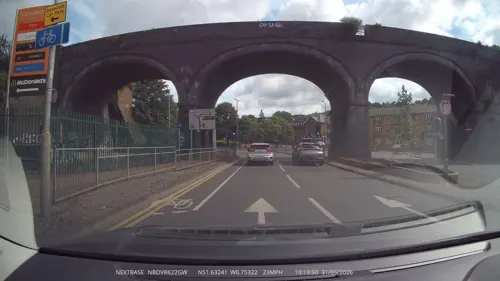
The Tower
Cinema and theater · 3.4 mi
Former school, swimming pool, skating rink, theatre, now office building, with a clock tower, in High Wycombe, England

Wycombe Swan
Cinema and theater · 3.1 mi
Theatre in High Wycombe, England

Museums and landmarks6

Cliveden
Museum · 2.9 mi
Country house in Taplow, Buckinghamshire, England, UK

Stanley Spencer Gallery
Museum · 2.2 mi
Art museum in Cookham, Berkshire, United Kingdom

Cookham Abbey
Monument and historic site · 2.1 mi
Abbey in Berkshire, England, UK

Living Chair Museum
Museum · 3.4 mi
Furniture museum in High Wycombe, England
Wycombe Museum
Museum · 3.3 mi
Museum in High Wycombe, Buckinghamshire, United Kingdom
Parks, trails and playgrounds12


Chairborough Road
Park · 3.2 mi
Local nature reserve in Buckinghamshire, England

Holtspur Bank
Park · 3.1 mi
Local nature reserve in Buckinghamshire, England

Park Wood and Goulding's Wood
Park · 2.9 mi
Protected area in Berkshire, England

Warren Nature Reserve
Park · 2.4 mi
Local nature reserve in Buckinghamshire, England





Restaurants and cafes35
KEG
Bar and pub · 1.2 mi
12 Oakfield Road, Bourne End
Mo off; Tu-We 12:00-21:00; Th-Fr 12:00-22:00; Sa 12:00-23:00; Su...
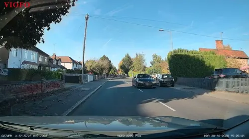
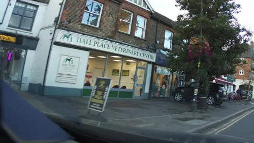
Lee's Bakery
Bakery · 1.2 mi
55 The Parade, Bourne End
Mo-Fr 06:45-15:00; Sa 06:45-14:30
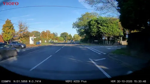

Coopers Roastery & Coffee Bar
Cafe · Coffee Shop, Coffee, Cake, Brunch, Lunch · 1.2 mi
Fieldhouse Lane, Marlow
Mo-Su 09:00-16:00



23 more on the map.
History
The Church of England parish church of Saint John the Baptist lies at the heart of the village, not far from the river and next to the Manor House. The original construction of the church is Norman, dating from the final years of the 12th century. Construction continued during the 14th, 15th, and early 16th centuries.
Little Marlow was once the site of Little Marlow Priory, a Benedictine priory dedicated to the Blessed Virgin Mary. In 1536 during the Dissolution of the Monasteries, it was transferred to Bisham Abbey, which was, in turn, dissolved in 1538. The priory’s conventual hall stood until 1740 when it was demolished.
Today the village is in a scenic location on the River Thames, although home to a large sewage works, with exceptional birdwatching habitats on the lakes created from former gravel extraction sites.
There are two public houses in the village: the Kings Head and the Queens Head.
From the History section of Little Marlow on Wikipedia, under CC BY-SA 4.0.
More about Little Marlow
Geography
Little Marlow is located along the north bank of the River Thames, about a mile east of Marlow and is surrounded by Little Marlow Lakes Country Park.
The toponym "Marlow" is derived from the Old English for "land remaining after the draining of a pool".
Hamlets in the parish of Little Marlow include Coldmoorholme, Fern, Handy Cross, Sheepridge, and Winchbottom.
The village cottages are set around a large space, surrounded by lime trees, that is used as a cricket ground and village green where an annual fête is held.
Arts and culture
Little Marlow appears briefly in Mary Shelley's 1826 science fiction novel The Last Man, in a sequence where the novel's protagonist recounts how the village's residents went about trying to prevent themselves from falling ill with the plague.
In 2021, Little Marlow was used as a temporary filming location for the Star Wars series Andor.
From the Wikipedia article Little Marlow, under CC BY-SA 4.0.
Notable people from Little Marlow
- John BarberBritish racing driver
- William Henry MiltonEnglish-South African rugby union footballer and cricketer (1854-1930)
Born in Little Marlow, according to Wikidata (CC0). Each name links to its Wikipedia article.
Where to stay3
Churches and places of worship6
Shopping3
Gas and EV charging4
Schools, colleges and libraries8
Healthcare3
Map of Little Marlow
89 places. The map loads OpenStreetMap tiles when you open it.
Getting there and nearby towns
Wycombe Air Park (HYC) is the nearest airport with scheduled flights listed in OpenStreetMap, 3 miles away.
- Marlow 2 mi southwest, about 3 min by car
- High Wycombe 3 mi north, about 5 min by car
- Maidenhead 4 mi south, about 7 min by car
- Beaconsfield 4 mi northeast, about 7 min by car
- Burnham 5 mi southeast, about 7 min by car
- Slough 8 mi southeast, about 13 min by car
- Amersham 8 mi northeast, about 13 min by car
- Gerrards Cross 8 mi east, about 13 min by car
- Henley-on-Thames 8 mi southwest, about 12 min by car
- Chalfont Saint Peter 8 mi east, about 13 min by car
Drive times are estimates from straight-line distance, not routes.
Towns near Little Marlow


Keep exploring
Local news
Headlines from INDB.
Reviews, tips and questions
Loading what members have shared...
Sources and licences
- GeoNames (CC BY 4.0): population, coordinates, regions and time zone
- Mapillary (see each image): photos
- OpenStreetMap contributors (ODbL 1.0): places, airports, map data
- Wikidata (CC0 1.0): elevation, founding date, time zone, website, landmarks and historic places
- Wikimedia Commons (see each image): photos
- Wikipedia (CC BY-SA 4.0): overview and history text
Photo credits
- Wooburn Green-Little Marlow 029 Queens Head, Little Marlow (10290307884), Peter O'Connor aka anemoneprojectors, CC BY-SA 2.0
- The Queens Head, Little Marlow-4631468380, Roger Nolan, CC BY-SA 2.0
- Church of St John the Baptist, Little Marlow, Buckinghamshire-10290411576, AnemoneProjectors ( talk ) ( Flickr ), CC BY-SA 2.0
- Church of St John the Baptist, Little Marlow, Buckinghamshire-10290313644, AnemoneProjectors ( talk ) ( Flickr ), CC BY-SA 2.0
- Manor Farmhouse, Little Marlow, Buckinghamshire-10310798496, AnemoneProjectors ( talk ) ( Flickr ), CC BY-SA 2.0
- Wooburn Green-Little Marlow 035 Church of St John the Baptist, Little Marlow, AnemoneProjectors ( talk ) ( Flickr ), CC BY-SA 2.0
- Church of St John the Baptist, Little Marlow, Buckinghamshire-10310770605, AnemoneProjectors ( talk ) ( Flickr ), CC BY-SA 2.0
- Wooburn Green-Little Marlow 026 Kings Head, Little Marlow (10290305734), Peter O'Connor aka anemoneprojectors, CC BY-SA 2.0
- Wooburn Green-Little Marlow 025 Home Barn, Little Marlow (10267892293), Peter O'Connor aka anemoneprojectors, CC BY-SA 2.0
- Bourne End Railway and Foot Bridge, Nancy, CC BY-SA 4.0
- CookhamBridge01, Motmit, CC BY-SA 3.0
- Uk-marlow-bridge, Chris j wood, CC BY-SA 4.0
- Marlow Bypass Bridge, Nancy, CC BY-SA 4.0
- TempleFootbridge01, Motmit, CC BY-SA 3.0
- Cliveden-2382, Antony McCallum. The original uploader was Wyrdlight at English Wikipedia ., CC BY 3.0
- Stanley Spencer Gallery, Cookham, Lagosman, CC BY-SA 3.0
- Bluebells (34146232732), Timo Newton-Syms from Helsinki, Finland & Maidenhead, Berkshire, UK, CC BY-SA 2.0
- Holtspur Bank 4, Dudley Miles, CC BY-SA 4.0
- Bisham Woods (40502128695), Timo Newton-Syms from Helsinki, Finland & Maidenhead, Berkshire, UK, CC BY-SA 2.0
- Gateway building, Buckinghamshire New University, High Wycombe, Buckinghamshire - July 2026 - 01, Mertbiol, CC0
- Chairborough Road 9, Dudley Miles, CC BY-SA 4.0
- Warren Nature Reserve 3, Dudley Miles, CC BY-SA 4.0
- Rolls Royce 20 25, Lordruss1969, CC BY-SA 4.0
- Street-level photo, laye, CC BY-SA 4.0
- Street-level photo, RyanBush, CC BY-SA 4.0
- Street-level photo, southglos, CC BY-SA 4.0
- Street-level photo, southglos, CC BY-SA 4.0
- Street-level photo, RyanBush, CC BY-SA 4.0
- Street-level photo, swinetown, CC BY-SA 4.0
- Street-level photo, RyanBush, CC BY-SA 4.0
- Street-level photo, RyanBush, CC BY-SA 4.0
- Street-level photo, RyanBush, CC BY-SA 4.0
- Street-level photo, RyanBush, CC BY-SA 4.0
- Street-level photo, southglos, CC BY-SA 4.0
- Street-level photo, southglos, CC BY-SA 4.0
- Street-level photo, southglos, CC BY-SA 4.0
- Street-level photo, RyanBush, CC BY-SA 4.0
- Street-level photo, RyanBush, CC BY-SA 4.0
- Street-level photo, RyanBush, CC BY-SA 4.0
- Street-level photo, RyanBush, CC BY-SA 4.0
- Street-level photo, laye, CC BY-SA 4.0
- Street-level photo, southglos, CC BY-SA 4.0


Page built November 10, 2026. Spotted a mistake? Tell us or suggest a place.