

Why visit Modbury
Townapedia lists 2 museums and landmarks, 1 park or trail, 4 places to eat and 1 place to stay in and around town.
Highlights include Andrew's Wood.
Weather in Modbury
Forecast from MET Norway (CC BY 4.0). Full forecast
About Modbury
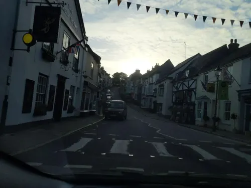
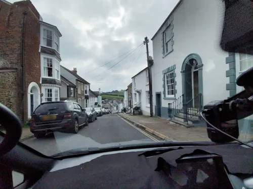
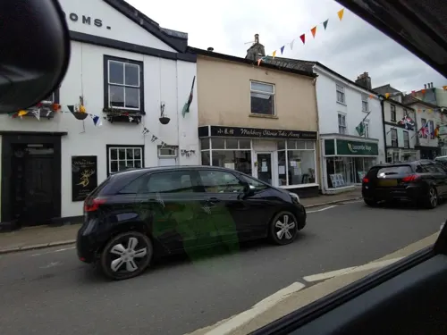
Modbury is a Town, ecclesiastical parish, civil parish and former manor in the South Hams district of the county of Devon in England."market town", as from at least 1199 the lord of the manor has held the right to hold a regular market. The town is situated on the A379 road, which links it to Plymouth and Kingsbridge. The current parish population is approximately 1,500.
From the Wikipedia article Modbury (this version), under CC BY-SA 4.0.
Museums and landmarks2

Parks, trails and playgrounds1

Restaurants and cafes4
Lazy Cow Cafe
Cafe · Coffee Shop
4 Chene Court, Modbury
Mo-Sa 09:00-05:00


Where to stay1
History
Modbury is recorded in the Domesday Book of 1086. It has had permission to hold a weekly fair since before 1199. The population of the town was greatly reduced as a consequence of the Black Death in the 14th century.
Modbury was the site of two battles in the English Civil War. The first battle was a surprise attack by a mounted Parliamentarian force led by Sir William Ruthven that moved under cover of darkness from Plymouth via Ivybridge on 7 December 1642. In the early morning charge they routed a mostly untrained Royalist force that had gathered in the town, where Sir Ralph Hopton, the King's senior commander in the West Country, was holding council at the manor house of Champernowne Court. The house was badly damaged by fire, Hopton escaped but many notable Devon Royalists were captured.
The second Battle of Modbury occurred on 22 February 1643 when the Royalists forces, expecting an attack by Parliamentarian forces assembled at nearby Kingsbridge, had fortified the town. Outnumbered approximately four to one, and running short of ammunition, the royalists retreated. This victory was largely instrumental in the lifting of the Siege of Plymouth, and the driving of the encircling Royalist forces into Cornwall.
Read more of the history
By 1801, the population of Modbury had risen to 1,813, with almost half engaged in the wool trade. The impact of the mechanisation of the wool industry had a dramatic effect on the economic prosperity and population of the town from the mid-1820s. Many workers left the town and headed to large cities in search of employment, while others left the country altogether, emigrating to America.
The railway line bypassed Modbury, contributing still further to this decline. Modbury remained an important market town until as late as 1944 when the cattle market ceased.
From the History section of Modbury on Wikipedia, under CC BY-SA 4.0.
Notable people from Modbury
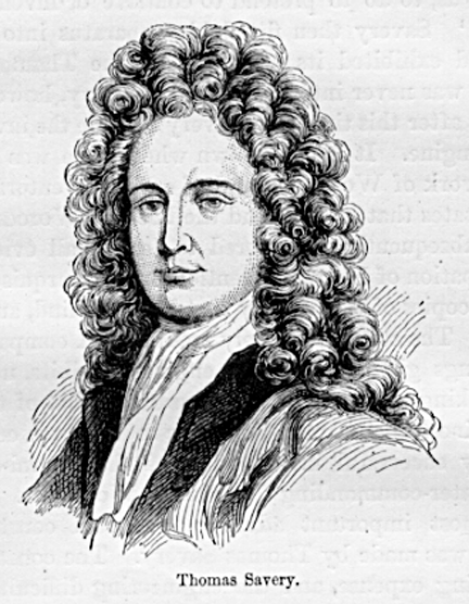 Thomas SaveryEnglish inventor and engineerPhoto: Unknown author Unknown author, Public domain
 William BattieBritish physicianPhoto: Unknown author, CC BY 4.0
- Paul WyattEnglish footballer (born 1989)
Born in Modbury, according to Wikidata (CC0). Each name links to its Wikipedia article.
Churches and places of worship4
Shopping2
Schools, colleges and libraries3
Healthcare1
Map of Modbury
18 places. The map loads OpenStreetMap tiles when you open it.
Getting there and nearby towns
Exeter Airport (EXT) is the nearest airport with scheduled flights listed in OpenStreetMap, 34 miles away.
- Ivybridge 3 mi northwest, about 5 min by car
- Yealmpton 5 mi west, about 8 min by car
- Newton Ferrers 7 mi west, about 11 min by car
- Plymstock 9 mi west, about 14 min by car
- Wembury 9 mi west, about 14 min by car
- Plymouth 11 mi west, about 18 min by car
- Stoke Gabriel 12 mi east, about 20 min by car
- Paignton 15 mi northeast, about 25 min by car
- Saltash 15 mi west, about 25 min by car
- Torquay 18 mi northeast, about 29 min by car
Drive times are estimates from straight-line distance, not routes.
Towns near Modbury


Keep exploring
Local news
Headlines from INDB.
Reviews, tips and questions
Loading what members have shared...
Sources and licences
- GeoNames (CC BY 4.0): population, coordinates, regions and time zone
- Mapillary (see each image): photos
- OpenStreetMap contributors (ODbL 1.0): places, airports, map data
- Wikidata (CC0 1.0): elevation, founding date, time zone, website, landmarks and historic places
- Wikimedia Commons (see each image): photos
- Wikipedia (CC BY-SA 4.0): overview and history text
Photo credits
- Ermington Church from SE, BrianAnalogue, CC BY-SA 3.0
- Street-level photo, WaggyDog, CC BY-SA 4.0
- Street-level photo, WaggyDog, CC BY-SA 4.0
- Street-level photo, WaggyDog, CC BY-SA 4.0
- Street-level photo, WaggyDog, CC BY-SA 4.0
- Street-level photo, WaggyDog, CC BY-SA 4.0
Page built November 10, 2026. Spotted a mistake? Tell us or suggest a place.