


Why visit Saltash
Townapedia lists 7 museums and landmarks, 9 parks and trails, 29 places to eat, 1 place to stay and 5 attractions in and around town.
Highlights include Royal Albert Bridge, Tamar Bridge, Saltash Heritage Museum and Antony House.
Weather in Saltash
Forecast from MET Norway (CC BY 4.0). Full forecast
About Saltash
Saltash (Cornish: Essa [ˈɛsːə] ) is a town and civil parish in eastern Cornwall, England. Saltash faces the city of Plymouth over the River Tamar and is popularly known as "the Gateway to Cornwall". Saltash's landmarks include the Tamar Bridge which connects Plymouth to Cornwall by road, and the Royal Albert Bridge. At the 2021 census the population of the parish was 16,288 and the population of the built up area was 15,435.
From the Wikipedia article Saltash (this version), under CC BY-SA 4.0.
Travel tips from other travellers: Saltash on Wikivoyage (CC BY-SA 4.0).
Things to do5

Royal Albert Bridge
Bridge · 1.0 mi
Railway bridge spanning the River Tamar in England


Tavy Bridge
Bridge · 2.4 mi
Truss bridge in Bickleigh, South Hams, Devon, England, UK


Museums and landmarks7

Saltash Heritage Museum
Museum · 0.7 mi
17 Lower Fore Street, Saltash
Apr-Nov We 14:00-16:00, Sa 10:00-16:00; Jul-Sep We 14:00-16:00, Fr...

Antony House
Museum · 3.0 mi
Grade I listed historic house museum in Cornwall, England, UK

Parks, trails and playgrounds9


Restaurants and cafes29
Everest Kitchen
Restaurant · Indian · 0.7 mi
37,39 Lower Fore Street, Saltash
Tu-Su 17:00-23:00
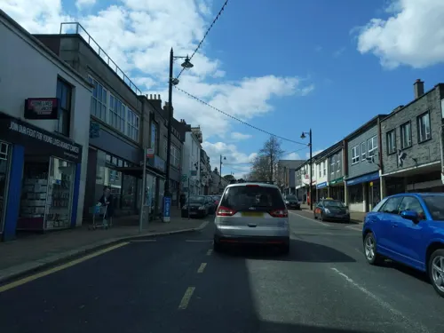
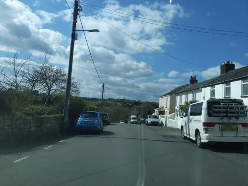
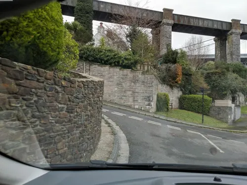
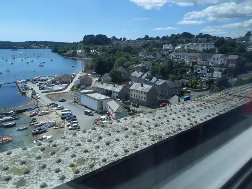



17 more on the map.
History
The Charter of Incorporation refers to the place as 'Essa' (Latin for 'Ash'). However, the spelling of the town has changed over the years. For example, in Edward the Confessor's time, it was called and spelt 'Aysche'. In the 1584 Charter, it is stated that Essa is now commonly called Saltash. A family called Essa lived in the twelfth century at their property near Ashtor Rock, where the Manor Courts were once held. The 'Salt' part of the name was added to distinguish it from other places called Ash.
Roger de Valletort sold out in 1270 to Richard, Earl of Cornwall and King of the Romans while Edward, the Black Prince, became the first Duke of Cornwall, and a visitor to Trematon Castle.
In 1549 there was a Cornish insurrection against the introduction of the Protestant liturgy, and the rebels under Humphrey Arundell, for which he was beheaded at Tyburn, gained possession of Trematon Castle by treachery, capturing Sir Richard Grenville, the elder, in the process. They then carried out acts of barbarity on their surprised visitors.
Read more of the history
The arms of Saltash are Az. the base water proper in pale an escutcheon Or thereon a lion rampant Gu. within a bordure Sa. bezantee ensigned with a prince's coronet of the third on either side of the escutcheon an ostrich feather Arg. labelled Or. There are seals of Saltash: A three-masted ship with sails furled at anchor; and An escutcheon charges with a lion rampant within a bordure bezantee resting upon water surmounted by a coronet composed on crosses patee and fleurs-de-lis and either side an ostrich feather; with the legends "Sigillum aquate Saltash" and "Sigillum Saltashe" respectively. Saltash Guildhall was built around 1780 and extended and restored in 1925.
The history of Saltash is linked to the passage, or ferrying place across the Tamar. The original ferry became established by fishermen for those passing to and from the monastery at St Germans and to Trematon Castle.
After the Norman Conquest, Robert, Count of Mortain, who held the castle and manor at Trematon, took the market from the canons at St. Germans and established it at Saltash. The Count granted Trematon and other manors to the de Valletorts, who had then to provide for the ferry boat. Around the start of the 13th century, Saltash was made a borough; at that time it was the only seaport between Dartmouth and Fowey to be a borough. This fact has given rise to the Saltash saying, Saltash was a borough town, when Plymouth was a fuzzy down ('fuzzy' = 'fursy' i.e. covered in gorse), as the town of Plymouth and its seaport did not exist in 1190. In medieval times the ferry was part of the manor of Trematon, held by the Valletorts.
The Antony Passage Ferry, which is mentioned in documents as early as 1324, was situated within the St Stephens suburb of Saltash civil parish.
The ferry belonged to the Daunay family in the 14th Century, in 1450 it passed to the Carew family, and by the end of the 18th century it was taken over by the Crosley family, who operated the ferry for several generations until it fell into disuse in the early 1950s. The route linked Jupiter Point (part of the Antony Estate), Antony Passage and Passage Point (both part of Saltash).
Officially the Antony Passage Ferry is still in existence since, as a public ferry, an Act of Parliament would be necessary to terminate it, and it still appears on Ordnance Survey maps.
The parish church of Saltash was, until 1881, St Stephen's by Saltash, one mile from the town. Though of earlier foundation, the structure of the building is largely the 15th century: there are two aisles and the tower is west of the north aisle. The font is Norman.
This church was probably founded in Norman times by the lords of Trematon Castle. Like the castle it belonged later to the Earls and Dukes of Cornwall; in 1351 King Edward III appropriated it to the Deanery of Windsor so that the benefice became a vicarage. In medieval times there was a chapel at Saltash and private chapels at Shillingham ((1318), Trehan ((1332), Earth (1413) and Trevalward (1395). The chapel at Saltash was dedicated to Saint Nicholas and Saint Faith and became the parish church of the town in 1881.
St. Nicholas & St. Faith's Church has an unbuttressed tower adjoining the former north transept which remains from the original Norman church. The blocked south door is Norman, as is; most of the masonry of the chancel, the nave, the south transept, and the west wall. A north chancel chapel was added in the 14th century. In the 15th century, a north aisle was added to the nave; the wagon roofs of the north aisle and the nave are of the same date. The font is probably Norman and is of an unusual vague shape. There is a monument to three naval officers, John and James Drew, and J. W. Drew, who were drowned in 1798 and 1799.
From the History section of Saltash on Wikipedia, under CC BY-SA 4.0.
More about Saltash
Education
Primary schools in Saltash include Burraton CP School, Bishop Cornish (V.A) Primary School, Brunel School (previously Longstone Infant School and Saltash Junior School) and St Stephens School.
The secondary school in Saltash was designated as a Science and Mathematics & Computing Specialist College in September 2004, and renamed Saltash.net community school. The school is now known as Saltash Community School. Saltash.net sought out links with Microsoft under the headship of Isobel Bryce and during her tenure, the school was rated as ‘good’ by OFTSED. In recent years, there has been a decline in the progress outcomes achieved by students at the school and, partially linked to this, OFSTED have judged the school to be ‘requires improvement. Whilst the school was rated as ‘requires improvement’ in 2019 and has recently (2022) been given the same rating, there is a new framework in place which is more challenging than that under which the school was previously judged. There is evidence within the report that school is moving in the right direction.
The former Cornwall College Campus is now Fountain Head House School.
From the Wikipedia article Saltash, under CC BY-SA 4.0.
Notable people from Saltash
 Moura LympanyBritish musician (1916–2005)Photo: Allan warren, CC BY-SA 3.0
 William Ponsonby, 2nd Earl of Bessboroughpolitician in Britain and Ireland (1704-1793)Photo: Unknown author, Public domain
 Richard Darton ThomasBritish Royal Navy admiral (1777-1857)Photo: Unidentified painter, Public domain
 Ann GlanvilleBritish rowerPhoto: Peter Holmes, CC BY-SA 2.0
 Steve FieldEnglish sculptorPhoto: Dudley Council from England, CC BY 2.0
- Royce PierresonBritish theater and film actor
- Ryan DicksonFootballer (born 1986)
- Evan NepeanBritish Naval officer and administrator
- Percy LegardBritish Army officer and sportsman (1906–1980)
- John BrimacombeEnglish footballer (born 1958)
- Lancelot Stephen Bosanquetmathematician
- Mike ReevesEnglish footballer (born 1943)
Born in Saltash, according to Wikidata (CC0). Each name links to its Wikipedia article.
Where to stay1
Churches and places of worship13
St Stephen's Church
Church · Anglican · 0.5 mi
St Stephens Road, Saltash
St Nicholas & St Faith
Church · Anglican · 0.7 mi
Station Road, Saltash
Our Lady of the Angels Catholic Church
Church · Roman Catholic
Bishops Close, Saltash
Shopping5
Gas and EV charging2
Schools, colleges and libraries8
Healthcare5
Map of Saltash
84 places. The map loads OpenStreetMap tiles when you open it.
Getting there and nearby towns
Cornwall Airport Newquay (NQY) is the nearest airport with scheduled flights listed in OpenStreetMap, 34 miles away.
- Torpoint 3 mi southeast, about 4 min by car
- Landrake 3 mi west, about 5 min by car
- Plymouth 4 mi southeast, about 7 min by car
- Lower Tregantle 4 mi southwest, about 6 min by car
- Tavistock 10 mi north, about 17 min by car
- Teignmouth 33 mi east, about 54 min by car
- Exeter 38 mi northeast, about 1 h by car
- Truro 38 mi west, about 1 h by car
- Tiverton 47 mi northeast, about 1 h 15 min by car
- Sidmouth 47 mi northeast, about 1 h 15 min by car
Drive times are estimates from straight-line distance, not routes.
Towns near Saltash


Keep exploring
Local news
Headlines from INDB.
Reviews, tips and questions
Loading what members have shared...
Sources and licences
- GeoNames (CC BY 4.0): population, coordinates, regions and time zone
- Mapillary (see each image): photos
- OpenStreetMap contributors (ODbL 1.0): places, airports, map data
- Wikidata (CC0 1.0): elevation, founding date, time zone, website, landmarks and historic places
- Wikimedia Commons (see each image): photos
- Wikipedia (CC BY-SA 4.0): overview and history text
Photo credits
- Rusty railings at Saltash Football Club, Cornwall, Kevin Hale, CC BY-SA 2.0
- Callington Road, Saltash, Cornwall - January 2024, Mutney, CC0
- Saltash Library, Cornwall - September 2022 (4), Mutney, CC BY-SA 4.0
- Saltash Library, Cornwall - September 2022 (3), Mutney, CC BY-SA 4.0
- Royal Albert Bridge 2009, Geof Sheppard, CC BY-SA 4.0
- Tamar Bridge from train, David McCormick, CC BY-SA 3.0
- Antony House 03, Brian, CC BY-SA 2.0
- St Boniface's Church, St Budeaux, Devon, Unknown author Unknown author, Public domain
- St Philip's Church, Weston Mill, Plymouth, Ashley Smith, CC BY-SA 4.0
- Saltash Ferry mural, Saltash Heritage Museum, Cornwall - January 2024, Mutney, CC0
- Street-level photo, WaggyDog, CC BY-SA 4.0
- Street-level photo, WaggyDog, CC BY-SA 4.0
- Street-level photo, WaggyDog, CC BY-SA 4.0
- Street-level photo, WaggyDog, CC BY-SA 4.0
- Street-level photo, WaggyDog, CC BY-SA 4.0
- Street-level photo, WaggyDog, CC BY-SA 4.0
- Street-level photo, WaggyDog, CC BY-SA 4.0
- Street-level photo, WaggyDog, CC BY-SA 4.0
- Street-level photo, WaggyDog, CC BY-SA 4.0
- Street-level photo, WaggyDog, CC BY-SA 4.0
- Street-level photo, WaggyDog, CC BY-SA 4.0
- Street-level photo, WaggyDog, CC BY-SA 4.0
- Street-level photo, WaggyDog, CC BY-SA 4.0
- Street-level photo, WaggyDog, CC BY-SA 4.0
- Street-level photo, WaggyDog, CC BY-SA 4.0
- Street-level photo, WaggyDog, CC BY-SA 4.0
- Street-level photo, miguel_andrade, CC BY-SA 4.0
- Street-level photo, WaggyDog, CC BY-SA 4.0
- Street-level photo, WaggyDog, CC BY-SA 4.0
- Street-level photo, WaggyDog, CC BY-SA 4.0


Page built November 10, 2026. Spotted a mistake? Tell us or suggest a place.