


Why visit Sandown
Townapedia lists 13 museums and landmarks, 25 parks and trails, 93 places to eat, 91 places to stay and 2 attractions in and around town.
Highlights include The Wildheart Animal Sanctuary, Shanklin Theatre, Brading Roman Villa and Dinosaur Isle.
Weather in Sandown
Forecast from MET Norway (CC BY 4.0). Full forecast
About Sandown
Sandown is a seaside resort town and civil parish on the south-east coast of the Isle of Wight, England. The neighbouring resort of Shanklin and the settlement of Lake are sited just to the south of the town. At the 2021 census, the parish had a population of 7,129, while the wider Sandown built-up area had a population of 11,655. Sandown is the northernmost town on Sandown Bay, with its easily accessible, sandy beaches running continuously from the cliffs below Battery Gardens in the south to Yaverland in the north.
From the Wikipedia article Sandown (this version), under CC BY-SA 4.0.
Photos of Sandown


Things to do2

The Wildheart Animal Sanctuary
Zoo and aquarium · 1.2 mi
Zoo on the Isle of Wight, UK
Yaverland Road, Sandown
Mo-Su 10:00-17:00

Shanklin Theatre
Cinema and theater · 1.8 mi
Theatre and former town hall in Shanklin, Isle of Wight, England, UK
Museums and landmarks13

Brading Roman Villa
Monument and historic site · 1.5 mi
Roman rural estate at Brading, United Kingdom
Morton Old Road, Sandown
Mo-Su 10:00-17:00

Dinosaur Isle
Museum · 1.0 mi
Dinosaur museum on the Isle of Wight
Culver Parade, Sandown
Tu-Sa 10:00-16:00


Nunwell House
Museum · 2.2 mi
Country house in Brading, Isle of Wight, England, UK



Rylstone Manor
Museum · 1.9 mi
Country house hotel in Shanklin, Isle of Wight, England, UK

Wight Water
Monument and historic site · 0.6 mi
1 more on the map.
Parks, trails and playgrounds25


Brading Marshes RSPB reserve
Park · 2.1 mi
RSPB nature reserve on the Isle of Wight





13 more on the map.
Restaurants and cafes93
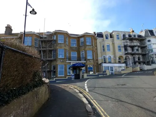
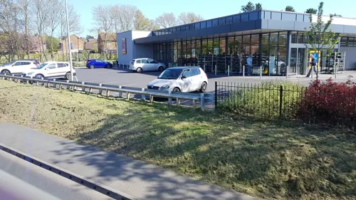
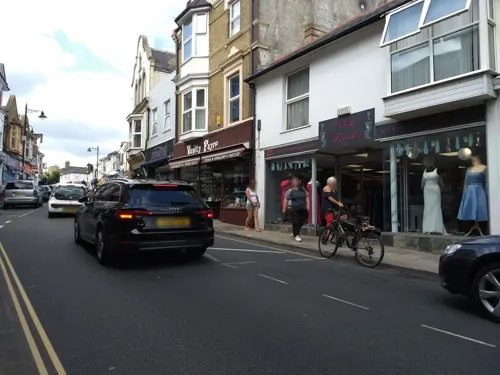
Mumbai Bites
Restaurant · Indian
12B High Street, Sandown
We,Th,Su,Mo 17:00-22:00; Tu,Fr,Sa 17:00-23:00
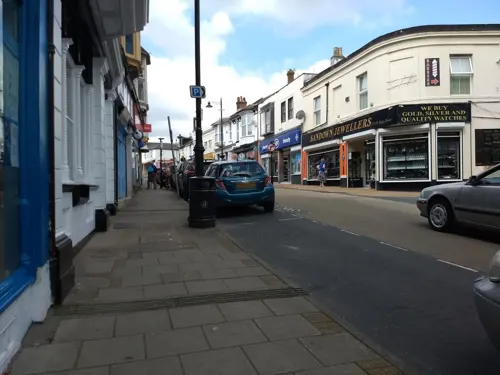
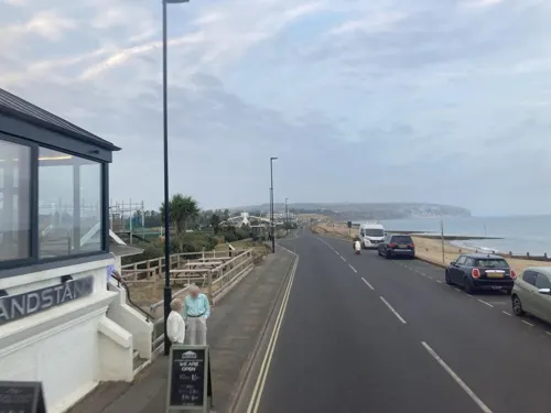

81 more on the map.
History
There is some evidence for a pre-Roman settlement in the area. During the Roman period, it was a site of salt production.
The name Sandown derives from the Old English sandhām meaning 'sandy village' or possibly from sandhamm meaning 'sandy hemmed-in land'.
During the medieval times, Sandown was known as Northsandham ('north Sandown'), with the village of Lake being known as Southsandham ('south Sandown').
Before the 19th century, Sandown was on the map chiefly for its military significance, with the Bay's beaches feared to offer easy landing spots for invaders from the Continent.
It is the site of the lost Sandown Castle. While undergoing construction in 1545, the fortification was attacked during the French invasion of the Isle of Wight when invaders fought their way over Culver Down from Whitecliff Bay before being repelled. The castle was built into the sea, prone to erosion and demolished fewer than a hundred years after it was built. In 1631, the castle was replaced by Sandham Fort, built further inland. In 1781, the fort's complement consisted of a master gunner and over twenty soldiers. Sandham Fort was demolished in the second half of the 19th century and is now the site of Sandham Gardens.
Read more of the history
In the 1860s, five Palmerston Forts were built along the coast of Sandown Bay, including Granite Fort at Yaverland, now the Wildheart Animal Sanctuary. On the town's western cliffs Sandown Barrack Battery survives as a scheduled monument and Bembridge Fort, where the National Trust offers tours, can be seen on the downs to the north-east.
One of the first non-military buildings was Sandham Cottage or 'Villakin', a holiday home leased by the radical politician and one-time Mayor of London John Wilkes in the final years of the 18th century. See 'Sandown's famous connections' below.
The arrival of the railway in 1864 saw Sandown grow as a Victorian resort, with the town's safe bathing becoming increasingly popular. In the summer of 1874, the Crown Prince Frederick and Princess Victoria of Germany, their children and entourage rented several properties in the town and took regular dips in the Bay. Sandown's pier was built in the same decade, opening in May 1878, and extended in length in 1895.
The town laid further claim to becoming a fashionable English resort when the Ocean Hotel opened in 1899. The brainchild of West End theatrical impresario Henry Lowenfeld, the Ocean built around the town's previous hotel of choice, the King's Head. For the new hotel's inauguration, a large number of dignitaries were invited from London, arriving in Sandown from Portsmouth by special boat. Guests had the chance to explore Sandown in coaches and carriages, and the hotel servants were all dressed in uniforms 'like admirals and post-captains'.
In 1894 Sandown became an urban district, the district contained only the parish of Sandown. On 1 April 1933 the district and parish were abolished to form Sandown-Shanklin. In 1974 "Sandown-Shanklin" became an unparished area in South Wight district. On 1 April 1984 Sandown became a parish again. In 1995 it became part of the Isle of Wight unitary authority area.
During 1939 and 1940, in World War II, Dorothy O'Grady was an enemy spy in Sandown. She moved from London to the Isle of Wight with her husband, a former sailor and fireman, around 20 years older than her, in the mid-1930s and lived in Lake for a time before moving to Osborne Villa on The Broadway the main road through Sandown. When the Luftwaffe began to bomb London, her husband returned as a fireman. While he was still in work, Dorothy, who remained in Sandown, was arrested in August 1939. There were suggestions that her husband did not know what she allegedly did, as she refused to see him during her arrest. She was often sighted taking her Golden Retriever for walks in areas with no public access, which aroused suspicions. She was summoned to the County Bench at Ryde. When she did not come, a warrant for her arrest was issued. She was found with a false name in the West Wight (Back of the Wight), arrested and taken to Yarmouth Police Station. She told officers "I was too scared to attend", and was again summoned to Ryde on 15 October of the same year. She was committed for trial at Hampshire Assizes. The 2 day trail was held at Winchester from 16 to 17 December before Mr Justice Macnaghten, when Mrs O'Grady, defended by Mr J Scott-Henderson, pleaded not guilty to all 9 charges, all around the subject of sabotaging the British forces. It took around 1 hour for the judge to reach his verdict: she was found guilty of all 9 counts and treachery. She was sentenced to be hanged. A few days after Christmas, national newspapers reported her application to appeal. On Monday 10 February 1941, it was held at the Central Criminal Court in London. Her husband said he was "shocked and appalled" with her charges. The appeal was successful. Instead of being hanged, she would spend 14 years in prison. She served her sentence fully at the HM Prison Holloway, returning to the Island and Osborne Villa in 1955. On the day of her return, she was interviewed by Ted Findon for the Daily Express.
Another spy, Rose Murphy, was arrested for sending morse code messages to German planes from Sandown.
Sandown's destiny in the 20th century was to become a favourite bucket-and-spade destination for all classes. The Canoe Lake was opened in 1929 by the author Henry De Vere Stacpoole followed in 1932 by Brown's Golf Course. The Art Deco Grand Hotel, opened next door to Brown's in April 1938, is now closed with planning permission for demolition granted in 2014.
Today, Sandown's esplanade has a mixture of former Victorian and Edwardian hotels with modern counterparts overlooking the beach and the Bay. A new Premier Inn opened in 2021.
The original Sandown Pier was opened in 1878 and extended to its present length in 1895. The Pier Pavilion Theatre closed in the 1990s and the pier's former landing stage is used for sea fishing today.
From the History section of Sandown on Wikipedia, under CC BY-SA 4.0.
More about Sandown
Geography
The town is surrounded by natural features that form part of the Isle of Wight Biosphere Reserve designated by UNESCO's Man and the Biosphere Programme in June 2019. The area features walks along the Isle of Wight Coastal Path.
The bay that gives Sandown its name is an example of a concordant coastline, with 5 miles (8 km) of tidal beaches from Luccombe to Culver replenished by longshore drift. Sandown Bay has one of the longest unbroken beaches in the British Isles.
To the north-east is Culver Down, mostly owned and managed by the National Trust. It supports typical chalk downland wildlife, and seabirds and birds of prey which nest on the cliffs.
Nearby is the flood plain of the Eastern Yar, one of the few freshwater wetlands on the Isle of Wight, where Alverstone Mead local nature reserve is popular for birdwatching. Sandown Meadows nature reserve, acquired by the Hampshire and Isle of Wight Wildlife Trust in 2012, is a place to spot kingfishers and water voles. Further inland, Borthwood Copse provides woodland walks, with many bluebells in the spring.
The area's marine sub-littoral zone, including the reefs and seabed, is a Special Area of Conservation. At extreme low tide, a petrified forest may be revealed in the northern part of the bay, and fragments of petrified wood are often washed up.
Arts and culture
Sandown had a twinning (jumelée in French) arrangement with the town of Tonnay-Charente in the western French département of Charente-Maritime, although the relationship was reported to be 'in tatters' in 2002. Sandown has also been twinned with the United States city of St. Pete Beach, Florida.
In 2026, Sandown applied to become the first UK Town of Culture, and was chosen from nearly 400 entries as one of 15 finalists in the competition, with the winner and two runners-up to be announced in 2027. Sandown's bid calls on the local community to become "tide turners", using the town's rundown reputation to kickstart regeneration after years of decline.
The town's summer carnival has existed since 1889 and is one of the oldest in the UK. Today, Sandown Carnival Association – a non-profit community group run by volunteers – puts on a series of popular events including the annual children's, main and illuminated carnivals, as well as fireworks displays.
In 2022, the association took on the organisation of Sandown Bay Regatta, another historic town event with roots in Victorian times and first held in 1857.
From the Wikipedia article Sandown, under CC BY-SA 4.0.
Notable people from Sandown
 Simon MooreEnglish association football player (born 1990)Photo: Timmy96, CC0
 Theodora BosanquetBritish amanuensis and literary editorPhoto: Unknown author Unknown author, Public domain
 Stuart Mooreassociation football player (born 1994)Photo: Timmy96, CC0
 Eric Charles Twelves WilsonVictoria Cross recipient (1912-2008)Photo: Len Chetwyn, Public domain
- Betty ComptonAmerican singer and actress (1904–1944)
- Charles Ralph BoxerBritish historian (1904-2000)
- James HayterEnglish footballer (born 1979)
- Hamilton SmithEnglish cricketer (1884-1955)
- Marc BurrowsEnglish footballer (1978-2009)
- Lawrence WallaceEnglish athlete and footballer (1917-1978)
- Tony KerrEnglish footballer (born 1987)
- James ClutterbuckEnglish cricketer (born 1973)
Born in Sandown, according to Wikidata (CC0). Each name links to its Wikipedia article.
Where to stay91
Churches and places of worship22
Shopping19
Gas and EV charging1
Schools, colleges and libraries6
The Bay Church of England School (Primary School)
School · Anglican · 0.4 mi
Winchester Park Road, Sandown
Healthcare5
Arthur Webster Clinic
Clinic and pharmacy · 1.3 mi
35 Landguard Manor Road, Shanklin
Map of Sandown
250 places. The map loads OpenStreetMap tiles when you open it.
Getting there and nearby towns
Bembridge Airport (BBP) is the nearest airport with scheduled flights listed in OpenStreetMap, 3 miles away.
- Portsmouth 11 mi north, about 17 min by car
- South Hayling 12 mi northeast, about 20 min by car
- Selsey 17 mi east, about 28 min by car
- Southampton 20 mi northwest, about 33 min by car
- Bournemouth 32 mi west, about 51 min by car
- Verwood 35 mi northwest, about 56 min by car
- Swanage 35 mi west, about 56 min by car
- Poole 36 mi west, about 58 min by car
- Worthing 36 mi east, about 58 min by car
- Wimborne Minster 37 mi west, about 1 h by car
Drive times are estimates from straight-line distance, not routes.
Towns near Sandown


Keep exploring
Local news
Headlines from INDB.
Reviews, tips and questions
Loading what members have shared...
Sources and licences
- GeoNames (CC BY 4.0): population, coordinates, regions and time zone
- Mapillary (see each image): photos
- OpenStreetMap contributors (ODbL 1.0): places, airports, map data
- Wikidata (CC0 1.0): elevation, founding date, time zone, website, landmarks and historic places
- Wikimedia Commons (see each image): photos
- Wikipedia (CC BY-SA 4.0): overview and history text
Photo credits
- Sandown Pier, Isle of Wight, England (4), ITookSomePhotos, CC BY-SA 4.0
- St Patrick's RC Church, Beachfield Road, Sandown (July 2016) (3), Hassocks5489, CC0
- St Patrick's RC Church, Beachfield Road, Sandown (July 2016) (2), Hassocks5489, CC0
- St Patrick's RC Church, Beachfield Road, Sandown (July 2016) (Entrance Porch), Hassocks5489, CC0
- St Patrick's RC Church, Beachfield Road, Sandown (July 2016) (1), Hassocks5489, CC0
- St Patrick's RC Church, Beachfield Road, Sandown (July 2016) (4), Hassocks5489, CC0
- Christ Church, Sandown (1), Shlumble, CC BY-SA 4.0
- Christ Church, Sandown (13), Shlumble, CC BY-SA 4.0
- Christ Church, Sandown (10), Shlumble, CC BY-SA 4.0
- Christ Church, Sandown (15), Shlumble, CC BY-SA 4.0
- Isle of Wight Zoo Front, Fluteflute, CC BY-SA 3.0
- Shanklin Theatre, Editor5807, CC BY 3.0
- Dinosaur Isle, Editor5807, Public domain
- Nunwell House, Jo Turner, CC BY-SA 2.0
- Brading Marshes, IW, UK, Mypix, CC BY-SA 4.0
- All Saints Church, High Street, Newchurch (May 2016) (4), Hassocks5489, CC0
- St Saviour-on-the-Cliff Church, Queens Road, Shanklin (July 2016) (2), Hassocks5489, CC0
- St Blasius Church, Shanklin, Isle of Wight, England, ITookSomePhotos, CC BY-SA 4.0
- St John the Baptist's Church, Yaverland Road, Yaverland (May 2016) (7), Hassocks5489, CC0
- St Mary's Church, Brading, Isle of Wight, England, ITookSomePhotos, CC BY-SA 4.0
- Poo Tree Exhibit, PooMuseum, CC BY-SA 4.0
- Christ Church, Broadway, Sandown (July 2016) (6), Hassocks5489, CC0
- Church of The Good Shepherd, Lake Road, Lake, Isle of Wight (July 2016) (4), Hassocks5489, CC0
- Sandown War Memorial, Editor5807, Public domain
- PLUTO Pump Sandown Isle of Wight, MarkS, CC BY-SA 3.0
- IWM-T-29-PLUTO-Conundrum-at-sea, Official photographer., Public domain
- Alverstone Mead Pose (6662341397), Peter Trimming from Croydon, England, CC BY 2.0
- Sandown Christ Church, Editor5807, CC BY 3.0
- Church of St John the Evangelist, Sandown, Isle of Wight, UK, Mypix, CC BY-SA 4.0
- Brading Roman Villa 7, Nilfanion, CC BY-SA 3.0
- Street-level photo, mappernerd, CC BY-SA 4.0
- Street-level photo, mappernerd, CC BY-SA 4.0
- Street-level photo, oferreira, CC BY-SA 4.0
- Street-level photo, cjmalone, CC BY-SA 4.0
- Street-level photo, trigpoint, CC BY-SA 4.0
- Street-level photo, mappernerd, CC BY-SA 4.0
- Street-level photo, cjmalone, CC BY-SA 4.0
- Street-level photo, mappernerd, CC BY-SA 4.0
- Street-level photo, cjmalone, CC BY-SA 4.0
- Street-level photo, cjmalone, CC BY-SA 4.0
- Street-level photo, mappernerd, CC BY-SA 4.0
- Street-level photo, trigpoint, CC BY-SA 4.0
- Street-level photo, mappernerd, CC BY-SA 4.0
- Street-level photo, mappernerd, CC BY-SA 4.0
- Street-level photo, trigpoint, CC BY-SA 4.0
- Street-level photo, cjmalone, CC BY-SA 4.0
- Street-level photo, mappernerd, CC BY-SA 4.0
- Street-level photo, trigpoint, CC BY-SA 4.0
- Street-level photo, mappernerd, CC BY-SA 4.0
- Street-level photo, mappernerd, CC BY-SA 4.0
- Street-level photo, mappernerd, CC BY-SA 4.0
- Street-level photo, mappernerd, CC BY-SA 4.0
- Street-level photo, mappernerd, CC BY-SA 4.0
- Street-level photo, trigpoint, CC BY-SA 4.0
- Street-level photo, cjmalone, CC BY-SA 4.0
- Street-level photo, mappernerd, CC BY-SA 4.0
- Street-level photo, trigpoint, CC BY-SA 4.0
- Street-level photo, mappernerd, CC BY-SA 4.0
- Street-level photo, cjmalone, CC BY-SA 4.0
- Street-level photo, cjmalone, CC BY-SA 4.0
- Street-level photo, cjmalone, CC BY-SA 4.0
- Street-level photo, cjmalone, CC BY-SA 4.0


Page built November 10, 2026. Spotted a mistake? Tell us or suggest a place.