


Northchurch, United Kingdom
Northchurch is a town of 2,800 people in England, United Kingdom.
Why visit Northchurch
Townapedia lists 18 museums and landmarks, 11 parks and trails, 80 places to eat, 3 places to stay and 6 attractions in and around town.
Highlights include The Rex, British Rail Midland Region London Rugby Line Bridge Number 114 (Parkhill Bridge), Berkhamsted Castle and Bridgewater Monument.
Weather in Northchurch
Forecast from MET Norway (CC BY 4.0). Full forecast
About Northchurch
Northchurch is a village and civil parish in the Bulbourne valley in the county of Hertfordshire in the United Kingdom. It lies between the towns of Berkhamsted and Tring.
From the Wikipedia article Northchurch (this version), under CC BY-SA 4.0.
Things to do6


British Rail Midland Region London Rugby Line Bridge Number 114 (Parkhill Bridge)
Bridge · 3.4 mi
Bridge in Tring, Dacorum, Hertfordshire, England, UK
Court Theatre
Cinema and theater · 2.9 mi
Theatre in the former stables of Pendley Manor in the UK

British Rail Midland Region London Rugby Line Bridge Number 113
Bridge · 2.9 mi
Bridge in Aldbury, Dacorum, Hertfordshire, England, UK
British Rail Midland Region London Rugby Line Bridge Number 115 (Folly Bridge)
Bridge · 3.9 mi
Road bridge in Tring, Dacorum, Hertfordshire, England, UK

Museums and landmarks18

Berkhamsted Castle
Monument and historic site · 1.2 mi
Norman motte-and-bailey castle built on earlier Saxon site. Final surrender of Saxons to Normans made here.

Bridgewater Monument
Monument and historic site · 2.6 mi
Grade II* scheduled monument in England

Inns of Court War Memorial
Monument and historic site · 1.7 mi
War memorial in Hertfordshire, England, UK

Natural History Museum at Tring
Museum · 3.5 mi
Museum under the control of the Natural History Museum in the UK

Ashridge House and Management College
Monument and historic site · 2.2 mi
Leighton Buzzard Road, Berkhamsted



Dacorum Heritage
Museum · 1.2 mi
Museum in Hertfordshire, United Kingdom
Clarence Road, Berkhamsted
"by appointment"

Northchurch Roman villa
Monument and historic site
Roman villa in the UK
The Telephone Box Kiosk No 6
Monument and historic site · 1.3 mi
6 more on the map.
Parks, trails and playgrounds11

Sands Bank
Park · 3.8 mi
Local nature reserve in Buckinghamshire, England

Tring Park
Park · 3.2 mi
Public open space in Tring, Hertfordshire, England
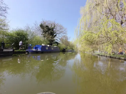
Canal Fields
Park · 0.9 mi
Canal Fields is the main park in Berkhamsted. It is an attractive green space, centrally located between the High Street and Berkhamsted...




Restaurants and cafes80

Platform Wines
Cafe · Coffee Shop · 1.1 mi
Lower Kings Road, Berkhamsted
Mo 12:00-20:30; Tu 07:00-10:00,12:00-20:30; We-Th...
Puccino's
Cafe · Coffee Shop · 1.1 mi
Lower Kings Road, Berkhamsted
Mo-Fr 06:00-18:00; Sa 07:00-18:00; Su 07:00-16:00



Church Farm Cafe
Cafe · Burger, Sandwich, Cake, Pancake, Coffee Shop, Breakfast, Brunch, Cycle, Grvl, Tea, Ice Cream, Fries, Juice, Salad · 2.4 mi
Station Road, Tring
Mo-Su 08:00-16:00
Jester
Cafe · Breakfast, Pancake, Cake · 1.1 mi
24 Lower Kings Road, Berkhamsted
Mo-Fr 08:00-16:00; Sa 08:00-17:00; Su 09:00-16:00


Wild Restaurant
Restaurant · Brunch · 1.0 mi
247-249 High Street, Berkhamsted
Tu 18:00-22:00; We-Sa 12:00-14:30,18:00-22:00
Caffè Nero
Cafe · Coffee Shop · 1.1 mi
230 High Street, Berkhamsted
Mo-Fr 06:30-18:30; Sa 07:30-19:00; Su 07:30-18:30
68 more on the map.
History
Other earlier names for Northchurch include Berkhamsted St. Mary and Berkhamsted Minor. Both names support the view that Northchurch may have been the site of the original Berkhamsted which expanded down the Bulbourne Valley following the construction of Berkhamsted Castle 2 miles to the south west. The village eventually became known as the area around the North Church, St. Mary's lying to the Northwest of the newer Parish Church of St. Peter built to the southeast nearer the Castle.
The parish church of St. Mary dates from Saxon times and is one of the oldest churches in Hertfordshire. Part of the original Saxon building remains in the south and west walls. Flint wall extensions were built between the 11th and 14th centuries, to form a cruciform building. A stone-faced tower was added over the crossing during the 15th century. A Victorian north aisle, vestries and south porch were added in the 1880s. The church is a Grade I listed building.
Read more of the history
The village stands on both the River Bulbourne and the Grand Union Canal. The main road running through Northchurch, the A4251, is built over Akeman Street, the original Roman road from London (Londinium) to Cirencester (Corinium). From 1762, the same road formed part of the Sparrows Herne Turnpike Road between Watford and Aylesbury. The parish almshouses, the Church Houses, are two-storey half-timbered houses dating from the 15th and 16th centuries and are Grade II* listed. From 1936 until 1972 Northchurch and Berkhamsted were united under Berkhamsted Urban District Council. Northchurch now forms a part of the Borough of Dacorum, but is recognised as a separate civil parish with its own parish council.
St Mary's churchyard contains the grave of Peter the Wild Boy (c. 1731-1785), a German feral child adopted at the court of King George I and II. His grave can be seen directly outside the main door to the church. Inside the church is a brass memorial of 1785 to Peter, with an engraved head after a portrait by Francesco Bartolozzi.
From the History section of Northchurch on Wikipedia, under CC BY-SA 4.0.
Where to stay3
Churches and places of worship14
St Michael's & All Angels Church
Church · Anglican · 1.7 mi
Ivy House Lane, Berkhamsted
Shopping11
Gas and EV charging3
Schools, colleges and libraries16
Victoria Church of England Infant and Nursery School
School · Anglican · 1.2 mi
Prince Edward Street, Berkhamsted
Healthcare5
Map of Northchurch
167 places. The map loads OpenStreetMap tiles when you open it.
Getting there and nearby towns
London Luton Airport (LTN) is the nearest airport with scheduled flights listed in OpenStreetMap, 12 miles away.
- Berkhamsted 1 mi southeast, about 2 min by car
- Tring 4 mi northwest, about 6 min by car
- Chesham 5 mi south, about 8 min by car
- Hemel Hempstead 6 mi east, about 10 min by car
- Cheddington 6 mi northwest, about 10 min by car
- Hyde Heath 6 mi southwest, about 10 min by car
- Amersham 7 mi south, about 12 min by car
- Kensworth 7 mi northeast, about 11 min by car
- Sarratt 7 mi southeast, about 11 min by car
- Dunstable 8 mi north, about 13 min by car
Drive times are estimates from straight-line distance, not routes.
Towns near Northchurch


Keep exploring
Local news
Headlines from INDB.
Reviews, tips and questions
Loading what members have shared...
Sources and licences
- GeoNames (CC BY 4.0): population, coordinates, regions and time zone
- Mapillary (see each image): photos
- OpenStreetMap contributors (ODbL 1.0): places, airports, map data
- Wikidata (CC0 1.0): elevation, founding date, time zone, website, landmarks and historic places
- Wikimedia Commons (see each image): photos
- Wikipedia (CC BY-SA 4.0): overview and history text
Photo credits
- West-Coast-Main-Line-20060629-003, Gary Houston, CC0
- UK Ashridge Bridgewater monument, Pointillist, CC BY-SA 3.0
- Inns of Court War Memorial, Berkhamsted, August 2026 01, No Swan So Fine, CC BY-SA 4.0
- Rothschild Museum Tring, Rob Farrow . Rob Farrow, CC BY-SA 2.0
- Tring park south, D Royal, Public domain
- Interior of St Peter and St Paul, Tring, September 2019 01, No Swan So Fine, CC BY-SA 4.0
- St Peter's Parish Church, Berkhamsted, Hertfordshire, MichaelMaggs, CC BY-SA 3.0
- Ashridge 2007-09-01 035, myself, CC BY-SA 3.0
- Ashlyns School driveway, Cnbrb, CC BY-SA 4.0
- Berkhamsted School Old Hall, Jbou at English Wikipedia, CC BY-SA 3.0
- Berkhamsted Rex proscenium2, Wikidwitch, CC BY-SA 3.0
- St. John the Baptist's Church, Aldbury 06, Simon Burchell, CC BY-SA 4.0
- Ashley Green Church, UKgeofan ( talk ), CC BY-SA 3.0
- Friends Meeting House, High Street, Berkhamsted 03, No Swan So Fine, CC BY-SA 4.0
- St. Michael and All Angels, Sunnyside, Alex, CC BY-SA 4.0
- Church of All Saints, Berkhamsted, February 2024 01, No Swan So Fine, CC BY-SA 4.0
- Old Mill House Hotel, Berkhamsted, September 2024 01, No Swan So Fine, CC BY-SA 4.0
- 125 High Street, Berkhamsted, June 2022, No Swan So Fine, CC BY-SA 4.0
- Inscription on Smith Dorrien Monument, St Peter's Churchyard, Berkhamsted, October 2022, No Swan So Fine, CC BY-SA 4.0
- H.H. Dickman at 222 High Street, Berkhamsted, March 2025, No Swan So Fine, CC BY-SA 4.0
- Aldbury stocks 04, Simon Burchell, CC BY-SA 4.0
- The Crown, High Street, Berkhamsted, October 2022, No Swan So Fine, CC BY-SA 4.0
- Sands Bank 17, Dudley Miles, CC BY-SA 4.0
- Berkhamsted Castle 3655, Cnbrb, CC BY-SA 4.0
- GOC Tring 096 Cow Roast Marina (18514270915), Peter O'Connor aka anemoneprojectors, CC BY-SA 2.0
- Street-level photo, sds, CC BY-SA 4.0
- Street-level photo, sds, CC BY-SA 4.0
- Street-level photo, alexanderar, CC BY-SA 4.0
- Street-level photo, tallguy, CC BY-SA 4.0
- Street-level photo, tallguy, CC BY-SA 4.0
- Street-level photo, tallguy, CC BY-SA 4.0
- Street-level photo, tallguy, CC BY-SA 4.0


Page built November 10, 2026. Spotted a mistake? Tell us or suggest a place.