


Why visit Sarratt
Townapedia lists 5 museums and landmarks, 4 parks and trails, 8 places to eat, 3 places to stay and 2 attractions in and around town.
Highlights include Bridge Carrying Railway Over North End Of Road, Nash Mills Railway Bridge, Chenies Manor House and Kings Langley Palace.
Weather in Sarratt
Forecast from MET Norway (CC BY 4.0). Full forecast
About Sarratt
Sarratt is a village and civil parish in Three Rivers District, Hertfordshire, England. It is situated 4 miles (6.4 km) north of Rickmansworth near the border with Buckinghamshire. The chalk stream, the River Chess, rising just north of Chesham in the Chiltern Hills, passes through Sarratt Bottom in the valley to the west of the village to join the River Colne in Rickmansworth. The conditions offered by the river are optimal for cultivating watercress.
From the Wikipedia article Sarratt (this version), under CC BY-SA 4.0.
Things to do2
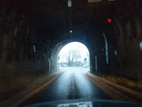
Bridge Carrying Railway Over North End Of Road
Bridge · 3.3 mi
Railway bridge in Abbots Langley, Three Rivers, Hertfordshire, England, UK
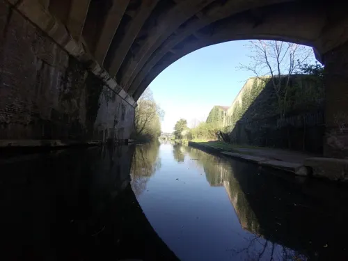
Nash Mills Railway Bridge
Bridge · 3.3 mi
Railway bridge in Abbots Langley, Three Rivers, Hertfordshire, England, UK
Museums and landmarks5

Chenies Manor House
Museum · 1.8 mi
Grade I listed historic house museum in Chiltern, United Kingdom

Kings Langley Palace
Monument and historic site · 2.4 mi
Former 13th-century Royal Palace in Kings Langley, Hertfordshire, England, UK
Parks, trails and playgrounds4


Sarratt Bottom nature reserve
Park · 0.8 mi
Biological Site of Special Scientific Interest in England

Chorleywood Common
Park · 1.5 mi
Nature reserve in Hertfordshire, England
Restaurants and cafes8


Notable people from Sarratt
- Algernon CollingsEnglish cricketer (1853-1945)
- H. T. Cadbury-Brownarchitect (1913-2009)
Born in Sarratt, according to Wikidata (CC0). Each name links to its Wikipedia article.
Where to stay3
Churches and places of worship6
Gas and EV charging1
Schools, colleges and libraries2
Map of Sarratt
31 places. The map loads OpenStreetMap tiles when you open it.
Getting there and nearby towns
RAF Northolt (NHT) is the nearest airport with scheduled flights listed in OpenStreetMap, 9 miles away.
- Chorleywood 2 mi southwest, about 4 min by car
- Rickmansworth 3 mi south, about 5 min by car
- Batchworth 4 mi south, about 6 min by car
- Croxley Green 4 mi southeast, about 6 min by car
- North Watford 4 mi east, about 7 min by car
- Watford 5 mi southeast, about 7 min by car
- Chesham 5 mi west, about 8 min by car
- Hemel Hempstead 5 mi north, about 8 min by car
- Amersham 5 mi west, about 9 min by car
- Chalfont Saint Peter 6 mi southwest, about 9 min by car
Drive times are estimates from straight-line distance, not routes.
Towns near Sarratt


Keep exploring
Local news
Headlines from INDB.
Reviews, tips and questions
Loading what members have shared...
Sources and licences
- GeoNames (CC BY 4.0): population, coordinates, regions and time zone
- Mapillary (see each image): photos
- OpenStreetMap contributors (ODbL 1.0): places, airports, map data
- Wikidata (CC0 1.0): elevation, founding date, time zone, website, landmarks and historic places
- Wikimedia Commons (see each image): photos
- Wikipedia (CC BY-SA 4.0): overview and history text
Photo credits
- Sarratt Bottom SSSI 2, Dudley Miles, CC BY-SA 4.0
- Kings Langley Church, UKgeofan ( talk ), CC BY-SA 3.0
- HolyCrossSarratt, UKgeofan ( talk ), CC BY-SA 3.0
- Frogmore Meadows and River Chess 2, Dudley Miles, CC BY-SA 4.0
- Chipperfield, Lumos3, CC BY-SA 3.0
- GOC Chorleywood & Chess Valley 028 Chorleywood House Estate (21707298731), Peter O'Connor aka anemoneprojectors, CC BY-SA 2.0
- Street-level photo, _mark, CC BY-SA 4.0
- Street-level photo, tallguy, CC BY-SA 4.0
Page built November 10, 2026. Spotted a mistake? Tell us or suggest a place.