


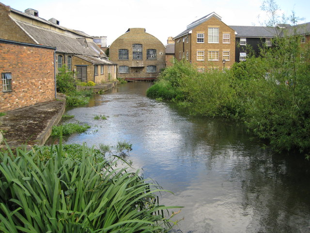
Hemel Hempstead, United Kingdom
Hemel Hempstead is a town of 95,961 people in England, United Kingdom.
Why visit Hemel Hempstead
Townapedia lists 12 museums and landmarks, 31 parks and trails, 100 places to eat, 7 places to stay and 10 attractions in and around town.
Highlights include The Old Town Hall, Bridge Carrying Railway Over North End Of Road, Frogmore Paper Mill and Hemel Hempstead War Memorial.
Weather in Hemel Hempstead
Forecast from MET Norway (CC BY 4.0). Full forecast
About Hemel Hempstead
Hemel Hempstead is a town in the Dacorum district of Hertfordshire, England. It is located 24 miles (39 km) north-west of London; nearby towns and cities include Watford, St Albans and Berkhamsted. The population at the 2021 census was 95,961.
From the Wikipedia article Hemel Hempstead (this version), under CC BY-SA 4.0.
Travel tips from other travellers: Hemel Hempstead on Wikivoyage (CC BY-SA 4.0).
Photos of Hemel Hempstead


Things to do10

The Old Town Hall
Cinema and theater · 1.0 mi
Theatre and arts centre in Hemel Hempstead, England
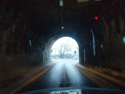
Bridge Carrying Railway Over North End Of Road
Bridge · 2.1 mi
Railway bridge in Abbots Langley, Three Rivers, Hertfordshire, England, UK
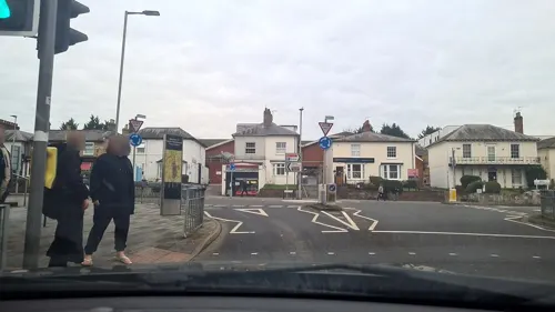
Dacorum Pavilion
Cinema and theater · 1.0 mi
Former theatre in Hemel Hempstead, England
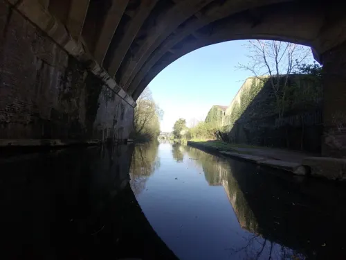
Nash Mills Railway Bridge
Bridge · 2.0 mi
Railway bridge in Abbots Langley, Three Rivers, Hertfordshire, England, UK




Museums and landmarks12


Old Gorhambury House
Museum · 2.4 mi
Country house in St Michael, Hertfordshire, England, UK


Kings Langley Palace
Monument and historic site · 2.9 mi
Former 13th-century Royal Palace in Kings Langley, Hertfordshire, England, UK

Parks, trails and playgrounds31


Longspring Wood
Park · 2.6 mi
Small Nature Reserve in Southern England




19 more on the map.
Restaurants and cafes100
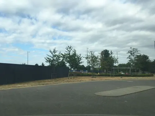
Toby Carvery
Restaurant · British · 0.5 mi
Maylands Avenue, Hemel Hempstead
Mo 11:00-21:00; Tu-Su 08:00-21:00
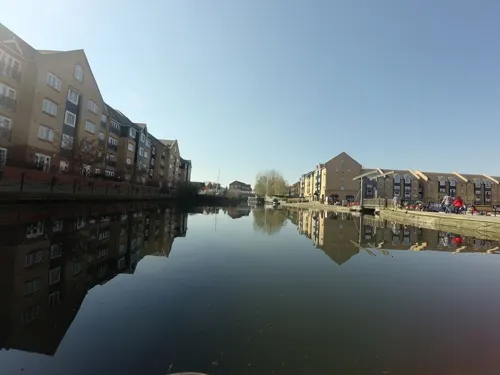


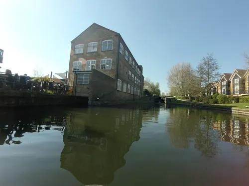
The Paper Mill
Bar and pub · 1.5 mi
Stationers Place, Hemel Hempstead
Mo-Th 09:00-23:00; Fr 09:00-00:00; Sa 10:00-00:00; Su 10:00-22:30

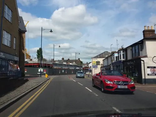
The White Lion
Bar and pub · 1.4 mi
44 London Road, Hemel Hempstead
Mo-Th 15:00-23:00; Fr-Sa 12:00-00:00; Su 12:00-23:00

Banana Leaf
Restaurant · Thai · 1.0 mi
127-129 Marlowes, Hemel Hempstead
Mo-Su 12:00-15:00,18:00-22:00
88 more on the map.
History
The settlement was called Henamsted or Hean-Hempsted in Anglo-Saxon times and Hemel-Amstede by the time of William the Conqueror. The name is referred to in the Domesday Book as Hamelamestede, but, in later centuries, it became Hamelhamsted and possibly Hemlamstede. In Old English, -stead or -stede simply meant "place" (reflected in German Stadt and Dutch stede or stad, meaning "city" or "town"), such as the site of a building or pasture, as in clearing in the woods. This suffix is used in the names of other English places, such as Hamstead and Berkhamsted.
One theory suggests that a previous name for the settlement became corrupted to something similar to Hempstead, and that Hemel originated as a way of specifying Hemel Hempstead, as opposed to nearby Berkhamsted. Hemel is reflected in the Dutch Hemel and German Himmel, both of which mean 'heaven' or 'sky'; it could be that Hemel Hempstead was in a less-forested area open to the sky, while Berkhamsted (which could mean 'birch', reflected in the Dutch berk) was in a forest of birch trees. However, this is speculation and unsupported by place name dictionaries.
Another suggestion is that Hemel came from Haemele, the name of the district in the 8th century, and was most likely either the name of the landowner or meant "broken country".
Read more of the history
Emigrants from Hemel Hempstead, led by John Carman, settled in the American colonies in the early 17th century and founded the town of Hempstead, New York in 1644.
The first recorded mention of the town is the grant of land at Hamaele by Offa, King of Essex, to the Saxon Bishop of London in 705 AD. Hemel Hempstead on its present site is mentioned in the Domesday Book of 1086 as a vill, Hamelhamstede, with about 100 inhabitants. The parish church of St Mary's was built in 1140, and is recognised as one of the finest Norman parish churches in the county. The church features an unusual 200-foot-tall (60-metre) spire, one of Europe's tallest, which was added in the 14th century.
After the Norman Conquest, Robert, Count of Mortain, the elder half-brother of William the Conqueror, was granted lands associated with Berkhamsted Castle which included Hemel Hempstead. The estates passed through several hands over the next few centuries including Thomas Becket in 1162. Hemel Hempstead was in the Domesday Book's hundred of Danais (Daneys, i.e. Danish), which by 1200 had been combined with the hundred of Tring to form the hundred of Dacorum. This maintained its court into the 19th century. In 1290, King John's grandson, the Earl of Cornwall, gave the manor to the religious order of the Bonhommes when he endowed the monastery at Ashridge.
The town remained part of the monastery's estates until the Reformation and break-up of Ashridge in 1539. In the same year, the town was granted a royal charter by Henry VIII to become a bailiwick with the right to hold a Thursday market and a fair on Corpus Christi Day. The first bailiff of Hemel Hempstead was William Stephyns (29 December 1539). Henry VIII and Anne Boleyn are reputed to have stayed in the town at this time.
In 1953, a collection of unusually fine medieval wall paintings dating from between 1470 and 1500 were discovered in a cottage in Piccotts End, a village on the outskirts of the town. This same building had been converted into the first cottage hospital providing free medical services by Sir Astley Cooper in 1827.
In 1581, a group of local people acquired lands – now referred to as Boxmoor – from the Earl of Leicester to prevent their enclosure. These were transferred to trustees in 1594. These have been used for public grazing and they are administered by the Box Moor Trust.
Remains of Roman villa farming settlements have been found at Boxmoor and Gadebridge, which span the entire period of Roman Britain. A well-preserved Roman burial mound is located in Adeyfield. A major Romano-Celtic temple complex was unearthed at Wood Lane End in Maylands in 1966.
In the 18th and 19th centuries, Hemel Hempstead was an agricultural market town. Wealthy landowners built a few large country houses in the locality, including The Bury, built in 1790, and Gadebridge House, erected by the noted surgeon and anatomist Sir Astley Cooper in 1811.
As the Industrial Revolution gained momentum, commercial travel between the Midlands and London increased greatly. Hemel Hempstead was located on a direct route between these areas of industry and commerce; this made it a natural waypoint for trade and travel between the two. Initially the Sparrows Herne Turnpike Road was opened in 1762.
In 1793, construction began on the Grand Junction Canal, a major project to provide a freight waterway between the Midlands and the Port of London. In 1798, the canal from the Thames reached Two Waters, just south of the town, and opened fully in 1805.
Hemel's position on the commercial transport network was established further in 1837 when the route of the new London and Birmingham Railway reached the town. The line's construction had been delayed for several years by vigorous lobbying by a number of powerful local landowners, including Sir Astley Cooper of Gadebridge House, who were all keen to protect their estates from invasion by the "iron horse". Their campaign was successful and the main line was routed along the River Bulbourne instead of the River Gade, skirting around the edge of Hemel Hempstead. As a result, the town's railway station was built one mile outside the town centre at Boxmoor; Boxmoor and Hemel Hempstead station (now Hemel Hempstead) opened in 1837.
From the History section of Hemel Hempstead on Wikipedia, under CC BY-SA 4.0.
More about Hemel Hempstead
Geography
Hemel Hempstead developed in a shallow chalkland valley at the confluence of the rivers Gade and Bulbourne, 27 miles (43 km) north-west of central London. The New Town expansion took place up the valley sides and onto the plateau above the original Old Town.
To the north and west lie mixed farm and woodland with scattered villages, part of the Chiltern Hills. To the west lies Berkhamsted. The River Bulbourne flows along the south-western edge of the town through Boxmoor. To the south lie Watford and the beginnings of the Greater London conurbation. To the east lies St Albans, a cathedral city and also part of the London commuter belt. Possibly the best view of Hemel Hempstead in its physical setting is from the top of Roughdown Common, a chalk hill to the south of the town.
Education
There are seven state-maintained secondary schools in the town:
Adeyfield Academy – a member of the ATLAS Multi Academy Trust
The Astley Cooper School – a member of the East Dacorum Co-operative Learning Trust
Laureate Academy – a member of Future Academies, a multi-academy trust; formerly known as the Cavendish School until 2019
The Hemel Hempstead School – a member of Scholars' Education Trust, a multi-academy trust
John F. Kennedy Catholic School – a member of the All Saints Catholic Academy Trust
Longdean School – a standalone academy trust specialising in maths and computing.
There are also three independent schools in, or adjacent, to the town:
Lockers Park School – a day and boarding school for boys aged 5–13
Westbrook Hay School – a co-educational school for children aged 3–13.
In addition, there is a West Herts College campus based in the town centre.
In 2006, the local education authority judged that there were too many primary school places in the town and published proposals to reduce them; the options involved school amalgamations and closures.
From the Wikipedia article Hemel Hempstead, under CC BY-SA 4.0.
Notable people from Hemel Hempstead
 Anthony Davidsonracing driver, 2014 World Endurance Drivers' Championship winnerPhoto: Jen_ross83, CC BY 2.0
 Harry WinksEnglish footballer (born 1996)Photo: Steffen Prößdorf, CC BY-SA 4.0
 Sheyi OjoEnglish association football playerPhoto: Jon Candy from Cardiff, Wales, CC BY-SA 2.0
 Anna HendersonBritish cyclistPhoto: Hoebele, CC BY-SA 4.0
 Jonathan BondEnglish association football playerPhoto: u/reepers_hellcat, CC BY 4.0
 Luke DonaldEnglish professional golferPhoto: Bryan Berlin, CC BY-SA 4.0
 Cauley WoodrowEnglish association football player (born 1994)Photo: Timmy96, CC0
 Brandon AustinEnglish association football playerPhoto: Govvy, CC BY-SA 4.0
 Luke O'NienEnglish footballer (born 1994)Photo: Timmy96, CC0
- Chris EaglesEnglish footballer (born 1985)
- Max WhitlockBritish artistic gymnast (born 1993)
- Claire SkinnerBritish film, radio, stage, and television actress
Born in Hemel Hempstead, according to Wikidata (CC0). Each name links to its Wikipedia article.
Where to stay7
Alexandra Guest House
Motel and hotel · 0.9 mi
40-42 Alexandra Road, Hemel Hempstead
Churches and places of worship28
Church of the Resurrection
Church · Anglican · 1.4 mi
Henry Wells Square, Hemel Hempstead
Church of St John the Evangelist and Attached Church Hall
Church · 1.4 mi
Quwwatul Islam Markazi Jamia Mosque Mehria Ghousia
Place of worship · Sunni · 0.7 mi
150 Saint Albans Hill, Hemel Hempstead
Shopping23
Gas and EV charging8
Schools, colleges and libraries34
Leverstock Green Church of England Primary School
School · Anglican · 0.9 mi
Green Lane, Hemel Hempstead
Nash Mills Church of England Primary School
School · Anglican · 1.5 mi
Belswains Lane, Hemel Hempstead
Saint Albert the Great Catholic Primary School
School · Roman Catholic · 0.5 mi
Acorn Road, Hemel Hempstead
St Cuthbert Mayne Voluntary Catholic Junior Academy
School · Roman Catholic · 1.4 mi
Clover Way, Hemel Hempstead
Healthcare3
Map of Hemel Hempstead
250 places. The map loads OpenStreetMap tiles when you open it.
Getting there and nearby towns
London Luton Airport (LTN) is the nearest airport with scheduled flights listed in OpenStreetMap, 9 miles away.
- St Albans 5 mi east, about 8 min by car
- Berkhamsted 5 mi west, about 8 min by car
- Harpenden 6 mi northeast, about 9 min by car
- Watford 7 mi south, about 12 min by car
- Chesham 7 mi southwest, about 12 min by car
- Chorleywood 7 mi south, about 12 min by car
- Rickmansworth 8 mi south, about 13 min by car
- Croxley Green 8 mi south, about 13 min by car
- Luton 9 mi north, about 14 min by car
- Bushey 9 mi southeast, about 14 min by car
Drive times are estimates from straight-line distance, not routes.
Towns near Hemel Hempstead


Keep exploring
Local news
Headlines from INDB.
Reviews, tips and questions
Loading what members have shared...
Sources and licences
- GeoNames (CC BY 4.0): population, coordinates, regions and time zone
- Mapillary (see each image): photos
- OpenStreetMap contributors (ODbL 1.0): places, airports, map data
- Wikidata (CC0 1.0): elevation, founding date, time zone, website, landmarks and historic places
- Wikimedia Commons (see each image): photos
- Wikipedia (CC BY-SA 4.0): overview and history text
Photo credits
- Crabtree Inn, Leverstock Green Road, Hemel Hempstead, March 2022, No Swan So Fine, CC BY-SA 4.0
- Old-Gorhambury-House-20051002-034, Gary Houston, CC0
- Kings Langley Church, UKgeofan ( talk ), CC BY-SA 3.0
- St. Mary's Church, Redbourn 33, Simon Burchell, CC BY-SA 4.0
- The Old Town Hall, Hemel Hempstead, Dormskirk, CC BY-SA 3.0
- Frogmore Mill Apsley, Nigel Cox, CC BY-SA 2.0
- The Old Bell, Hemel Hempstead, Oxfordian Kissuth, CC BY 3.0
- Howe Grove Wood 4, Dudley Miles, CC BY-SA 4.0
- 89 High Street, Hemel Hempstead, March 2022, No Swan So Fine, CC BY-SA 4.0
- Rose and Crown Inn, High Street, Hemel Hempstead, July 2021, No Swan So Fine, CC BY-SA 4.0
- Hemel Hempstead Hospital, Dormskirk, CC BY-SA 3.0
- Hemel Hempstead War Memorial, April 2024 01, No Swan So Fine, CC BY-SA 4.0
- Church of the Resurrection, Grovehill, May 2024 01, No Swan So Fine, CC BY-SA 4.0
- Longspring Wood 5, Dudley Miles, CC BY-SA 4.0
- Not How To Ride A Bike, Thomas Willmott, CC0
- Adeyfield- Tenzing Road, Nigel Cox, CC BY-SA 2.0
- Queens Square Adeyfield, Nigel Cox, CC BY-SA 2.0
- Ricky German August 2019, SFletcher06, CC BY-SA 4.0
- 1982-07 CA USA - Wilma Way, San Jose, Yolanl, CC BY 4.0
- GOC Hemel Hempstead 109 Boxmoor Hall (48722673901), Peter O'Connor aka anemoneprojectors, CC BY-SA 2.0
- GOC Hemel Hempstead 107 Pump and lamppost (48722847902), Peter O'Connor aka anemoneprojectors, CC BY-SA 2.0
- Bridge over River Gade, Gadebridge Park, Hemel Hempstead, May 2022 03, No Swan So Fine, CC BY-SA 4.0
- Street-level photo, rudolfmayer, CC BY-SA 4.0
- Street-level photo, _mark, CC BY-SA 4.0
- Street-level photo, sds, CC BY-SA 4.0
- Street-level photo, zymurgic, CC BY-SA 4.0
- Street-level photo, volucris, CC BY-SA 4.0
- Street-level photo, _mark, CC BY-SA 4.0
- Street-level photo, rudolfmayer, CC BY-SA 4.0
- Street-level photo, _mark, CC BY-SA 4.0
- Street-level photo, tallguy, CC BY-SA 4.0
- Street-level photo, tallguy, CC BY-SA 4.0
- Street-level photo, sds, CC BY-SA 4.0
- Street-level photo, mappo2, CC BY-SA 4.0
- Street-level photo, mappo2, CC BY-SA 4.0
- Street-level photo, _mark, CC BY-SA 4.0
- Street-level photo, mappo2, CC BY-SA 4.0
- Street-level photo, tallguy, CC BY-SA 4.0
- Street-level photo, zymurgic, CC BY-SA 4.0
- Street-level photo, sds, CC BY-SA 4.0
- Street-level photo, sds, CC BY-SA 4.0
- Street-level photo, photomaps, CC BY-SA 4.0
- Street-level photo, mappo2, CC BY-SA 4.0
- Street-level photo, volucris, CC BY-SA 4.0
- Street-level photo, volucris, CC BY-SA 4.0
- Street-level photo, zymurgic, CC BY-SA 4.0
- Street-level photo, zymurgic, CC BY-SA 4.0
- Street-level photo, _mark, CC BY-SA 4.0
- Street-level photo, rudolfmayer, CC BY-SA 4.0
- Street-level photo, mappo2, CC BY-SA 4.0


Page built November 10, 2026. Spotted a mistake? Tell us or suggest a place.