



Why visit Oakley
Townapedia lists 3 museums and landmarks, 11 parks and trails, 12 places to eat, 3 places to stay and 2 attractions in and around town.
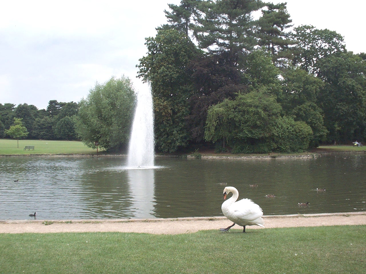
Highlights include Bedford Civic Theatre, Statue of John Bunyan, Browns Wood Local Nature Reserve and Bedford Park, Bedford.
Weather in Oakley
Forecast from MET Norway (CC BY 4.0). Full forecast
About Oakley
Oakley is a village and civil parish located in the Borough of Bedford in Bedfordshire, England, about four miles northwest of Bedford along the River Great Ouse. It has a population of 2,493 and is near the villages of Bromham, Milton Ernest, Clapham, Radwell and Felmersham.
From the Wikipedia article Oakley, Bedfordshire (this version), under CC BY-SA 4.0.
Things to do2

Bedford Civic Theatre
Cinema and theater · 3.4 mi
Former theatre in Bedford, England

Museums and landmarks3

Statue of John Bunyan
Monument and historic site · 3.3 mi
Statue in Bedford, England
Parks, trails and playgrounds11


Bromham Lake Nature Reserve
Park · 1.5 mi
Local nature reserve in Bedfordshire, England, UK

Felmersham Gravel Pits
Park · 3.4 mi
Nature reserve in Bedfordshire, United Kingdom


Pavenham Osier Beds
Park · 1.6 mi
Nature reserve in the United Kingdom

Restaurants and cafes12



History
Some of the earliest evidence of a settlement was found within the current village boundaries in the form of flint axes and arrow heads labelled OAK(ley)and EAM(cdonald), which were dated to c. 7000–6000 BC. Iron Age (c. 50 BC.) evidence was found when excavations were undertaken for the Almshouses.
Oakley featured in the Domesday Book, and before the Norman Conquest, where the land was held by an Oswulf, a thane (companion) of King Edward the Confessor.
In 1166 AD, the lord of the manor was recorded as one Simon de Bosard, and his brother was known to have had connections with the town now known as Leighton Buzzard. In 1200 it was recorded that the present parish church was built, replacing an earlier church built of wood in Saxon times. Nothing of this earlier church remains. In 1230 the first vicar was recorded, a Stephen de Castell. In 1278, a Richard de Bosard had no male heir, but his daughter married Thomas Reynes who took over Oakley thanks to his wife. The village was known as Oakley Reynes at least until the drafting of the 1795 pre-enclosure map. The name still appears today in "Reynes Drive". The family also owned Clifton Reynes, just over the border into Buckinghamshire. In 1331, there was another Thomas Reynes recorded.
Read more of the history
In 1349 the Black Death struck the village, and three vicars died that year; D. Walter, John Marshall and Robert Fox. The disease had a fatality rate of some 50%, and was caused by disease-carrying fleas living on the Black Rat. The medieval cottages provided full accommodation for rats in walls, thatch and under the earth floors. When rats died of the disease, the fleas attacked the human occupants. In 1451, John Reynes died and left no male heirs, so the village passed to the Taylard family. Again, in 1548 there were no male heirs to the Taylards, but the heiress married a Robert Brundenell, who took over. Oakley remained in the Brundenell family until 1648, when it passed to the Mordaunts. It is possible that after the Civil War had ended, the members of the losing side were made to pay heavily for their part in the conflict. Perhaps the Brundenells supported the King.
In 1671 a window tax was introduced, which recorded the population of Oakley as 255. In 1679 the Mordaunts sold Oakley to the Levinz family, who in their turn sold it in 1737 to the 4th Duke of Bedford. The Duke, a leading politician and successful business man, enlarged the Ducal properties considerably, buying Houghton House near Ampthill, as well as Oakley Manor House.
In 1735 an elderly Oakley woman was accused of being a witch, and was subjected to an ordeal by swimming.
After the purchase of Oakley House by the 4th Duke, the old house was demolished and a new (present) one was built on its site. It served as a hunting box for successive dukes, thirteen mile from their main seat at Woburn. In 1795, the Oakley Reynes Pre-Enclosure map was drawn, and in 1803 Oakley was enclosed. Records show the annual expenditure of the Church from Easter 1821 to Easter 1822 as £2.7s.3d. (£2.36). It gave its name to Oakley Square near Camden Town in London which was developed in the nineteenth century from land owned by the Dukes of Bedford.
In 1839, the 6th Duke of Bedford died and was succeeded by the 7th Duke, who improved the Bedford Estate and put the enterprise on a strong financial footing. In 1851, there was a census, which included details of church attendance at the three places of worship in the village – the Parish Church of St. Mary, the Primitive Methodist Chapel and the Congregational Church (now demolished).
The 7th Duke built new cottages for the Estate tenants, using the best materials available to avoid future repairs. These properties were easy to clean, and had all facilities – gardens, water supply etc. Also, the winding roads were straightened and a new road was built – Station Road – running from Lovell Road to where the station stood. The High Street was straightened, as was Duck End Road, now Church Lane. All the cottages in the High Street and Station Road were built in blocks for the sake of economy, usually six to a block. Most have a stone inscription in the gable showing a ducal coronet, a letter "B" for Bedford and the date of construction. Most of the earlier homes were of stone and thatch and were demolished when the new houses became available.
The old school, housed in two cottages in ruinous condition, was taken over by the Duke and the present building given to the village in 1842, the Duke taking over the cottages for his own use.
A village hall was built to celebrate the Diamond Jubilee of Queen Victoria. This was paid for by the Dowager Duchess, the widow of the 10th Duke. It was situated at the end of what is now Reynes Drive. It provided the village with a reading room for meetings, entertainment, and a library. The First World War saw great change. The 11th Duke had served in Egypt, and he set up a military training camp in Ampthill Park at his own expense. This, together with the expenditure on the estate, exceeded the income, and together with increased taxation occasioned by the war, forced him to reduce his land holdings. Therefore, in 1918, the Oakley estate was sold at auction by Knight, Frank and Rutley. Each tenant was given the opportunity of purchasing his own residence. From then on, Oakley ceased to be a ducal estate, and went into private ownership.
During the 1920s, Lovell Homes were built, together with bungalows along the north side of Church Lane. The 1930s saw more building in Church Lane and in-filling in the High Street. After the 1939–45 war, building resumed. Grange Farm was sold to the farming partnership of Ibbett and McKie, with Ibbett providing the financial expertise and McKie the agricultural experience. In due course, Jock McKie died, and the land passed into the sole ownership of the Ibbett family. A little while afterwards, planning permission for development on the farm was applied for and granted.
From the History section of Oakley, Bedfordshire on Wikipedia, under CC BY-SA 4.0.
Notable people from Oakley
 David John BartholomewBritish statistician; 1931-2017Photo: Unknown author, No restrictions
- Sam LaidlowFrench triathlete
- W. B. StonebridgeBritish architect (1879–1962)
Born in Oakley, according to Wikidata (CC0). Each name links to its Wikipedia article.
Where to stay3
Churches and places of worship15
Church of St Thomas of Canterbury, Clapham, Bedfordshire
Church · 1.6 mi
St Mary the Virgin
Church · Anglican · 1.2 mi
Church Road, Stevington
Schools, colleges and libraries5
Healthcare4
Map of Oakley
55 places. The map loads OpenStreetMap tiles when you open it.
Getting there and nearby towns
Sywell Aerodrome (ORM) is the nearest airport with scheduled flights listed in OpenStreetMap, 15 miles away.
- Bedford 3 mi southeast, about 6 min by car
- Kempston 4 mi south, about 6 min by car
- Sharnbrook 4 mi north, about 7 min by car
- Harrold 4 mi northwest, about 7 min by car
- Kempston Hardwick 6 mi south, about 9 min by car
- Lavendon 6 mi west, about 9 min by car
- Riseley 6 mi north, about 10 min by car
- Stewartby 7 mi south, about 11 min by car
- Great Barford 7 mi east, about 12 min by car
- Rushden 9 mi north, about 14 min by car
Drive times are estimates from straight-line distance, not routes.
Towns near Oakley


Keep exploring
Local news
Headlines from INDB.
Reviews, tips and questions
Loading what members have shared...
Sources and licences
- GeoNames (CC BY 4.0): population, coordinates, regions and time zone
- Mapillary (see each image): photos
- OpenStreetMap contributors (ODbL 1.0): places, airports, map data
- Wikidata (CC0 1.0): elevation, founding date, time zone, website, landmarks and historic places
- Wikimedia Commons (see each image): photos
- Wikipedia (CC BY-SA 4.0): overview and history text
Photo credits
- CivicTheatreBedford, Simon Speed, Public domain
- BedfordParkLakeSwan, Simon Speed, Public domain
- Felmersham Gravel Pits 2, Dudley Miles, CC BY-SA 4.0
- Pavenham Osier Beds 2, Dudley Miles, CC BY-SA 4.0
- StMary'sChurch-Felmersham, Benjah-bmm27, Public domain
- StPeter'sChurch-Pavenham, Unknown author, Public domain
- Hill Rise, Bedford 3, Dudley Miles, CC BY-SA 4.0
- Bromham Lake 6, Dudley Miles, CC BY-SA 4.0
- Browns Wood 6, Dudley Miles, CC BY-SA 4.0
- Street-level photo, sk53, CC BY-SA 4.0
Page built November 10, 2026. Spotted a mistake? Tell us or suggest a place.