


Penistone, United Kingdom
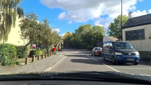
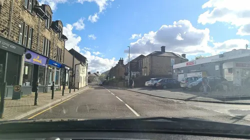
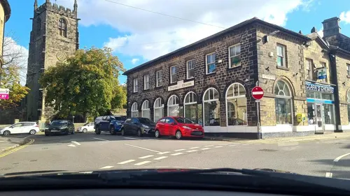
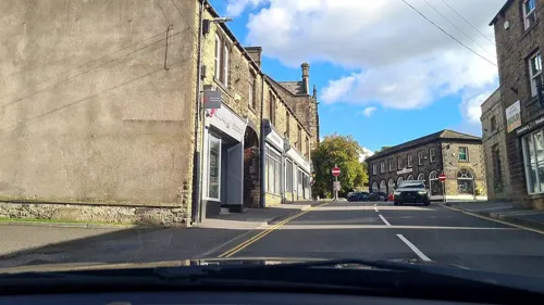
Penistone is a town of 10,956 people in England, United Kingdom.
Why visit Penistone
Townapedia lists 5 museums and landmarks, 6 parks and trails, 34 places to eat, 2 places to stay and 3 attractions in and around town.
Highlights include Penistone Paramount Cinema and Penistone Railway Viaduct on Penistone and Denby Dale Line.
Weather in Penistone
Forecast from MET Norway (CC BY 4.0). Full forecast
About Penistone
Penistone is a market town and civil parish in the Metropolitan Borough of Barnsley, South Yorkshire, England. Historically in the ancient Wapentake of Staincross and the West Riding of Yorkshire, it lies 7 miles (11 km) west of central Barnsley, 17 miles (27 km) north-east of Glossop, 15 miles (24 km) north-west of Sheffield, 27 miles (43 km) south-west of Leeds and 29 miles (47 km) east of Manchester. Sited in the foothills of the Pennines, it had a population of 13,270 at the 2021 census. The town is frequently noted on lists of unusual place names.
From the Wikipedia article Penistone (this version), under CC BY-SA 4.0.
Photos of Penistone


Things to do3

Penistone Paramount Cinema
Cinema and theater
Community cinema and theatre in Penistone near Barnsley, South Yorkshire, England
Shrewsbury Road, Sheffield

Penistone Railway Viaduct on Penistone and Denby Dale Line
Bridge
Railway viaduct in Penistone, Barnsley, South Yorkshire, England, UK

Museums and landmarks5

Hoylandswaine Nailworks
Monument and historic site · 1.5 mi
Barnsley Road, Sheffield
Parks, trails and playgrounds6




Restaurants and cafes34

The Little Bakery
Bakery · 0.8 mi
1 High Bank, Sheffield
Mo 09:00-14:30; Tu-Fr 08:30-14:30; Sa 08:00-12:30




22 more on the map.
History
The place-name Penistone is first attested in the Domesday Book of 1086, where it appears as Pengeston(e) and Pangeston; later sources record it as Peningston. It may mean "the farmstead at the hill called Penning", in reference to the high ridge immediately south of the town. This combines the Brittonic word penn (meaning a head, end, or height) with the Old English suffix ing and the word tun (meaning a farmstead or village).
Penistone has frequently been noted on lists of unusual place-names, although the initial five letters are pronounced differently to what might otherwise be expected.
Since the times of the Anglian kingdom of Northumbria and at least Viking times Penistone was historically within the Wapentake of Staincross, an area that almost corresponds with the present day Barnsley Metropolitan Borough.
In 1066, the township was owned by Ailric. It was razed in 1069 in the Harrying of the North following the Norman Conquest; the Domesday Book described the settlement in 1086 as "waste".
Sir Gyles Penyston (fl. 13th century), whose family seat was in Cornwall (perhaps at Truro) before his time, and who is an ancestor of the Penyston Baronets, was styled of Penyston, denoting that he resided in Penistone.
Read more of the history
The town was renowned for its Penistone cloth (or "forest white"), a rough, home-spun cloth. In a law passed in 1601 (43 Eliz. 1 cap. 10) regulating the working of cloth, penalties were set out for weavers found to be making Penistone cloth of inferior quality. Until the 18th century, home weavers in the area brought their products to town for sale in an annual cloth fair, but a Cloth Hall (or "piece hall") was built by subscription to facilitate regular sales to wool merchants in 1768.
Sheep sales have been held in the town since before 1699, when the market received a royal charter and the area produced the now rare Penistone sheep.
The town remained small until the coming of the railway in 1845, although several pre-19th century buildings survive. The oldest still standing is Penistone Church. This is the Grade I listed medieval parish church, St John the Baptist Church. The White Hart pub in the town dates from 1377. Penistone had a market for a long time before its royal charter was granted in 1699, although its historic livestock market was closed recently to make way for town centre re-development. A new landmark building has been built in Penistone for the Market Place. This is an oaken Cruck Barn and was built by Carpenter Oak of Totnes, Devon.
The Manchester, Sheffield and Lincolnshire Railway opened on 15 July 1845, on a route via Penistone, Dunford Bridge and the three-mile long Woodhead Tunnel.
The line to Huddersfield was opened on 1 July 1850; Penistone became a railway junction, with a depot for engineering trains. There were frequent railway services to Barnsley, Manchester London Road, Sheffield Victoria and Huddersfield.
The 29-arch Penistone Viaduct was built in 1849 by Messrs. Ingham and Bower to a design by Sir John Hawkshaw. Stone was obtained from Walk Mill Bank, Oxspring and was conveyed by a tramway on the side of the river Don. The second and third arches of Penistone Viaduct collapsed on 2 February 1916, when heavy rain weakened the foundations; the driver and fireman of a stationary goods locomotive were able to jump clear and survive the collapse. Cracks in the parapet had been observed some days earlier. The viaduct was repaired and was back in service in August of the same year.
The town was served by the Woodhead line between Manchester London Road and Sheffield Victoria. Following major investment, which started in 1935 but was delayed by the Second World War, electrification of the railway was completed in 1954 and the line's power control centre was built adjacent to Penistone station. The building still stands and has been converted for commercial use. The Woodhead line was the first main line railway in the country to be electrified, but its once-pioneering 1500V DC system soon became non-standard.
Although the Beeching Report recommended the closure of the Hope Valley Line and the retention of Woodhead services, the government chose to implement the opposite; Woodhead line passenger services beyond Hadfield ended on 5 January 1970. Goods trains (mainly coal) continued to travel through the station for a further 1 years until the line was closed controversially between Penistone and Hadfield in July 1981; the track was lifted several years later. The route of the track is now used as part of the Trans-Pennine Trail.
From the History section of Penistone on Wikipedia, under CC BY-SA 4.0.
More about Penistone
Geography
Penistone is situated on the south bank of the river Don. The parish, which included Gunthwaite, Hunshelf, Ingbirchworth, Langsett, Oxspring and Thurlstone, covered 21,338 acres (8,635 ha), mostly arable land and pasture and 2,000 acres (809 ha) of moorland. The underlying geology is the coal measures of the South Yorkshire Coalfield, from which some coal was mined in the 19th century, and sandstone flags were quarried.
Economy
Penistone still has a market, although smaller since the building of a Tesco supermarket in 2011, which reduced the market footprint. The cattle market, which opened in 1910, replaced the sale of livestock in the streets of Penistone. It was extended in 1933 again in 1951, but it closed after the 2003 foot and mouth disease outbreak of 2001. The Fur n Feathers market is also long since gone. At 747 feet (228 metres) elevation, Penistone is among the highest market towns in Yorkshire.
On 26 February 2007, the town was officially declared a Fairtrade Town.
The Market Cruck Barn was officially opened on 21 July 2011. Penistone Farmers' Market is a monthly farmers' market on the second Saturday of every month held in the market place.
Education
Penistone Grammar School was founded in 1392. Notable former pupils include the blind mathematician Nicholas Saunderson, and Anne Campbell, who served as MP for Cambridge until May 2005. Most of the old school was demolished in 2011 and a new school was built.
Local primary schools include St John's, Spring Vale and Thurlstone.
From the Wikipedia article Penistone, under CC BY-SA 4.0.
Notable people from Penistone
 Kate RusbyEnglish folk singerPhoto: Bryan Ledgard, CC BY 2.0
- Bill GooingEnglish association footballer (1874-1969)
- Bert HodgkinsonEnglish footballer (1903-1974)
- Benny GreenEnglish footballer (1883–1917)
- Jordan BarnettEnglish footballer
- Seth KingFootballer (1897-1958)
- Chris WoodBritish association football player (born 1955)
- Alison LittlewoodBritish author of horror novels and short stories
Born in Penistone, according to Wikidata (CC0). Each name links to its Wikipedia article.
Where to stay2
Churches and places of worship12
Kingdom Hall of Jehovah's Witnesses
Church · Jehovahs Witness · 0.7 mi
Wind Mill Lane, Sheffield
Thurlstone & Millhouse Green Methodist Church
Church · Methodist · 1.4 mi
Manchester Road, Sheffield
Thurlstone Providence Baptist Chapel
Church · Baptist · 0.9 mi
Ingbirchworth Road, Sheffield
Shopping11
Gas and EV charging2
Schools, colleges and libraries5
Healthcare3
Map of Penistone
83 places. The map loads OpenStreetMap tiles when you open it.
Getting there and nearby towns
Leeds Bradford Airport (LBA) is the nearest airport with scheduled flights listed in OpenStreetMap, 24 miles away.
- Stocksbridge 3 mi southeast, about 5 min by car
- Wombwell 10 mi east, about 15 min by car
- Huddersfield 11 mi northwest, about 17 min by car
- Sheffield 12 mi southeast, about 19 min by car
- Wakefield 12 mi northeast, about 20 min by car
- Wath upon Dearne 12 mi east, about 19 min by car
- Rotherham 13 mi southeast, about 21 min by car
- Rawmarsh 13 mi east, about 20 min by car
- Saddleworth 15 mi west, about 25 min by car
- South Elmsall 15 mi east, about 24 min by car
Drive times are estimates from straight-line distance, not routes.
Towns near Penistone


Keep exploring
Local news
Headlines from INDB.
Reviews, tips and questions
Loading what members have shared...
Sources and licences
- GeoNames (CC BY 4.0): population, coordinates, regions and time zone
- Mapillary (see each image): photos
- OpenStreetMap contributors (ODbL 1.0): places, airports, map data
- Wikidata (CC0 1.0): elevation, founding date, time zone, website, landmarks and historic places
- Wikimedia Commons (see each image): photos
- Wikipedia (CC BY-SA 4.0): overview and history text
Photo credits
- Tower of St John's Church, Penistone, Jonathan Thacker, CC BY-SA 2.0
- 5-9 Market Street, Penistone, Ian S, CC BY-SA 2.0
- Cross Shaft, Penistone, Mike Rayner, CC BY-SA 2.0
- Penistone War Memorial, Ian S, CC BY-SA 2.0
- Cross Base, Penistone, Mike Rayner, CC BY-SA 2.0
- St John's Church, Penistone, Jonathan Thacker, CC BY-SA 2.0
- Spread Eagle, Penistone (16307427084), Tim Green from Bradford, UK, CC BY 2.0
- Former Midland Bank, Penistone, Humphrey Bolton, CC BY-SA 2.0
- Penistone Paramonut, DaveGorman at English Wikipedia, Public domain
- Penistone - Viaduct, Dave Bevis, CC BY-SA 2.0
- All Saints Silkstone, Geoff Pick, CC BY-SA 2.0
- St James church, Midhopestones, Mick Knapton, CC BY-SA 3.0
- Penistone Grammar 2016 view 01, Chemical Engineer, CC BY-SA 4.0
- St Mary's Church, Talbot Road, Penistone (October 2024) (2), User:Hassocks5489, CC0
- Bridge, Watermeadows Park, Dave Pickersgill, CC BY-SA 2.0
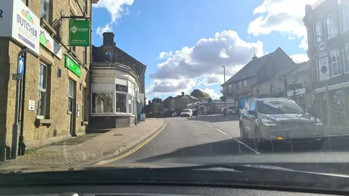
- Street-level photo, mappo2, CC BY-SA 4.0
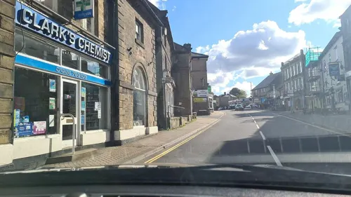
- Street-level photo, mappo2, CC BY-SA 4.0
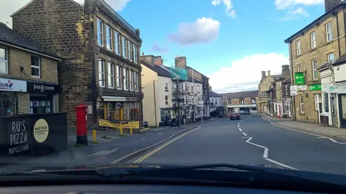
- Street-level photo, mappo2, CC BY-SA 4.0
- Street-level photo, mappo2, CC BY-SA 4.0
- Street-level photo, mappo2, CC BY-SA 4.0
- Street-level photo, mappo2, CC BY-SA 4.0
- Street-level photo, mappo2, CC BY-SA 4.0
- Street-level photo, mappo2, CC BY-SA 4.0
- Street-level photo, mappo2, CC BY-SA 4.0
- Street-level photo, mappo2, CC BY-SA 4.0
- Street-level photo, mappo2, CC BY-SA 4.0
- Street-level photo, mappo2, CC BY-SA 4.0
- Street-level photo, mappo2, CC BY-SA 4.0
- Street-level photo, mappo2, CC BY-SA 4.0
- Street-level photo, mappo2, CC BY-SA 4.0
- Street-level photo, mappo2, CC BY-SA 4.0
- Street-level photo, mappo2, CC BY-SA 4.0
- Street-level photo, mappo2, CC BY-SA 4.0
- Street-level photo, mappo2, CC BY-SA 4.0
- Street-level photo, mappo2, CC BY-SA 4.0
- Street-level photo, mappo2, CC BY-SA 4.0


Page built November 10, 2026. Spotted a mistake? Tell us or suggest a place.