


Stocksbridge, United Kingdom
Stocksbridge is a town of 13,069 people in England, United Kingdom.
Why visit Stocksbridge
Townapedia lists 6 museums and landmarks, 9 parks and trails, 29 places to eat and 5 attractions in and around town.
Highlights include Penistone Paramount Cinema, Penistone Railway Viaduct on Penistone and Denby Dale Line, Clock Tower and The Venue.
Weather in Stocksbridge
Forecast from MET Norway (CC BY 4.0). Full forecast
About Stocksbridge
Stocksbridge is a town and civil parish, it is encircled to the north and east by the southern edge of the Metropolitan Borough of Barnsley, although since 1974 it lies within the borders of the City of Sheffield, in South Yorkshire, England. The town is approximately 9 miles (14 km) from Barnsley and 10 miles (16 km) from Sheffield.
From the Wikipedia article Stocksbridge (this version), under CC BY-SA 4.0.
Things to do5

Penistone Paramount Cinema
Cinema and theater · 3.3 mi
Community cinema and theatre in Penistone near Barnsley, South Yorkshire, England

Penistone Railway Viaduct on Penistone and Denby Dale Line
Bridge · 3.4 mi
Railway viaduct in Penistone, Barnsley, South Yorkshire, England, UK

K Stuart & Sons Milk & Farm Shop
Farm and orchard · 1.4 mi
Dyson Cote Lane, Sheffield

Museums and landmarks6



Parks, trails and playgrounds9

Glen Howe Park
Park · 3.0 mi
Park in Wharncliffe Side, South Yorkshire, England




Restaurants and cafes29
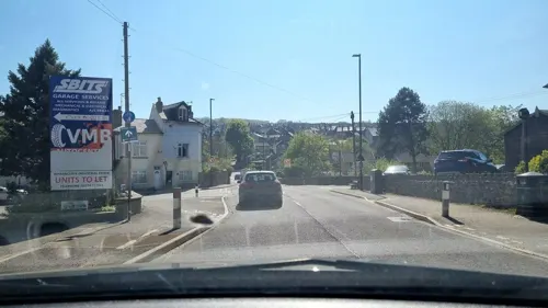




17 more on the map.
More about Stocksbridge
Arts and culture
The British Steel Stocksbridge Band [sic] is credited with performing "Slaidburn" in the trailer of the 1997 film The Full Monty. Stocksbridge Engineering Steels Brass Band has since been renamed to Unite the Union Band. Deepcar Brass Band remains locally.
Nearby Bolsterstone is home to a well-known male voice choir, particularly noted for its performances of Sheffield local carols.
Stocksbridge has a strong amateur theatre group called Steel Valley Beacon which produces Shakespeare and other plays every year.
Mathcore band Rolo Tomassi were formed and are still based in Stocksbridge. Some of the Arctic Monkeys, and the vocalist of Bring Me the Horizon, are from Stocksbridge and attended Stocksbridge School.
From the Wikipedia article Stocksbridge, under CC BY-SA 4.0.
Notable people from Stocksbridge
- Chris WilderEnglish association football manager and former player
- Paul Holmesprofessional footballer (1968-2024)
- Peter EustaceEnglish footballer (born 1944)
- Geoff DenialEnglish footballer (born 1932)
- John Deakinprofessional footballer (born 1966)
- Les HarrisEnglish footballer
- Alan MercerEnglish professor of Operational Research (1931-2014)
- Basil WoodEnglish footballer (1900-1977)
Born in Stocksbridge, according to Wikidata (CC0). Each name links to its Wikipedia article.
Churches and places of worship11
Shopping14
Fox Valley Bikes (+ Stocksbridge Electric Bikes)
Shop
500-502 Manchester Road, Sheffield
Gas and EV charging2
Schools, colleges and libraries7
Deepcar St John's Church of England Junior School
School · Anglican · 0.9 mi
St Margaret Avenue, Sheffield
Healthcare2
Map of Stocksbridge
85 places. The map loads OpenStreetMap tiles when you open it.
Getting there and nearby towns
Leeds Bradford Airport (LBA) is the nearest airport with scheduled flights listed in OpenStreetMap, 27 miles away.
- Sheffield 9 mi southeast, about 14 min by car
- Wombwell 9 mi east, about 14 min by car
- Rotherham 10 mi east, about 17 min by car
- Wath upon Dearne 10 mi east, about 17 min by car
- Huddersfield 14 mi northwest, about 22 min by car
- Wakefield 14 mi north, about 23 min by car
- Chesterfield 18 mi southeast, about 28 min by car
- Doncaster 19 mi east, about 31 min by car
- Leeds 22 mi north, about 35 min by car
- Oldham 22 mi west, about 35 min by car
Drive times are estimates from straight-line distance, not routes.
Towns near Stocksbridge


Keep exploring
Local news
Headlines from INDB.
Reviews, tips and questions
Loading what members have shared...
Sources and licences
- GeoNames (CC BY 4.0): population, coordinates, regions and time zone
- Mapillary (see each image): photos
- OpenStreetMap contributors (ODbL 1.0): places, airports, map data
- Wikidata (CC0 1.0): elevation, founding date, time zone, website, landmarks and historic places
- Wikimedia Commons (see each image): photos
- Wikipedia (CC BY-SA 4.0): overview and history text
Photo credits
- Stocksbridge - Leisure Centre from Steel Works, Dave Bevis, CC BY-SA 2.0
- Penistone Paramonut, DaveGorman at English Wikipedia, Public domain
- Penistone - Viaduct, Dave Bevis, CC BY-SA 2.0
- St James church, Midhopestones, Mick Knapton, CC BY-SA 3.0
- Bolsterstone Church 1, Mick Knapton, CC BY-SA 3.0
- Stocksbridge High School, Mr. Vulpes, CC BY-SA 3.0
- The Tower, Glen Howe Park, Mick Knapton, CC BY-SA 3.0
- Village Stocks, Green Moor, Neil Theasby, CC BY-SA 2.0
- Street-level photo, mappo2, CC BY-SA 4.0
Page built November 10, 2026. Spotted a mistake? Tell us or suggest a place.