


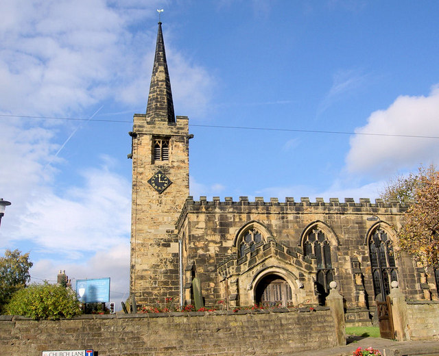
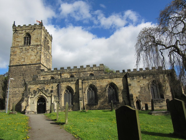


Wombwell, United Kingdom
Wombwell is a town of 15,518 people in England, United Kingdom.
Why visit Wombwell
Townapedia lists 4 museums and landmarks, 11 parks and trails, 49 places to eat, 2 places to stay and 2 attractions in and around town.
Highlights include Hoober Stand, Elsecar Heritage Centre and Maurice Dobson Museum.
Weather in Wombwell
Forecast from MET Norway (CC BY 4.0). Full forecast
About Wombwell
Wombwell (locally ) is a town in the Metropolitan Borough of Barnsley in South Yorkshire, England. In the 2011 census, data for the town was split between the ward of Wombwell and small sections that fell into the wards of Darfield (specifically the area south of Pitt Street, including Broomhill) and Stairfoot (specifically the area south of Aldham Crescent). Added together, these record the town's population at approximately 15,316.
From the Wikipedia article Wombwell (this version), under CC BY-SA 4.0.
Things to do2

Hoober Stand
Monument and historic site · 2.8 mi
Tower in Wentworth, South Yorkshire, England, UK

Museums and landmarks4

Elsecar Heritage Centre
Museum · 2.1 mi
Living history museum in Elsecar, England


Parks, trails and playgrounds11




Restaurants and cafes49




37 more on the map.
History
Wombwell railway station (formerly Wombwell West) serves the Penistone and Hallam lines. Until 1959 the town had another station, Wombwell Central, on the Barnsley–Doncaster line; this was closed when the line lost its passenger service. Wombwell was home to two collieries: Wombwell Main and Mitchells Main. Wombwell is close to the large shopping and leisure facilities of Cortonwood, and also has a number of local business, from cafes to travel agents to high-street chains such as Wilko.
Wombwell has one main cemetery, maintained by a voluntary group, the Friends of Wombwell Cemetery. Two chapels stand in the cemetery, both Grade II listed buildings: one was transformed into a "Peace Garden" after a fire that destroyed its roof; the other has been renovated by the group to become a "community hub".
Wombwell Urban District Council was the administrative body for the town from 1865 until 1974. The district also included Broomhill, Brampton, Aldham, Smithley, Lundhill, Jump and Hemingfield.
Parts of Wombwell were affected by the 2007 floods in the UK. The River Dove breached its banks on Friday 15 June and then again on Monday 25 June. Many homes and businesses were flooded.
From the History section of Wombwell on Wikipedia, under CC BY-SA 4.0.
More about Wombwell
Education
Netherwood Academy, established in 2012 from a merger of Wombwell High School and Darfield Foulstone School
St Michael and All Angels Catholic Primary School, located on Stonyford Road, was established in 1903
Kings Oak Primary Learning Centre, established in 2007 from a merger of Kings Road Infant School and Oakfield Junior School
High View Primary Learning Centre, established in 2007 from a merger of Highfields Junior School and Wood View Infant School
From the Wikipedia article Wombwell, under CC BY-SA 4.0.
Notable people from Wombwell
 Harold Warris Thompsonphysical chemist, football administrator (1908-1983)Photo: Lasermichel, CC BY-SA 4.0
- George RaynorEnglish footballer and manager
- Harold GoodwinBritish actor (1917-2004)
- Roy KilnerCricket player of England. (1890-1928)
- George BriggsBritish footballer (born 1903)
- Stan BurtonEnglish footballer (1912-1977)
- Fred BriggsFootballer (1908-1985)
- Ian HolmesEnglish association football player (born 1950)
- Michael TurnbullBishop of Rochester; Bishop of Durham (born 1935)
- Billy ClarksonEnglish footballer (1891-1954)
- Tony WagstaffEnglish footballer (born 1944)
- Bob Mountainprofessional footballer (born 1956)
Born in Wombwell, according to Wikidata (CC0). Each name links to its Wikipedia article.
Where to stay2
Churches and places of worship13
Shopping15
Gas and EV charging2
Schools, colleges and libraries14
St Michael and All Angels Catholic Primary School
School · Roman Catholic · 0.6 mi
Stonyford Road, Barnsley
Healthcare5
Map of Wombwell
117 places. The map loads OpenStreetMap tiles when you open it.
Getting there and nearby towns
Leeds Bradford Airport (LBA) is the nearest airport with scheduled flights listed in OpenStreetMap, 26 miles away.
- Rotherham 7 mi south, about 11 min by car
- Sheffield 10 mi south, about 16 min by car
- Doncaster 11 mi east, about 18 min by car
- Wakefield 12 mi north, about 19 min by car
- Huddersfield 18 mi northwest, about 29 min by car
- Chesterfield 19 mi south, about 30 min by car
- Leeds 20 mi north, about 32 min by car
- Bradford 24 mi northwest, about 38 min by car
- Mansfield 28 mi south, about 45 min by car
- Oldham 30 mi west, about 48 min by car
Drive times are estimates from straight-line distance, not routes.
Towns near Wombwell


Keep exploring
Local news
Headlines from INDB.
Reviews, tips and questions
Loading what members have shared...
Sources and licences
- GeoNames (CC BY 4.0): population, coordinates, regions and time zone
- Mapillary (see each image): photos
- OpenStreetMap contributors (ODbL 1.0): places, airports, map data
- Wikidata (CC0 1.0): elevation, founding date, time zone, website, landmarks and historic places
- Wikimedia Commons (see each image): photos
- Wikipedia (CC BY-SA 4.0): overview and history text
Photo credits
- Wombwell in 2005, Martin Clark, CC BY-SA 2.0
- St Mary's Church, Wombwell, Graham Hogg, CC BY-SA 2.0
- Worsbrough - Saint Mary's Church, Steve F, CC BY-SA 2.0
- All saints church, Darfield, ChicXulub, CC BY-SA 4.0
- NetherwoodAdvancedLearningCentre - 04052015, ChicXulub, CC BY-SA 4.0
- Brampton Brierlow - Hoober Stand, Christopher Thomas, CC BY-SA 2.0
- Elsecar Heritage Centre Sentinel Elizabeth locomotive - November 2017, Neil Turner, CC BY-SA 2.0
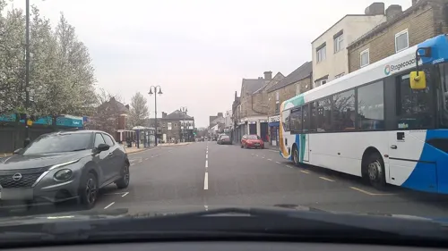
- Street-level photo, cuttlebug, CC BY-SA 4.0
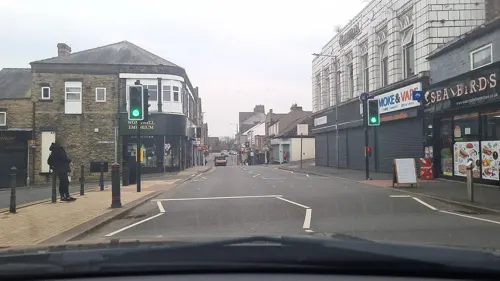
- Street-level photo, mappo2, CC BY-SA 4.0
- Street-level photo, mappo2, CC BY-SA 4.0
- Street-level photo, mappo2, CC BY-SA 4.0
- Street-level photo, mappo2, CC BY-SA 4.0
- Street-level photo, mappo2, CC BY-SA 4.0
- Street-level photo, mappo2, CC BY-SA 4.0
- Street-level photo, mappo2, CC BY-SA 4.0
- Street-level photo, mappo2, CC BY-SA 4.0
- Street-level photo, mappo2, CC BY-SA 4.0
- Street-level photo, mappo2, CC BY-SA 4.0
- Street-level photo, cuttlebug, CC BY-SA 4.0
- Street-level photo, mappo2, CC BY-SA 4.0
- Street-level photo, mappo2, CC BY-SA 4.0
- Street-level photo, mappo2, CC BY-SA 4.0
- Street-level photo, mappo2, CC BY-SA 4.0
- Street-level photo, mappo2, CC BY-SA 4.0
Page built November 10, 2026. Spotted a mistake? Tell us or suggest a place.