



Why visit Penrith
Townapedia lists 23 museums and landmarks, 13 parks and trails, 91 places to eat, 24 places to stay and 4 attractions in and around town.
Highlights include Alhambra, Eamont Bridge, Penrith & Eden Musuem and King Arthur's Round Table.
Weather in Penrith
Forecast from MET Norway (CC BY 4.0). Full forecast
About Penrith
Penrith (, ) is a market town and civil parish in the Westmorland and Furness unitary authority area of Cumbria, England. It is less than 3 miles (5 km) outside the Lake District National Park and about 17 miles (27 km) south of Carlisle. It is between the Rivers Petteril and Eamont and just north of the River Lowther. It was historically part of Cumberland.
From the Wikipedia article Penrith, Cumbria (this version), under CC BY-SA 4.0.
Travel tips from other travellers: Penrith on Wikivoyage (CC BY-SA 4.0).
Photos of Penrith

Things to do4




Museums and landmarks23

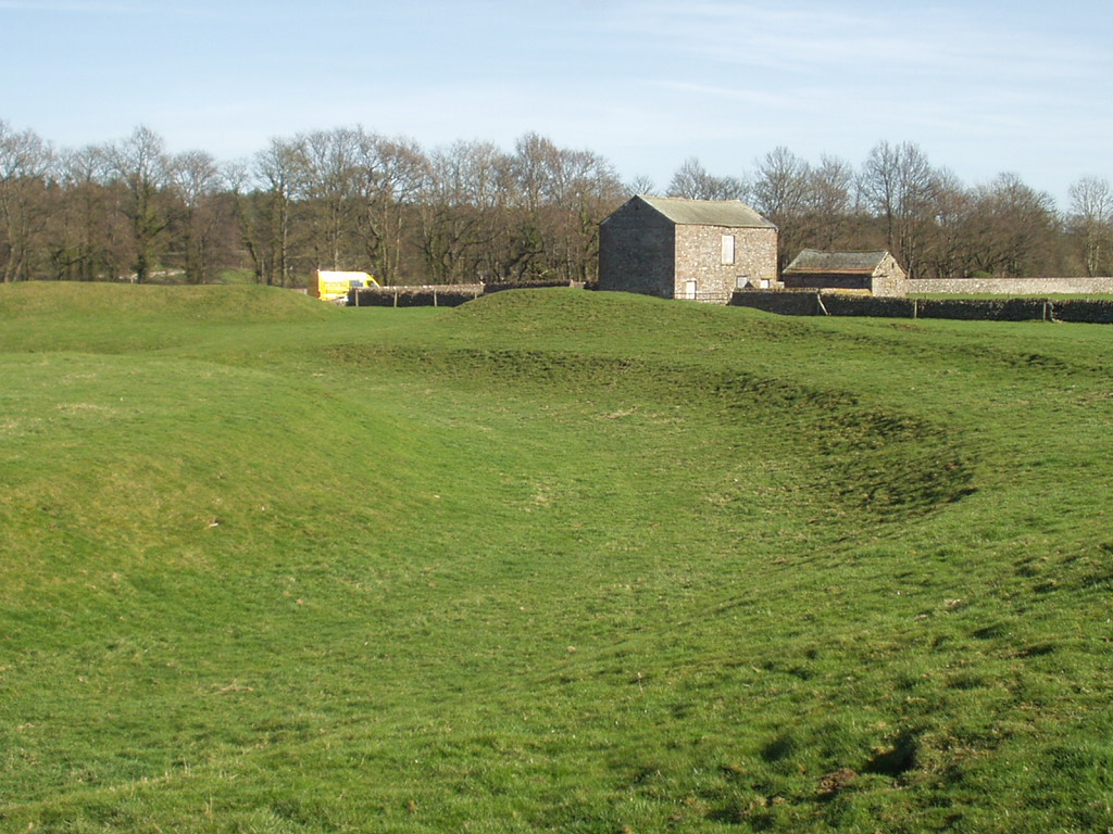
King Arthur's Round Table
Monument and historic site · 1.4 mi
Neolithic henge monument in Eamont Bridge, Westmorland, Cumbria, England, UK


Brougham Hall
Museum · 1.6 mi
Country house in Cumbria, United Kingdom

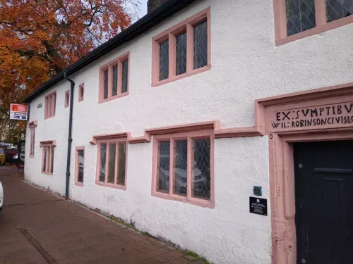
Penrith and Eden Museum
Museum
Museum in Penrith, Cumbria, England, United Kingdom




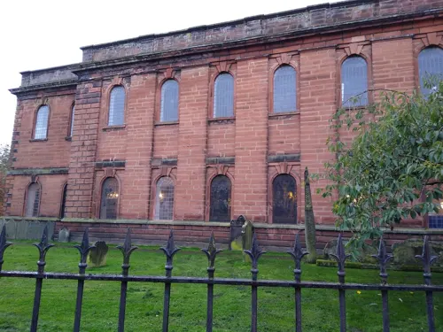
11 more on the map.
Parks, trails and playgrounds13

Cold Springs Community Nature Reserve
Hiking and trails · 1.0 mi
Nature reserve with full permitted access without a dog. Some paths are also suitable for dogs.


1 more on the map.
Restaurants and cafes91
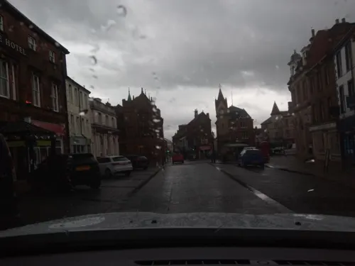
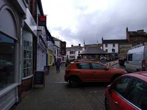
The Ice Cream Garden & Tearoom
Cafe · Coffee Shop
10 Cornmarket, Penrith
Mo-Tu,Th-Sa 10:00-15:30; We,Su off
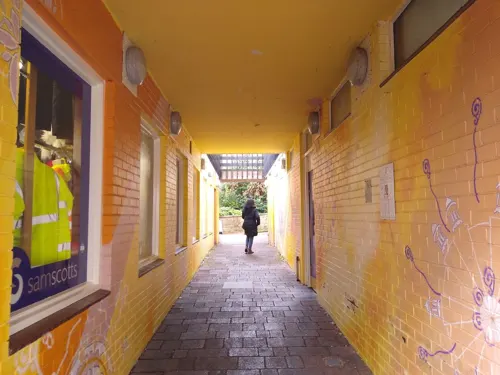
Chapter 12 Coffee Rooms
Cafe
12 Little Dockray, Penrith
Mo-Th 10:00-16:00; Fr,Sa 09:00-16:00; Su 11:00-17:00



FYR Grill
Restaurant · Steak House, Burger · 0.8 mi
Ullswater Road
Mo-Fr 08:00-17:00; Sa-Su 10:00-17:00
79 more on the map.
History
The toponymy of "Penrith" has been debated. Several writers argue for the Cumbric or Welsh pen "head, chief, end" (both noun and adjective) with the Cumbric rid, Welsh rhyd "ford", to mean "chief ford", "hill ford", "ford end", or Whaley's suggestion: "the head of the ford" or "headland by the ford".
The centre of Penrith, however, lies about 1 mile (1.6 km) from the nearest crossing of the River Eamont at Eamont Bridge. An alternative has been suggested consisting of the same pen element meaning "head, end, top" + the equivalent of Welsh rhudd "crimson". Research on the medieval spelling variants of Penrith also suggests this alternative toponymy. The name "red hill" may refer to Beacon Hill, to the north-east of today's town. There is also a place called Redhills to the south-west, near the M6 motorway, and a place called Penruddock, about 6 miles (9.7 km) west of Penrith. These names all reflect the local geology, as red sandstone is abundant in the area and was used for many buildings in Penrith.
The origins of Penrith go far back in time. There is archaeological evidence of "early, concentrated and continuous settlement" in the
Read more of the history
area. The Neolithic (c. 4500–2350 BCE) or early-Bronze Age (c. 2500–1000 BCE) sites at nearby Mayburgh Henge, King Arthur's Round Table, Little Round Table, Long Meg and Her Daughters, and Little Meg, and the stone circles at Leacet Hill and, a little further away, at the Shap Stone Avenue and at Oddendale are some of the visible traces of "one of the most important groups of prehistoric ritual sites in the region." In addition there have been various finds (stone axes, hammers, knives) and carvings found in the Penrith area.
For the Celtic (Iron Age) era (c. 800 BCE – 100 CE), nearby Clifton Dykes has been proposed as the centre of the Carvetti tribe, due to the large enclosure discovered there and assumptions about the strategic position of the Penrith area in the communications systems running north–south through the Eden Valley and east–west across Stainmore.
Penrith itself was not established by the Romans, but they recognised the strategic importance of the place, especially near the confluence of the rivers Eamont and Lowther, where the Roman road crossing the Pennines (the present A66) came through. In doing so, they built the fort at Brougham (Brocavum) along with another road (the present A6) going north over Beacon Hill to the large fort at Plumpton (Voreda) – and from there northwards to Carlisle (Luguvallium). Brocavum may also have been built in order to have a military presence close to the centre of the Carvetti.
The Roman fort of Voreda occupied the site now known as Old Penrith, five miles north of the town. The 18th-century antiquarian and vicar of Penrith, Dr.Hugh Todd, speculated that the Ala I Petriana may have been stationed there, giving its name to the subsequent town, but see the "Toponymy" section above.
The Roman road from Manchester to Carlisle ran through the area. Excavations before an extension to Penrith Cemetery showed the road had survived better at the edges of the field. The cobble and gravel surfaces seemed to have been ploughed out at the centre. The road was constructed by excavating a wide, shallow trench below subsoil level. Large cobbles were probably obtained nearby, as they did not appear frequently in the subsoil in the excavated area. They were added to the excavated subsoil dumped back into the cut to form a stable foundation, canted at the centre of the road.
The two forts close to where Penrith is today would have had a vicus, an ad-hoc civilian settlement nearby, where farmers supplying food to the forts, and traders and others supplying goods and services lived and died. There is evidence of continuous settlement throughout the Roman period and into the post-Roman era.
Following the departure of the Romans (c. 450 CE), the north became a patchwork of warring Celtic tribes (Hen Ogledd). One of these may have been Rheged, perhaps with a centre in the Eden valley and covering the area formerly held by the Carvetti. However, this has been disputed by historians. The Rheged Centre, just outside Penrith, commemorates the name.
During the 7th century, the region was invaded by the Angles, a Germanic tribe which moved west from Northumbria. The Celtic place-names in the region such as Penrith, Blencow, Culgaith, Penruddock, were now joined by settlements ending in "-ham" (estate) and "-ton" (farm), such as Askham, Barton, Clifton, Plumpton and Stainton.
From about 870, the area became subject to Viking settlement by Norse from Dublin and the Hebrides, along with Danes from Yorkshire. Settlements with names ending in "-by" ("village") and "-thorpe" ("hamlet") were largely on higher ground – the Vikings were pastoralists, the Angles arable farmers. Examples are Melkinthorpe, Langwathby, Lazonby, and Ousby. Little and Great Dockray (not to be confused with the nearby village Dockray) in Penrith itself are Norse names.
The Penrith Hoard of Viking silver brooches was found in the Eden valley at Flusco Pike, Penrith, as were 253 pieces of silver at Lupton.
Two cross-shafts and four hogbacks, along with a small cross found immediately to the west of St Andrew's Church, known as the "Giant's Grave" and "Giant's Thumb" (c. 920s), have long prompted speculation. They may have been separate items brought together by an antiquary, or they may be a genuine group. They appear to be an Anglo-Norse fusion of Christian and Norse motifs, but it is still debated whether they are linked to the King of the Strathclyde Cumbrians, Owain ap Dyfnwal (fl. 934). It is thought that Strathclyde British had settled in parts of north Cumbria in the 10th century.
From the History section of Penrith, Cumbria on Wikipedia, under CC BY-SA 4.0.
More about Penrith
Geography
Penrith lies in the Eden Valley, just north of the River Eamont. Other local rivers bounding the town are the Lowther and Petteril. Thacka Beck flows through the town centre partly in a culvert, remaining mostly underground. It links the River Petteril and the River Eamont. For many centuries, the Beck provided Penrith's main water supply. Thacka Beck Nature Reserve provides flood storage to protect buildings in Penrith. Another stream, the Myers or Dog Beck, flows through and under the south-west of the town, joining Thacka Beck near Tynefield Court. The Dog Beck section has also been known as Scumscaw Beck or Tyne Syke. In 2014 the pub chain Wetherspoons opened a branch in Penrith, naming it the Dog Beck. There are also streams or becks running through the Carleton area of the town.
Castletown, west of the West Coast Main Line, includes the Gilwilly Industrial Estate and some of the Penrith or Myers Industrial Estate. The area, originally built for workers on the railway line, mostly consists of late 19th and early 20th-century terraced housing, including some council housing. Since the 1990s, private developments such as Greystoke Park, Castletown Drive and Castle Park have appeared.
Economy
As a market town relying heavily on the tourist trade, Penrith benefits from some high-street chain stores and local specialist shops alongside other businesses such as banks, building societies and travel agents.
Market days are traditionally Tuesday and Saturday. On Tuesdays there was a small outdoor market in Great Dockray and Cornmarket. This ceased in the early 21st century, since when a small farmers' market has been held in the Market Square once a month. On Saturdays, Cumbria's largest outdoor market takes place at the Auction Mart alongside the M6 motorway junction 40.
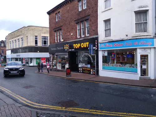
The main central shopping areas are Middlegate, Little Dockray, Devonshire Street/Market Square, Cornmarket, King Street, Angel Lane and the Devonshire Arcade and Angel Square precincts, with some shops in Burrowgate, Brunswick Road and Great Dockray.
Arts and culture
The Penrith dialect known as Penrithian, spoken around the Penrith and Eden district area, is a variant of the Cumbrian dialect.
Like other rural towns of its size, Penrith relies on public houses to form the basis of social entertainment. It was once famous for the sheer number of its pubs, served by five working breweries. The trend of pub closures continues, but many remain. They range from small traditional pubs with a loyal clientele to bigger bars that form part of the "circuit". Penrith also has numerous dining places and restaurants.
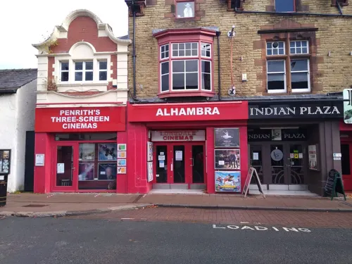
The Lonsdale (formerly the Alhambra) in Middlegate is a cinema with three screens built in 1910 by William Forrester. There was until the 1980s another cinema called the Regent on Old London Road.
Amateur dramatics and musicals are staged at the Penrith Players Theatre, Ullswater Community College and Queen Elizabeth Grammar School.
Mayday Carnival: On the first Monday in May, Penrith holds a Mayday Carnival run by Penrith Lions Club. It includes a parade, street dancers and fairground rides in the Great Dockray and Market Square car parks of the commercial area. The procession includes floats, vintage cars and tractors, a marching band, various local celebrities and members of the Penrith Lions Club. It starts in the yard of Ullswater Community College and ends in the bus station car park. Many roads in the centre are closed for the event.
Education
Penrith hosts two Community Cadet Forces units: 1247 Squadron of the Air Training Corps and Penrith Detachment of Cumbria Army Cadet Force.
Beaconside Primary, Eden Mount/Brent Road. Until 2008 there were separate Beaconside Infant and Junior schools.
North Lakes School (formerly Wetheriggs Junior; was at first a girls-only school), Huntley Avenue – North Lakes was one of the first schools in England to be awarded a Sing Up Gold Award (in December 2008) and soon after that their highest accolade, a Sing Up Platinum Award.
Ullswater Community College (formerly Ullswater High School, and before that, two single sex secondary modern schools on the same site called Tynefield (girls) and Ullswater (boys)), Wetheriggs Lane
Queen Elizabeth Grammar School (QEGS) (selective), Ullswater Road
The former Newton Rigg College had its campus just outside the town. Its most recent owner was Askham Bryan College but in the past it has been part of UCLAN and subsequently the University of Cumbria. Since the closure some facilities remain available for public and educational use, for example the Equestrian Centre re-opened in February 2022
Ullswater Community College had a large further or adult education centre.
Girls National School (building now housing school replaced by Beaconside Juniors), Drovers Lane
From the Wikipedia article Penrith, Cumbria, under CC BY-SA 4.0.
Notable people from Penrith
 Oliver Turveyracecar driverPhoto: Jake Archibald, CC BY 2.0
 Mark DonovanBritish cyclistPhoto: Hugo LUC, CC BY-SA 4.0
 Bettina ArndtAustralian sex therapist and social commentatorPhoto: Bettina Arndt, CC BY-SA 2.0
 Danny GraingerEnglish association football player (born 1986)Photo: Alonstoter, CC BY-SA 3.0
- Esmé Howard, 1st Baron Howard of PenrithBritish diplomat (1863-1939)
- Henry Alleyne NicholsonBritish palaeontologist and zoologist (1844-1899)
- Adam CollinEnglish association football player (born 1984)
- Stuart LancasterEnglish rugby union footballer and coach
- John LesterAmerican cricketer (1871-1969)
- David Cowanfootballer (born 1982)
- Jonny Allanfootballer (born 1983)
- Liz BlackmanBritish politician (born 1949)
Born in Penrith, according to Wikidata (CC0). Each name links to its Wikipedia article.
Where to stay24
Churches and places of worship17
Shopping35
Gas and EV charging5
Schools, colleges and libraries10
Healthcare5
Map of Penrith
227 places. The map loads OpenStreetMap tiles when you open it.
Getting there and nearby towns
Carlisle Lake District Airport (CAX) is the nearest airport with scheduled flights listed in OpenStreetMap, 19 miles away.
- Stainton 2 mi southwest, about 4 min by car
- Langwathby 4 mi northeast, about 7 min by car
- Workington 31 mi west, about 51 min by car
- Whitehaven 34 mi west, about 55 min by car
- Ulverston 35 mi southwest, about 57 min by car
- Prudhoe 41 mi northeast, about 1 h by car
- Spennymoor 46 mi east, about 1 h 15 min by car
- Whickham 47 mi northeast, about 1 h 15 min by car
- Ponteland 48 mi northeast, about 1 h 15 min by car
- Newcastle upon Tyne 50 mi northeast, about 1 h 15 min by car
Drive times are estimates from straight-line distance, not routes.
Towns near Penrith


Keep exploring
Local news
Headlines from INDB.
Reviews, tips and questions
Loading what members have shared...
Sources and licences
- GeoNames (CC BY 4.0): population, coordinates, regions and time zone
- Mapillary (see each image): photos
- OpenStreetMap contributors (ODbL 1.0): places, airports, map data
- Wikidata (CC0 1.0): elevation, founding date, time zone, website, landmarks and historic places
- Wikimedia Commons (see each image): photos
- Wikipedia (CC BY-SA 4.0): overview and history text
Photo credits
- 1326913 Clock Tower, Market Square Penrith 20240527 0058, Tilman2007, CC BY-SA 4.0
- Former Congregational Church, Penrith, Ian S, CC BY-SA 2.0
- Penrith Co-Op, Steve Partridge, CC BY-SA 2.0
- Eamont Bridge, Cumbria, Northernhenge, CC0
- Arthur's Round Table 3, Davidberry51 at English Wikipedia, Public domain
- Ruins of Brougham Hall, Tom Parnell, CC BY-SA 4.0
- Queen Elizabeth Grammar School, Penrith. Picture, Joshuawjames, CC BY-SA 3.0
- Hutton Hall (1), Richard Nevell, CC BY-SA 3.0
- Crown Hotel, Eamont Bridge, JThomas, CC BY-SA 2.0
- Penrith Library (1), Gpwitteveen, CC BY-SA 3.0
- Christ Church, Penrith, Roger Templeman, CC BY-SA 2.0
- Methodist Church 3, Frombowen, CC BY-SA 4.0
- Gateway To Cemetery With Pair Of Integral Chapels, Richard Nevell, CC BY-SA 3.0
- Cross Keys, Carleton, Roger Templeman, CC BY-SA 2.0
- Friends' Meeting House, Richard Nevell, CC BY-SA 3.0
- War Memorial, Eamont Bridge, JThomas, CC BY-SA 2.0
- Alhambra Cinema - panoramio, flipflopnick, CC BY-SA 3.0
- Penrith Castle 2, Clintheacock66 at en.wikipedia, CC BY 3.0
- United Reformed Church (2), Richard Nevell, CC BY-SA 3.0
- Mayburgh Henge - Central Monolith - panoramio, Adrian Farwell, CC BY 3.0
- Street-level photo, victuallers, CC BY-SA 4.0
- Street-level photo, jethro10, CC BY-SA 4.0
- Street-level photo, zuse, CC BY-SA 4.0
- Street-level photo, jethro10, CC BY-SA 4.0
- Street-level photo, jethro10, CC BY-SA 4.0
- Street-level photo, jethro10, CC BY-SA 4.0
- Street-level photo, victuallers, CC BY-SA 4.0
- Street-level photo, laye, CC BY-SA 4.0
- Street-level photo, zuse, CC BY-SA 4.0
- Street-level photo, jethro10, CC BY-SA 4.0
- Street-level photo, jethro10, CC BY-SA 4.0
- Street-level photo, jethro10, CC BY-SA 4.0
- Street-level photo, jethro10, CC BY-SA 4.0
- Street-level photo, victuallers, CC BY-SA 4.0
- Street-level photo, jethro10, CC BY-SA 4.0
- Street-level photo, victuallers, CC BY-SA 4.0
- Street-level photo, jethro10, CC BY-SA 4.0
- Street-level photo, victuallers, CC BY-SA 4.0
- Street-level photo, jethro10, CC BY-SA 4.0
- Street-level photo, jethro10, CC BY-SA 4.0
- Street-level photo, victuallers, CC BY-SA 4.0
- Street-level photo, zuse, CC BY-SA 4.0
- Street-level photo, jethro10, CC BY-SA 4.0
- Street-level photo, laye, CC BY-SA 4.0
- Street-level photo, hobgoblin, CC BY-SA 4.0
- Street-level photo, zuse, CC BY-SA 4.0
- Street-level photo, jethro10, CC BY-SA 4.0
- Street-level photo, zuse, CC BY-SA 4.0
- Street-level photo, zuse, CC BY-SA 4.0


Page built November 10, 2026. Spotted a mistake? Tell us or suggest a place.