


Litherland, United Kingdom
Litherland is a town of 22,971 people in England, United Kingdom.
Why visit Litherland
Townapedia lists 2 museums and landmarks, 31 parks and trails, 83 places to eat, 4 places to stay and 5 attractions in and around town.
Highlights include Crosby Beach, Floral Pavilion Theatre, Bootle War Memorial and Canalside Park.
Weather in Litherland
Forecast from MET Norway (CC BY 4.0). Full forecast
About Litherland
Litherland is a town in the Metropolitan Borough of Sefton, Merseyside. Until 1974, it was within the historic county of Lancashire. It was an urban district, which included Seaforth and Ford. It neighbours Waterloo to the north, Seaforth to the west, and Bootle to the south and is approximately 5 miles (8.0 km) north of Liverpool city centre.
From the Wikipedia article Litherland (this version), under CC BY-SA 4.0.
Photos of Litherland


Things to do5


Floral Pavilion Theatre
Cinema and theater · 2.6 mi
Theatre in New Brighton, England

New Brighton Lighthouse
Lighthouse · 2.5 mi
Grade II* listed lighthouse in New Brighton, Wirral, Merseyside, England, UK


Winter Gardens Theatre
Cinema and theater · 3.0 mi
Former cinema in New Brighton, Wallasey, Wirral, Merseyside, England
Museums and landmarks2

Bootle War Memorial
Monument and historic site · 1.8 mi
Grade II* listed war memorial in Bootle, Merseyside, England, UK

Parks, trails and playgrounds31


Stanley Park
Park · 2.9 mi
Park in Liverpool, Merseyside, England, UK

Vale Park
Park · 3.0 mi
Park in New Brighton, Merseyside, England, UK



19 more on the map.
Restaurants and cafes83
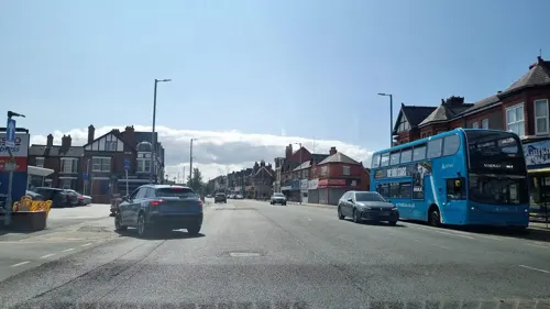
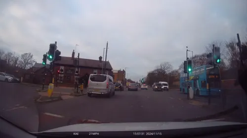
Mr Deli
Restaurant · Burger, Chicken, Sandwich, Japanese, Chinese, Sushi, Breakfast, Salad, Brunch · 1.1 mi
136 South Road, Waterloo
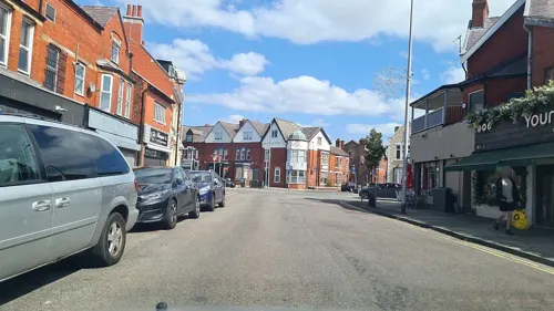
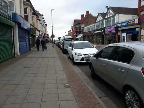
Valerie’s Coffee
Cafe · Coffee Shop, Breakfast, Toasted Sandwiches · 1.2 mi
52-54 South Road, Waterloo
Mo-Sa 08:00-17:00, Su 09:00-15:00



Another Coffee Place
Cafe · Breakfast, Coffee Shop, Sandwich · 1.2 mi
1A Lorne Road, Liverpool
Tu-Sa 08:00-14:00
Trap & Hatch
Bar and pub · 1.1 mi
135 South Road, Waterloo
Mo 17:00-23:00, We-Th 16:00-23:00, Fr 15:00-23:00, Su 14:00-23:00
The Liver Hotel
Bar and pub · 1.1 mi
137 South Road, Liverpool
Mo-Su,PH 12:00-24:00
71 more on the map.
History
The name Litherland derives from two elements, Old Norse hlið/hlith-ar, which means "slope", and Old English land, "land".
Litherland was mentioned in the Domesday Book of 1086 as Liderlant, however there was no mention of Liverpool at that time. The first manor of Litherland consisted of one half and two quarters, the areas being Litherland including what is now Seaforth (the half) and present day Orrell and Ford (the two quarters).
Litherland remained a poor area until the arrival of the Leeds and Liverpool Canal in 1774, this brought the area into the modern world, originally providing a safe route through Lancashire from Liverpool to Wigan, and eventually in 1816 through to Leeds. The route became very busy primarily for goods and later for the transportation of passengers. The outcome of all this activity was to bring prosperous businessmen from the city to the countryside, where they had a desire to live. The canal was crossed by a mechanical lifting bridge built in 1934 (replacing an earlier swing bridge) which was demolished in 1974.
Read more of the history
The area was the northern extremity of the Bootle and North Docks lines of Liverpool's tramway network. From the boundary with Bootle, it ran for ¾ of a mile along Linacre Road to a terminus at the junction with Bridge Road. This short stretch was the last horse drawn service in Liverpool, switching to electric operation in August 1903, eight months after the rest of the system converted.
The Litherland Gala was staged every year and was famous for the procession of shire horses and floats from the docks. The gala procession ended at the Bryant and May sports field.
Litherland Town Hall was officially opened in February 1941: The Beatles played some of their earliest gigs there in 1961.
From the History section of Litherland on Wikipedia, under CC BY-SA 4.0.
More about Litherland
Education
Primary schools in the area include Beach Road primary school, Hatton Hill Primary School, English Martyrs' Catholic Primary School, Litherland Moss Primary School, Lander Road Primary School, Our Lady Queen of Peace Catholic Primary School, St Elizabeth's Catholic Primary School and St Philip's Church of England Controlled Primary School.
Litherland High School is the main secondary school in the area, while Rowan Park School is a special school for 2 to 19 year-olds.
South Sefton College is a sixth form which serves students in Litherland as well as the wider southern part of the Metropolitan Borough of Sefton.
From the Wikipedia article Litherland, under CC BY-SA 4.0.
Notable people from Litherland
 Paul MullinEnglish footballer (born 1994)Photo: Timmy96, CC0
- Roger McGoughBritish writer and poet
- Bryan GriffithsBritish association football player (born 1939)
- Robert DepledgeEnglish footballer
- Archibald SpoonerEnglish cricketer (1886-1965)
- Teddy LightfootEnglish footballer (1889-1918)
Born in Litherland, according to Wikidata (CC0). Each name links to its Wikipedia article.
Where to stay4
Churches and places of worship44
Shopping16
Gas and EV charging3
Schools, colleges and libraries41
Our Lady Queen of Peace Catholic Primary School
School · Roman Catholic · 0.8 mi
Ford Close, Liverpool
Our Lady Star of the Sea Catholic Primary School
School · Roman Catholic · 0.5 mi
Kepler Street, Liverpool
Healthcare9
Map of Litherland
238 places. The map loads OpenStreetMap tiles when you open it.
Getting there and nearby towns
Liverpool John Lennon Airport (LPL) is the nearest airport with scheduled flights listed in OpenStreetMap, 11 miles away.
- Liverpool 4 mi south, about 7 min by car
- Maghull 4 mi northeast, about 6 min by car
- West Derby 4 mi southeast, about 7 min by car
- Birkenhead 5 mi south, about 9 min by car
- Moreton 7 mi southwest, about 11 min by car
- Ormskirk 8 mi northeast, about 13 min by car
- Woolton 8 mi southeast, about 14 min by car
- Rainhill 10 mi east, about 17 min by car
- St Helens 11 mi east, about 18 min by car
- Speke 11 mi southeast, about 18 min by car
Drive times are estimates from straight-line distance, not routes.
Towns near Litherland


Keep exploring
Local news
Headlines from INDB.
Reviews, tips and questions
Loading what members have shared...
Sources and licences
- GeoNames (CC BY 4.0): population, coordinates, regions and time zone
- Mapillary (see each image): photos
- OpenStreetMap contributors (ODbL 1.0): places, airports, map data
- Wikidata (CC0 1.0): elevation, founding date, time zone, website, landmarks and historic places
- Wikimedia Commons (see each image): photos
- Wikipedia (CC BY-SA 4.0): overview and history text
Photo credits
- Leeds and Liverpool Canal south of bridge 2J, Rodhullandemu, CC BY-SA 4.0
- St Philip's Church, Litherland, Anthony Parkes, CC BY-SA 2.0
- Crosby Beach ship, Chris Howells (= Chowells ), CC BY-SA 3.0
- Floral Pavilion Theatre, Frombowen, CC BY-SA 4.0
- Perch Rock Lighthouse 2021, Rodhullandemu, CC BY-SA 4.0
- Bootle War Memorial 1, Rodhullandemu, CC BY-SA 4.0
- Canalside Park September 16 2010 (1), John Bradley, CC BY-SA 3.0
- Stanley Park Feb 11 2010 (10), John Bradley, CC BY 3.0
- Vale Park, Wallasey (33), Rept0n1x, CC BY-SA 3.0
- Warbreck Park 2, Rodhullandemu, CC BY-SA 4.0
- Church of St. Monica, Bootle 1, Rodhullandemu, CC BY-SA 4.0
- Crosby United Reformed Church 1, Rodhullandemu, CC BY-SA 4.0
- Old Christ Church, Waterloo 2, Rodhullandemu, CC BY-SA 4.0
- Our Lady Star of the Sea, Seaforth 1, Rodhullandemu, CC BY-SA 4.0
- Spellow Lane church 2018, Rodhullandemu, CC BY-SA 4.0
- St Anthony's, Scotland Road 2019-1a, Rodhullandemu, CC BY-SA 4.0
- St Benet's Chapel, Netherton 2, Rodhullandemu, CC BY-SA 4.0
- St George's Everton 2019-2, Rodhullandemu, CC BY-SA 4.0
- St Helen's Church, Sefton 2021, Rodhullandemu, CC BY-SA 4.0
- Entrance to Rimrose Valley at St Mary's Road, Rodhullandemu, CC BY-SA 4.0
- Savio Salesian College, Litherland, Rodhullandemu, CC BY-SA 4.0
- Plaza cinema, Waterloo, Rodhullandemu, CC BY-SA 4.0
- St Robert Bellarmine, Orrell 4, Rodhullandemu, CC BY-SA 4.0
- Merseybus 2122 CUL122V (8717337473), Alan Sansbury from Liverpool, England, CC BY 2.0
- Leeds and Liverpool Canal north of bridge 2J, Rodhullandemu, CC BY-SA 4.0
- Merseyside PTE 1032 A112HLV (8718529258), Alan Sansbury from Liverpool, England, CC BY 2.0
- Merseybus 2122 CUL122V & Merseyside PTE 1032 A112HLV (8718527672), Alan Sansbury from Liverpool, England, CC BY 2.0
- Street-level photo, mappo2, CC BY-SA 4.0
- Street-level photo, lamaar639, CC BY-SA 4.0
- Street-level photo, victuallers, CC BY-SA 4.0
- Street-level photo, lamaar639, CC BY-SA 4.0
- Street-level photo, davidsong, CC BY-SA 4.0
- Street-level photo, davidsong, CC BY-SA 4.0
- Street-level photo, mappo2, CC BY-SA 4.0
- Street-level photo, davidsong, CC BY-SA 4.0
- Street-level photo, cyclestreets, CC BY-SA 4.0
- Street-level photo, cyclestreets, CC BY-SA 4.0
- Street-level photo, lamaar639, CC BY-SA 4.0
- Street-level photo, davidsong, CC BY-SA 4.0
- Street-level photo, davidsong, CC BY-SA 4.0
- Street-level photo, thingomy, CC BY-SA 4.0
- Street-level photo, davidsong, CC BY-SA 4.0
- Street-level photo, davidsong, CC BY-SA 4.0


Page built November 10, 2026. Spotted a mistake? Tell us or suggest a place.