


Why visit Dingle
Townapedia lists 42 museums and landmarks, 20 parks and trails, 163 places to eat, 6 places to stay and 9 attractions in and around town.
Highlights include Dell Bridge, Port Sunlight, Epstein Theatre, The Oratory and The Hardmans' House.
Weather in Dingle
Forecast from MET Norway (CC BY 4.0). Full forecast
About Dingle
Dingle (known locally as the Dingle) is an inner city area of Liverpool, Merseyside, England. It is located to the south of the city, bordered by the adjoining districts of Toxteth and Aigburth. At the 2001 Census, the population was recorded at 13,246.
From the Wikipedia article Dingle, Liverpool (this version), under CC BY-SA 4.0.
Photos of Dingle


Things to do9

Dell Bridge, Port Sunlight
Bridge · 2.5 mi
Grade II listed bridge in Wirral

Epstein Theatre
Cinema and theater · 2.0 mi
Theatre in Liverpool, Merseyside, England, UK

Everyman Theatre
Cinema and theater · 1.7 mi
Theatre and building in Liverpool, Merseyside, England

Liverpool Olympia
Cinema and theater · 2.5 mi
Theatre in Liverpool, Merseyside, England, UK

Liverpool Playhouse
Cinema and theater · 2.1 mi
Theatre in Liverpool, England, UK

Radio City Tower
Monument and historic site · 2.1 mi
Radio and observation tower in Liverpool, Merseyside, England, UK

Unity Theatre
Cinema and theater · 1.6 mi
Theatre in Liverpool, Merseyside, England

Argyle Theatre
Cinema and theater · 2.6 mi
Former theatre, music hall and cinema in Birkenhead, England
Museums and landmarks42
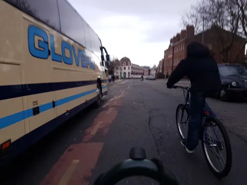
The Oratory
Monument and historic site · 1.5 mi
Church in Liverpool, Merseyside, England, UK
Upper Duke Street, Liverpool

59 Rodney Street, Liverpool
Museum · 1.5 mi
Historic house museum in Liverpool

Birkenhead Priory
Museum · 2.2 mi
Monastery and musem in Wirral, United Kingdom

Birkenhead War Memorial
Monument and historic site · 2.5 mi
Grade II listed war memorial in Wirral, Merseyside, England, UK

Calderstones Park
Monument and historic site · 2.7 mi
Public park in Liverpool, England

Eleanor Rigby statue
Monument and historic site · 2.2 mi
Statue in Stanley Street, Liverpool, England


John Lennon Peace Monument
Monument and historic site · 1.8 mi
Monument dedicated to the memory of John Lennon in Liverpool

Lady Lever Art Gallery
Museum · 2.3 mi
Art museum in Wirral, Merseyside, England, UK

Leverhulme Memorial
Monument and historic site · 2.3 mi
Memorial in Port Sunlight, Merseyside, England, UK

Liverpool Beatles Museum
Museum · 2.2 mi
Museum dedicated to the Beatles
30 more on the map.
Parks, trails and playgrounds20


Everton Park
Park · 2.9 mi
Park in the Everton area of Liverpool, England

Port Sunlight River Park
Park · 1.7 mi
Park in Port Sunlight, United Kingdom




8 more on the map.
Restaurants and cafes163
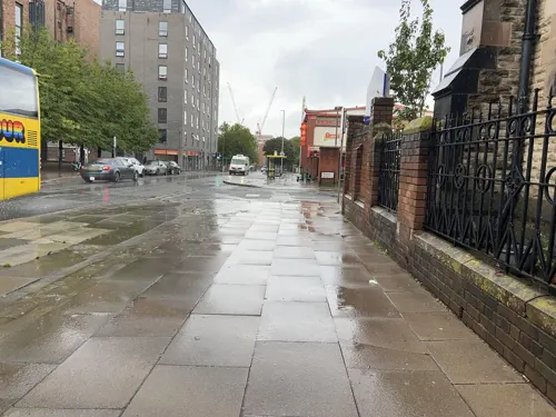
Ryde Cycle cafe
Cafe · Coffee Shop · 1.5 mi
54 St James Street, Liverpool
Mo-Fr 08:00-16:00; Sa 09:00-16:00

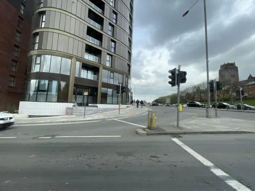
Le Viet Social
Restaurant · Vietnamese · 1.3 mi
Parliament Street, Liverpool
Tu,We,Th,Su 11:00-22:00; Fr-Sa 11:00-23:00
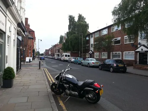
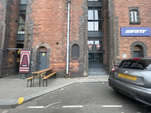
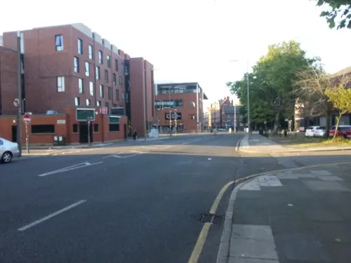


Baltic Bakehouse
Cafe · Sandwich · 1.5 mi
46 Bridgewater Street, Liverpool
Tu-Fr 08:30-17:30; Sa-Su 10:00-16:00

151 more on the map.
History
Dingle is an area entirely within the boundaries of the old Toxteth Park. It is named after Dingle Brook (Dingle meaning a wooded valley), which rose at High Park Street and roughly followed Park Road towards the Old Toxteth Chapel, just south of Dingle Lane, and entered the River Mersey at Knott's Hole, which was a narrow bay or inlet next to where the Dingle flowed out to the Mersey.
On either side were steep rocky cliffs, with Dingle Point to the south west. In the 1850s, the Dingle area was purely rural. Liverpool lay to the north west, but this was an area of large houses, vast gardens, babbling streams and a long beach.
It was a mainly Protestant area, which developed from the influx of Welsh settlers, whilst the north end of Liverpool such as Everton and Vauxhall was settled by Irish immigrants, and became mainly Irish Catholic.
Between 1896 and 1956, the Liverpool Overhead Railway's terminus and only underground station was Dingle railway station, located on Park Road, the Dingle. This was the end of the line for services from Seaforth Sands in the north of the city, not to be confused with Seaforth and Litherland on the Merseyrail line to Southport.
From the History section of Dingle, Liverpool on Wikipedia, under CC BY-SA 4.0.
Notable people from Dingle
 Ringo StarrBritish musician, drummer for the Beatles (born 1940)Photo: dearMoon, CC BY 3.0
 Eddie BrabenEnglish comedy writerPhoto: Rodhullandemu, CC BY-SA 4.0
- Tony JacksonBritish singer (1938–2003)
Born in Dingle, according to Wikidata (CC0). Each name links to its Wikipedia article.
Where to stay6
Churches and places of worship81
St. Bride's Church
Church · Anglican · 1.3 mi
Percy Street, Liverpool
Shopping27
Gas and EV charging4
Schools, colleges and libraries44
Healthcare14
Smithdown Children's NHS Walk-in Centre
Clinic and pharmacy · 1.4 mi
Smithdown Road, Liverpool
Map of Dingle
250 places. The map loads OpenStreetMap tiles when you open it.
Getting there and nearby towns
Liverpool John Lennon Airport (LPL) is the nearest airport with scheduled flights listed in OpenStreetMap, 6 miles away.
- Liverpool 2 mi north, about 4 min by car
- Birkenhead 2 mi northwest, about 4 min by car
- Woolton 4 mi east, about 6 min by car
- West Derby 4 mi northeast, about 7 min by car
- Halewood 5 mi east, about 9 min by car
- Speke 6 mi southeast, about 9 min by car
- Fazakerley 6 mi north, about 9 min by car
- Litherland 6 mi north, about 10 min by car
- Heswall 7 mi southwest, about 11 min by car
- Moreton 7 mi west, about 11 min by car
Drive times are estimates from straight-line distance, not routes.
Towns near Dingle


Keep exploring
Local news
Headlines from INDB.
Reviews, tips and questions
Loading what members have shared...
Sources and licences
- GeoNames (CC BY 4.0): population, coordinates, regions and time zone
- Mapillary (see each image): photos
- OpenStreetMap contributors (ODbL 1.0): places, airports, map data
- Wikidata (CC0 1.0): elevation, founding date, time zone, website, landmarks and historic places
- Wikimedia Commons (see each image): photos
- Wikipedia (CC BY-SA 4.0): overview and history text
Photo credits
- Substation, Dingle Vale, Rodhullandemu, CC BY-SA 3.0
- Dingle Vale, Rodhullandemu, CC BY-SA 3.0
- Dingle Mount Church, Rodhullandemu, CC BY-SA 3.0
- Mosaic globe, Dingle Mount, Rodhullandemu, CC BY-SA 3.0
- St Finbar's RC primary school, Dingle, Rodhullandemu, CC BY-SA 3.0
- Mosaic cross, Dingle Mount, Rodhullandemu, CC BY-SA 3.0
- Gaumont cinema, Dingle, Rodhullandemu, CC BY-SA 3.0
- Dingle station train fire, Liverpoolpics, CC BY-SA 3.0
- Post box on Cockburn Street, Dingle, Rodhullandemu, CC BY-SA 3.0
- Dell Bridge, David Squire, CC BY-SA 2.0
- Neptune Theatre, Liverpool, John Bradley, CC BY-SA 3.0
- Everyman Theatre, Liverpool 2018, Rodhullandemu, CC BY-SA 4.0
- Liverpool Olympia 2018, Rodhullandemu, CC BY-SA 4.0
- Playhouse Theatre, Liverpool 2018-2, Rodhullandemu, CC BY-SA 4.0
- Radio City Tower from Lime Street railway station, Rodhullandemu, CC BY-SA 4.0
- Entrance of Unity Theatre, Liverpool, Rodhullandemu, CC BY-SA 4.0
- Birkenhead Priory from St Mary's Tower 2019-2, Rodhullandemu, CC BY-SA 4.0
- Birkenhead War Memorial, Rodhullandemu, CC BY-SA 4.0
- Calderstones House, Sue Adair, CC BY-SA 2.0
- Eleanor Rigby 2018-1, Rodhullandemu, CC BY-SA 4.0
- John Lennon peace memorial, Echo Arena 1, Rodhullandemu, CC BY-SA 4.0
- Lady Lever Art Gallery, Port Sunlight - IMG 0915, Rept0n1x, CC BY-SA 3.0
- 23 Mathew Street, Liverpool, Rodhullandemu, CC BY-SA 4.0
- Canalside Park September 16 2010 (1), John Bradley, CC BY-SA 3.0
- Chavasse Park 4, John Bradley, CC BY-SA 3.0
- Everton Park, Vanbasten 23, CC BY-SA 3.0
- Tree stump sculpture at Port Sunlight River Park (30099888911), Rept0n1x, CC BY-SA 2.0
- Christ Church, Oxton 2018-2, Rodhullandemu, CC BY-SA 4.0
- Christ Church, Higher Bebington 1, Rodhullandemu, CC BY-SA 4.0
- Christ Church, Kensington 2019, Rodhullandemu, CC BY-SA 4.0
- Christ Church, Port Sunlight, Rodhullandemu, CC BY-SA 4.0
- Church of Our Lady of Reconciliation, Liverpool 2019, Rodhullandemu, CC BY-SA 4.0
- St Andrew's Church, Rodney Street 2019-1, Rodhullandemu, CC BY-SA 4.0
- St Bridget's Church, Wavertree, Sue Adair, CC BY-SA 2.0
- StJohnTheBaptist, S Parish, CC BY-SA 2.0
- St Clare's 201711-1, Rodhullandemu, CC BY-SA 4.0
- 59 Rodney Street, Liverpool 2020, Rodhullandemu, CC BY-SA 4.0
- LIVERPOOL ANGLICAN CATHEDRAL SEP2012 (7916053494), calflier001, CC BY-SA 2.0
- Liverpool College Upper School 1890, Abyapem, Public domain
- St Philip Neri 2017-3, Rodhullandemu, CC BY-SA 4.0
- Sefton Park Palm House, Liverpool, England-26Dec2009, Ben James, CC BY-SA 2.0
- St Brides Church Liverpool, User:David Humphreys, CC BY-SA 3.0
- St Hilda's Church of England High School, Frombowen, CC BY-SA 4.0
- St Margaret's Church of England Academy, Frombowen, CC BY-SA 4.0
- King's Leadership Academy, Liverpool 2021, Rodhullandemu, CC BY-SA 4.0
- The Boundary, Liverpool, 2016 1, Rodhullandemu, CC BY-SA 3.0
- The Albert Public House Including Lamp Holders, Liverpoolpics, CC BY-SA 3.0
- Huskisson Monument In Saint James' Cemetery, Maly3city, CC BY-SA 4.0
- Entrance, Liverpool Women's Hospital 2, Rodhullandemu, CC BY-SA 4.0
- St Charles' Catholic Primary School, Frombowen, CC BY-SA 4.0
- St Silas Church of England Primary School, Frombowen, CC BY-SA 4.0
- Auckland College, Frombowen, CC BY-SA 4.0
- Princes Park, Liverpool (6), John Bradley, CC BY-SA 3.0
- St Finbar's Catholic Primary School, Frombowen, CC BY-SA 4.0
- The Leverhulme Memorial, Port Sunlight, The wub, CC BY-SA 4.0
- Aigburth Vale playground, Rodhullandemu, CC BY-SA 4.0
- Street-level photo, Junguin, CC BY-SA 4.0
- Street-level photo, cyclestreets, CC BY-SA 4.0
- Street-level photo, thingomy, CC BY-SA 4.0
- Street-level photo, filipb, CC BY-SA 4.0
- Street-level photo, filipb, CC BY-SA 4.0
- Street-level photo, filipb, CC BY-SA 4.0
- Street-level photo, thingomy, CC BY-SA 4.0
- Street-level photo, thingomy, CC BY-SA 4.0
- Street-level photo, cyclestreets, CC BY-SA 4.0
- Street-level photo, cyclestreets, CC BY-SA 4.0
- Street-level photo, Junguin, CC BY-SA 4.0
- Street-level photo, thingomy, CC BY-SA 4.0


Page built November 10, 2026. Spotted a mistake? Tell us or suggest a place.