


Why visit Rhosneigr
Townapedia lists 5 museums and landmarks, 4 parks and trails, 7 places to eat and 6 places to stay in and around town.
Highlights include Barclodiad y Gawres, Valley Wetlands and Anglesey Golf Course.
Weather in Rhosneigr
Forecast from MET Norway (CC BY 4.0). Full forecast
About Rhosneigr
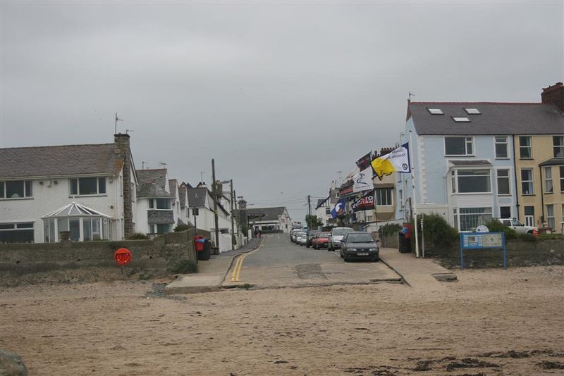
Rhosneigr (Welsh: [r̥oːsˈnɛiɡr] ) is a village in the south-west of Anglesey, north Wales. It is situated on the A4080 road. It is south-east of Holyhead, and is on the Anglesey Coastal Path. From the clock tower in the village centre, RAF Valley and Holyhead Mountain (Mynydd Twr) can be seen.
From the Wikipedia article Rhosneigr (this version), under CC BY-SA 4.0.
Travel tips from other travellers: Rhosneigr on Wikivoyage (CC BY-SA 4.0).
Museums and landmarks5

Barclodiad y Gawres
Monument and historic site · 1.8 mi
Neolithic burial chamber in Anglesey, Wales, UK

Parks, trails and playgrounds4

Valley Wetlands
Park · 2.1 mi
RSPB nature reserve in the United Kingdom


Restaurants and cafes7



Where to stay6


More about Rhosneigr
Education
Ysgol Gynradd Rhosneigr provides Welsh-medium primary education to the village and the surrounding area. As of 2024, there were 85 pupils enrolled at the school. As of 2024, 31 per cent of pupils come from Welsh-speaking homes.
In terms of secondary education, the village is in the catchment area of Ysgol Uwchradd Caergybi.
From the Wikipedia article Rhosneigr, under CC BY-SA 4.0.
Notable people from Rhosneigr
- Max Kennedy HortonRoyal Navy admiral (1883-1951)
Born in Rhosneigr, according to Wikidata (CC0). Each name links to its Wikipedia article.
Churches and places of worship9
Gas and EV charging2
Schools, colleges and libraries2
Healthcare2
Map of Rhosneigr
37 places. The map loads OpenStreetMap tiles when you open it.
Getting there and nearby towns
RAF Valley - Anglesey Airport (VLY) is the nearest airport with scheduled flights listed in OpenStreetMap, 1 miles away.
- Valley 4 mi northwest, about 7 min by car
- Holyhead 7 mi northwest, about 11 min by car
- Bangor 16 mi east, about 26 min by car
- Tregarth 18 mi east, about 29 min by car
- Llandudno 29 mi east, about 47 min by car
- Colwyn Bay 33 mi east, about 53 min by car
- Abergele 39 mi east, about 1 h by car
- Rhyl 43 mi east, about 1 h 15 min by car
- Rhuddlan 43 mi east, about 1 h 15 min by car
- Prestatyn 46 mi east, about 1 h 15 min by car
Drive times are estimates from straight-line distance, not routes.
Towns near Rhosneigr


Keep exploring
Local news
Headlines from INDB.
Reviews, tips and questions
Loading what members have shared...
Sources and licences
- GeoNames (CC BY 4.0): population, coordinates, regions and time zone
- OpenStreetMap contributors (ODbL 1.0): places, airports, map data
- Wikidata (CC0 1.0): elevation, founding date, time zone, website, landmarks and historic places
- Wikimedia Commons (see each image): photos
- Wikipedia (CC BY-SA 4.0): overview and history text
Photo credits
- Rhosneigr, Porius1, CC BY-SA 3.0
- BarclodiadyGawres, Rhion, CC BY-SA 3.0
- LlynPenrhyn, Porius1, CC BY-SA 3.0
- Eglwys Sant Cwyfan, Aberffraw, Ynys Môn - St Cwyfan's Church near Aberffraw, Anglesey, Wales 63, Llywelyn2000, CC BY-SA 4.0
- Eglwys St Mihangel's Church, Stephen Elwyn RODDICK, CC BY-SA 2.0
- Eglwys Peulan Sant, Llanbeulan, Eric Jones, CC BY-SA 2.0
- Eglwys Maelog Sant Church, Eric Jones, CC BY-SA 2.0

Page built November 10, 2026. Spotted a mistake? Tell us or suggest a place.