


Why visit Rothbury
Townapedia lists 12 museums and landmarks, 1 park or trail, 16 places to eat, 8 places to stay and 2 attractions in and around town.
Highlights include Cragside, Armstrong Cross and Rothbury Golf Club.
Weather in Rothbury
Forecast from MET Norway (CC BY 4.0). Full forecast
About Rothbury
Rothbury is a market town and civil parish in Northumberland, England, on the River Coquet. It is 14 miles (22.5 km) north-west of Morpeth and 26 miles (42 km) north of Newcastle upon Tyne. At the 2011 census, it had a population of 2,107.
From the Wikipedia article Rothbury (this version), under CC BY-SA 4.0.
Things to do2

Museums and landmarks12

Cragside
Monument and historic site · 0.9 mi
Country house near Rothbury in Northumberland, England, UK
10:00-17:00


Parks, trails and playgrounds1

Restaurants and cafes16

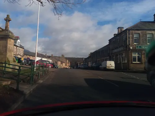
The Narrow Nick
Bar and pub
High Street, Morpeth
Mo-Th 16:00-23:00; Fr-Su 15:00-23:00

Rothbury Fish & Chips
Restaurant · Fish And Chips
High Street, Morpeth
Tu,We 17:00-20:30, Th 11:30-13:30, Th 17:00-20:30, Fr,Sa...


4 more on the map.
History
The area around Rothbury was populated during the prehistoric period, as evidenced by finds dating from the Mesolithic period and later, although all the known finds are from beyond the outer edges of the modern town. Sites include a cairnfield, standing stone and cup-marked rock on Debdon Moor to the north of the town, a well-preserved circular cairn some 26 feet (7.9 m) in diameter, a late Neolithic or Bronze Age standing stone, and an extensive hillfort, covering an area 165 by 125 metres (541 by 410 ft) and associated cairnfield to the west of the town. No evidence of the Roman period has been found, probably because the town was a considerable distance north beyond Hadrian's Wall.
Fragments from an Anglo-Saxon cross, possibly dating from the 9th century, are the only surviving relics pre-dating the Norman conquest. They were discovered in 1849, when part of the church was demolished, and in 1856. They are now in the town church and the University of Newcastle Museum.
Read more of the history
The first documentary mention of Rothbury, according to a local history, was in around the year 1100, as Routhebiria, or "Routha's town" ("Hrotha", according to Beckensall). The village was retained as a Crown possession after the conquest, but in 1201 King John signed the Rothbury Town Charter and visited Rothbury four years later, when the rights and privileges of the manor of Rothbury were given to Robert Fitz Roger, the baron of Warkworth. Edward I visited the town in 1291, when Fitz Roger obtained a charter to authorise the holding of a market every Thursday, and a three-day annual fair near St Matthew's Day, celebrated on 21 September.
Rothbury was not particularly significant at the time, with records from 1310 showing that it consisted of a house, a garden, a bakehouse and a watermill, all of which were leased to tenants. When the line of Fitz Roger died out, the town reverted to being a crown possession, but in 1334 Edward III gave it to Henry de Percy, who had been given the castle and baronry of Warkworth six years earlier. Despite the Scottish border wars, Rothbury rose in prosperity during the 14th century, and had become the town with the highest parochial value in Northumberland by 1535. Feuds still dominated local affairs, resulting in some parishioners failing to attend church because of them in the 16th century, and at other times, gathering in armed groups in separate parts of the building.
Rothbury became a relatively important town in Coquetdale, being a crossroads situated on a ford of the River Coquet, with turnpike roads leading to Newcastle upon Tyne, Alnwick, Hexham and Morpeth. After it was chartered as a market town in 1291, it became a centre for dealing in cattle and wool for the surrounding villages. A market cross was erected in 1722, but demolished in 1827. In the 1760s, according to Bishop Pococke, Rothbury also had a small craft industry, including hatters. At that time, the parish church's vicarage and living was in the gift of the Bishop of Carlisle, and worth £500 per year.
Rothbury has had a turbulent and bloody history. In the 15th and 16th centuries the Coquet valley was a pillaging ground for bands of Reivers who attacked and burned the town with terrifying frequency. Hill farming has been a mainstay of the local economy for many generations. Names such as Armstrong, Charleton and Robson remain well represented in the farming community. Their forebears, members of the reiver 'clans', were in constant conflict with their Scots counterpart. The many fortified farms, known as bastle houses, are reminders of troubled times which lasted until the unification of the kingdoms of England and Scotland in 1603.
The theologian Bernard Gilpin, known as the 'Apostle of the North' for his work in northern England during this period, visited Rothbury. While he preached a sermon, two rival gangs were threatening each other; realising they might start fighting, Gilpin stood between them asking them to reconcile – they agreed as long as Gilpin stayed in their presence. On another occasion, Gilpin observed a glove hanging in the church and asked the sexton about it. He was told it was a challenge to anyone who removed it. Gilpin thus took the glove and put it in his pocket and carried on with his sermon, and no-one challenged him. A painting of this incident by artist William Bell Scott is housed at Wallington Hall.
Near the town's All Saints' Parish Church stands the doorway and site of the 17th-century Three Half Moons Inn, where the Jacobite rebel James Radclyffe, 3rd Earl of Derwentwater stayed with his followers in 1715 prior to marching into a heavy defeat at the Battle of Preston in 1715.
On 16 June 1782, Methodist theologian John Wesley preached in Rothbury.
Although Rothbury is of ancient origin, it mainly developed during the Victorian era. A factor in this development was industrialist Sir William Armstrong, later Lord Armstrong of Cragside, who built the country house, and "shooting box" (hunting lodge), of Cragside, between 1862 and 1865, then extended it as a "fairy palace" between 1869 and 1900. The house and its estate are now in the possession of the National Trust and are open to the public.
Another factor in Rothbury's Victorian development was the arrival of the railway. Rothbury Station opened in 1870, bringing tourists on walking holidays to the surrounding hill country. This railway was most notably used by the Prince of Wales (later Edward VII) and Princess Alexandra and their children (Albert Victor, 10, George later George V, 9, Louise, 7, Victoria, 6, Maud, 4), They arrived in Rothbury on 19 August 1884 and left on 22 August to visit Cragside and Lord Armstrong. Firework displays were held by Pain's of London.
David Dippie Dixon was a historian from Rothbury. He previously worked in his father's draper's shop, William Dixon and Sons, set up in Coquetdale House. After William Dixon died, David Dippie Dixon and his brother John Turnbull Dixon renamed the shop Dixon Bros.
From the History section of Rothbury on Wikipedia, under CC BY-SA 4.0.
More about Rothbury
Geography
Rothbury is located in Northumberland, England, on the River Coquet, it is 13.5 miles (21.7 km) northwest of Morpeth and 26 miles (42 km) of Newcastle upon Tyne. It is located on the edge of the Northumberland National Park. Rothbury has two Zone 6 B roads going through it: West to East is the B6341, Rothbury's main street, Front Street, is part of this B road; The second B road is the B6342, its starting point is in Rothbury, and is connected to the B6341, it is part of Rothbury's Bridge Street before going over the River Coquet on the Rothbury Bridge and going South for 23.4 miles (37.7 km) connecting to the A68 (Dere Street) at the hamlet of Colwell. Rothbury also has the B6344 on the eastern edge, it is connected to the B6341 and goes southeast for 5.6 miles (9.0 km) passing through the hamlet of Pauperhaugh and connecting to the A697 at the hamlet of Weldon Bridge.
Arts and culture
Rothbury has an annual Rothbury Traditional music festival. It consists of music concerts and competitions within the genre of folk music, mainly traditional Northumberland folk music. In 2013, the festival was featured on Northumberland-born TV Presenter and actor Robson Green's documentary series Tales from Northumberland with Robson Green (Season one, Episode five). In 2019, TV presenter and singer Alexander Armstrong, who was born in Rothbury, was made patron of the festival, in 2021 Armstrong announced the return of the Music Festival from an erupting Icelandic volcano in a video posted on the Facebook page of the Festival after it was cancelled in 2020 due to the COVID-19 pandemic. Notable music acts that have performed at the festival include:
Chris Parkinson, co-founder of the British folk band The House Band
Rothbury has a tune about it called "Rothbury Hills," written by Jack Armstrong in 1944. It has been performed by Kathryn Tickell on her 2009 album "Northumberland Collection", and Alexander Armstrong wrote and sang some lyrics to it on his 2015 album "A Year of Songs".
Education
Rothbury First School – a community school for 3- to 9-year-olds of both sexes. (This type of school is state funded, with the local education authority employing the staff, being responsible for the school's admissions and owning the school's estate.) It can accommodate 126 pupils and currently has 94.
Dr Thomlinson Church of England Middle School – founded in 1720, and for 9- to 13-year-olds of both sexes, is run by the academy trust The Three Rivers Learning Trust. The school can accommodate 258 pupils and currently has 232. In February 2019 pupils took part in the School's Climate Strike, which saw pupils not attending school and protesting over climate change.
Rothbury is in the catchment area for The King Edward VI School, Morpeth, also run by The Three Rivers Learning Trust.
From the Wikipedia article Rothbury, under CC BY-SA 4.0.
Notable people from Rothbury
 Alexander ArmstrongBritish comedian, actor and singerPhoto: Edwardx, CC BY-SA 4.0
- Imogen StubbsBritish actress
- John BrownEnglish divine and author (1715-1766)
- Elspeth GarmanProfessor of Molecular Biophysics
- Henry TwizellEnglish cricketer (born 1959)
- Michael CrawleyBritish ecologist, Emeritus Professor of Plant Ecology at Imperial College London
- William Watson-Armstrong, 2nd Baron Armstrongpeer (1892-1972)
- Richard BurridgeScreenwriter, author
Born in Rothbury, according to Wikidata (CC0). Each name links to its Wikipedia article.
Where to stay8
Churches and places of worship3
Shopping8
Schools, colleges and libraries2
Healthcare2
Map of Rothbury
54 places. The map loads OpenStreetMap tiles when you open it.
Getting there and nearby towns
Newcastle International Airport (NCL) is the nearest airport with scheduled flights listed in OpenStreetMap, 21 miles away.
- Shilbottle 10 mi northeast, about 15 min by car
- Warkworth 12 mi east, about 19 min by car
- Morpeth 13 mi southeast, about 21 min by car
- East Chevington 13 mi east, about 21 min by car
- Lesbury 13 mi northeast, about 20 min by car
- Longhoughton 14 mi northeast, about 23 min by car
- Ashington 16 mi southeast, about 26 min by car
- Lynemouth 16 mi southeast, about 26 min by car
- Bedlington 18 mi southeast, about 28 min by car
- Cramlington 20 mi southeast, about 32 min by car
Drive times are estimates from straight-line distance, not routes.
Towns near Rothbury


Keep exploring
Local news
Headlines from INDB.
Reviews, tips and questions
Loading what members have shared...
Sources and licences
- GeoNames (CC BY 4.0): population, coordinates, regions and time zone
- Mapillary (see each image): photos
- OpenStreetMap contributors (ODbL 1.0): places, airports, map data
- Wikidata (CC0 1.0): elevation, founding date, time zone, website
- Wikimedia Commons (see each image): photos
- Wikipedia (CC BY-SA 4.0): overview and history text
Photo credits
- Rothburycentre2, Glennsmart at English Wikipedia, Public domain
- Rothbury (2023-10-08) 72, Simon Cobb, CC0
- Rothbury (2023-10-08) 74, Simon Cobb, CC0
- Rothbury (2023-10-08) 73, Simon Cobb, CC0
- Cragside1, Glen Bowman from Newcastle, England, CC BY 2.0
- Rothbury (2023-10-08) 37, Simon Cobb, CC0
- Rothbury (2023-10-08) 31, Simon Cobb, CC0
- Rothbury (2023-10-08) 36, Simon Cobb, CC0
- Street-level photo, victuallers, CC BY-SA 4.0
- Street-level photo, victuallers, CC BY-SA 4.0
- Street-level photo, victuallers, CC BY-SA 4.0
- Street-level photo, victuallers, CC BY-SA 4.0
- Street-level photo, victuallers, CC BY-SA 4.0
- Street-level photo, victuallers, CC BY-SA 4.0
- Street-level photo, victuallers, CC BY-SA 4.0
- Street-level photo, victuallers, CC BY-SA 4.0
- Street-level photo, victuallers, CC BY-SA 4.0
- Street-level photo, victuallers, CC BY-SA 4.0
- Street-level photo, victuallers, CC BY-SA 4.0
- Street-level photo, victuallers, CC BY-SA 4.0
- Street-level photo, victuallers, CC BY-SA 4.0
- Street-level photo, floatingboater, CC BY-SA 4.0
- Street-level photo, victuallers, CC BY-SA 4.0
- Street-level photo, victuallers, CC BY-SA 4.0
- Street-level photo, floatingboater, CC BY-SA 4.0
- Street-level photo, floatingboater, CC BY-SA 4.0

Page built November 10, 2026. Spotted a mistake? Tell us or suggest a place.