
Cramlington, United Kingdom
Cramlington is a town of 33,180 people in England, United Kingdom.
Why visit Cramlington
Townapedia lists 4 museums and landmarks, 15 parks and trails, 56 places to eat, 1 place to stay and 2 attractions in and around town.
Highlights include Vue Cinema Cramlington, Big Waters and Plessey Woods Country Park.
Weather in Cramlington
Forecast from MET Norway (CC BY 4.0). Full forecast
About Cramlington
Cramlington is a town and civil parish in Northumberland. It is 6 miles (9.7 kilometres) north of Newcastle upon Tyne. The name suggests a probable founding by the Danes or Anglo-Saxons.
From the Wikipedia article Cramlington (this version), under CC BY-SA 4.0.
Travel tips from other travellers: Cramlington on Wikivoyage (CC BY-SA 4.0).
Things to do2

Museums and landmarks4

Parks, trails and playgrounds15

Plessey Woods Country Park
Park · 2.5 mi
Park in Northumberland, United Kingdom

Alexandra Park
Park · 0.7 mi
This park is home to various sporting arenas. During 2017 Alexandra park was awarded a greenflag award.


3 more on the map.
Restaurants and cafes56
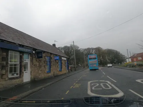
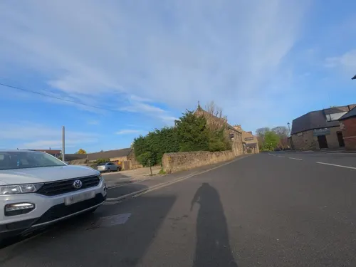
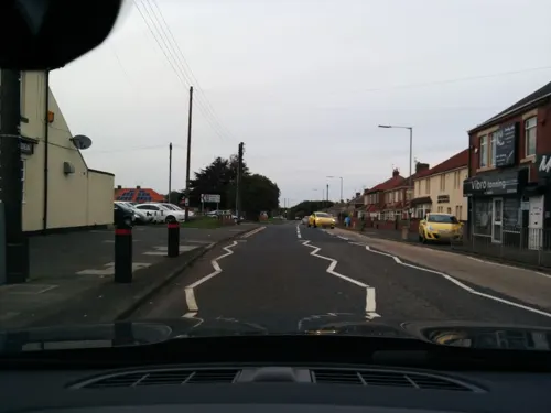

44 more on the map.
History
The first record of the Manor of Cramlington is from a mention in 1135 when the land was granted to Nicholas de Grenville. A register of early chaplains begins with John the Clerk of Cramlington (c. 1163–1180). The register continues to the present day.
From the 12th century onwards, Cramlington’s history was predominantly rural, with several farms and the parish church of St Nicholas. Coal mining began to transform Cramlington during the early 19th century, with the opening of collieries in the surrounding area. The development of the industry brought rapid population growth, with the population of Cramlington chapelry increasing from 330 in 1821 to 931 in 1831 and 2,634 in 1841. By 1851, the population had reached 3,367; a contemporary account published in 1855 attributed this rapid increase to the opening of coal mines, including East Cramlington Colliery. By the mid-19th century, mining settlements had developed around several collieries, including Cramlington High Pit and West Cramlington Colliery. Coal mining remained central to the area’s development, best demonstrated by the construction of a new parish church of St Nicholas, completed in 1868 at a cost of £3,000. Historic England classifies its design as a "free 13th-century style," which leans into the Early English Gothic period while incorporating subtle French influences.
Read more of the history
The development of railways in Cramlington began with the transport of coal from the local collieries. The Cramlington waggonway opened in 1822–1823, connecting the collieries with routes used to transport coal towards the Tyne. The opening of the Newcastle and Berwick Railway and Cramlington station in 1847 provided a link for passenger traffic, as well as supporting the area's growing industrial development. Cramlington was the site of two notable railway accidents. In 1855, the chassis of a first-class carriage failed, while in 1926 the Merry Hampton locomotive and five carriages of the Flying Scotsman express from Edinburgh to King's Cross were derailed by striking miners during the General Strike. The story of the derailment was recounted in the BBC Two programme Yesterday's Witness: The Cramlington Train Wreckers in 1970, and later turned into a successful play.
During World War I, the North East of England was protected by the No. 36 Home Defence Squadron. The squadron was formed at Cramlington on 1 February 1916 by Capt. R. O. Abercromby, with Cramlington subsequently becoming an important base for military planes and airships. The Airship Station was at Nelson Village. A reference to Cramlington airfield is made in W. E. Johns 1935 book The Black Peril from the extremely popular Biggles series.
The town remained small until 1964 when it was chosen by Northumberland County Council as the location for a new “township”.
The development of a new town development in Cramlington was first discussed in 1958. In June 1961, Northumberland County Council's Planning Committee approved the draft plans to establish what it hoped would be "Britain's first enterprise town." The development model for Cramlington was radically different to the government sponsored New Town. While the County Council supported the town’s infrastructure, the majority of development was planned by two house building companies, William Leech and J.T. Bell. It was predicted to take 20 years, cost £50m and eventually house 40,000 inhabitants across a four square mile site that also included an industrial zone. A one-way road system was proposed, with the waggon ways of the former pits being repurposed as pedestrians paths. The plan was finally approved by the Minister of Housing and Local Government in January 1963, by which time the estimated population had grown to 48,000 and the cost projected at £60m. It marked the first time a new town had been developed without the establishment of a government-backed development corporation. The planning officer predicted that it should look like a town in five years and be complete in 20 years. The first factory was to be completed by summer 1963. In October 1964, an advert inviting investment in the development recorded an area of 2,200 acres, 530 of which were for industry.
The housing and industrial sites developed rapidly, by 1968 this led to Cramlington becoming a "dormitory of urban Tyneside" due to the lack of investment in shops, schools, and community facilities. Local MP Eddie Milne sought government assistance to bring the amenities in line with these large scale developments.
2017 archaeological excavations carried out ahead of housing development at White Hall Farm uncovered the remains of an Iron Age settlement, including an enclosed settlement and several roundhouses. The discovery attracted considerable interest from local residents, but the archaeological remains were excavated and recorded to allow the housing development to proceed.
From the History section of Cramlington on Wikipedia, under CC BY-SA 4.0.
More about Cramlington
Economy
There are several large industrial zones in Cramlington, most to the town's north-west near the sewage treatment plant, housing major pharmaceutical companies including Organon & Co.. Other growing chemical companies including Aesica Pharmaceuticals are also present. The Officers Club menswear firm (now owned by Blue Inc), previously had its headquarters and supply warehouse in Cramlington, in part of the old Wilkinson Blade factory while other companies such as GE Oil & Gas also occupy large sites. Start Football is also headquartered in the town.
Wilkinson Sword established the first factory in the town in 1964. American Air Filter Company later built premises. Brentford Nylons also opened a large site in the town in 1968.
Boots, the pharmaceuticals manufacturer, opened their plant in Cramlington in 1983.
The Manor Walks shopping centre was constructed in the centre of the town in the 1970s, and was subsequently expanded in the mid-1990s and in 2003/4. The centre now includes retailers such as Argos, Asda, Boots, Boyes, Next and Sainsbury's. In 2011, plans were put forward to revamp the main centre by building a new Vue multiplex cinema and improving the retail facilities. The South Mall extension opened in 2013.
Education
Until September 2008, all schools in Northumberland operated under a three tier system. However, following a decision to convert the county to a two tier system, Cramlington was chosen as one of the first towns to complete this. Following the abolition of the three-tier school system in 2008, some former middle-school buildings in Cramlington were repurposed for primary education, including those used by Burnside Primary School and Cragside Primary School.
There had been concern from local residents over traffic and parking arrangements at the new sites.
Other schools in Cramlington are listed as follows: Hareside Primary School, Hillcrest School, Shanklea Primary School, Burnside Primary School, Cragside Church of England Primary School, Northburn Primary School, Cramlington Village Primary School, Eastlea Primary School, Beaconhill Primary School and SS Peter and Paul's Catholic Primary Academy.
From the Wikipedia article Cramlington, under CC BY-SA 4.0.
Notable people from Cramlington
 Andy Sintonfootballer; football manager (born 1966)Photo: Timmy96, CC0
 Aran EmbletonEnglish footballer (born 1981)Photo: Aranembleton, CC BY-SA 4.0
 George CannAustralian politicianPhoto: Swiss Studios, Public domain
- Ray PointerEnglish footballer (1936-2016)
- Martin Brittainfootball player (born 1984)
- Graeme OwensEnglish footballer (born 1988)
- Joe BrownEnglish footballer and manager (1929-2014)
- James BrownEnglish footballer who plays as a striker or a winger for Gateshead (born 1987)
- Gary RobsonEnglish darts player
- Bobby HoweEnglish footballer (born 1973)
- Tommy Dixonfootballer (1882-1941)
- Jamie McClenEnglish footballer
Born in Cramlington, according to Wikidata (CC0). Each name links to its Wikipedia article.
Where to stay1
Churches and places of worship8
Cramlington Community Church of the Nazarene
Church · 0.7 mi
Northumbrian Road, Cramlington
Shopping18
Gas and EV charging5
Schools, colleges and libraries12
Ss Peter and Paul's Catholic Primary Academy
School · Roman Catholic · 0.7 mi
Northumbrian Road, Cramlington
Healthcare7
Northumbria Specialist Emergency Care Hospital
Hospital · 1.1 mi
Northumbria Way, Cramlington
Northumbria Way Pharmacy
Clinic and pharmacy · 1.0 mi
Northumbria Way, Cramlington
Map of Cramlington
128 places. The map loads OpenStreetMap tiles when you open it.
Getting there and nearby towns
Newcastle International Airport (NCL) is the nearest airport with scheduled flights listed in OpenStreetMap, 6 miles away.
- Bedlington 3 mi north, about 5 min by car
- Gosforth 6 mi south, about 10 min by car
- Whitley Bay 6 mi southeast, about 10 min by car
- Ashington 6 mi north, about 10 min by car
- Wallsend 7 mi south, about 11 min by car
- North Shields 7 mi southeast, about 12 min by car
- Ponteland 7 mi west, about 11 min by car
- Morpeth 7 mi northwest, about 11 min by car
- Newcastle upon Tyne 8 mi south, about 13 min by car
- Tynemouth 8 mi southeast, about 13 min by car
Drive times are estimates from straight-line distance, not routes.
Towns near Cramlington


Keep exploring
Local news
Headlines from INDB.
Reviews, tips and questions
Loading what members have shared...
Sources and licences
- GeoNames (CC BY 4.0): population, coordinates, regions and time zone
- Mapillary (see each image): photos
- OpenStreetMap contributors (ODbL 1.0): places, airports, map data
- Wikidata (CC0 1.0): elevation, founding date, time zone, website, landmarks and historic places
- Wikipedia (CC BY-SA 4.0): overview and history text
Photo credits
- Street-level photo, NinjaBill, CC BY-SA 4.0
- Street-level photo, floatingboater, CC BY-SA 4.0
- Street-level photo, floatingboater, CC BY-SA 4.0
- Street-level photo, floatingboater, CC BY-SA 4.0
- Street-level photo, floatingboater, CC BY-SA 4.0
- Street-level photo, floatingboater, CC BY-SA 4.0
- Street-level photo, floatingboater, CC BY-SA 4.0
- Street-level photo, floatingboater, CC BY-SA 4.0
- Street-level photo, floatingboater, CC BY-SA 4.0
- Street-level photo, floatingboater, CC BY-SA 4.0
- Street-level photo, floatingboater, CC BY-SA 4.0
- Street-level photo, floatingboater, CC BY-SA 4.0
- Street-level photo, floatingboater, CC BY-SA 4.0
- Street-level photo, floatingboater, CC BY-SA 4.0
- Street-level photo, floatingboater, CC BY-SA 4.0
- Street-level photo, floatingboater, CC BY-SA 4.0
- Street-level photo, floatingboater, CC BY-SA 4.0
- Street-level photo, floatingboater, CC BY-SA 4.0
- Street-level photo, floatingboater, CC BY-SA 4.0
- Street-level photo, floatingboater, CC BY-SA 4.0
- Street-level photo, floatingboater, CC BY-SA 4.0
- Street-level photo, floatingboater, CC BY-SA 4.0
- Street-level photo, floatingboater, CC BY-SA 4.0
- Street-level photo, floatingboater, CC BY-SA 4.0
- Street-level photo, floatingboater, CC BY-SA 4.0
Page built November 10, 2026. Spotted a mistake? Tell us or suggest a place.