


Ashington, United Kingdom
Ashington is a town of 27,670 people in England, United Kingdom.
Why visit Ashington
Townapedia lists 9 museums and landmarks, 15 parks and trails, 56 places to eat and 1 place to stay in and around town.
Highlights include Woodhorn Museum, Woodhorn Colliery Explosion Memorial and Castle Island.
Weather in Ashington
Forecast from MET Norway (CC BY 4.0). Full forecast
About Ashington
Ashington is a town and civil parish in Northumberland, England, with a population of 27,864 at the 2011 Census. It was once a centre of the coal mining industry. The town is 15 miles (24 km) north of Newcastle upon Tyne, west of the A189 and bordered to the south by the River Wansbeck. Many inhabitants have a distinctive accent and dialect known as Pitmatic.
From the Wikipedia article Ashington (this version), under CC BY-SA 4.0.
Travel tips from other travellers: Ashington on Wikivoyage (CC BY-SA 4.0).
Museums and landmarks9
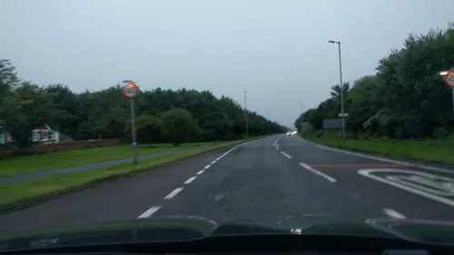
Woodhorn Museum
Museum · 0.9 mi
Museum, archive and county record office for Northumberland



Northumberland Aged Mineworkers Homes Centenary Group 1966
Monument and historic site · 0.4 mi
Parks, trails and playgrounds15

Castle Island
Park · 1.0 mi
Island in the River Wansbeck in Ashington, Northumberland, England


3 more on the map.
Restaurants and cafes56



44 more on the map.
Where to stay1

History
The name Ashington comes from the earlier form Essendene, which has been referenced since 1170. This may have originated from a given name Æsc, not unknown among Saxon invaders who sailed from Northern Germany. If so he came to the Wansbeck and would have settled in this deep wooded valley near Sheepwash. The "de" in the early orthographies more strongly suggests dene, so ash dene - these trees would have lined it. In the 1700s all that existed of Ashington was a small farm with a few dwellings around it.
Read more of the history
The first evidence of mining is from bell-shaped pits and monastic mine workings discovered in the 20th Century during tunnelling. Ashington developed from a small hamlet in the 1840s when the Duke of Portland built housing to encourage people escaping the Great Famine of Ireland to come and work at his nearby collieries. As in many other parts of Britain, "deep pit" coal mining in the area declined during the 1980s and 1990s leaving just one colliery, Ellington, which closed in January 2005. In 2006 plans for an opencast mine on the outskirts of the town were put forward, although many people objected to it. During the heyday of coal-mining, Ashington was considered to be the "world's largest coal-mining village". There is now a debate about whether Ashington should be referred to as a town or a village; if considered as a village it would be one of the largest villages in England.
As coal mining expanded, more people left the countryside and settled in Ashington. This led the Ashington Coal Company to build parallel rows of colliery houses. Some newcomers came from as far as Cornwall to make use of their tin-mining skills.
Ashington railway station opened in 1878, and services to Newbiggin and Tynemouth were operated by the Blyth and Tyne Railway. The nearest station to Ashington on the East Coast Main Line was Longhirst, to the north west of the town, which opened in 1847 and had services to both Newcastle and Edinburgh. By 1896, the town had grown sufficiently to warrant the creation of Ashington Urban District.
In 1913 the original Ashington Hospital was built. It was about 1/4 mile from the town centre. The hospital was expanded in the 1950s and 1960s with large new wings.
Traditionally, the area to the east of the railway was called Hirst and that to the west was Ashington proper. Although collectively called Ashington, both halves had their own park: Hirst Park (opened in 1915) in the east and the People's Park in the west.
The colliery-built houses followed a grid plan. The streets in the Hirst End running north to south were named after British trees, such as Hawthorn Road, Beech Terrace, and Chestnut Street. The east–west running streets were numbered avenues, starting with First Avenue near the town centre, finishing at Seventh Avenue towards the southern end. After the 1920s houses in Ashington were built by the council and were most often semi-detached houses, such as Garden City Villas. These occupied much of the fields in the Hirst area. New estates were built in different areas. The biggest building programme was in the late 1960s and saw Ashington extend south from Seventh Avenue opposite the Technical College towards North Seaton and south eastwards towards the A189. Some of the houses at the north end of Alexandra Road were private homes. During this building programme several new schools were built, for example Coulson Park, Seaton Hirst Middle. Community shops and a social club (the Northern) were built off Fairfield Drive. The late 1970s and early 1980s saw construction of Nursery Park opposite the North Seaton Hotel. The late 1980s and 1990s saw the building of the Wansbeck Estate between the River Wansbeck and Green Lane as well as the large Fallowfield Estate.
In 1964, as part of the Beeching Axe, Ashington railway station was closed. The site of the station was developed in the late 1960s into Wansbeck Square, housing a supermarket, council offices and a public library, built partly over the railway line.
In 1981 the Woodhorn Pit closed and its chimney was demolished. In the late 1980s this became a museum. In 1988 Ashington Pit was closed and is now occupied by a business park. In the early 2000s maisonette flats in various parts of Hirst were demolished and parts of the Moorhouse and Woodbridge estate opposite Woodhorn Pit were demolished.
The railway was used until recently by the Alcan Aluminium plant, to transport coal to its adjacent power station in the nearby town of Lynemouth. The plant closed in late 2015. The line was put in use again from mid-2017 to transport materials to Lynemouth, for the conversion of the coal-fired power station to produce power from biomass.
In October 2008, plans to opencast 2m tonnes of coal in Ashington were approved. UK Coal's plans which were first submitted in 2005, would create 60+ jobs.
From the History section of Ashington on Wikipedia, under CC BY-SA 4.0.
More about Ashington
Geography
Ashington is in south east Northumberland, which is a largely urban area adjacent to Newcastle. Most of the area is of flat ground formed during the Carboniferous period when ancient tropical swamp forests were buried and formed the coal seams that have given this area its significance. The local geology is of yellow sandstone. The land to the north west of the town is slightly undulating due to mining subsidence, which sometimes causes farmland to be flooded. The south east part of the town is slightly raised giving views to the north. From certain parts of town the Cheviot Hills are visible about 30 miles (48 km) to the north.
The town is roughly square in shape, lying north to south. The town centre is in the north of the town. South of this are residential areas. Farmland is on both east and west flanks. The south part is residential bordered by the River Wansbeck to the south. To the east of the town is the coastal town of Newbiggin and to the west is the small village of Bothal, also on the River Wansbeck. South of the town is the small village of North Seaton which once had its own pit. North of the town about 2 miles is the village of Linton and north east of the town is Lynemouth.
Arts and culture
In 1934, some of the Ashington miners enrolled in painting classes as an alternative pastime and then began to produce paintings to sell at local markets to supplement their poor wages. They achieved unexpected success and approval from the art community and were given prestigious gallery exhibitions during the 1930s and 1940s under the name "The Pitmen Painters", although the group had called themselves the "Ashington Group". In the 1970s the group's work was "rediscovered" and popularised as "workers' art" and given international exhibitions. On 26 October 2006, a new £16m museum housing the work was opened in Ashington by The Princess Royal.
Education
The previous system of first school, middle school and high school used in Ashington was phased out in September 2015, with Bothal Middle School and Hirst Park Middle School closing. First schools became primary schools while Ashington High School (now Ashington Academy) became a full secondary school. Schools were first built by the Ashington coal company, but many have since been replaced.
Northumberland College (formerly, Ashington Technical College) is the main further education provider in the town, and offers A levels, NVQs, vocational courses and various evening classes.
From the Wikipedia article Ashington, under CC BY-SA 4.0.
Notable people from Ashington
 Jack CharltonEnglish footballer and manager (1935-2020)Photo: Bert Verhoeff for Anefo , Den Haag,..., CC0
 Michael OliverEnglish football refereePhoto: Bryan Berlin, CC BY-SA 4.0
 Mark WoodEnglish cricketer (born 1990)Photo: Neb, CC BY-SA 4.0
 Ian LaveryBritish politician (born 1963)Photo: ©House of Commons / Laurie Noble, CC BY 3.0
 Ben HarmisonEnglish cricketer (born 1986)Photo: Harrias, CC BY-SA 3.0
 Macaulay GillespheyEnglish association football player (born 1995)Photo: Timmy96, CC0
- Bobby CharltonEnglish association football player and manager (1937–2023)
- Jackie MilburnEnglish footballer (1924-1988)
- Martin TaylorEnglish footballer (born 1979)
- Jimmy AdamsonEnglish footballer (1929–2011)
- Katherine CopelandBritish rower
- Mark CullenEnglish association football player (born 1992)
Born in Ashington, according to Wikidata (CC0). Each name links to its Wikipedia article.
Churches and places of worship8
The Church of Jesus Christ of Latter-day Saints
Church · Mormon · 0.6 mi
Blackclose Bank, Ashington
Shopping17
Gas and EV charging4
Schools, colleges and libraries15
Healthcare8
Map of Ashington
133 places. The map loads OpenStreetMap tiles when you open it.
Getting there and nearby towns
Newcastle International Airport (NCL) is the nearest airport with scheduled flights listed in OpenStreetMap, 11 miles away.
- Bedlington 3 mi south, about 5 min by car
- Morpeth 5 mi west, about 8 min by car
- Ponteland 11 mi southwest, about 18 min by car
- Gosforth 12 mi south, about 20 min by car
- Newcastle upon Tyne 14 mi south, about 23 min by car
- Jarrow 14 mi south, about 22 min by car
- Hebburn 14 mi south, about 23 min by car
- Blaydon-on-Tyne 16 mi south, about 25 min by car
- Whickham 17 mi south, about 27 min by car
- The Boldons 17 mi south, about 27 min by car
Drive times are estimates from straight-line distance, not routes.
Towns near Ashington


Keep exploring
Local news
Headlines from INDB.
Reviews, tips and questions
Loading what members have shared...
Sources and licences
- GeoNames (CC BY 4.0): population, coordinates, regions and time zone
- Mapillary (see each image): photos
- OpenStreetMap contributors (ODbL 1.0): places, airports, map data
- Wikidata (CC0 1.0): elevation, founding date, time zone, website, landmarks and historic places
- Wikimedia Commons (see each image): photos
- Wikipedia (CC BY-SA 4.0): overview and history text
Photo credits
- Northumberland College of Arts and Technology, Ashington, PookieFugglestein, CC0
- Wansbeck General Hospital Ashington, Steven Fruitsmaak, CC BY 3.0
- Woodhorn Miners Memorial, Graeme Darbyshire, CC BY 2.0
- St Andrews Church, Ashington, PookieFugglestein, CC0
- First Time Growing Pelargonium... (35916919852), Dave Photography... from Ashington, Northumberland, CC BY-SA 2.0
- Lily... (33501587131), Dave Photography... from Ashington, Northumberland, CC BY-SA 2.0
- Street-level photo, NinjaBill, CC BY-SA 4.0
- Street-level photo, floatingboater, CC BY-SA 4.0
- Street-level photo, floatingboater, CC BY-SA 4.0
- Street-level photo, floatingboater, CC BY-SA 4.0
- Street-level photo, floatingboater, CC BY-SA 4.0
- Street-level photo, floatingboater, CC BY-SA 4.0
- Street-level photo, floatingboater, CC BY-SA 4.0
- Street-level photo, floatingboater, CC BY-SA 4.0
- Street-level photo, floatingboater, CC BY-SA 4.0
- Street-level photo, floatingboater, CC BY-SA 4.0
- Street-level photo, floatingboater, CC BY-SA 4.0
- Street-level photo, NinjaBill, CC BY-SA 4.0
- Street-level photo, NinjaBill, CC BY-SA 4.0
- Street-level photo, floatingboater, CC BY-SA 4.0
- Street-level photo, floatingboater, CC BY-SA 4.0
- Street-level photo, floatingboater, CC BY-SA 4.0
- Street-level photo, floatingboater, CC BY-SA 4.0
- Street-level photo, NinjaBill, CC BY-SA 4.0
- Street-level photo, floatingboater, CC BY-SA 4.0
- Street-level photo, floatingboater, CC BY-SA 4.0
- Street-level photo, floatingboater, CC BY-SA 4.0
- Street-level photo, floatingboater, CC BY-SA 4.0
- Street-level photo, floatingboater, CC BY-SA 4.0
- Street-level photo, floatingboater, CC BY-SA 4.0
Page built November 10, 2026. Spotted a mistake? Tell us or suggest a place.