


Huntingdon, United Kingdom
Huntingdon is a town of 23,937 people in England, United Kingdom.
Why visit Huntingdon
Townapedia lists 26 museums and landmarks, 46 parks and trails, 82 places to eat, 8 places to stay and 6 attractions in and around town.
Highlights include Godmanchester Chinese Bridge, Cineworld, The Cromwell Museum and Farm Hall.
Weather in Huntingdon
Forecast from MET Norway (CC BY 4.0). Full forecast
About Huntingdon
Huntingdon is a market town in the Huntingdonshire district of Cambridgeshire, England. The town was given its town charter by King John in 1205. It was the county town of the historic county of Huntingdonshire. Oliver Cromwell was born there in 1599 and became one of its Members of Parliament (MP) in 1628.
From the Wikipedia article Huntingdon (this version), under CC BY-SA 4.0.
Travel tips from other travellers: Huntingdon on Wikivoyage (CC BY-SA 4.0).
Things to do6

Godmanchester Chinese Bridge
Monument and historic site · 0.9 mi
Bridge in the town of Godmanchester, Huntingdonshire, Cambridgeshire, England




Museums and landmarks26

The Cromwell Museum
Museum
Grammar School Walk
Apr-Oct Tu-Su 11:00-16:00; Nov-Mar Tu-Su 11:00-15:30; PH Mo 11:00-16:00

Farm Hall
Monument and historic site · 1.1 mi
24 West Street, Huntingdon


Hinchingbrooke House
Museum · 0.6 mi
Building in Huntingdon, Cambridgeshire, England, UK



14 more on the map.
Parks, trails and playgrounds46

Godmanchester Nature Reserve
Park · 1.4 mi
Nature reserve in the United Kingdom

Hemingford Grey Meadow
Park · 3.8 mi
Nature reserve in Hemingford Grey, Huntingdonshire, Cambridgeshire, England, UK



Brampton Wood
Park · 3.6 mi
Nature reserve in Cambridgeshire, England, UK

34 more on the map.
Restaurants and cafes82
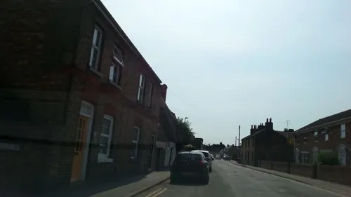
The Willows
Cafe · Coffee Shop · 1.7 mi
79 High Street, Huntingdon
We,Th 10:00-16:00; Fr,Sa 10:00-15:00
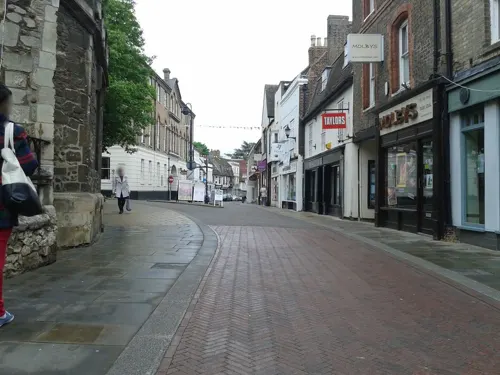
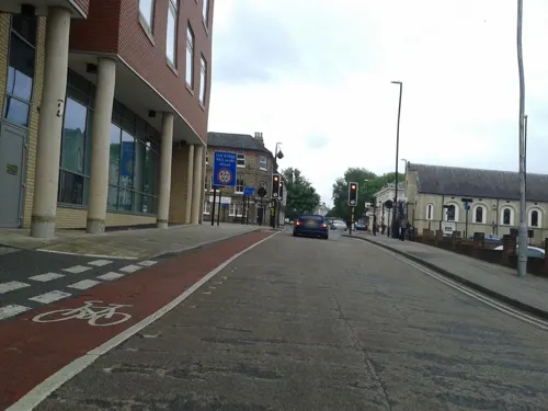


ESE lounge
Restaurant · African
St Benedict's Court
Mo-Th 11:30-23:00; Fr-Sa 12:00-28:00; Su 14:00-23:00
70 more on the map.
History
During the Roman Empire, in 274, a massive coin hoard dating to the reign of Tetricus I and Roman Emperor Aurelian was hidden in a field near the town. Consisting of 9,724 Roman coins, and discovered in 2018, the Muddy Hoard is considered to date the largest treasure trove of Cambridgeshire.
Huntingdon was founded by the Anglo-Saxons and Danes. It is first mentioned in the Anglo-Saxon Chronicle in 921, where it appears as Huntandun. It appears as Huntedun in the Domesday Book of 1086. The name means "The huntsman's hill" or possibly "Hunta's hill".
Huntingdon seems to have been a staging post for Danish raids outside East Anglia until 917, when the Danes moved to Tempsford, now in Bedfordshire, before they were crushed by Edward the Elder. It prospered successively as a bridging point of the River Great Ouse, a market town, and in the 18th and 19th centuries a coaching centre, notably at the George Hotel. The town has a well-preserved medieval bridge that used to serve as the main route of Ermine Street over the river. The bridge only ceased to be the sole crossing point to Godmanchester in 1975, with the building of what is now the A1307 (formerly A14) bypass.
Read more of the history
The town's valuable trading position was secured by Huntingdon Castle, of which only the earthworks of the motte survive. The site is a Scheduled Ancient Monument and home to a beacon used to mark the 400th anniversary of the Spanish Armada.
In 1746, the nurserymen Wood and Ingram of nearby Brampton developed an elm-tree cultivar, Ulmus × hollandica 'Vegeta', which they named the Huntingdon Elm after the town.
Original documents on Huntingdon's history, including the borough charter of 1205, are held by Cambridgeshire Archives and Local Studies at the County Record Office, Huntingdon.
Parts of Huntingdon, including the centre, were struck by an F1/T3 tornado on 23 November 1981, during a record-breaking nationwide tornado outbreak on that day. The centre suffered moderate damage.
Between the railway station and the old hospital building, stands a replica cannon installed in the 1990s to replace one from the Crimean War, scrapped for the war effort in the Second World War. However, it faces in the opposite direction from the original. St Mary's Street drill hall was built in the late 19th century.
The George Hotel on the corner of High Street and George Street was once a posting house. It was named after Saint George of England in 1574 and bought some 25 years later by Henry Cromwell, grandfather of Oliver Cromwell. King Charles I made the George his headquarters during the English Civil War in 1645. Later the highwayman Dick Turpin is said to have been a customer when it was a coaching inn on the Great North Road. A theatre was built to the rear of the George in about 1799. The Lincoln company of actors managed by Thomas Shaftoe Robertson and later Fanny Robertson performed here in race weeks. Two wings of the inn burnt down in the mid-19th century, but two were saved, including one with a balcony overlooking the yard. Since 1959, the courtyard and balcony have been used for Shakespeare performances by a company run by the Shakespeare at the George Trust. These performances took place until 2024 when the Green King company who run the George Hotel decided it was not in their best interest to continue Shakespeare at the George, ending its 65-year run.
From the History section of Huntingdon on Wikipedia, under CC BY-SA 4.0.
More about Huntingdon
Geography
Situated approximately midway between the cities of Cambridge and Peterborough, the town lies on the north bank of the River Great Ouse opposite Godmanchester and close to the market town of St Ives to the east and the village of Brampton to the west. Huntingdon incorporates the village of Hartford to the east and the developing areas of Oxmoor, Stukeley Meadows and Hinchingbrooke to the north and west.
Between Godmanchester, Huntingdon and Brampton lies Portholme Meadow, England's largest. Its 257 acres (104 hectares) contain many rare species of grass, flowers and dragonfly. It is the only known British habitat of the marsh dandelion. It acts as a natural reservoir for water in times of flood, enabling the river to run off slowly, so helping to preclude flooding in nearby towns. It has also served as a horse racecourse and once was a centre for aviation.
Huntingdon is home to many local businesses, including Huntingdon Racecourse. Hinchingbrooke Business Park also contains offices and warehouses.
The nearest weather station for long-term data is at RAF Wyton, 3 mi (5 km) north-east of the town centre. More recently Monks Wood, 5 mi (8 km) to the north-west, has also provided data.
Arts and culture
The former Literary and Scientific Institute is now Commemoration Hall.
Following the 2013 closure of RAF Brampton, once home to Headquarters RAF Support Command, there are two operational RAF stations within 4 mi (6 km) of the town: RAF Wyton, once a major flying station but now a facility of the Defence Equipment and Support arm of the MOD; and RAF Alconbury currently occupied by the United States Air Force.
Part of the medieval infirmary hall of St Johns in the market place became Huntingdon Grammar School. It was attended by Cromwell and by the diarist Samuel Pepys. The building is now the Cromwell Museum, run by Cambridgeshire County Council.
Hinchingbrooke House, once a convent, is said to be haunted. The bridge over the Alconbury Brook named Nun's Bridge is said also to be haunted, by one of the nuns who once lived at the convent. She is said often to be accompanied by another ghost that resembles a nurse. The myth goes that the nun had a monk lover who caused them to be murdered.
Education
The local primary schools are Hartford Junior School, Huntingdon Primary School, Thongsley Fields Primary School, St John's Primary School, Stukeley Meadows Primary School and Cromwell Academy Primary School. Spring Common School is a special-needs school. Secondary schools include St Peter's School and Hinchingbrooke School. Further education colleges include Huntingdonshire Regional College, Hinchingbrooke School sixth-form college and St Peter's sixth form.
From the Wikipedia article Huntingdon, under CC BY-SA 4.0.
Notable people from Huntingdon
 Oliver CromwellEnglish military and political leader (1599–1658)Photo: After Samuel Cooper, Public domain
 Richard CromwellEnglish politician and Lord Protector (1626–1712)Photo: Gerard Soest, Public domain
 William the LionKing of Alba from 1165 to 1214Photo: The photo is not credited., Public domain
 Himesh PatelBritish actorPhoto: PhilipRomano, CC BY-SA 4.0
 Todd KaneEnglish association football player (born 1993)Photo: Julian Mason from London, UK, CC BY 2.0
 Michael FosterEnglish physiologist (1836–1907)Photo: Elliott & Fry, Public domain
 Jamie LidellBritish singerPhoto: Flickr user soundfromwayout, CC BY 2.0
 Charlotte EdwardscricketerPhoto: PaddyBriggs, Public domain
 Charlie ElphickeBritish politician (born 1971)Photo: Chris McAndrew, CC BY 3.0
- Terry ReidBritish musician (1949–2025)
- Giles ScottBritish sailor
- Henry CromwellLord Deputy of Ireland (1628–1674)
Born in Huntingdon, according to Wikidata (CC0). Each name links to its Wikipedia article.
Where to stay8
Churches and places of worship25
Shopping18
Gas and EV charging4
Schools, colleges and libraries21
Healthcare11
Map of Huntingdon
247 places. The map loads OpenStreetMap tiles when you open it.
Getting there and nearby towns
Cambridge City Airport (CBG) is the nearest airport with scheduled flights listed in OpenStreetMap, 17 miles away.
- Saint Ives 5 mi east, about 7 min by car
- Saint Neots 9 mi southwest, about 14 min by car
- Sandy 15 mi south, about 23 min by car
- Cambridge 16 mi southeast, about 25 min by car
- Whittlesey 16 mi north, about 26 min by car
- Peterborough 17 mi north, about 27 min by car
- Bedford 18 mi southwest, about 29 min by car
- March 19 mi northeast, about 31 min by car
- Kempston 20 mi southwest, about 32 min by car
- Royston 21 mi south, about 33 min by car
Drive times are estimates from straight-line distance, not routes.
Towns near Huntingdon


Keep exploring
Local news
Headlines from INDB.
Reviews, tips and questions
Loading what members have shared...
Sources and licences
- GeoNames (CC BY 4.0): population, coordinates, regions and time zone
- Mapillary (see each image): photos
- OpenStreetMap contributors (ODbL 1.0): places, airports, map data
- Wikidata (CC0 1.0): elevation, founding date, time zone, website, landmarks and historic places
- Wikimedia Commons (see each image): photos
- Wikipedia (CC BY-SA 4.0): overview and history text
Photo credits
- Huntingdon town centre, Will Fox, Public domain
- HuntingdonTown-26, Michael Trolove, CC BY-SA 2.0
- HuntingdonTown-11, Stephen McKay, CC BY-SA 2.0
- The George Hotel, Huntingdon 19th century sides from High Street, Chiswick Chap, CC BY-SA 4.0
- Model of Monastic Spital that preceded Huntingdon Grammar School and Cromwell Museum, Chiswick Chap, CC BY-SA 4.0
- Schoolio 003, The original uploader was Multiple films at English Wikipedia ., CC BY-SA 2.5
- Godmanchester Nature Reserve, Island Lake 2 cropped, Dudley Miles, CC BY-SA 4.0
- Hemingford Grey Meadow 4, Dudley Miles, CC BY-SA 4.0
- Hemingford Abbots church, Smb1001, CC BY-SA 3.0
- St Peter's Church, near to Offord D'arcy, Cambridgeshire, Great Britain, Blackinkwash, CC BY-SA 3.0
- Cromwell Museum Huntingdon, Robert Weedon, CC BY-SA 3.0
- Hinchingschool, Duncan Grey, CC BY-SA 2.0
- FarmHallLarge, National Archives, http://www.nara.gov, Public domain
- HuntingdonTown-12, Paul Shreeve, CC BY-SA 2.0
- Godmanchester to St Ives 001 The Black Bull, Godmanchester (22040079706), Peter O'Connor aka anemoneprojectors, CC BY-SA 2.0
- Huntingdon library (8063942309), JuliaC2006 from Rochester, UK, CC BY 2.0
- Godmanchester Chinese Bridge, Unknown author, Public domain
- Godmanchester to St Ives 294 Island Hall, Godmanchester (23057186455), Peter O'Connor aka anemoneprojectors, CC BY-SA 2.0
- Godmanchester to St Ives 090 The Manor House gardens, Hemingford Grey (22164131578), Peter O'Connor aka anemoneprojectors, CC BY-SA 2.0
- Godmanchester to St Ives 198 Houghton Meadows (22653366042), Peter O'Connor aka anemoneprojectors, CC BY-SA 2.0
- Street-level photo, adam2, CC BY-SA 4.0
- Street-level photo, cyclestreets, CC BY-SA 4.0
- Street-level photo, adam2, CC BY-SA 4.0
- Street-level photo, cyclestreets, CC BY-SA 4.0
- Street-level photo, cyclestreets, CC BY-SA 4.0
- Street-level photo, adam2, CC BY-SA 4.0
- Street-level photo, coljay72, CC BY-SA 4.0
- Street-level photo, adam2, CC BY-SA 4.0
- Street-level photo, coljay72, CC BY-SA 4.0
- Street-level photo, adam2, CC BY-SA 4.0
- Street-level photo, adam2, CC BY-SA 4.0
- Street-level photo, adam2, CC BY-SA 4.0
- Street-level photo, cyclestreets, CC BY-SA 4.0
- Street-level photo, coljay72, CC BY-SA 4.0
- Street-level photo, cyclestreets, CC BY-SA 4.0
- Street-level photo, cyclestreets, CC BY-SA 4.0
- Street-level photo, cyclestreets, CC BY-SA 4.0
- Street-level photo, adam2, CC BY-SA 4.0
- Street-level photo, adam2, CC BY-SA 4.0
- Street-level photo, adam2, CC BY-SA 4.0
- Street-level photo, adam2, CC BY-SA 4.0
- Street-level photo, adam2, CC BY-SA 4.0
- Street-level photo, adam2, CC BY-SA 4.0
- Street-level photo, adam2, CC BY-SA 4.0
- Street-level photo, adam2, CC BY-SA 4.0
- Street-level photo, adam2, CC BY-SA 4.0


Page built November 10, 2026. Spotted a mistake? Tell us or suggest a place.