


Kilmarnock, United Kingdom
Kilmarnock is a town of 46,970 people in Scotland, United Kingdom.
Why visit Kilmarnock
Townapedia lists 30 museums and landmarks, 8 parks and trails, 82 places to eat, 4 places to stay and 5 attractions in and around town.
Highlights include Palace Theatre, Laigh Milton Viaduct, Dick Institute and Dean Castle.
Weather in Kilmarnock
Forecast from MET Norway (CC BY 4.0). Full forecast
About Kilmarnock
Kilmarnock ( kil-MAR-nək; Scots: Kilmaurnock; Scottish Gaelic: Cill Mheàrnaig, IPA: [kʲʰiːʎ ˈvaːɾnəkʲ]), meaning "the church of Mernóc", also colloquially referred to as Killie, is a town and former burgh in East Ayrshire situated in southwest Scotland. The town has served as the administrative centre of East Ayrshire Council since 1996, and is the region's main commercial and industrial centre. The town has a total of 284 listed buildings and structures as designed by Historic Environment Scotland, including the Dick Institute, Dean Castle, Loanhead School and the original 1898 building of Kilmarnock Academy, with post-war developments of the controversial 1970s regeneration including the Clydesdale Bank building receiving Category C status in 2026.
From the Wikipedia article Kilmarnock (this version), under CC BY-SA 4.0.
Travel tips from other travellers: Kilmarnock on Wikivoyage (CC BY-SA 4.0).
Photos of Kilmarnock


Things to do5

Palace Theatre
Cinema and theater
Theatre in a former corn exchange building, Kilmarnock, East Ayrshire, Scotland, UK

Laigh Milton Viaduct
Bridge · 2.9 mi
Railway viaduct near Gatehead, East Ayrshire, Scotland
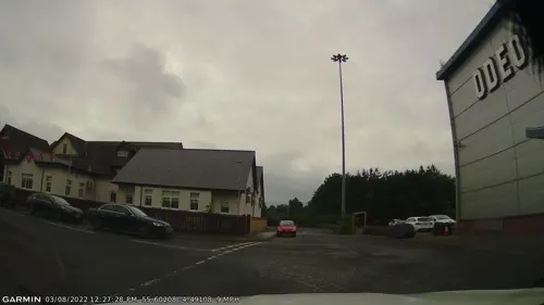

Kings Theatre, Kilmarnock
Cinema and theater · 0.5 mi
Theatre in East Ayrshire, Scotland, UK
Museums and landmarks30


Dean Castle
Monument and historic site · 0.9 mi
Castle and museum in East Ayrshire, Scotland, United Kingdom

Burns Monument
Monument and historic site
Monument in Kilmarnock, East Ayrshire, Scotland, UK

Kilmarnock War Memorial
Monument and historic site
War memorial in East Ayrshire, Scotland, UK

Castle Hill, Caprington
Monument and historic site · 1.6 mi
Mound in East Ayrshire, Scotland, UK
The Dick Institute
Museum
Public library and museum in East Ayrshire, Scotland, UK


18 more on the map.
Parks, trails and playgrounds8





Restaurants and cafes82
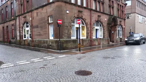
Mamita's Coffee House
Cafe
37 Bank Street, Kilmarnock
Mo,Su off; Tu-Sa 09:00-15:30

The Wheatsheaf Inn
Bar and pub
70 Portland Street, Kilmarnock
Mo,Tu,We,Th,Su 08:00-24:00; Fr,Sa 08:00-25:00


The Station Cafe
Cafe · Coffee Shop
Station Brae, Kilmarnock
Mo-Sa 06:30-14:30; Su off
70 more on the map.
History
The town's precise origins are largely unclear, however, it is believed that a community was established between the fifth–seventh centuries at the Laigh Kirk Church by a Saint Marnock. The earliest known mention of the town was in the 14th century, with Clan Boyd coming to prominence in the area during that time, building the Keep of the Dean Castle. The Romans held a "tentative grip" on the area in and around Kilmarnock, with forts nearby at Loudoun Castle as well as possessing costal harbours around Ayrshire. Early references to the town are vague in regards to population numbers and the geographical size of the town, however, it is widely believed that at this time, the town was little more than a small cluster of dwellings situated around the Laigh Kirk church.
By the end of the sixteenth century, Kilmarnock had become a burgh of barony, and had a weekly market stall and by the 1600s had grown into a small network of narrow streets, with the population relying on industries such as spinning wool, knitting bonnets and the manufacturing of metal cutlery to make a living. A fire engulfed the town in 1668, following the hunting of Covenanters by government troops.
Read more of the history
The core of the early town appears to have lain around what is now the Laigh Kirk, Kilmarnock (Low Church), although the oldest parts of the current building are no earlier than the 17th century, extending north and northwest. In 1668 the town was largely destroyed by an accidental fire. About 120 families lost most of their possessions and were forced to live destitute in the fields surrounding the town. These tradespeople had no other way of making a living and had already been driven to the edge of poverty by having troops stationed with them as part of the anti-Covenanter measures. Parish churches throughout Scotland collected money for the relief of these homeless citizens.
In 1592, King James VI of Scotland granted a charter to Thomas, Lord Boyd, erecting Kilmarnock into a burgh of barony. The charter confirms that the Boyd family to be in possession of the land of Kilmarnock and assures any future line of succession. At the beginning of the 16th century, Kilmarnock was described as "a large village and of great repair" with nearby Kilmaurs notably larger than Kilmarnock. However, over the course of the next one hundred years, the expansion of Kilmarnock was evident. Its expansion led to Kilmarnock becoming larger than Kilmaurs and becoming Ayrshire's largest inland centre and challenging the supremacy of the royal burghs of Ayr and Irvine. During the 19th century, due to the growing rate of expansion due to the industrial expansion, Kilmarnock's population growth increased significantly from 6,000 in 1800, 21,000 in 1851 and 35,000 by 1901.
In the early nineteenth century, Kilmarnock was developed considerably, with the town improvement committee creating plans to improve the road network around the town as they considered the narrow streets that had been in place at the time to be a hindrance for potential trade and development. Plans for new grid-based streets were developed following the consideration of the town improvement committee which resulted in thoroughfares through King Street, Titchfield Street, John Finnie Street and surrounding roadways. The full planned course of the development were never fully completed, resulting in many of the towns older streets and lanes within the new grid-based developments, including Bank Street, Croft Street and Nelson Street not being redeveloped. The refurbished streets were lined with commercial properties, and John Finnie Street is considered one of the most complete examples of Victorian architecture in Scotland.
Although never granted the title of royal burgh, largely due to its geography as an inland settlement with no port to enhance trade at sea, Kilmarnock, as a parliamentary burgh was ranked as equal to other nearby royal burghs such as Ayr and Irvine. Its close proximity to Troon and its harbour helped Kilmarnock's trade and economy and its reputation of a strong and important burgh despite its inland position. Goods such as coal were frequently transported from Kilmarnock to Troon for export, and by 1812 a new railway line between Kilmarnock and Troon was constructed to allow trade to flow from the town much easier. The line opened in 1812, and was the first railway in Scotland to obtain an authorising Act of Parliament; it became the first railway in Scotland to use a steam locomotive; the first to carry passengers; and the River Irvine bridge, Laigh Milton Viaduct, is the earliest railway viaduct in Scotland. It was a plateway, using L-shaped iron plates as rails, to carry wagons with flangeless wheels. In 1841, when more modern railways had developed throughout the West of Scotland, the line was converted from a plateway to a railway and realigned in places. The line became part of the Glasgow and South Western Railway system. Much of the original route is part of the present-day Kilmarnock to Barassie railway line, although the extremities of the original line have been lost.
When elected county councils were created in 1890 under the Local Government (Scotland) Act 1889, the burgh of Kilmarnock was deemed capable of running its own affairs and so was excluded from the jurisdiction of Ayrshire County Council. Further local government reform in 1930 brought the burgh within the area controlled by Ayrshire County Council, but classed as a large burgh, which allowed the town to continue to run many local services itself. Kilmarnock Town Council was based at the Town Hall at 28 King Street, which was built in 1805 and demolished in the 1970s.
The growth of Kilmarnock in population and geographical area swallowed up the old separate village communities
From the History section of Kilmarnock on Wikipedia, under CC BY-SA 4.0.
More about Kilmarnock
Economy
The economy of Kilmarnock had historically been centred around heavy manufacturing and goods based services. However, in recent years, and in trend with other towns and cities across Scotland, Kilmarnock's economic dependence has shifted from manufacturing and instead become more reliant on skills-based knowledge. Companies such as Vodafone (Webhelp Call Centre) and Teleperformance occupy a large part of the Rowallan Business Park, which was also previously home to Food Partners, a nationwide sandwich franchise. Nowadays, the economy of Kilmarnock is largely based on public service and office work, with local property redevelopment and regeneration company, The KLIN Group occupies the former Andrew Barclay Sons & Co offices in West Langland Street, Brodie Engineering operate two production factories for locomotives in the town centre and Utopia Computers also have their headquarters and main site situated in Kilmarnock in High Glencairn Street. Kilmarnock is also home to The HALO Urban Regeneration, a business innovation park, urban regeneration and business start-up support company. HALO is set to provide £205 million of Gross Domestic Product (GDP) to the Economy of Scotland. The window and door company, Scotia have their main headquarters in Kilmarnock, as well as a manufacturing and production plant.
Arts and culture
Kilmarnock boasts a large number of listed buildings. The Dick Institute, opened in April 1901, was severely damaged by fire only eight years after it opened. Some of the museums collections were lost in the fire. It reopened two years after the fire in 1911. The Dick Institute was used as an Auxiliary Hospital in 1917 during World War One. It is now shared by the Arts and Museums Service, and the Libraries, Registration and Information Service. The two Art Galleries and three Museum Galleries house permanent and temporary displays of Fine Art, Contemporary Art and Craft, Local and Industrial History and Natural Sciences. The Lending Library, Audio Library, Junior Library, Reference Library, and Learning Centre are all housed on the ground floor.
Education
Kilmarnock has ten primary schools, three secondary schools (Kilmarnock Academy, Grange Academy and Saint Josephs' Academy) and thirteen nursery schools. The schools are managed by East Ayrshire Council. Further education in the town is provided by Ayrshire College, previously known as Kilmarnock College and, prior to that, Kilmarnock Technical College.
The town's oldest secondary school Kilmarnock Academy dates back to the 1600s. The school in its present-day serves as a comprehensive school, one of three in Kilmarnock. It can trace its history back to the local burgh school founded in the 1630s and the first school to bear the name was established in 1876. Kilmarnock Academy is one of a small number of schools in the United Kingdom, and was the first school in Scotland, to have educated two Nobel Prize Laureates – Sir Alexander Fleming, discoverer of Penicillin, and The 1st Baron Boyd-Orr, for his scientific research into nutrition and his work as the first Director-General of the United Nations Food and Agriculture Organization (FAO). Grange Academy in the Bonnyton area of the town, is one of only seven Scottish Football Association (SFA) Performance Schools.
From the Wikipedia article Kilmarnock, under CC BY-SA 4.0.
Notable people from Kilmarnock
 Colin MochrieCanadian actor and comedian (born 1957)Photo: Colin_Mochrie_at_BANFF,_2008.jpg :..., CC BY-SA 3.0
 William McIlvanneyBritish writer, precursor of tartan noir genre (1936–2015)Photo: nonsenseferret, CC BY-SA 3.0
 Steven CreeScottish actorPhoto: JackieM8, CC BY-SA 4.0
 Alexander SmithBritish poet and essayistPhoto: Stephencdickson, CC BY-SA 3.0
 Robert Thomson LeiperBritish parasitologist and helminthologist (1881–1969)Photo: Juliet Haddon, CC BY 4.0
- Jim BrownScottish-American soccer player (1908-1994)
- Gilbert AdairScottish writer, journalist, translator, film critic and poet (1944–2011)
- James McDougal HartAmerican artist (1828-1901)
- Rose ReillyScottish and Italian association football player (born 1955)
- Alan BrownScottish politician (born 1970)
- David CalderheadScottish footballer and manager (1864-1938)
- Gavin CrawfordScottish footballer (1869-1955)
Born in Kilmarnock, according to Wikidata (CC0). Each name links to its Wikipedia article.
Where to stay4
Churches and places of worship17
Shopping19
Gas and EV charging5
Schools, colleges and libraries18
Healthcare4
Map of Kilmarnock
192 places. The map loads OpenStreetMap tiles when you open it.
Getting there and nearby towns
Glasgow Prestwick Airport (PIK) is the nearest airport with scheduled flights listed in OpenStreetMap, 9 miles away.
- Troon 8 mi southwest, about 13 min by car
- Kilwinning 9 mi west, about 14 min by car
- Prestwick 10 mi southwest, about 16 min by car
- Saltcoats 11 mi west, about 18 min by car
- Newton Mearns 13 mi northeast, about 21 min by car
- Paisley 15 mi north, about 25 min by car
- Johnstone 15 mi north, about 24 min by car
- Renfrew 18 mi north, about 30 min by car
- Rutherglen 19 mi northeast, about 30 min by car
- Glasgow 20 mi northeast, about 32 min by car
Drive times are estimates from straight-line distance, not routes.
Towns near Kilmarnock


Keep exploring
Local news
Headlines from INDB.
Reviews, tips and questions
Loading what members have shared...
Sources and licences
- GeoNames (CC BY 4.0): population, coordinates, regions and time zone
- Mapillary (see each image): photos
- OpenStreetMap contributors (ODbL 1.0): places, airports, map data
- Wikidata (CC0 1.0): elevation, founding date, time zone, website, landmarks and historic places
- Wikimedia Commons (see each image): photos
- Wikipedia (CC BY-SA 4.0): overview and history text
Photo credits
- 05304 Ex Free High-UF High-West High Parish Church, Kilmarnock 003, WeeHolly, CC BY-SA 4.0
- 05304 Ex Free High-UF High-West High Parish Church, Kilmarnock 017, WeeHolly, CC BY-SA 4.0
- 05304 Ex Free High-UF High-West High Parish Church, Kilmarnock 008, WeeHolly, CC BY-SA 4.0
- 05304 Ex Free High-UF High-West High Parish Church, Kilmarnock 015, WeeHolly, CC BY-SA 4.0
- 05304 Ex Free High-UF High-West High Parish Church, Kilmarnock 001, WeeHolly, CC BY-SA 4.0
- 05304 Ex Free High-UF High-West High Parish Church, Kilmarnock 020, WeeHolly, CC BY-SA 4.0
- 05304 Ex Free High-UF High-West High Parish Church, Kilmarnock 009, WeeHolly, CC BY-SA 4.0
- 05304 Ex Free High-UF High-West High Parish Church, Kilmarnock 019, WeeHolly, CC BY-SA 4.0
- 05304 Ex Free High-UF High-West High Parish Church, Kilmarnock 010, WeeHolly, CC BY-SA 4.0
- 05304 Ex Free High-UF High-West High Parish Church, Kilmarnock 021, WeeHolly, CC BY-SA 4.0
- 05304 Ex Free High-UF High-West High Parish Church, Kilmarnock 013, WeeHolly, CC BY-SA 4.0
- 05304 Ex Free High-UF High-West High Parish Church, Kilmarnock 007, WeeHolly, CC BY-SA 4.0
- 05304 Ex Free High-UF High-West High Parish Church, Kilmarnock 016, WeeHolly, CC BY-SA 4.0
- 05304 Ex Free High-UF High-West High Parish Church, Kilmarnock 014, WeeHolly, CC BY-SA 4.0
- 05304 Ex Free High-UF High-West High Parish Church, Kilmarnock 005, WeeHolly, CC BY-SA 4.0
- 05304 Ex Free High-UF High-West High Parish Church, Kilmarnock 006, WeeHolly, CC BY-SA 4.0
- 05304 Ex Free High-UF High-West High Parish Church, Kilmarnock 011, WeeHolly, CC BY-SA 4.0
- 05304 Ex Free High-UF High-West High Parish Church, Kilmarnock 012, WeeHolly, CC BY-SA 4.0
- 05304 Ex Free High-UF High-West High Parish Church, Kilmarnock 018, WeeHolly, CC BY-SA 4.0
- 05304 Ex Free High-UF High-West High Parish Church, Kilmarnock 002, WeeHolly, CC BY-SA 4.0
- 05304 Ex Free High-UF High-West High Parish Church, Kilmarnock 004, WeeHolly, CC BY-SA 4.0
- NS4238 - Mason & Murphy - Kilmarnock, Ian Rainey, CC BY-SA 2.0
- Dean Castle, Fraser Sutherland, CC BY 2.5
- KilmarnockBusStation, M J Richardson, CC BY-SA 2.0
- Laighmilton5, Rosser1954 at English Wikipedia, Public domain
- Burns Monument, Kilmarnock, Scotland, Photochrom Print Collection, Public domain
- Kilmarnock War Memorial, Closeupon, CC BY 3.0
- Castle Hill, Caprington, East Ayrshire, Scotland, Rosser1954, CC BY-SA 4.0
- Kay Park Loch, Kilmarnock, East Ayrshire, Rosser1954, CC BY-SA 4.0
- HowardPark, Geograph, CC BY-SA 2.0
- Rugby Park, Kilmarnock, Martin Le Roy, CC BY-SA 4.0
- William McIllvanney campus, November 2018, Goodreg3, CC BY-SA 4.0
- St Josephs Academy, Kilmarnock, wfmillar, CC BY-SA 2.0
- William McIllvanney campus, November 2018 (cropped), Goodreg3, CC BY-SA 4.0
- Laigh Kirk Church, Kilmarnock, Scotland, Leslie Barrie, CC BY-SA 2.0
- NS4337 - The Dick Institute, Ian Rainey, CC BY-SA 2.0
- Street-level photo, gmc, CC BY-SA 4.0
- Street-level photo, gmc, CC BY-SA 4.0
- Street-level photo, gmc, CC BY-SA 4.0
- Street-level photo, mfk, CC BY-SA 4.0
- Street-level photo, gmc, CC BY-SA 4.0
- Street-level photo, mfk, CC BY-SA 4.0
- Street-level photo, trishfarrell26, CC BY-SA 4.0
- Street-level photo, gmc, CC BY-SA 4.0
- Street-level photo, gmc, CC BY-SA 4.0


Page built November 10, 2026. Spotted a mistake? Tell us or suggest a place.