


Why visit Shadwell
Townapedia lists 5 museums and landmarks, 17 parks and trails, 18 places to eat, 3 places to stay and 2 attractions in and around town.
Highlights include Roundhay Castle (Folly), Roundhay Park and Potternewton Park.
Weather in Shadwell
Forecast from MET Norway (CC BY 4.0). Full forecast
About Shadwell
Shadwell is a village and civil parish in northeast Leeds, West Yorkshire, England. The village is 6 miles (9.7 km) to the north east of Leeds city centre.
From the Wikipedia article Shadwell, West Yorkshire (this version), under CC BY-SA 4.0.
Photos of Shadwell


Things to do2

Museums and landmarks5


Marie Curie Cancer Field Of Hope Marker Stone
Monument and historic site · 1.4 mi
Parks, trails and playgrounds17


Tropical World
Park · 1.6 mi
Butterfly house and animal attraction in England


Roundhay Golf Club
Golf course · 1.2 mi
9 hole par 35 "pay & play. classic nine hole course in mature wooded parkland, part of the Roundhay Park Estate. The course is 5322 yards"
Park Lane, Leeds


5 more on the map.
Restaurants and cafes18
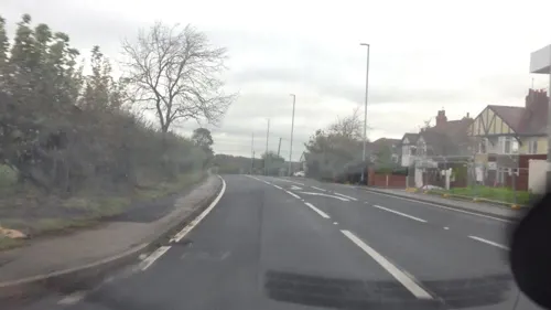
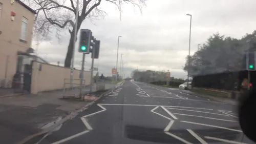





6 more on the map.
History
The first written proof of Shadwell's existence is in 1086 in William the Conqueror's Domesday Book, where it is called Scadewelle, and is part of the Feudal Barony of Pontefract. The origin of the name is not certain, and some 25 variations are found in the historical record, the present one being largely fixed in the 18th century. In the original Anglo-Saxon form, welle could mean a well, spring or boundary, often a boundary stream, such as Shadwell Beck. The scade portion could refer to shade, such as a shady spring, or a name such as Chad or Shad, and different characters with these names have been postulated.
Eight "wells" or ‘springs" situated within Shadwell are shown on an 1851 Ordnance Survey map. One of these, a “Holy Well”, is located in the Shadwell Holywell Triangle, a conservation area. Spring water emerges in a ditch near to the north entrance to Spencer House, a property on Holywell Lane. According to Leeds City Council's Conservation Area Appraisal and Management Plan, it is reputed to have been visited by Bede, and used for the baptism of early Christians. The village pub "The Red Lion" is located between two wells which were originally used to gather water for the brewing process.
Read more of the history
In the Middle Ages it was part of the Wapentake of Skyrack. Over the centuries Shadwell was sometimes a separate manor, sometimes part of the Manor of Roundhay until these rights were extinguished in 1935.
In the early part of the 19th century it was still a village with fewer than 200 inhabitants, containing 11 farms, 2 inns and a Methodist chapel but no school or church. However, from the middle of the century buildings began to appear as wealthier people moved out of industrial Leeds, made with stone from the local quarries.
Shadwell was historically a township in the ancient church parish of Thorner in the West Riding of Yorkshire, until the construction of St Paul's Church in 1842 when it became a parish in its own right. Roundhay Grange, originally a grange of Kirkstall Abbey, was a detached part of the township. In 1866 the township became a separate civil parish as part of Wetherby Rural district, but in 1912 the parish was abolished and absorbed into Leeds.
In 1974 Shadwell became part of the enlarged City of Leeds in the new county of West Yorkshire. In 2002 the civil parish was reconstituted, with an elected parish council.
From the History section of Shadwell, West Yorkshire on Wikipedia, under CC BY-SA 4.0.
Notable people from Shadwell
- Reuben BurrowBritish mathematician and orientalist
Born in Shadwell, according to Wikidata (CC0). Each name links to its Wikipedia article.
Where to stay3
Churches and places of worship8
Gas and EV charging3
Schools, colleges and libraries5
Whinmoor St Paul's Church of England Primary School
School · Anglican · 1.3 mi
Whinmoor Crescent, Leeds
Healthcare2
The Whinmoor Pharmacy - Pharma Nord
Clinic and pharmacy · 1.4 mi
46B White Laithe Approach, Leeds
Map of Shadwell
63 places. The map loads OpenStreetMap tiles when you open it.
Getting there and nearby towns
Leeds Bradford Airport (LBA) is the nearest airport with scheduled flights listed in OpenStreetMap, 7 miles away.
- Scarcroft 1 mi northeast, about 2 min by car
- Thorner 2 mi east, about 3 min by car
- Chapel Allerton 3 mi southwest, about 5 min by car
- East Keswick 3 mi north, about 5 min by car
- Leeds 5 mi southwest, about 8 min by car
- Bramham 5 mi east, about 8 min by car
- Garforth 6 mi southeast, about 9 min by car
- Wetherby 6 mi northeast, about 10 min by car
- Aberford 6 mi east, about 9 min by car
- Horsforth 7 mi west, about 11 min by car
Drive times are estimates from straight-line distance, not routes.
Towns near Shadwell


Keep exploring
Local news
Headlines from INDB.
Reviews, tips and questions
Loading what members have shared...
Sources and licences
- GeoNames (CC BY 4.0): population, coordinates, regions and time zone
- Mapillary (see each image): photos
- OpenStreetMap contributors (ODbL 1.0): places, airports, map data
- Wikidata (CC0 1.0): elevation, founding date, time zone, website, landmarks and historic places
- Wikimedia Commons (see each image): photos
- Wikipedia (CC BY-SA 4.0): overview and history text
Photo credits
- Shadwell67, Chemical Engineer, Public domain
- Shadwell12StPaul, Chemical Engineer, Public domain
- Shadwell88VHall, Chemical Engineer, Public domain
- PotternewtonParkLeeds, Chemical Engineer, Public domain
- Tropical World, Frombowen, CC BY-SA 4.0
- St Andrews Roundhay LS8 1DU, Chemical Engineer, Public domain
- St Matthew, Chapel Allerton (4697617898), Tim Green from Bradford, CC BY 2.0
- Epiphany Gipton, Chemical Engineer, Public domain
- Seacroft parish church, User:Gunnar Larsson, CC BY-SA 3.0
- St Peter Church and Yard, Thorner, Tim Green, CC BY 2.0
- The Castle, Roundhay Park, Stevekraken, CC BY-SA 4.0
- Shadwell72Library, Chemical Engineer, Public domain
- Whinmoor Library (29224608314), Libraries Taskforce, CC BY 2.0
- 197-205, Main Street, Richard Locket, CC BY-SA 4.0
- 133-139, Main Street, Richard Locket, CC BY-SA 4.0
- Upper Lake, Roundhay Park, Leeds - panoramio, Buffers on tour, CC BY-SA 3.0
- Leeds Golf Club - panoramio, docpro, CC BY-SA 3.0
- Street-level photo, lvl5, CC BY-SA 4.0
- Street-level photo, lvl5, CC BY-SA 4.0
- Street-level photo, lvl5, CC BY-SA 4.0
- Street-level photo, lvl5, CC BY-SA 4.0
- Street-level photo, lamaar639, CC BY-SA 4.0


Page built November 10, 2026. Spotted a mistake? Tell us or suggest a place.