


Garforth, United Kingdom
Garforth is a town of 14,838 people in England, United Kingdom.
Why visit Garforth
Townapedia lists 4 museums and landmarks, 9 parks and trails, 47 places to eat, 2 places to stay and 3 attractions in and around town.
Highlights include Crawshaw Woods (Shippen House Farm) Bridge, Hul4/20, Temple Newsam, Aberford Dykes and St Aidan's.
Weather in Garforth
Forecast from MET Norway (CC BY 4.0). Full forecast
About Garforth
Garforth () is a town in the metropolitan borough of the City of Leeds, West Yorkshire.
From the Wikipedia article Garforth (this version), under CC BY-SA 4.0.
Photos of Garforth

Things to do3

Crawshaw Woods (Shippen House Farm) Bridge, Hul4/20
Bridge · 1.5 mi
Bridge in Leeds, West Yorkshire, England, UK


Museums and landmarks4

Temple Newsam
Museum · 3.3 mi
Grade I listed historic house museum in Leeds, United Kingdom, United Kingdom

Aberford Dykes
Monument and historic site · 3.1 mi
Series of archaeological earthworks

Lotherton Hall
Museum · 3.1 mi
Country house in West Yorkshire, England
Parks, trails and playgrounds9

St Aidan's
Park · 3.2 mi
Country Park and RSPB reserve between Leeds and Castleford in West Yorkshire, England
Garforth Community Wildlife Area
Park
An amazing space tucked behind Oak Grove. Incredible Edible Garforth are busy turning it into a environmentally friendly resource for...




Restaurants and cafes47
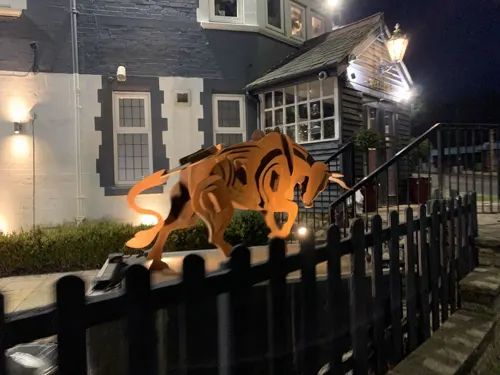
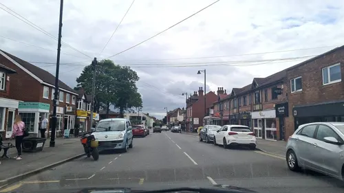


The Lord Gascoigne
Bar and pub · Burger, Chicken, Fish And Chips · 0.4 mi
6 Aberford Road, Leeds


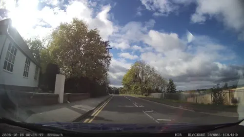
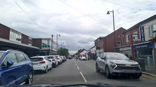


35 more on the map.
History
Garforth owes its size to expansion in the seventeenth and eighteenth centuries during which the local land-owning Gascoigne family ran several coalmines in the area. The surrounding settlements of Micklefield, Kippax, Swillington, Methley and Allerton Bywater Great and Little Preston are all villages that prospered and grew as a result of the coal industry. Nowadays manufacturing and motor-vehicle repair account for more than a third of the workforce in the area.
More recent expansion can also be traced to a combination of overall economic success in Leeds, and that Garforth is served by transport links. The A1 and M1 are minutes away, and both have recently been linked by an extension of the M1 which passes to the west and north of the village, with two nearby access points at Junctions 46 and 47. The M1 extension led to rapid development of commercial, light industrial and residential sites clustered around Junctions 46 and 47. The village rail link to Kippax and Castleford was closed under the Beeching Axe of the 1960s.
Garforth has been home to first Garforth Scout Group since 1908. Garforth & District Lions Club was formed in 1972.
From the History section of Garforth on Wikipedia, under CC BY-SA 4.0.
More about Garforth
Economy
Originally a coal mining area, the collieries of much of east Leeds and surrounding areas closed in the 1960s, although further south mining was still strong in the 1990s and is still prevalent to some degree today. Garforth has increasingly become a commuter town for Leeds, York & City of Wakefield area. There is a light industrial estate to the north of the village which provides some employment, such as Ginetta Cars, while the neighbouring Thorpe Business Park in Colton also provides employment. Garforth's rail connections and access to the M1, A1(M) and M62 have made it a desirable area for commuters to live.
Education
Education establishments in Garforth include a secondary school, primary schools and a vocational performing arts college.
Garforth Academy, a secondary school and sixth form for pupils aged 11–18 is located on Lidgett Lane in Garforth. The school has over 2,000 pupils and staff. Garforth Community Arts School (situated in Garforth Academy) runs the Garforth Arts Festival, which is a display of artistic works.
Opposite Garforth Academy is the recently refurbished Strawberry Fields Primary School, formerly known as West Garforth Primary School. Other Garforth schools are Ninelands Primary School, Green Lane Primary Academy, East Garforth Primary Academy and St Benedict's Primary School, which is a Catholic school.
SLP College is a further education college in Garforth, providing specialist vocational training in dance and performing arts. Founded as a dance school, it later developed a full-time performing arts course and is now a course provider for the Trinity College, London professional performing arts qualifications. The college is accredited to the Council for Dance Education and Training and one of the colleges selected to award the government Dance and Drama Awards.
From the Wikipedia article Garforth, under CC BY-SA 4.0.
Notable people from Garforth
 Kevin Ruddformer professional Rugby League player, coach and administratorPhoto: Graham Rudd, CC BY-SA 4.0
- Will BoyleEnglish association football player (born 1995)
- Reginald TateEnglish actor (1896–1955)
- Sedley CooperEnglish footballer (born 1911)
- Nigel DaveyEnglish footballer
- Jessica Fletcherbadminton player
- William HowsonEnglish footballer (1892-?)
- Stuart Walkerfootball goalkeeper and physiotherapist (born 1951)
- Jim BirchEnglish rugby league footballer
- Augustus WalkerRoyal Air Force air marshal
- Liam WilliamsEnglish comedian
- Jimmy Wilsonassociation football player
Born in Garforth, according to Wikidata (CC0). Each name links to its Wikipedia article.
Where to stay2
Churches and places of worship9
Shopping5
Gas and EV charging4
Schools, colleges and libraries10
Healthcare4
Map of Garforth
97 places. The map loads OpenStreetMap tiles when you open it.
Getting there and nearby towns
Leeds Bradford Airport (LBA) is the nearest airport with scheduled flights listed in OpenStreetMap, 12 miles away.
- Kippax 2 mi south, about 3 min by car
- Lofthouse 6 mi southwest, about 10 min by car
- Leeds 7 mi west, about 11 min by car
- Knottingley 8 mi southeast, about 12 min by car
- Wakefield 9 mi southwest, about 14 min by car
- Wetherby 9 mi north, about 15 min by car
- Horsforth 11 mi west, about 18 min by car
- Ossett 11 mi southwest, about 18 min by car
- Pudsey 11 mi west, about 18 min by car
- Horbury 12 mi southwest, about 19 min by car
Drive times are estimates from straight-line distance, not routes.
Towns near Garforth


Keep exploring
Local news
Headlines from INDB.
Reviews, tips and questions
Loading what members have shared...
Sources and licences
- GeoNames (CC BY 4.0): population, coordinates, regions and time zone
- Mapillary (see each image): photos
- OpenStreetMap contributors (ODbL 1.0): places, airports, map data
- Wikidata (CC0 1.0): elevation, founding date, time zone, website, landmarks and historic places
- Wikimedia Commons (see each image): photos
- Wikipedia (CC BY-SA 4.0): overview and history text
Photo credits
- Shopping Parade, Main Street, Garforth (19th July 2014), Mtaylor848, CC BY-SA 4.0
- Garforth St Mary BleVi nave & aisles GeoUK 7077584, Steven Craven, CC BY-SA 2.0
- St Mary's Church and Cemetery, Garforth (29th September 2026) 008, Mtaylor848, CC BY-SA 3.0
- St Mary's Church and Cemetery, Garforth (29th September 2026) 011, Mtaylor848, CC BY-SA 3.0
- St Mary's Church and Cemetery, Garforth (29th September 2026) 007, Mtaylor848, CC BY-SA 3.0
- St Mary's Church and Cemetery, Garforth (29th September 2026) 010, Mtaylor848, CC BY-SA 3.0
- St Mary's Church and Cemetery, Garforth (29th September 2026) 004, Mtaylor848, CC BY-SA 3.0
- St Mary's Church and Cemetery, Garforth (29th September 2026) 009, Mtaylor848, CC BY-SA 3.0
- Temple Newsam House from the grounds, Sirenuk, CC BY-SA 3.0
- St Aidan's Nature Reserve1, Richard Avery, CC BY-SA 4.0
- St Ricarius Nov 2016 (43), Storye book, CC BY 4.0
- St. Mary's, Whitkirk, Barkendeavour, CC BY-SA 3.0
- Church of St Mary Swillington, Wdhill2, CC BY-SA 3.0
- St. Mary's Church, Garforth, Rcsprinter123, CC BY 3.0
- GarforthCC2009, Chemical Engineer, Public domain
- Garforth Library and One Stop Centre (19th July 2014), Mtaylor848, CC BY-SA 4.0
- GapingGooseGarforth, Chemical Engineer, Public domain
- The Miners', Aberford Road, Garforth (19th July 2014) 003, Mtaylor848, CC BY-SA 4.0
- The Newmarket, Main Street, Garforth (10th April 2023), Mtaylor848, CC BY-SA 4.0
- The Gascoigne, Aberford Road, Garforth (19th July 2014) 004, Mtaylor848, CC BY-SA 4.0
- St. Benedict's Roman Catholic Church, Aberford Road, Garforth (19th July 2014), Mtaylor848, CC BY-SA 4.0
- Magnesium limestone grassland at Roach Lime Hills SSSI, Lajmmoore, CC BY-SA 4.0
- Street-level photo, gmc, CC BY-SA 4.0
- Street-level photo, mappo2, CC BY-SA 4.0
- Street-level photo, mappo2, CC BY-SA 4.0
- Street-level photo, mapz4lolz, CC BY-SA 4.0
- Street-level photo, mappo2, CC BY-SA 4.0
- Street-level photo, mappo2, CC BY-SA 4.0
- Street-level photo, livingwithdragons, CC BY-SA 4.0
- Street-level photo, mappo2, CC BY-SA 4.0
- Street-level photo, mappo2, CC BY-SA 4.0
- Street-level photo, lvl5, CC BY-SA 4.0
- Street-level photo, mappo2, CC BY-SA 4.0
- Street-level photo, mappo2, CC BY-SA 4.0
- Street-level photo, mappo2, CC BY-SA 4.0
- Street-level photo, mappo2, CC BY-SA 4.0
- Street-level photo, humez, CC BY-SA 4.0
- Street-level photo, mappo2, CC BY-SA 4.0
- Street-level photo, mappo2, CC BY-SA 4.0
- Street-level photo, lvl5, CC BY-SA 4.0
- Street-level photo, humez, CC BY-SA 4.0
- Street-level photo, livingwithdragons, CC BY-SA 4.0
- Street-level photo, humez, CC BY-SA 4.0
- Street-level photo, livingwithdragons, CC BY-SA 4.0


Page built November 10, 2026. Spotted a mistake? Tell us or suggest a place.