


Shipton under Wychwood, United Kingdom
Shipton under Wychwood is a town of 2,892 people in England, United Kingdom.
Why visit Shipton under Wychwood
Townapedia lists 13 museums and landmarks, 3 parks and trails and 8 places to eat in and around town.
Highlights include Lyneham Longbarrow and Ascot d'Oilly Castle.
Weather in Shipton under Wychwood
Forecast from MET Norway (CC BY 4.0). Full forecast
About Shipton under Wychwood
Shipton-under-Wychwood is a village and civil parish in the Evenlode valley about 4 miles (6.4 km) north of Burford, in the West Oxfordshire district, in the county of Oxfordshire, England. The village is one of three named after the ancient forest of Wychwood. The others are Milton-under-Wychwood immediately to the west of the village and Ascott-under-Wychwood about 1.5 miles (2.4 km) to the east. The 2011 Census recorded Shipton-under-Wychwood's parish population as 1,244.
From the Wikipedia article Shipton-under-Wychwood (this version), under CC BY-SA 4.0.
Travel tips from other travellers: Shipton under Wychwood on Wikivoyage (CC BY-SA 4.0).
Museums and landmarks13
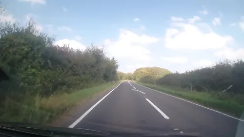
Lyneham Longbarrow
Monument and historic site · 2.2 mi
Long barrow in Oxfordshire, England

Ascot d'Oilly Castle
Monument and historic site · 1.6 mi
Castle in Oxfordshire, England, UK
Ascott Earl motte and bailey castle
Monument and historic site · 1.2 mi
Bottle Kiln immediately east of No 50 (Coldstones)
Monument and historic site · 1.2 mi
1 more on the map.
Parks, trails and playgrounds3


Restaurants and cafes8



Churches and places of worship3


Notable people from Shipton under Wychwood
- Frank HartleyEnglish footballer (1896–1965)
Born in Shipton under Wychwood, according to Wikidata (CC0). Each name links to its Wikipedia article.
Gas and EV charging2
Schools, colleges and libraries2
Healthcare1
Map of Shipton under Wychwood
32 places. The map loads OpenStreetMap tiles when you open it.
Getting there and nearby towns
RAF Brize Norton (BZZ) is the nearest airport with scheduled flights listed in OpenStreetMap, 7 miles away.
- Burford 4 mi southwest, about 6 min by car
- Minster Lovell 5 mi southeast, about 8 min by car
- Witney 7 mi southeast, about 12 min by car
- Carterton 7 mi south, about 11 min by car
- Stow on the Wold 7 mi northwest, about 12 min by car
- Stonesfield 7 mi east, about 12 min by car
- North Leigh 7 mi southeast, about 12 min by car
- Ducklington 8 mi southeast, about 13 min by car
- Aston 10 mi south, about 16 min by car
- Woodstock 11 mi east, about 17 min by car
Drive times are estimates from straight-line distance, not routes.
Towns near Shipton under Wychwood


Keep exploring
Local news
Headlines from INDB.
Reviews, tips and questions
Loading what members have shared...
Sources and licences
- GeoNames (CC BY 4.0): population, coordinates, regions and time zone
- Mapillary (see each image): photos
- OpenStreetMap contributors (ODbL 1.0): places, airports, map data
- Wikidata (CC0 1.0): elevation, founding date, time zone, website, landmarks and historic places
- Wikimedia Commons (see each image): photos
- Wikipedia (CC BY-SA 4.0): overview and history text
Photo credits
- Shipton-under-Wychwood, Dave.Dunford, Public domain
- Shaven Crown Shipton-under-Wychwood, Dave.Dunford, CC BY-SA 3.0
- MiltonUnderW SsSimon&Jude SW Landscape, Motacilla, CC BY-SA 3.0
- Street-level photo, trigpoint, CC BY-SA 4.0
- Street-level photo, southglos, CC BY-SA 4.0
- Street-level photo, southglos, CC BY-SA 4.0
- Street-level photo, southglos, CC BY-SA 4.0
Page built November 10, 2026. Spotted a mistake? Tell us or suggest a place.