


Woodstock, United Kingdom
Woodstock is a town of 3,521 people in England, United Kingdom.
Why visit Woodstock
Townapedia lists 14 museums and landmarks, 17 parks and trails, 18 places to eat, 7 places to stay and 1 attraction in and around town.
Highlights include Blenheim Palace and Soldiers of Oxfordshire Museum.
Weather in Woodstock
Forecast from MET Norway (CC BY 4.0). Full forecast
About Woodstock
Woodstock is a market town and civil parish, 8 miles (13 km) north-west of Oxford in West Oxfordshire in the county of Oxfordshire, England. The 2021 census recorded a parish population of 3,521, up from the previous 3,100 in 2011.
From the Wikipedia article Woodstock, Oxfordshire (this version), under CC BY-SA 4.0.
Travel tips from other travellers: Woodstock on Wikivoyage (CC BY-SA 4.0).
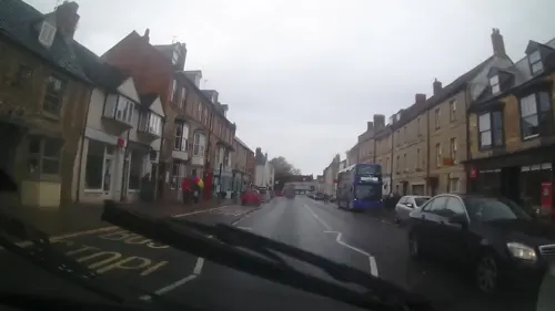
Photos of Woodstock


Things to do1

Museums and landmarks14

Blenheim Palace
Monument and historic site · 0.6 mi
Country house near Woodstock, Oxfordshire, England, UK


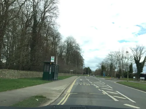
Oxford Bus Museum
Museum · 1.8 mi
Transport museum in Oxfordshire, England, United Kingdom

Oxfordshire Museum
Museum
Museum in Woodstock, Oxfordshire, United Kingdom
Park Street, Woodstock
Tu-Sa 10:00-17:00; Su 14:00-17:00

2 more on the map.
Parks, trails and playgrounds17




5 more on the map.
Restaurants and cafes18
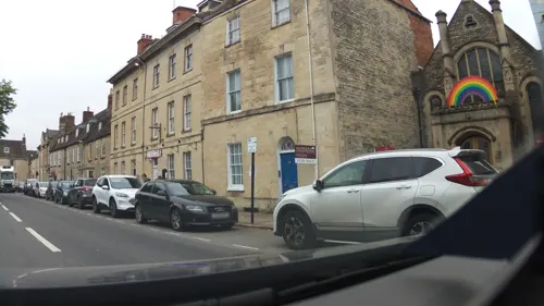

The Punchbowl
Bar and pub
12 Oxford Street, Woodstock
Mo,Tu 12:00-21:30; We,Th 12:00-21:30; Fr,Sa 12:00-22:00; Su 12:00-17:30
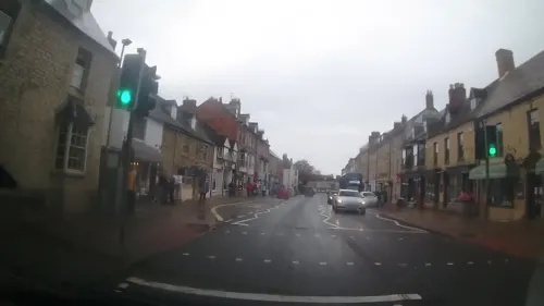
Alfonso Gelateria
Ice cream
30 High Street, Woodstock
Mo-Fr 09:00-17:00; Sa 09:00-17:30; Su 09:30-17:00
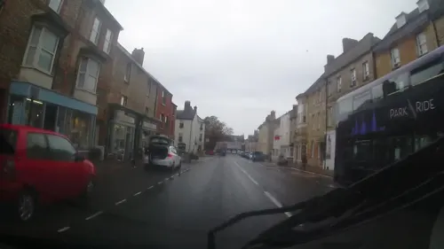

The Chef Imperial
Restaurant · Chinese
Tu-Sa 12:00-14:30,18:00-22:30; Su 12:00-14:30,06:00-22:00; PH...

The Back Lane Tavern
Bar and pub
11 Park Lane, Woodstock
Mo-Fr 11:00-22:00; Sa 11:00-23:00; Su 11:00-21:00


6 more on the map.
History
The name Woodstock is Old English in origin, meaning a "clearing in the woods". The Saxon name was Wudestoc, i.e. a woody place. The Domesday Book of 1086 describes Woodstock (Wodestock, Wodestok, Wodestole) as a royal forest. Æthelred the Unready, king of England, is said to have held an assembly at Woodstock at which he issued a legal code now known as IX Æthelred. Henry I may have kept a menagerie in the park. Woodstock was the scene of Henry II's courtship of Rosamund Clifford (Fair Rosamund). The market of the town was established when Henry II gave Woodstock a market charter in 1179. The Bear Hotel in Park Street opposite The Oxfordshire Museum dates from the 13th century.
Read more of the history
Near the village was Woodstock Palace, a residence that was popular with several English kings throughout the medieval period. The building was destroyed in the English Civil War. 60 years later the palace remains were cleared for the building of Blenheim Palace. From the 16th century the town prospered by making gloves. In the 17th century the town was altered greatly, when the 1st Duke of Marlborough became a permanent resident. The town had a successful fine steelwork industry by 1720 and by 1742 its products were of high enough quality to be considered viable diplomatic gifts. By the end of the 18th century this had developed into cut steel jewellery. Today it is largely dependent on tourists, many of whom visit Blenheim Palace.
When Thomas Wyatt led an uprising in 1554 to depose Queen Mary I and put Princess Elizabeth on the throne in her place, Elizabeth was imprisoned in a lodge in Woodstock as a precaution. The lodge was used because the now lost Woodstock Palace or manor house was too dilapidated to house her. A survey in 1551 reported that "the mansion... for many years past hath been decayed." While imprisoned, Elizabeth wrote a poem. "Much suspected by [of] me, None proved can be." She was released in April 1555 after nearly a year in captivity.
By 1626 James Keene, who had a bell-foundry in Bedford, had started one in Woodstock. Until 1640 another member of the family, Humphrey Keene, was a bell-founder with him. James died in 1654 and was succeeded by his son Richard. Richard Keene apparently closed the Woodstock foundry in the 1680s but continued casting bells at Royston, Hertfordshire, until 1703.
Numerous parish churches still have one or more bells cast by the Keenes, including at Asthall, Bloxham, Cassington, Charlton-on-Otmoor, Chastleton, Chesterton, Duns Tew, Eynsham, Garsington, Islip, Kiddington, Merton, Milton, North Moreton, Oddington, Rousham, Sandford St Martin, Stanton Harcourt, Steeple Aston, Steeple Barton, Stratton Audley, Tackley, Towersey and Woodeaton in Oxfordshire, Stowe and Water Stratford in Buckinghamshire, Stanton in Gloucestershire, Middleton Cheney in Northamptonshire and Martley in Worcestershire.
The town previously had a railway station, Blenheim and Woodstock railway station, initially privately run by the Duke of Marlborough until 1897 when it became part of the Great Western Railway. The final train to run on the line departed on 27 February 1954. The western end of the line, leading to the old station, is now a residential road, "New Road". The part of the line on the eastern edge of the town now forms a nature area called the "OWL" (Old Woodstock Line) Nature Reserve.
From the History section of Woodstock, Oxfordshire on Wikipedia, under CC BY-SA 4.0.
Notable people from Woodstock
 Winston ChurchillBritish statesman, soldier and writer (1874–1965)Photo: Unknown author, Public domain
 Hugh EdwardsBritish rower (1906-1972)Photo: Xth Olympiade Committee, Public domain
 Nancy NicholsonBritish painter and fabric designer (1899-1977)Photo: Mabel Pryde, Public domain
- William Bertram TurrillEnglish botanist (1890–1961)
- Charles TurnerEnglish engraver (1774-1857)
- Mary Ann JacksonEnglish botanical illustrator (1819-1915)
- Joseph Anthony HarperSouth Australian politician (1867–1939)
- Frank WrightBritish cricketer (1844-1924)
- Simon HatleyEnglish sailor
- John CaseEnglish writer on Aristotle
- James FreerCanadian film director (1855–1933)
- Mary Brook[née Brotherton] (c.1726–1782), Quaker and writer
Born in Woodstock, according to Wikidata (CC0). Each name links to its Wikipedia article.
Where to stay7
Churches and places of worship8
Shopping3
Schools, colleges and libraries5
Healthcare1
Map of Woodstock
74 places. The map loads OpenStreetMap tiles when you open it.
Getting there and nearby towns
Oxford Airport (OXF) is the nearest airport with scheduled flights listed in OpenStreetMap, 1 miles away.
- Kidlington 3 mi southeast, about 5 min by car
- Stonesfield 3 mi west, about 5 min by car
- Yarnton 3 mi southeast, about 6 min by car
- North Leigh 5 mi southwest, about 7 min by car
- Witney 7 mi southwest, about 12 min by car
- Oxford 8 mi southeast, about 13 min by car
- Ducklington 8 mi southwest, about 13 min by car
- Bicester 9 mi northeast, about 15 min by car
- Standlake 9 mi south, about 14 min by car
- Cowley 10 mi southeast, about 16 min by car
Drive times are estimates from straight-line distance, not routes.
Towns near Woodstock


Keep exploring
Local news
Headlines from INDB.
Reviews, tips and questions
Loading what members have shared...
Sources and licences
- GeoNames (CC BY 4.0): population, coordinates, regions and time zone
- Mapillary (see each image): photos
- OpenStreetMap contributors (ODbL 1.0): places, airports, map data
- Wikidata (CC0 1.0): elevation, founding date, time zone, website, landmarks and historic places
- Wikimedia Commons (see each image): photos
- Wikipedia (CC BY-SA 4.0): overview and history text
Photo credits
- Woodstocktownhall, OHCLOUDSUNFOLD, Public domain
- Blenheim Palace 6-2008 4, Jvhertum, Public domain
- Combe StLaurence SE, Motacilla, CC BY-SA 3.0
- St. Martin's Church, Bladon 11, Simon Burchell, CC BY-SA 4.0
- The Bear Hotel in Woodstock, Steve Daniels, CC BY-SA 2.0
- The Oxford School of Drama, Kashcroft, CC BY-SA 4.0
- The Star Inn, Woodstock, Simon Burchell, CC BY-SA 4.0
- The Punchbowl Inn, Woodstock, Simon Burchell, CC BY-SA 4.0
- Blenheim Palace panorama, Magnus Manske, CC BY-SA 3.0
- Fishery Cottage, DIaNyf8q, CC0
- Bladon StMartin south, Motacilla, CC BY-SA 3.0
- Waterloo Medal - Charles Rowan, DilletantiAnonymous, CC BY-SA 4.0
- Blenheim Park 04, Simon Burchell, CC BY-SA 4.0
- Street-level photo, southglos, CC BY-SA 4.0
- Street-level photo, southglos, CC BY-SA 4.0
- Street-level photo, trigpoint, CC BY-SA 4.0
- Street-level photo, laye, CC BY-SA 4.0
- Street-level photo, zymurgic, CC BY-SA 4.0
- Street-level photo, trigpoint, CC BY-SA 4.0
- Street-level photo, trigpoint, CC BY-SA 4.0
- Street-level photo, southglos, CC BY-SA 4.0
- Street-level photo, southglos, CC BY-SA 4.0
- Street-level photo, trigpoint, CC BY-SA 4.0
- Street-level photo, southglos, CC BY-SA 4.0
- Street-level photo, alexanderar, CC BY-SA 4.0
- Street-level photo, trigpoint, CC BY-SA 4.0
- Street-level photo, southglos, CC BY-SA 4.0
- Street-level photo, laye, CC BY-SA 4.0
- Street-level photo, southglos, CC BY-SA 4.0
Page built November 10, 2026. Spotted a mistake? Tell us or suggest a place.