


Carterton, United Kingdom
Carterton is a town of 15,680 people in England, United Kingdom.
Why visit Carterton
Townapedia lists 6 museums and landmarks, 8 parks and trails, 33 places to eat, 2 places to stay and 1 attraction in and around town.
Highlights include Crocodiles of the World, Asthall Barrow: an Anglo-Saxon burial mound 100m SSW of Barrow Farm, Swinford Museum and Cotswold Wildlife Park.
Weather in Carterton
Forecast from MET Norway (CC BY 4.0). Full forecast
About Carterton
Carterton is a town in West Oxfordshire district in the county of Oxfordshire, England and is 4 miles (6.4 km) south-west of Witney. The 2011 Census recorded the parish's population as 15,769. The current population as estimated by censusdata.uk is 18,691.
From the Wikipedia article Carterton, Oxfordshire (this version), under CC BY-SA 4.0.
Things to do1

Crocodiles of the World
Zoo and aquarium · 1.4 mi
Zoo in Oxfordshire, England
Burford Road, Brize Norton
Museums and landmarks6
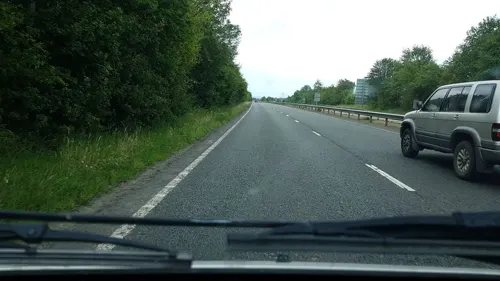
Asthall Barrow: an Anglo-Saxon burial mound 100m SSW of Barrow Farm
Monument and historic site · 2.1 mi
Archaeological site in Asthall, West Oxfordshire, England, UK

Swinford Museum
Museum · 3.1 mi
Museum in Filkins, West Oxfordshire, England, UK

47 Air Despatch Squadron RLC, Dakota IV gate guardian
Monument and historic site · 0.6 mi
Parks, trails and playgrounds8




Restaurants and cafes33
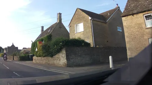


Rose and Crown
Bar and pub · 1.4 mi
Su 12:00-21:00; Mo-Fr 11:00-15:00,18:00-22:00


21 more on the map.
History
Much of what is now the northern part of the town was held by the Moleyns family from at least 1369, but in 1429 William Lord Moleyns was killed at the siege of Orléans and the land passed to the Hungerford family. During the medieval period the main road through Carterton was one of the most important in the country, taking trains of packhorses laden with Cotswold wool over Radcot Bridge and on to Southampton for export to the weaving centre of Europe. In the 1770s the land was acquired by the Duke of Marlborough.
The pattern of the present settlement dates from 1894 when part of the estate was sold to Homesteads Limited whose director was William Carter. The land was divided into plots of 6 acres and sold for £20 an acre with bungalows costing from £120. Many of the settlers were retired soldiers and people moving from the towns. Carterton soon made its name in the market gardening world. Black grapes from Frenchester Nurseries and the famous Carterton tomatoes were sold at Covent Garden Market.
Read more of the history
Carterton, which by the late 20th century was one of the largest towns in Oxfordshire, was founded soon after 1900 as a colony of smallholders, on agricultural land in the northern part of Black Bourton parish. The founder was William Carter of Branksome (Dorset), a speculator who, through his company Homesteads Ltd of London, bought estates in several counties, in order to establish smallholdings and attract people back to the land. In Oxfordshire he acquired from W. C. Arkell, in 1900, the 740-a. Rock farm north of Black Bourton village, part of an estate sold by the duke of Marlborough in 1894. By late 1902 there were 16 houses, and the following year the new settlement, already called Carterton, was included in a local trades directory.
Carterton's later growth was closely related to the construction in 1937 of the nearby RAF Brize Norton airbase. This development profoundly altered the settlement's character as Brize Norton became the Royal Air Force's largest operating base. A small group of substantial two-storey houses for RAF personnel, called Brizewood, was built east of Swinbrook Road about 1938, and in the 1950s was expanded with uniform bungalows for American servicemen. By 1953 Carterton was a "busy and expanding village", and its rapid population increase was creating severe housing problems: in 1962 the plight of significant numbers of caravan dwellers prompted an article in the Lancet, though many residents took exception to the town's portrayal, and denied that the picture was typical. By then there were claimed to be more civilians than servicemen living in mobile homes, some of them single women, and the "shack-like houses of the early settlers", their "meagre appearance [bearing] eloquent witness to tight budgets and hardship" elsewhere on the "busy village main street".
A few scattered "Robin" hangars, hastily built during the Second World War to allow aircraft to be housed away from the airfield itself, were converted to other uses during the same period, one on Alvescot Road surviving in the early 21st century as part of a motor repair garage. Rock Farm and its converted agricultural buildings, all stone-built, survived as a small group at the intersection of Lawton and Arkell Avenues, with William Wilkinson's pair of model labourers' cottages set back from the Alvescot road between modern housing. In 1967 an ambitious scheme was launched for controlled expansion and for regeneration of the town centre, with a ring road (Upavon Way) to serve new housing, to divert traffic from the centre, and to contain future expansion. New RAF housing was to provide over 1,450 dwellings and private enterprise another 300, while local authorities were to provide shops and other much needed facilities around the central crossroads. A reduced scheme for the town centre was launched in 1975 after repeated delays and controversy, and Upavon Way was opened soon after.
By 1976 over 2,000 houses had been built since the 1960s, those on the large estates in the north-east mostly of uniform appearance with concrete exteriors, and 850 more were planned. Settlement by then spilled over the parish boundary into Brize Norton, though on the north there was no expansion beyond the parish boundary, and expansion south of Milestone Road was constrained by the airfield perimeter. A large transit hotel within the airfield precinct was built by the RAF in 1970 to serve military personnel and their families. The number of people in mobile homes still caused controversy in 1980, when there were almost 250 permanent or temporary pitches distributed among several sites, and in the early 1980s some sites were closed and replaced by council houses. Expansion in the town's eastern part, chiefly for housing, continued in the mid 1980s.
By 1997 the town centre had been transformed: shops in a variety of styles lined the four broad main streets, interspersed with a few older buildings such as the Beehive Hotel and the former Emporium, and the crossroads was dominated by a tall domed tower built in 1996, surmounting new shops and offices. A large Co-operative Society supermarket of flamboyant design, on the site of the earlier building on Black Bourton Road, was erected in 1998, and in 2000 work began on a major expansion programme on the town's eastern edge, to include another 1,200 houses, a shopping centre, leisure facilities, and a new access road. A variety of early settler's houses also survived scattered among the modern buildings, though by 2004 several had been recently demolished or were semiderelict and under threat from developers, prompting mounting local controversy.
From the History section of Carterton, Oxfordshire on Wikipedia, under CC BY-SA 4.0.
More about Carterton
Education
St. John the Evangelist and St. Joseph's are voluntary controlled schools. Carterton Community College is the town's secondary school.
From the Wikipedia article Carterton, Oxfordshire, under CC BY-SA 4.0.
Where to stay2
Churches and places of worship8
Shopping4
Gas and EV charging2
Schools, colleges and libraries10
Healthcare3
Map of Carterton
77 places. The map loads OpenStreetMap tiles when you open it.
Getting there and nearby towns
RAF Brize Norton (BZZ) is the nearest airport with scheduled flights listed in OpenStreetMap, 1 miles away.
- Witney 5 mi east, about 8 min by car
- Oxford 14 mi east, about 23 min by car
- Kidlington 14 mi east, about 22 min by car
- Wantage 14 mi southeast, about 22 min by car
- Swindon 16 mi southwest, about 26 min by car
- Cirencester 16 mi west, about 26 min by car
- Cowley 17 mi east, about 27 min by car
- Didcot 18 mi southeast, about 29 min by car
- Royal Wootton Bassett 20 mi southwest, about 32 min by car
- Cheltenham 23 mi northwest, about 37 min by car
Drive times are estimates from straight-line distance, not routes.
Towns near Carterton


Keep exploring
Local news
Headlines from INDB.
Reviews, tips and questions
Loading what members have shared...
Sources and licences
- GeoNames (CC BY 4.0): population, coordinates, regions and time zone
- Mapillary (see each image): photos
- OpenStreetMap contributors (ODbL 1.0): places, airports, map data
- Wikidata (CC0 1.0): elevation, founding date, time zone, website, landmarks and historic places
- Wikimedia Commons (see each image): photos
- Wikipedia (CC BY-SA 4.0): overview and history text
Photo credits
- Cotswold Wildlife Park -Burford, England -gardens-25June2006, ciukes, CC BY 2.0
- Bampton StMaryV SE, Motacilla, CC BY-SA 4.0
- Langford StMatthew SE, Motacilla, CC BY-SA 3.0
- Alvescot church, gary radford, CC BY-SA 2.0
- Church of St Britius 2013-09-29 10-51-08, Daveyonthemove, CC BY-SA 3.0
- Carterton StJohnEvangelist NW, Motacilla, CC BY-SA 4.0
- Street-level photo, richardc, CC BY-SA 4.0
- Street-level photo, southglos, CC BY-SA 4.0
- Street-level photo, southglos, CC BY-SA 4.0
- Street-level photo, southglos, CC BY-SA 4.0
Page built November 10, 2026. Spotted a mistake? Tell us or suggest a place.