


St. Helens, United Kingdom
St. Helens is a town of 1,213 people in England, United Kingdom.
Why visit St. Helens
Townapedia lists 10 museums and landmarks, 11 parks and trails, 26 places to eat, 9 places to stay and 3 attractions in and around town.
Highlights include St Helens Fort, Ryde Theatre and Town Hall, Bembridge Windmill and Brading Roman Villa.
Weather in St. Helens
Forecast from MET Norway (CC BY 4.0). Full forecast
About St. Helens
St Helens is a village and civil parish located on the eastern side of the Isle of Wight.
From the Wikipedia article St Helens, Isle of Wight (this version), under CC BY-SA 4.0.
Photos of St. Helens


Things to do3

St Helens Fort
Lighthouse · 1.3 mi
Sea fort with lighthouse in the Solent close to the Isle of Wight, England, UK

Ryde Theatre and Town Hall
Cinema and theater · 3.3 mi
Theatre and former town hall in Ryde, Isle of Wight, England, UK

Museums and landmarks10


Brading Roman Villa
Museum · 2.4 mi
Roman rural estate at Brading, United Kingdom


Nunwell House
Museum · 2.3 mi
Country house in Brading, Isle of Wight, England, UK


Parks, trails and playgrounds11

Alan Hersey Nature Reserve
Park · 1.5 mi
Nature reserve on the Isle of Wight

Brading Marshes RSPB reserve
Park · 1.7 mi
RSPB nature reserve on the Isle of Wight

Seaview Wildlife Encounter
Park · 1.7 mi
Wildlife park in Seaview, Isle of Wight, England

The Wildheart Animal Sanctuary
Park · 2.8 mi
Zoo on the Isle of Wight, UK





Restaurants and cafes26
Old Village Inn
Bar and pub · 1.1 mi
61 High Street, Bembridge
Mo-Fr 12:00-00:00; Sa 12:00-01:00; Su 12:00-10:30
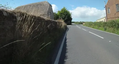
Propeller Inn
Bar and pub · 1.5 mi
Sandown Road, Bembridge
Mo-Tu off; We-Sa 12:00-22:00; Su 12:00-17:00
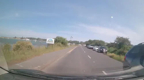
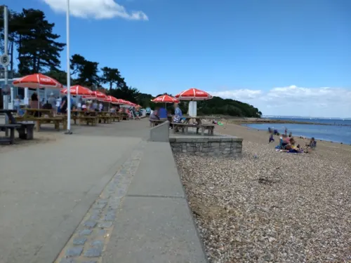
Baywatch on the Beach
Cafe · Fish And Chips, Seafood, Sandwich · 0.6 mi
The Duver, Ryde



14 more on the map.
History
The origin of St Helens seems to revolve around the Cluniac Priory and the monastic church, built circa 1080. In 1340 a French raid landed at St Helens but was repulsed by Sir Theobald Russell. In 1346 Edward III set sail from St Helens to invade Normandy.
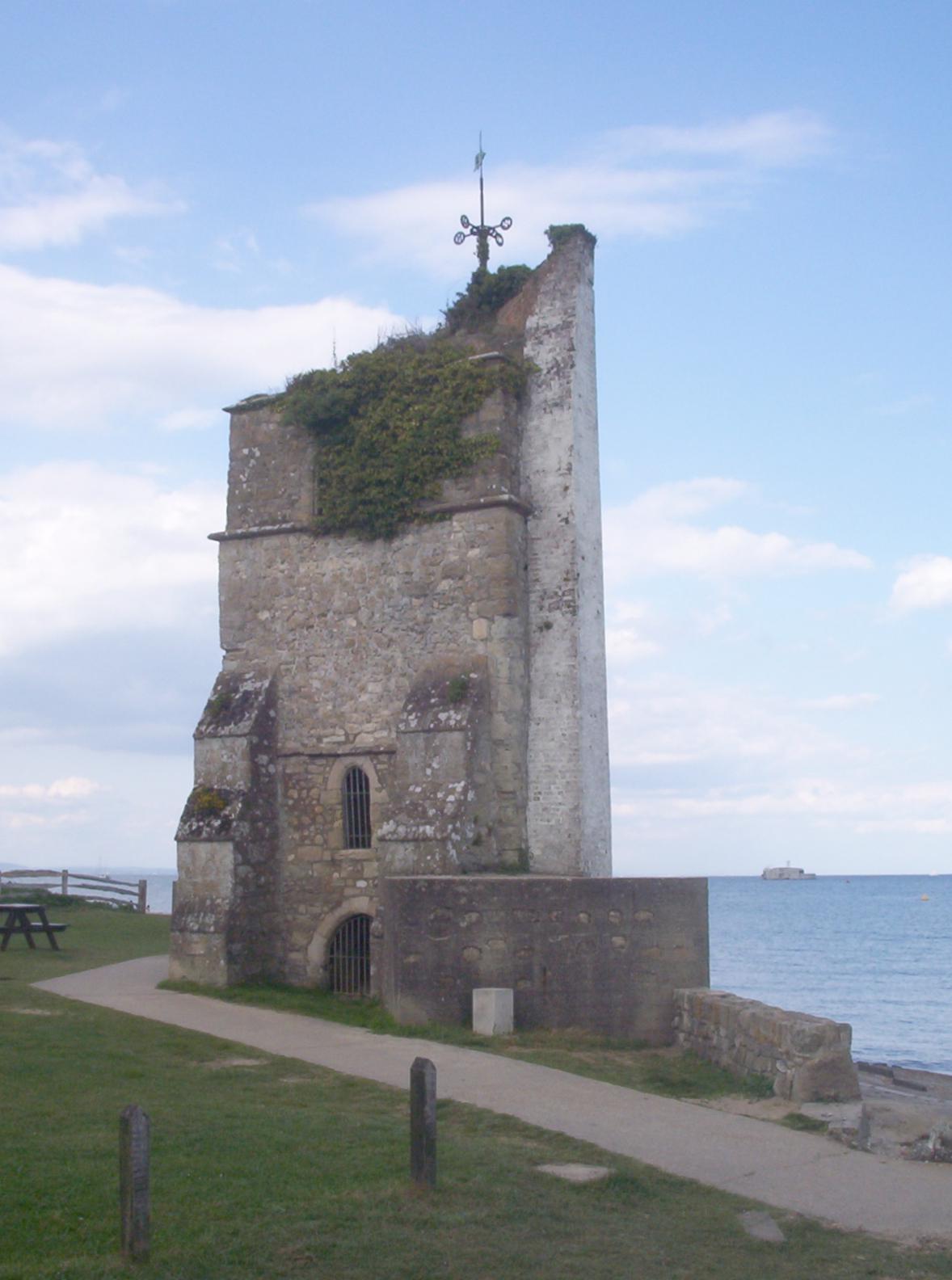
After Henry V suppressed the alien priories in 1414 the old church became the parish church. The original church eventually became unsafe and a new one was built further inland. In 1720 a great wave destroyed the old church, though the church tower still stands to this day; the seaward side is painted as a sea mark. It is believed that Admiral Lord Nelson's last view of England was of the St Helens seamark - HMS Victory had anchored nearby to collect drinking water, before setting sail for Cádiz and participation in the Battle of Trafalgar.
There used to be a ferry service running to Bembridge when the Eastern Yar was a broad tidal creek.
In the early 18th Century, the entrance to the harbour was near the church. Attempts at reclamation of the harbour, which were unsuccessful due to locals removing building materials, resulted in the harbour being moved. The church was undermined by the quarrying of stone from the beach, which accounts for the large dressed blocks leading along the beach to Priory Bay. A small gun battery, which has been lost to the sea, once defended the entrance.
Read more of the history
Dressed stones from the walls of the destroyed church, which were soft sandstone, were found to be good for scrubbing the decks of wooden planked warships - hence the terms 'holystone' and 'holystoning the decks'.
The closest Royal Commission sea fort to the island is St Helens Fort, named after St Helens. Historic England has St Helens Fort listed as a Scheduled Monument and Grade II Listed Building.
From the History section of St Helens, Isle of Wight on Wikipedia, under CC BY-SA 4.0.
More about St. Helens
Geography
St Helens is located to the east of the Isle of Wight on high ground to the north of Bembridge, giving it views over the harbour. The nearest town is Ryde, about 3 miles (4.8 km) away.
The village is located on the coast, with St Helens Duver nearby at the mouth of the harbour. The area features a sand-dune complex where the first golf course on the island was located, and where there is now a sheltered beach, cafe and beach huts. The Duver is no longer a golf course and is maintained by the National Trust. A promenade stretches along the beach, with the sand dunes at the rear. During the summer season the beach is litter picked, with large amounts of seaweed removed and given to local farmers for composting. In 1997, the beach was given a Seaside Award Flag.
The Eastern Yar, which rises near Niton to the south of the island, runs to the south of the village into Bembridge Harbour, en route to the Solent.
St Helens' built environment is set around large village greens, which are often claimed to make up the second largest green in England. The greens are split up in some areas to allow for roads, with housing and other development to the north and south sides of the greens.
From the Wikipedia article St Helens, Isle of Wight, under CC BY-SA 4.0.
Notable people from St. Helens
- Howard PhillipsEnglish cricketer (1872-1960)
- Alfred ToogoodEnglish golfer
- Rowland Jonesgolfer (1871-1952)
Born in St. Helens, according to Wikidata (CC0). Each name links to its Wikipedia article.
Where to stay9
Mulberry Cottage Bed & Breakfast
Motel and hotel · 1.1 mi
41 High Street, Bembridge
Churches and places of worship17
Church of St. Michael and All Angels, Swanmore, Ryde
Church · 2.9 mi
Shopping5
Schools, colleges and libraries4
Healthcare4
Map of St. Helens
89 places. The map loads OpenStreetMap tiles when you open it.
Getting there and nearby towns
Bembridge Airport (BBP) is the nearest airport with scheduled flights listed in OpenStreetMap, 1 miles away.
- Ryde 3 mi northwest, about 5 min by car
- Sandown 4 mi southwest, about 6 min by car
- Portsmouth 7 mi north, about 11 min by car
- Gosport 7 mi north, about 11 min by car
- Wroxall 7 mi southwest, about 12 min by car
- Newport 8 mi west, about 13 min by car
- South Hayling 9 mi northeast, about 14 min by car
- Hayling Island 9 mi northeast, about 14 min by car
- Cowes 9 mi northwest, about 15 min by car
- Fareham 11 mi north, about 18 min by car
Drive times are estimates from straight-line distance, not routes.
Towns near St. Helens


Keep exploring
Local news
Headlines from INDB.
Reviews, tips and questions
Loading what members have shared...
Sources and licences
- GeoNames (CC BY 4.0): population, coordinates, regions and time zone
- Mapillary (see each image): photos
- OpenStreetMap contributors (ODbL 1.0): places, airports, map data
- Wikidata (CC0 1.0): elevation, founding date, time zone, website, landmarks and historic places
- Wikimedia Commons (see each image): photos
- Wikipedia (CC BY-SA 4.0): overview and history text
Photo credits
- St helens old church1, Naturenet, CC BY-SA 3.0
- The Green, St. Helens (8633299890), grassrootsgroundswell, CC BY 2.0
- The Green, St. Helens (8632184031), grassrootsgroundswell, CC BY 2.0
- The Green, St. Helens (8633296832), grassrootsgroundswell, CC BY 2.0
- St Helens Fort, Editor5807, CC BY 3.0
- Dinosaur Isle, Editor5807, Public domain
- Nunwell House, Jo Turner, CC BY-SA 2.0
- Alan Hersey Nature Reserve central streams, Editor5807, Public domain
- Isle of Wight Zoo Front, Fluteflute, CC BY-SA 3.0
- All Saints' Church in Ryde, Editor5807, Public domain
- Church of St. Michael and All Angels, Swanmore, Ryde, Editor5807, Public domain
- Former Holy Trinity Church, Dover Street, Ryde (June 2017) (5), Hassocks5489, CC0
- St John the Baptist's Church, Yaverland Road, Yaverland (May 2016) (7), Hassocks5489, CC0
- Ryde St. John's Church 2, Editor5807, CC BY 3.0
- Brading Marshes, IW, UK, Mypix, CC BY-SA 4.0
- Holy Trinity Church, Bembridge, Editor5807, Public domain
- St Helens New Church, Isle of Wight, UK (2), Mypix, CC BY-SA 4.0
- Bembridge Windmill - Isle of Wight, Nancy, CC BY-SA 4.0
- St Helens The Vine bus stop, Arriva436, CC BY-SA 3.0
- Southern Vectis 309 HW54 BUH and St Helens Green 2, Arriva436, CC BY-SA 3.0
- Southern Vectis 309 HW54 BUH and St Helens Green, Arriva436, CC BY-SA 3.0
- Southern Vectis 309 HW54 BUH and St Helens The Vine, Arriva436, CC BY-SA 3.0
- St Helens The Vine Inn van B214 ODL, Arriva436, CC BY-SA 3.0
- M3 St Hellens, Szu1410, CC BY-SA 4.0
- Southern Vectis 1102 HW08 AOR and St Helens Green 3, Arriva436, CC BY-SA 3.0
- Southern Vectis 1102 HW08 AOR and St Helens Station Road, Arriva436, CC BY-SA 3.0
- Southern Vectis 319 SN03 LDJ and St Helens Station Road, Arriva436, CC BY-SA 3.0
- Southern Vectis 1102 HW08 AOR and St Helens Green 2, Arriva436, CC BY-SA 3.0
- Southern Vectis 1102 HW08 AOR and St Helens Green, Arriva436, CC BY-SA 3.0
- Southern Vectis 319 SN03 LDJ and St Helens Green 2, Arriva436, CC BY-SA 3.0
- Southern Vectis 319 SN03 LDJ and St Helens Green, Arriva436, CC BY-SA 3.0
- Brading Roman Villa 7, Nilfanion, CC BY-SA 3.0
- Plaques on the wall of St Helen's Old Church, Naturenet, CC BY-SA 4.0
- Urocissa erythrorhyncha -Seaview Wildlife Encounter, Seaview, Isle of Wight, UK-8a, John Proctor from Southampton, CC BY 2.0
- Street-level photo, mappernerd, CC BY-SA 4.0
- Street-level photo, mappernerd, CC BY-SA 4.0
- Street-level photo, jpennycook, CC BY-SA 4.0
- Street-level photo, trigpoint, CC BY-SA 4.0
- Street-level photo, mappernerd, CC BY-SA 4.0
- Street-level photo, cjmalone, CC BY-SA 4.0
- Street-level photo, mappernerd, CC BY-SA 4.0
- Street-level photo, mappernerd, CC BY-SA 4.0
- Street-level photo, mappernerd, CC BY-SA 4.0
- Street-level photo, mappernerd, CC BY-SA 4.0
- Street-level photo, mappernerd, CC BY-SA 4.0
- Street-level photo, mappernerd, CC BY-SA 4.0
- Street-level photo, mappernerd, CC BY-SA 4.0
- Street-level photo, jpennycook, CC BY-SA 4.0
- Street-level photo, cjmalone, CC BY-SA 4.0
- Street-level photo, mappernerd, CC BY-SA 4.0
- Street-level photo, mappernerd, CC BY-SA 4.0
- Street-level photo, trigpoint, CC BY-SA 4.0
- Street-level photo, mappernerd, CC BY-SA 4.0
- Street-level photo, mappernerd, CC BY-SA 4.0
- Street-level photo, mappernerd, CC BY-SA 4.0
- Street-level photo, mappernerd, CC BY-SA 4.0
- Street-level photo, trigpoint, CC BY-SA 4.0
- Street-level photo, jpennycook, CC BY-SA 4.0
- Street-level photo, jpennycook, CC BY-SA 4.0


Page built November 10, 2026. Spotted a mistake? Tell us or suggest a place.