


Stirling, United Kingdom
Stirling is a town of 37,910 people in Scotland, United Kingdom.
Why visit Stirling
Townapedia lists 50 museums and landmarks, 18 parks and trails, 119 places to eat, 19 places to stay and 11 attractions in and around town.
Highlights include Albert Halls, Forthside Bridge, Smith Art Gallery & Museum and Stirling Castle.
Weather in Stirling
Forecast from MET Norway (CC BY 4.0). Full forecast
About Stirling
Stirling is a city in central Scotland, 26 miles (42 km) north-east of Glasgow and 37 miles (60 km) north-west of Edinburgh. The city is surrounded by rich farmland and had a royal citadel, the medieval old town with its merchants and tradesmen, the Old Bridge and the port are all linked to its history. Situated on the River Forth, Stirling is the administrative centre for the Stirling council area, and is traditionally the county town and historic county of Stirlingshire. Stirling's key position as the lowest bridging point of the River Forth before it broadens towards the Firth of Forth made it a focal point for travel north or south.
From the Wikipedia article Stirling (this version), under CC BY-SA 4.0.
Travel tips from other travellers: Stirling on Wikivoyage (CC BY-SA 4.0).
Photos of Stirling


Things to do11
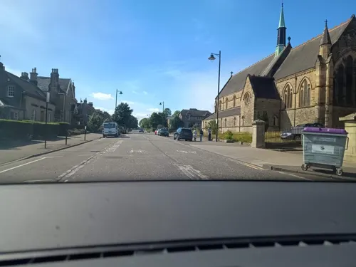

Forthside Bridge
Bridge
Footridge in Stirling, Scotland, UK, across Stirling railway station


Tullibody Old Bridge
Bridge · 3.2 mi
Bridge in Tullibody, Clackmannanshire, Scotland


Macrobert Arts Centre
Cinema and theater · 2.0 mi
Arts centre of the University of Stirling, Scotland, UK

Museums and landmarks50

Smith Art Gallery & Museum
Museum · 0.4 mi
40 Stirling Place, Stirling
Tu-Sa 10:30-17:00; Su 14:00-17:00


Mar's Wark
Monument and historic site
Renaissance town house built 1570–1572 by John Erskine, Regent of Scotland and Earl of Mar

Argyll and Sutherland Highlanders Regimental Museum
Museum · 0.6 mi
Military museum in Stirling, Scotland, United Kingdom

Statue of Henry Campbell-Bannerman
Monument and historic site
Statue in Stirling, Scotland, UK
Stirling Smith Museum and Art Gallery
Museum
Museum in Stirling, Scotland, United Kingdom

Wallace Monument
Monument and historic site · 1.5 mi
Tower standing on the summit of Abbey Craig, near Stirling in Scotland


38 more on the map.
Parks, trails and playgrounds18
Kidz Town
Playground · 0.5 mi
£7.95 play only / £10.95 Play’n’Dine package includes childrens lunch and drink. Babies under 1 and first adult free, additional adults...
35 KIDZ TOWN roleplay ltd Colquhoun Street Stirling FK7 7PX
Mo-Fr 09:45-11:45, 12:30-15:00; Sa, Su 09:45-11:15, 11:45-13:45,...




6 more on the map.
Restaurants and cafes119
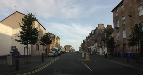
Vincenzo's Fish&Chips
Restaurant · Fish And Chips · 0.4 mi
53 Cowane Street, Stirling
Mo-Sa 08:00-22:00
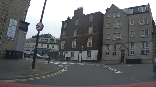
Green Gates Indian
Restaurant · Indian
2 Queen Street, Stirling
Mo-Th 16:00-22:00; Fr,Sa 12:00-15:00,16:30-22:00; Su 12:00-22:00
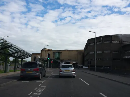
PizzaExpress
Restaurant · Pizza
1,3,5 Murray Place
Mo-Th 11:30-21:00; Fr-Sa 11:30-22:00; Su,PH 12:00-21:00
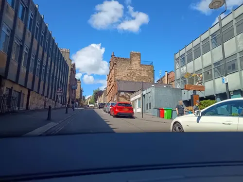

Chicken Union
Restaurant · Chicken, Korean
15 Friar Street, Stirling
Mo, We-Fr 17:00-21:00; Sa-Su 12:00-15:00, 17:00-21:00
Nooch Bar & Kitchen
Restaurant · Sandwich, Coffee Shop, Cake, Regional
44 Upper Craigs, Stirling
We 11:30-21:00, Th-Sa 11:30-23:00, Su 11:30-19:00
Piotsa
Restaurant · Italian
33-35 King Street, Stirling
Mo off; Tu-Th 16:30-21:30; Fr-Su 12:00-15:30,16:30-21:30

107 more on the map.
History
A stone cist, found in Coneypark Nursery in 1879, is Stirling's oldest catalogued artefact. Bones from the cist were radiocarbon dated and found to be over four millennia old, originating within the date range 2152 to 2021 BC. Nicknamed Torbrex Tam, the man, whose bones were discovered by workmen, died while still in his twenties. Other Bronze Age finds near the city come from the area around Cambusbarron. It had been thought that the Randolphfield standing stones were more than 3000 years old but recent radiocarbon dating suggests they may date from the time of Bruce.
The earliest known structures in Stirling are now destroyed but comprised two Neolithic Cursus in Bannockburn. To the south of Stirling is Gillies Hill which contains a series of prehistoric fortifications. Two structures are known: what is currently called Wallstale Dun on the southern end of Touchadam Craig, and Gillies Hill fort on the northwest end of the craig. Both structures were built by Iron Age peoples and Gillies Hill is c 2500 years old while the Wallstale structure is later and is related in form to brochs, these appear to coincide with the Roman period and there are around 40 or so in the wider area. South of the city, the King's Park prehistoric carvings (cup and ring marks) can still be found, these date to c 3000 BC.
Read more of the history
Its other notable geographic feature is its proximity to the lowest crossing point of the River Forth. Control of the bridge brought military advantage in times of unrest and excise duty, or pontage dues, in peacetime. Unsurprisingly excise men were installed in a covered booth in the centre of the bridge to collect tax from any entering the royal burgh with goods. Stirling remained the river's lowest reliable crossing point (that is, without a weather-dependent ferry or seasonal ford) until the construction of the Alloa Swing Bridge between Throsk and Alloa in 1885.
The city has two Latin mottoes, which appeared on the earliest burgh seal of which an impression of 1296 is on record. The first alludes to the story as recorded by Boece who relates that in 855 Scotland was invaded by two Northumbrian princes, Osbrecht and Ella. They united their forces with the Cumbrian Britons in order to defeat the Scots. Having secured Stirling castle, they built the first stone bridge over the Forth.
On the top they reportedly raised a crucifix with the inscription: "Anglos, a Scotis separat, crux ista remotis; Arma hic stant Bruti; stant Scoti hac sub cruce tuti." Bellenden translated this loosely as "I am free marche, as passengers may ken, To Scottis, to Britonis, and to Inglismen." It may be the stone cross was a tripoint for the three kingdom's borders or marches; the cross functioning both as a dividing territorial marker, and as a uniting witness stone like in the Bible story in Joshua 22. "Angles and Scots here demarked, By this cross kept apart. Brits and Scots armed stand near, By this cross stand safe here." This would make the cross on the centre of the first stone bridge the Heart of Scotland.
The Stirling seal has only the second part, in a slightly different form:
(Brits and Scots armed and near, by this cross stand safe here.)
The Latin is apparently not first rate, as it has four syllables in "cruce tuti". However, the meaning seems to be that the Lowland Strathclyde Britons on the southern shore and the Highland Pictish Scots on the northern shore stand protected from each other by their common Christianity.
A more modern translation suggests that rather than Briton, bruit might be better read as brute, i.e. brute Scots, implying a non-Scots identity was retained in Stirling for some time after inclusion into the land controlled by the King of Scots.
(Contained within this seal pressed down, the wood an' castle o' Stirlin' town.)
It has been claimed that the "Bridge" seal was regarded as the Burgh seal proper, the "Castle" seal being simply a reverse, used when the seal was affixed by a lace to a charter. This agrees with a description in an official publication (which spells Bruti with only one letter t). Clearer images are available with different lettering. Sibbald conflated the two mottos into a single rhyme; he gave no indication that he was aware of Boece's work.
Stirling was first declared a royal burgh by King David in the 12th century, with later charters reaffirmed by subsequent monarchs. A ferry, and later bridge, on the River Forth at Stirling brought wealth and strategic influence, as did its tidal port at Riverside. As Stirling's economy grew, a Royal Park was established as a landscape setting to the north of the castle in the 12th century. The short-lived New Park was established in the later 13th century and contains a cockshot wood (Coxet Hill), likely to have been used as a base in the Battle of Bannockburn. Major battles during the Wars of Scottish Independence took place at the Stirling Old Bridge in 1297 and at the nearby village of Bannockburn in 1314 involving Andrew Moray and William Wallace, and Robert the Bruce respectively. After the Battle of Stirling Bridge, Moray and Wallace wrote to Hanseatic League leaders in Lübeck and Hamburg to encourage trade between Scottish and German ports. There were also several Sieges of Stirling Castle in the conflict, notably in 1304.
From the History section of Stirling on Wikipedia, under CC BY-SA 4.0.
More about Stirling
Geography
Stirling is renowned as the Gateway to the Highlands and is generally regarded as occupying a strategic position at the point where the flatter, largely undulating Scottish Lowlands meet the rugged slopes of the Highlands along the Highland Boundary Fault. The starkness of this contrast is evidenced by the many hills and mountains of the lower Highlands such as Ben Vorlich and Ben Ledi which can be seen to the northwest of the city. On the other hand, the Carse of Stirling, stretching to the west and east of the city, is one of the flattest and most agriculturally productive expanses of land in the whole of Scotland.
The land surrounding Stirling has been most affected by glacial erosion and deposition. The city itself has grown up around its castle which stands atop an ancient quartz-dolerite sill, known as the Stirling Sill, a major defensive position which was at the lowest crossing point on the River Forth. Stirling stands on the Forth at the point where the river widens and becomes tidal. To the east of the city the Ochil Hills dominate the skyline with the highest peak in the range being Ben Cleuch, although Dumyat is more noticeable from Stirling. The Ochils meet the flat carse (floodplain) of the River Forth to the east of the distinctive geographical feature of Abbey Craig, a crag and tail hill upon which stands the 220 ft (67 m) high National Wallace Monument.
Economy
With Stirling's development as a market town and its location as the focus of transport and communications in the region, it has developed a substantial retail sector serving a wide range of surrounding communities as well as the city itself. Primarily centred on the city centre, there are a large number of chain stores in and adjacent to the Thistles shopping centre. This has been augmented by out-of-town developments such as the Springkerse Retail Park on the city bypass to the east of Stirling.
The Forthside regeneration project on the site of the former port area and the 40-acre (160,000 m2) former Ministry of Defence site, adjacent to Stirling Railway Station, is linked to the railway station via Forthside Bridge. The development comprises retail, residential and commercial elements, including a conference centre, hotel and Vue multiplex cinema, expanding the city centre area and linking it to the River Forth, which had been cut off from the city centre area since the construction of the A9 bypass under the railway station in the 1960s.
In the service sector, financial and insurance services as well as tourism are the biggest employers. The financial services and insurance company Scottish Amicable Life Assurance, later part of Prudential and M&G, established a large base at Craigforth on the outskirts of Stirling in the 1970s.
Arts and culture
Walking the Marches is a custom probably started in the 12th century. The only way the town's boundaries could be protected was to walk round inspecting them annually. The walk was followed by a dinner. This was traditionally done by the Birlaw men made up from members of the Seven Trades, the Guildry and Council. In 2014 the tradition was revived after an official abeyance of several years. It now takes place on the last Saturday in May and is open for all to take part in.
There are about sixteen libraries and two mobile libraries in Stirling. The Smith Art Gallery and Museum is now free to tourists and residents alike. Shearer's 1895 Penny Guide to Stirling and Neighbourhood used to list it under "How to spend a few hours on a wet day".
The Macrobert Arts Centre has a variety of exhibitions and performances. There are many events at the Stirling Tolbooth and at The Albert Halls.
Stirling has hosted the National Mòd several times: in 1909, 1961, 1971 and 1987.
Education
The University of Stirling opened in 1967 on a greenfield site outside the town. In 2025 the university had 18,500 students globally, of whom over 11,000 are undergraduates and over 6,000 are postgraduates. There are over 140 nationalities represented on the university campus, with more than 30% of students being international. It has grown into a major research centre, with a large Innovation Park located immediately adjacent to the main university campus. Innovation Park has grown since its initiation in 1993, and is now home to 40 companies engaging in various forms of research and development. In January 2008 it was announced that students from Singapore would be able to gain degrees in retail from the University of Stirling in a tie-up with the country's Nanyang Polytechnic (NYP). Stirling is also home to part of the wider Forth Valley College which was formed on 1 August 2005 from the merger of Falkirk, Stirling and Clackmannan colleges.
From the Wikipedia article Stirling, under CC BY-SA 4.0.
Notable people from Stirling
 Norman McLarenScottish Canadian animator (1914-1987)Photo: Jack Long/National Film Board of Canada, Public domain
 James Edward AlexanderScottish soldier, traveller and author (1803-1885)Photo: Richard James Lane, Public domain
 David GoodwillieScottish footballer (born 1989)Photo: Anything Goes with James English, CC BY 3.0
 George Elphinstone1st Viscount Keith, Royal Navy admiral (1746–1823)Photo: John Hoppner, Public domain
 Julian SmithMember of United Kingdom Parliament (born 1971)Photo: Chris McAndrew, CC BY 3.0
- James BruceScottish explorer and botanist (1730–1794)
- Billy BremnerScottish association football player and manager
- Gary CaldwellScottish association football manager (born 1982)
- Duncan FergusonScottish association football player and manager (born 1971)
- James StirlingScottish mathematician (*1692 – †1770)
- Chris SawyerScottish game developer
- Simon TerryBritish archer (1974–2021)
Born in Stirling, according to Wikidata (CC0). Each name links to its Wikipedia article.
Where to stay19
Churches and places of worship24
Kingdom Hall of Jehovah's Witnesses
Church · Jehovahs Witness · 0.4 mi
Forrest Road, Stirling
St Margaret of Scotland RC Church
Church · Roman Catholic · 1.2 mi
Drip Road, Stirling
Shopping46
Gas and EV charging4
Schools, colleges and libraries13
Healthcare4
Map of Stirling
250 places. The map loads OpenStreetMap tiles when you open it.
Getting there and nearby towns
Edinburgh Airport (EDI) is the nearest airport with scheduled flights listed in OpenStreetMap, 25 miles away.
- Cambusbarron 1 mi southwest, about 2 min by car
- Whitburn 20 mi southeast, about 32 min by car
- Glasgow 21 mi southwest, about 35 min by car
- Wishaw 24 mi south, about 39 min by car
- Edinburgh 31 mi east, about 50 min by car
- Tranent 40 mi east, about 1 h by car
- Dundee 44 mi northeast, about 1 h 15 min by car
- Saint Andrews 46 mi east, about 1 h 15 min by car
- Saltcoats 47 mi southwest, about 1 h 15 min by car
- Troon 49 mi southwest, about 1 h 15 min by car
Drive times are estimates from straight-line distance, not routes.
Towns near Stirling


Keep exploring
Local news
Headlines from INDB.
Reviews, tips and questions
Loading what members have shared...
Sources and licences
- GeoNames (CC BY 4.0): population, coordinates, regions and time zone
- Mapillary (see each image): photos
- OpenStreetMap contributors (ODbL 1.0): places, airports, map data
- Wikidata (CC0 1.0): elevation, founding date, time zone, website, landmarks and historic places
- Wikimedia Commons (see each image): photos
- Wikipedia (CC BY-SA 4.0): overview and history text
Photo credits
- Stirling Castle (5455709703), Stirling Council from Stirling, UK, CC BY 2.0
- Norman Dickson, July 1883, by Crowe & Rodgers, Stirling (4354346134), whatsthatpicture from Hanwell, London, UK, CC BY 2.0
- James Arthur Dickson, July 1883, by Crowe & Rodgers, Stirling (4354345288), whatsthatpicture from Hanwell, London, UK, CC BY 2.0
- Robert C(?) Dickson, July 1883, by Crowe & Rodgers, Stirling (4353599811), whatsthatpicture from Hanwell, London, UK, CC BY 2.0
- 6 Stirling Arcade, Panama1958, CC BY-SA 4.0
- 10 Stirling Arcade, Panama1958, CC BY-SA 4.0
- 12 Stirling Arcade, Panama1958, CC BY-SA 4.0
- 13 Stirling Arcade, Panama1958, CC BY-SA 4.0
- Stirling - Stirling railway station DSCN8645, AlasdairW, CC BY-SA 4.0
- Forthside2020, Andrew Hendo, CC BY-SA 4.0
- Stirling Bridge in sun (cropped), Iain Cameron, CC BY 2.0
- TullibodyOldBridgeOctober2011, Craig Omus, CC BY-SA 3.0
- Sir Henry Campbell-Bannerman (27803322372), Robert Cutts from Bristol, England, UK, CC BY 2.0
- Wfm wallace monument, Finlay McWalter, CC BY-SA 3.0
- Scotland-2016-Aerial-Logie Kirk (Church of Logie), Godot13, CC BY-SA 4.0
- St Mary's RC Church, Stirling, BertieB, CC BY-SA 4.0
- University of Stirling - Dormitories, Roger Wollstadt from Sarasota, Florida, CC BY-SA 2.0
- Stirling Castle King's Old Building, Janfrie1988, Public domain
- Stirling - The Smith Institute Museum 20120419, Otter, CC BY-SA 3.0
- Church of the Holy Rude 002, Postdlf, CC BY-SA 3.0
- Stirlingcastle, Unknown author, CC BY-SA 3.0
- Fm cambuskenneth abbey, Unknown author, CC BY-SA 3.0
- Forthbankwest, James Stewart., CC BY 3.0
- Mar's Wark, Hopmans at nl.wikipedia, CC BY-SA 3.0
- Wfm stirling high v3 construction, Finlay McWalter, CC BY-SA 3.0
- Wallacehighschool stirling, Supercriminal, CC BY-SA 3.0
- Cowane's Hospital, 2003, Elisa.rolle, CC BY-SA 3.0
- LB41095-6 StNiniansKirk and yard, AllyD, CC BY-SA 4.0
- Chapel Royal exterior Stirling Castle 6957881322, Uriah Welcome, CC BY 2.0
- Stirling - Robert the Bruce, Eusebius, CC BY 3.0
- Stirling Health and Care Centre, AllyD, CC0
- Stirling Castle Aerial Photo, John McPake, CC BY 2.0
- Cambuskenneth Abbey Bell Tower, Rory660, CC BY-SA 4.0
- Wallace High School Stirling (cropped), Supercriminal, CC BY-SA 3.0
- The Thistles - panoramio, pudina, CC BY 3.0
- Stirling Tolbooth - view of clock tower framed by crow-stepped gables, Tom Parnell, CC BY-SA 4.0
- Street-level photo, zuse, CC BY-SA 4.0
- Street-level photo, rudolfmayer, CC BY-SA 4.0
- Street-level photo, rudolfmayer, CC BY-SA 4.0
- Street-level photo, zuse, CC BY-SA 4.0
- Street-level photo, hobgoblin, CC BY-SA 4.0
- Street-level photo, gmc, CC BY-SA 4.0
- Street-level photo, ccbb7766, CC BY-SA 4.0
- Street-level photo, ccbb7766, CC BY-SA 4.0
- Street-level photo, zuse, CC BY-SA 4.0
- Street-level photo, hobgoblin, CC BY-SA 4.0
- Street-level photo, ccbb7766, CC BY-SA 4.0
- Street-level photo, rudolfmayer, CC BY-SA 4.0
- Street-level photo, zuse, CC BY-SA 4.0
- Street-level photo, rudolfmayer, CC BY-SA 4.0
- Street-level photo, southglos, CC BY-SA 4.0
- Street-level photo, ccbb7766, CC BY-SA 4.0
- Street-level photo, zuse, CC BY-SA 4.0
- Street-level photo, ccbb7766, CC BY-SA 4.0
- Street-level photo, thx, CC BY-SA 4.0
- Street-level photo, hobgoblin, CC BY-SA 4.0
- Street-level photo, rudolfmayer, CC BY-SA 4.0
- Street-level photo, ccbb7766, CC BY-SA 4.0
- Street-level photo, southglos, CC BY-SA 4.0
- Street-level photo, southglos, CC BY-SA 4.0
- Street-level photo, zuse, CC BY-SA 4.0
- Street-level photo, hobgoblin, CC BY-SA 4.0
- Street-level photo, ccbb7766, CC BY-SA 4.0
- Street-level photo, ccbb7766, CC BY-SA 4.0


Page built November 10, 2026. Spotted a mistake? Tell us or suggest a place.