


Strathpeffer, United Kingdom
Strathpeffer is a town of 1,070 people in Scotland, United Kingdom.
Why visit Strathpeffer
Townapedia lists 8 museums and landmarks, 1 park or trail, 4 places to eat, 10 places to stay and 4 attractions in and around town.
Highlights include Rogie Falls, Knockfarrel, Highland Museum of Childhood and Castle Leod.
Weather in Strathpeffer
Forecast from MET Norway (CC BY 4.0). Full forecast
About Strathpeffer
Strathpeffer (Scottish Gaelic: Srath Pheofhair) is a village and spa town in Ross and Cromarty, Highland, Scotland, with a population of 1,469.
From the Wikipedia article Strathpeffer (this version), under CC BY-SA 4.0.
Travel tips from other travellers: Strathpeffer on Wikivoyage (CC BY-SA 4.0).
Photos of Strathpeffer


Things to do4

Rogie Falls
Waterfall · 2.2 mi
Series of waterfalls on Black Water, Highland, Scotland, UK


Museums and landmarks8

Highland Museum of Childhood
Museum · 0.4 mi
Museum in Highland, Scotland, United Kingdom
We-Fr 10:00-15:00; Sa 11:30-15:00

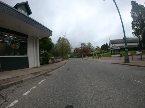


Parks, trails and playgrounds1

Restaurants and cafes4
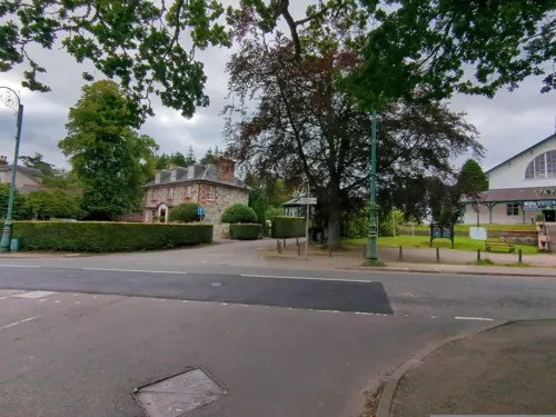
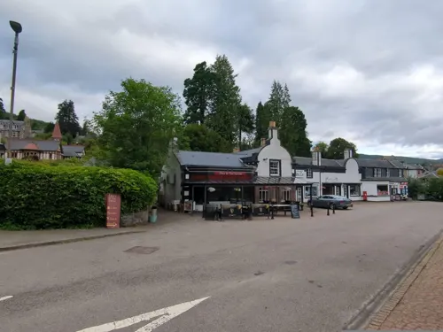
Deli In The Square
Restaurant · Breakfast, Soup, Pizza, Pasta
1 The Square, Strathpeffer

History
The strategic location of the village has led to several battles being fought in the area:
Blar Nan Ceann (battle (field) of the heads), lies at the western end of the modern village (grid reference NH47625773). Very little is known about the battle there, not even its date, other than the MacKenzies of Seaforth defeated the MacDonells of Glengarry and some incident took place at a well near the battlefield, subsequently called Tobar a' Chinn (well of the head).
Battle of Blar Na Pairce (battle (field) of the park), in approximately 1486 saw the local MacKenzies, under their chief Kenneth MacKenzie, defeat a large invading force of MacDonalds. The battlefield lies south-west of the modern village, on the banks of Loch Kinellan. The loch contains a crannog, which remained a hunting seat of the Earls of Ross until the late medieval period and was reportedly visited by Robert The Bruce during his reign. It was from this crannog that Kenneth MacKenzie went out to meet the MacDonalds.
The Battle of Drumchatt, which took place in 1497 on Drumchatt (Druimchat) or "the Cat's Back", a ridge to the southeast of Strathpeffer. The Clan Mackenzie and Clan Munro defeated the invading Clan MacDonald of Lochalsh.
Read more of the history
In the Victorian era Strathpeffer was popular as a spa resort, owing to the discovery of sulphurous springs in the 18th century. The pump-room in the middle of the village dates from 1819. Soon after that, a hospital and a hotel were also built. During World War 1, the hospital was a convalescent US Naval Hospital. In 1942 the Spa hospital was destroyed by fire. The Strathpeffer Pavilion dates from 1880, and was built to provide a venue for entertainment of the visitors. It fell into disuse and disrepair towards the end of last century, but has now been restored as a new venue for the arts, weddings, other functions, and events of all kinds.
Coal like material was found near Castle Leod in the 1700s and was worked for a short time. The material was evaluated by well known Mining Engineer John Geddes in the mid 1800s but it is not known if his suggestion that it should be further evaluated was implemented.
From the History section of Strathpeffer on Wikipedia, under CC BY-SA 4.0.
More about Strathpeffer
Geography
It lies in a strath 5 miles (8 km) west of Dingwall, with the elevation ranging from 60 to 120 m (200 to 400 ft) above sea level. Sheltered on the west and north, it has a comparatively dry and warm climate.
Arts and culture
Strathpeffer's distinctive Victorian architecture has added to its appeal. Strathpeffer contains several large hotels and many guest houses, holiday cottages and B&B establishments. There is a scenic golf course, which boasts the longest drop from tee to green of any course in Scotland.
Strathpeffer is the home of one of the world's most extreme mountain bike races, the Strathpuffer, a 24-hour event held in January each year. Organised by Square Wheels bike shop, it uses the local trail network and regularly attracts over 400 competitors.
The Strathpeffer and District Pipe Band and local Highland dancers perform in the square every Saturday from end May to September, and this is a popular gathering for both visitors and residents. Nearby is Castle Leod, seat of the Earl of Cromartie, Chief of the Clan Mackenzie, which is now open to the public several times a year. The annual Strathpeffer Highland Gathering, one of the longest-established Highland Games in Scotland, takes place in the grounds of Castle Leod every August.
From the Wikipedia article Strathpeffer, under CC BY-SA 4.0.
Notable people from Strathpeffer
- Finn CrockettBritish cyclist
- James Forbes-Robertsonrecipient of the Victoria Cross (1884–1955)
Born in Strathpeffer, according to Wikidata (CC0). Each name links to its Wikipedia article.
Where to stay10
Churches and places of worship2
Shopping1
Gas and EV charging1
Schools, colleges and libraries1
Healthcare1
Map of Strathpeffer
33 places. The map loads OpenStreetMap tiles when you open it.
Getting there and nearby towns
Inverness Airport (INV) is the nearest airport with scheduled flights listed in OpenStreetMap, 19 miles away.
- Maryburgh 4 mi east, about 6 min by car
- Dingwall 4 mi east, about 7 min by car
- Conon Bridge 4 mi east, about 7 min by car
- Muir of Ord 5 mi southeast, about 9 min by car
- Beauly 8 mi southeast, about 12 min by car
- Evanton 9 mi northeast, about 15 min by car
- Inverness 14 mi southeast, about 22 min by car
- Nairn 25 mi east, about 39 min by car
- Ullapool 31 mi northwest, about 51 min by car
- Elgin 45 mi east, about 1 h 15 min by car
Drive times are estimates from straight-line distance, not routes.
Towns near Strathpeffer


Keep exploring
Local news
Headlines from INDB.
Reviews, tips and questions
Loading what members have shared...
Sources and licences
- GeoNames (CC BY 4.0): population, coordinates, regions and time zone
- Mapillary (see each image): photos
- OpenStreetMap contributors (ODbL 1.0): places, airports, map data
- Wikidata (CC0 1.0): elevation, founding date, time zone, website, landmarks and historic places
- Wikimedia Commons (see each image): photos
- Wikipedia (CC BY-SA 4.0): overview and history text
Photo credits
- Strathpeffer. Hotel frontage. - panoramio, brian gillman, CC BY 3.0
- Northern Constabulary Pipe Band at Strathpeffer Scotland (2228998643), Dave Conner from Inverness, Scotland, CC BY 2.0
- Northern Constabulary Pipe Band at Strathpeffer (163678115), Dave Conner from Inverness, Scotland, CC BY 2.0
- Strathpeffer IV14, UK - panoramio (14), Tanya Dedyukhina, CC BY 3.0
- Strathpeffer - panoramio, Tanya Dedyukhina, CC BY 3.0
- Abandoned croft near Knockfarrel, sylvia duckworth, CC BY-SA 2.0
- Castle Leod (Ross and Cromarty) (5008857210), Colin Hepburn from Sale, UK, CC BY-SA 2.0
- Ruth Strathpeffer Rly Stn 23.06.11 edited-2, RuthAS, CC BY 3.0
- Kerb crawling bunny (4824385051), Phil Sangwell from United Kingdom, CC BY 2.0
- Pelikaan - Brabant Expres (7823235254), Glen Wallace from Inverness, Scotland, CC BY-SA 2.0
- Pelikaan - Brabant Expres (7823236762), Glen Wallace from Inverness, Scotland, CC BY-SA 2.0
- Shearings BK09 LUT (7823233452), Glen Wallace from Inverness, Scotland, CC BY-SA 2.0
- Rogie Falls - panoramio, Neil Aitkenhead, CC BY-SA 3.0
- Touchstone Maze - panoramio, Tanya Dedyukhina, CC BY 3.0
- Street-level photo, jurkis, CC BY-SA 4.0
- Street-level photo, jurkis, CC BY-SA 4.0
- Street-level photo, plexi32, CC BY-SA 4.0
- Street-level photo, plexi32, CC BY-SA 4.0
- Street-level photo, plexi32, CC BY-SA 4.0
- Street-level photo, plexi32, CC BY-SA 4.0
- Street-level photo, plexi32, CC BY-SA 4.0
Page built November 10, 2026. Spotted a mistake? Tell us or suggest a place.