


Why visit Walkern
Townapedia lists 2 museums and landmarks, 4 parks and trails, 8 places to eat and 1 place to stay in and around town.
Highlights include Church Farm, Pryor's Wood and Ridlins Mire.
Weather in Walkern
Forecast from MET Norway (CC BY 4.0). Full forecast
About Walkern
Walkern is a village and civil parish in the East Hertfordshire district of Hertfordshire, England. It lies in the valley of the River Beane, about 3 miles (5 km) east of the centre of Stevenage, its post town. At the 2021 census, the parish had a population of 1,491.
From the Wikipedia article Walkern (this version), under CC BY-SA 4.0.
Photos of Walkern

Museums and landmarks2


Parks, trails and playgrounds4

Pryor's Wood
Park · 1.5 mi
Nature reserve in Great Ashby, Hertfordshire, England



Astonbury Wood
Park · 3.2 mi
Nature reserve in Hertfordshire, England
Restaurants and cafes8






Golden Fry Fish Bar
Fast food · 1.4 mi
Mo,Tu 17:00-21:30; We-Sa 12:00-14:00,17:00-21:30
Where to stay1

History
It has been suggested that the name comes from the Old English wealc-ærn, ‘a fulling mill’ (see note1).
Whether or not the village is named after a mill, there has been a watermill in the village since medieval times. The surviving building is 19th-century,
and is at the bottom of the High Street which runs parallel to the River Beane.
From the History section of Walkern on Wikipedia, under CC BY-SA 4.0.
Notable people from Walkern
- Anthony John CampBritish genealogist
Born in Walkern, according to Wikidata (CC0). Each name links to its Wikipedia article.
Churches and places of worship6
Gas and EV charging1
Schools, colleges and libraries2
Ardeley St Lawrence Church of England Voluntary Aided Primary School
School · Anglican · 1.3 mi
School Lane, Stevenage
Healthcare1
Map of Walkern
25 places. The map loads OpenStreetMap tiles when you open it.
Getting there and nearby towns
London Luton Airport (LTN) is the nearest airport with scheduled flights listed in OpenStreetMap, 11 miles away.
- Stevenage 3 mi west, about 5 min by car
- Baldock 5 mi northwest, about 9 min by car
- Letchworth Garden City 6 mi northwest, about 10 min by car
- Hitchin 7 mi west, about 11 min by car
- Codicote 7 mi southwest, about 11 min by car
- Welwyn Garden City 9 mi southwest, about 14 min by car
- Hertford 9 mi south, about 14 min by car
- Ware 9 mi southeast, about 14 min by car
- Royston 10 mi northeast, about 16 min by car
- Henlow 10 mi northwest, about 16 min by car
Drive times are estimates from straight-line distance, not routes.
Towns near Walkern


Keep exploring
Local news
Headlines from INDB.
Reviews, tips and questions
Loading what members have shared...
Sources and licences
- GeoNames (CC BY 4.0): population, coordinates, regions and time zone
- Mapillary (see each image): photos
- OpenStreetMap contributors (ODbL 1.0): places, airports, map data
- Wikidata (CC0 1.0): elevation, founding date, time zone, website, landmarks and historic places
- Wikimedia Commons (see each image): photos
- Wikipedia (CC BY-SA 4.0): overview and history text
Photo credits
- GOC Walkern and Great Ashby 001 Granary Cottage, Walkern (51392263661), Peter O'Connor aka anemoneprojectors, CC BY-SA 2.0
- GOC Walkern and Great Ashby 002 Dovecote, Manor Farm, Walkern (51393284710), Peter O'Connor aka anemoneprojectors, CC BY-SA 2.0
- St Nicholas' Church, Stevenage, 2013, AnemoneProjectors, CC BY-SA 3.0
- Holy Trinity Church Weston, Jack1956, CC0
- Pryor's Wood Bluebells 2017-04-26-4, Colin, CC BY-SA 4.0
- Ridlins Mire 2, Dudley Miles, CC BY-SA 4.0
- Phasianus colchicus -Woburn Safari Park, Bedfordshire, England-8a, ozz13x, CC BY 2.0
- Walkern Hall (4929536782), Peter O'Connor aka anemoneprojectors, CC BY-SA 2.0
- Rhabdomiris striatellus, Great Ashby District Park (27766852013), Peter O'Connor aka anemoneprojectors from Stevenage, United Kingdom, CC BY-SA 2.0
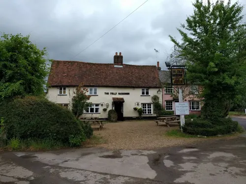
- The Jolly Waggoner and Rose Cottage, Ardeley (51022911681), Peter O'Connor aka anemoneprojectors, CC BY-SA 2.0
- The Crown, Aston End (5531823689), Peter O'Connor aka anemoneprojectors, CC BY-SA 2.0
- Street-level photo, nello, CC BY-SA 4.0
Page built November 10, 2026. Spotted a mistake? Tell us or suggest a place.