


Walthamstow, United Kingdom
Walthamstow is a city of 109,424 people in England, United Kingdom.
Why visit Walthamstow
Townapedia lists 33 museums and landmarks, 47 parks and trails, 259 places to eat, 5 places to stay and 7 attractions in and around town.
Highlights include Bernie Grant Arts Centre, Lea Bridge, Walthamstow Pumphouse Museum and William Morris Gallery.
Weather in Walthamstow
Forecast from MET Norway (CC BY 4.0). Full forecast
About Walthamstow
Walthamstow is a town within the London Borough of Waltham Forest in East London. The town borders Chingford to the north, Snaresbrook and South Woodford to the east, Leyton and Leytonstone to the south, and Tottenham to the west. At the 2011 census, Walthamstow had a population of approximately 109,424 and is around 7.5 miles (12 km)
From the Wikipedia article Walthamstow (this version), under CC BY-SA 4.0.
Photos of Walthamstow


Things to do7

Bernie Grant Arts Centre
Cinema and theater · 2.2 mi
Arts centre in Tottenham, London



Millfield Theatre
Cinema and theater · 3.1 mi
Theatre in Enfield, London
Museums and landmarks33

Walthamstow Pumphouse Museum
Museum · 1.1 mi
Museum in London
10 South Access Road, London
Su 10:30-15:30

William Morris Gallery
Museum
Museum in Walthamstow, London, United Kingdom
Forest Road, London
10:00-17:00; May-Sep Fr-We off; May-Sep Th 10:00-20:00

God's Own Junkyard
Museum · 0.7 mi
Art gallery in London
Shernhall Street, London
Fr-Sa 11:00-21:00; Su 11:00-18:00

Vestry House Museum
Museum · 0.6 mi
Museum in Walthamstow, London, United Kingdom
2 Vestry Road, London

Anti–Air War Memorial
Monument and historic site · 2.7 mi
Memorial in Woodford Green, London


Chingford War Memorial
Monument and historic site · 2.9 mi
War memorial in London

War Memorial, Queens Road Cemetery, Walthamstow
Monument and historic site · 0.8 mi
Cross of Sacrifice war memorial

491 Gallery
Museum · 2.0 mi
Former gallery and social centre in London, England
Banner Repeater
Museum · 3.4 mi
Artist-run reading room and project space in London
21 more on the map.
Parks, trails and playgrounds47


Hackney Downs
Park · 3.0 mi
Common land in the London Borough of Hackney


Springfield Park, Upper Clapton, Hackney
Park · 2.1 mi
Park in Upper Clapton in the London Borough of Hackney

35 more on the map.
Restaurants and cafes259

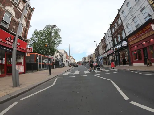
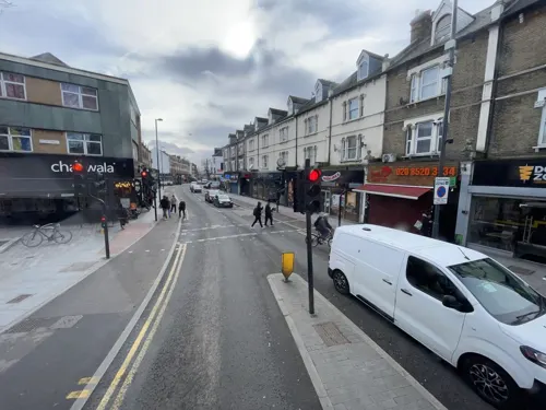
Chaiiwala
Cafe · Coffee Shop · 0.6 mi
223 Hoe Street, London
Mo-Th 08:00-23:00; Fr-Sa 09:00-01:00; Su 09:00-23:00
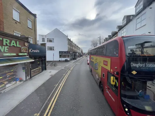
Hot n Juicy Shrimp LDN
Restaurant · Seafood · 0.9 mi
35 St James Street, London
Tu-Fr 14:00-21:30; Sa-Su 12:00-21:30
Papa John's
Restaurant · Pizza · 1.1 mi
724 Lea Bridge Road, London
Mo-Th 11:00-00:30; Fr-Sa 11:00-01:45; Su 11:00-00:30


Don Francisco y La Luna
Restaurant · Tapas · 0.8 mi
18 High Street, London
Tu-Th 18:00-23:00; Fr 13:00-23:00; Sa 12:00-23:00; Su 12:00-19:00
247 more on the map.
History
Walthamstow is recorded c. 1075 as Wilcumestowe ("the Place of Welcome") and in the Domesday Book of 1086 as Wilcumestou.
The Domesday Book describes Wilcumestou as a manor owned by the Anglo-Saxon nobleman Earl Waltheof of Huntingdon and Northumbria before the Norman conquest of 1066. After the execution of Earl Waltheof, the property of the land passed to his wife, Countess Judith, also known as Judith of Lens, a niece of William the Conqueror. The Domesday Book records 36 villeins, 25 bordars and 4 slaves living in the manor in 1086. Alice, daughter of Earl Waltheof and Countess Judith, inherited Walthamstow. She married the Norman nobleman Ralph de Tosny or Toeni (also known as Raoul IV de Conches) in 1103. When her husband died, c. 1126, Alice gave the church of Walthamstow to the Priors of the Holy Trinity based in Aldgate, London.
King John stayed in Walthamstow for two nights in February 1208.
In the 1660s Sir William Batten, Surveyor of the Navy, and his wife Elizabeth Woodcocke had a house in Wood Street where, according to Samuel Pepys, Batten lived "like a prince" and cultivated a vineyard. The Vestry House, now the Vestry House Museum, was used as the first town hall.
Read more of the history
The influential textile designer and craftsman William Morris was born in Walthamstow in 1834. The Georgian mansion where he lived as a teenager houses the William Morris Gallery. By 1870 Walthamstow had grown to the size of a small suburb and a new town hall was built in Orford Road from which affairs of the village were run. A new town hall designed by architect Philip Dalton Hepworth in the Nordic Classical style was built between 1938 and 1942.
Until the late 19th century Walthamstow was largely rural, with a small village centre (now Walthamstow Village) and a number of large estates. The main route through the district was Hoe Street. There were various smaller lanes crossing the town. The road now known as Forest Road was originally called Clay Street. Further south, the High Street was named Marsh Street, and led from the original settlement out to the marshes. Shernhall Street is an ancient route, as is Wood Street, to the east.
With the advent of the railways and the ensuing suburbanisation in the late 19th century, Walthamstow experienced a large growth in population and speculative building.
The Lighthouse Methodist Church which dates from 1893 is situated on Markhouse Road, on the corner of Downsfield Road. There is a lantern at the top of the tower, which also contains a spiral staircase. The church was erected because of the generosity of Captain David King of the shipbuilding firm of Bullard King & Co which also ran the Natal Direct Shipping Line, which ran ships direct from London to Durban without stopping at the Cape.
In 1885, John Kemp Starley, originally from Church Hill in Walthamstow, designed the first modern bicycle, and in 1892, Frederick Bremer built the first British motorcar in a workshop in his garden, at Connaught Road. The vehicle is on display at the Vestry House Museum in Walthamstow.
The LGOC X-type and B-type buses were built at Blackhorse Lane from October 1908 onwards. The B-type is considered one of the first mass-production buses. The manufacturing operation later became AEC, famous as the manufacturer of many of London's buses. On 13 June 1909, A. V. Roe's aircraft took to the air from Walthamstow Marshes. It was the first all-British aircraft and was given the ominous nickname of the "Yellow Terror" but officially carried the name Avro1. Roe later founded the Avro aircraft company, which later built the acclaimed Avro Lancaster.
Walthamstow Corporation had been authorised in 1904 to supply electricity to the borough. The power station in Exeter Street had three brick chimneys and an array of wooden cooling towers. In 1923 the revenue from sales of electricity was £109,909. Upon nationalisation of the electricity industry in 1948 ownership of the station passed to the British Electricity Authority and later to the Central Electricity Generating Board. The CEGB closed the station in 1967 when the thermal efficiency was 9.30 per cent. It was subsequently demolished.
Walthamstow was an ancient parish in the Becontree Hundred of Essex. In 1873 most of the parish was made a local government district, administered by an elected local board. An exclave of the parish known as the "Walthamstow Slip" was included instead in the Leyton district; that exclave was transferred to Leyton parish in 1878.
Such local government districts were reconstituted as urban districts under the Local Government Act 1894. The Walthamstow Urban District was converted into a municipal borough in 1929, becoming the Municipal Borough of Walthamstow. In 1931 the population of the borough, covering an area of 4,342 acres (1,757 hectares), peaked at 132,972. In 1965 the borough was abolished and its former area merged with that of the Municipal Borough of Chingford and the Municipal Borough of Leyton to form the London Borough of Waltham Forest in Greater London. Other places in east London formerly of the county of Essex, such as Ilford and Romford were placed into London boroughs along with Walthamstow. None of the postal district names or codes was changed at this time (e.g. Ilford remained Ilford, Essex IG1-IG6 and Walthamstow remained London E17).
Since the 2012 Summer Olympics, the town has become increasingly popular mostly as a result of gentrification. Local property prices increased at a high rate of 22.3% from 2013 to 2014, compared to London's average of 17.8%. It has turned Walthamstow into a 'trendy' town similar to Shoreditch. The leafy Walthamstow Village in particular has become sought after by buyers.
From the History section of Walthamstow on Wikipedia, under CC BY-SA 4.0.
More about Walthamstow
Geography
Walthamstow is bordered to the north by Chingford and to the south by Leyton and Leytonstone. Woodford lies to the east with a boundary running through Epping Forest, Hackney lies to the south-west beyond the Walthamstow Marshes and the Lea, while Tottenham is situated westward on the far side of the River Lea and the Lee Valley Reservoir Chain. The A112 (Leyton High Road, Hoe Street, Chingford Road, Chingford Mount Rd) passes south–north through Walthamstow and its neighbouring towns forming part of an ancient route from London to Waltham Abbey. Walthamstow is situated south of the North Circular Road.
Walthamstow Village conservation area is a district to the east of what has become the commercial centre of Walthamstow. The area is roughly defined as being south of Church Hill, west of Shernhall Street, north of Grove Road, and east of Hoe Street. Orford Road is the main route through the district, though even this is a quiet thoroughfare by the standards of London. The village has a small selection of specialist shops, pubs and restaurants, and house prices tend to be higher in the streets of this neighbourhood. It was voted best urban village in London by Time Out magazine in 2004.
Economy
The High Street is dominated by Walthamstow Market, which began in 1885, and occupies all but the last 100 yards of the street. It is reputed to be a mile long, but in fact measures approximately 2⁄3 mi (1.1 km). It is the second longest street market in Europe. The market is open five days a week (not Sunday or Monday), and there is a Sunday farmers' market. The street is lined with shops: a selection of high street chains, but also many independent small shops specialising in food, fabrics, and household goods, as well as cafés. There are two patches of more recent development: Sainsbury's supermarket and the covered shopping centre 17&Central (originally Selborne Walk, then The Mall Walthamstow, badly damaged by a fire in 2019 and fully restored) both of which have large multi-storey car parks.
From the Wikipedia article Walthamstow, under CC BY-SA 4.0.
Notable people from Walthamstow
 Harry KaneEnglish association football player (born 1993)Photo: Bryan Berlin, CC BY-SA 4.0
 William Morristextile designer, artist, writer, printer (1834–1896)Photo: Frederick Hollyer, Public domain
 Naomi AckieEnglish actress (born 1991)Photo: Mateusz Malta, CC BY-SA 4.0
 Mick BoxEnglish guitaristPhoto: Stefan Brending ( 2eight ), CC BY-SA 3.0 de
 John DankworthBritish musician (1927-2010)Photo: Mykp at English Wikipedia, Public domain
 Lutalo MuhammadTaekwondo practitionerPhoto: Jim Thurston from London, UK, CC BY-SA 2.0
 Jordan ArcherScottish footballer (born 1993)Photo: https://www.flickr.com/photos/darlo2009/, CC BY 2.0
- Dwight GayleEnglish association football player
- Thomas Griffith TaylorBritish geographer, anthropologist and world explorer. (1880–1963)
- John Kemp StarleyBritish businessman (1854-1901)
- Billy WilliamsBritish cinematographer
- Agnes MarshallEnglish food writer, editor (1855-1905)
Born in Walthamstow, according to Wikidata (CC0). Each name links to its Wikipedia article.
Where to stay5
Ibis Styles London Leyton Hotel
Motel and hotel · 1.2 mi
543 Lea Bridge Road, London
Churches and places of worship107
Shopping88
Gas and EV charging16
Schools, colleges and libraries58
Healthcare30
Whipps Cross University Hospital
Hospital · 1.3 mi
Whipps Cross Road, London
Map of Walthamstow
250 places. The map loads OpenStreetMap tiles when you open it.
Getting there and nearby towns
London City Airport (LCY) is the nearest airport with scheduled flights listed in OpenStreetMap, 7 miles away.
- Snaresbrook 2 mi east, about 3 min by car
- Tottenham 2 mi northwest, about 4 min by car
- Wanstead 2 mi southeast, about 3 min by car
- Leyton 2 mi south, about 4 min by car
- Woodford Green 2 mi northeast, about 4 min by car
- Edmonton 3 mi northwest, about 5 min by car
- London 7 mi southwest, about 12 min by car
- Watford 17 mi west, about 27 min by car
- Woking 30 mi southwest, about 48 min by car
- Worthing 56 mi south, about 1 h 30 min by car
Drive times are estimates from straight-line distance, not routes.
Towns near Walthamstow


Keep exploring
Local news
Headlines from INDB.
Reviews, tips and questions
Loading what members have shared...
Sources and licences
- GeoNames (CC BY 4.0): population, coordinates, regions and time zone
- Mapillary (see each image): photos
- OpenStreetMap contributors (ODbL 1.0): places, airports, map data
- Wikidata (CC0 1.0): elevation, founding date, time zone, website, landmarks and historic places
- Wikimedia Commons (see each image): photos
- Wikipedia (CC BY-SA 4.0): overview and history text
Photo credits
- Walthamstow Town Hall 20 Apr 2006, David Gerard, CC BY-SA 3.0
- The Marie Kondo of the 1800s, Ruby Road, Walthamstow, Loz Pycock, CC BY-SA 2.0
- 'None Here' by Steve McCracken Art, Forest Road, Walthamstow - 48695001316, Loz Pycock, CC BY-SA 2.0
- 'None Here' by Steve McCracken Art, Forest Road, Walthamstow, Loz Pycock, CC BY-SA 2.0
- K6 Telephone Kiosk Outside William Morris Gallery, Walthamstow - 2022-10-01, The wub, CC BY-SA 4.0
- William Morris Gallery, Walthamstow (2) - 2022-10-01, The wub, CC BY-SA 4.0
- Plaque at William Morris Gallery, Walthamstow - 2022-10-01, The wub, CC BY-SA 4.0
- Entrance to William Morris Gallery, Walthamstow - 2022-10-01, The wub, CC BY-SA 4.0
- William Morris Gallery, Walthamstow (1) - 2022-10-01, The wub, CC BY-SA 4.0
- William Morris Gallery - Lloyd Park Forest Road Walthamstow London E17 4PP, Spudgun67, CC BY-SA 4.0
- 20231231 London Walthamstow 09b, WeeJeeVee, CC BY-SA 4.0
- Elephant sculptures at William Morris Gallery, Walthamstow - 2022-10-01, The wub, CC BY-SA 4.0
- Bernie Grant Arts Centre JL 001, Berniegrantcentre, CC BY 3.0
- Lea Bridge Station re-opening after 31 years (26432053793), Sludge G, CC BY-SA 2.0
- The Yard Theatre, AlexandraHC, CC BY-SA 4.0
- Thae Walthamstow Pumphouse Museum Building, Electrolux2, CC BY-SA 3.0
- William Morris Gallery-001, ProfDEH, CC BY-SA 3.0
- God's Own Junkyard 10100775327306884, JRennocks, CC BY 4.0
- Pankhurst Memorial, 29 May 2011 (4), RolandR, CC BY-SA 3.0
- Bruce Castle front 2024-02-24 (2), The wub, CC BY-SA 4.0
- Chingford War Memorial 07, Edwardx, CC BY-SA 3.0
- Ainslie Wood 1, Dudley Miles, CC BY-SA 3.0
- Downhills Park, Sheriff Of Nothing, CC BY 2.0
- Dagenham Brook, Nigel Cox, CC BY-SA 2.0
- Pymmes Park1, Northmetpit, Public domain
- Springfield Park, Dudley Miles, Public domain
- Stoke newington common 1, Tarquin Binary, CC BY-SA 2.5
- Abney park chapel, Tarquin Binary, CC BY-SA 2.5
- All Hallows, Tottenham, Alan Stanton, CC BY-SA 2.0
- Barclay School Leyton, Alansplodge, CC BY-SA 4.0
- Whipps Cross Hospital old building, Secretlondon, CC BY-SA 4.0
- Church of St Barnabas and St James the Greater, Uukgoblin, CC BY-SA 3.0
- Ferry Inn Public House, Emma Chan, CC BY-SA 4.0
- St Peter-in-the-Forest - 02, The wub, CC BY-SA 4.0
- Lloyd Park, Walthamstow - 2022-10-01, The wub, CC BY-SA 4.0
- Abney Park 3, Mx. Granger, CC0
- Hackney downs 1, Tarquin Binary, CC BY-SA 2.5
- Prayer-city-front-view-1536x623, Tacotruckman69, CC BY-SA 4.0
- Campbell Works, Mx. Granger, CC0
- Aerial view of Walthamstow Reservoirs from the north, Russss, CC BY-SA 4.0
- Dover Rd, Aldersbrook, Andertpj, CC BY-SA 4.0
- Forest Cinemas Walthamstow, Walthamstow, E17, Ewan-M, CC BY-SA 4.0
- Soho Theatre Walthamstow, Walthamstow, E17, Ewan-M, CC BY-SA 4.0
- The Cage - Vestry House Museum Vestry Rd Walthamstow London E17 9NH, Spudgun67, CC BY-SA 4.0
- Chestnuts Park Entrance With Plaque, Paul Carpenter, CC BY-SA 4.0
- The Mabley Green Megalith with Lesney Factory. London E9,March 2009, sludgegulper, CC BY-SA 2.0
- Street-level photo, rskedgell, CC BY-SA 4.0
- Street-level photo, gness, CC BY-SA 4.0
- Street-level photo, gness, CC BY-SA 4.0
- Street-level photo, nalex, CC BY-SA 4.0
- Street-level photo, nalex, CC BY-SA 4.0
- Street-level photo, wasd42, CC BY-SA 4.0
- Street-level photo, wasd42, CC BY-SA 4.0
- Street-level photo, wasd42, CC BY-SA 4.0
- Street-level photo, gness, CC BY-SA 4.0
- Street-level photo, wasd42, CC BY-SA 4.0
- Street-level photo, zymurgic, CC BY-SA 4.0
- Street-level photo, zymurgic, CC BY-SA 4.0
- Street-level photo, wasd42, CC BY-SA 4.0
- Street-level photo, wasd42, CC BY-SA 4.0
- Street-level photo, rskedgell, CC BY-SA 4.0
- Street-level photo, rskedgell, CC BY-SA 4.0
- Street-level photo, wasd42, CC BY-SA 4.0
- Street-level photo, wasd42, CC BY-SA 4.0
- Street-level photo, wasd42, CC BY-SA 4.0
- Street-level photo, wasd42, CC BY-SA 4.0
- Street-level photo, wasd42, CC BY-SA 4.0
- Street-level photo, wasd42, CC BY-SA 4.0
- Street-level photo, gness, CC BY-SA 4.0


Page built November 10, 2026. Spotted a mistake? Tell us or suggest a place.