


Daventry, United Kingdom
Daventry is a town of 28,123 people in England, United Kingdom.
Why visit Daventry
Townapedia lists 5 museums and landmarks, 13 parks and trails, 67 places to eat, 2 places to stay and 5 attractions in and around town.
Highlights include Borough Hill, Bannaventa, Borough Hill Roman building and Daventry Country Park.
Weather in Daventry
Forecast from MET Norway (CC BY 4.0). Full forecast
About Daventry
Daventry ( DAV-ən-tree, historically DAYN-tree) is a market town and civil parish in West Northamptonshire, England, close to Northamptonshire's border with Warwickshire. At the 2021 Census, Daventry had a population of 28,123, making it the sixth-largest town in Northamptonshire.
From the Wikipedia article Daventry (this version), under CC BY-SA 4.0.
Travel tips from other travellers: Daventry on Wikivoyage (CC BY-SA 4.0).
Photos of Daventry


Things to do5




Museums and landmarks5

Bannaventa
Monument and historic site · 2.8 mi
Settlement in Northamptonshire, England

Borough Hill Roman building
Monument and historic site · 0.8 mi
Archaeological site at Borough Hill hillfort, Daventry, United Kingdom


Parks, trails and playgrounds13




Daventry Town Football Club
Sports field and stadium · 1.2 mi
Browns Road, Daventry


1 more on the map.
Restaurants and cafes67

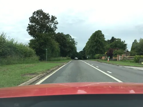




55 more on the map.
History
Daventry is overlooked by the 653 ft-high (199 m) Borough Hill on the eastern edge of the town. The hill has been the site of human activity dating back into prehistory: remains have been found of two Bronze Age barrows, two Iron Age hill forts – one of which is the fourth largest found in Britain, and a later Roman villa and farming settlement.
According to local folklore Daventry had Danish (Viking) origins, this was partly due to the old pronunciation of Daventry as Daintry, which was interpreted as "Dane Tree", however in more modern interpretation the town's name is thought likelier to be Anglo-Saxon in origin: "Dafa's tree" (Dafa being a founding father or paterfamila) and there was very likely a meeting tree, possibly on Borough Hill. Thus the name may have been formed on lines similar to Coventry ("Cofa's tree", i.e. "tree of Cofa"). Another theory which was popular in the 19th century, was that of Thomas Pennant, the Welsh naturalist and antiquarian, who acknowledged the town's 'considerable antiquity' and speculated that the name was Brythonic, dwy-avon-tre (town of two rivers), a derivation seemingly supported by the town's topography, situated as it is between the sources of the River Leam, which flows west, and the River Nene which flows east. This theory however is now discredited.
Read more of the history
Daventry was mentioned in the Domesday Book of 1086 as Daventrei. It was recorded as belonging to Countess Judith, niece of William the Conqueror.
In around 1108, Daventry Priory a small Cluniac priory was founded at Daventry, alongside the parish church. The priory was closed in 1526 by Cardinal Wolsey who granted its assets to Christ Church, Oxford.
In 1203 a market was first recorded at Daventry. The market benefited from Daventry's location upon the main road (now the A45 road) linking the important city of Coventry with Watling Street (now the A5 road) which was the main route from the Midlands to London, which brought in much passing trade.
In 1576 Daventry grammar school was founded by William Parker, a woollen draper and native of the town. The original schoolhouse on New Street, dating from around 1600 still stands, although it is now a private house. That same year Queen Elizabeth I granted Daventry borough status.
The town was mentioned by William Shakespeare in Henry IV, Part I (Act IV, Sc II), which refers to "the red-nosed innkeeper of Daventry". Shakespeare would have known Daventry due to its relatively close proximity to Stratford-upon-Avon, and its position on the main route from the Midlands to London.
During the English Civil War, the army of King Charles I stayed at Daventry in 1645 after storming the Parliamentary garrison at Leicester and on its way to relieve the siege of Oxford. The King stayed at the Wheatsheaf Inn, whilst his Royalist army camped on Borough Hill.
According to local legend, it was during his stay at the Wheatsheaf Inn in Daventry that Charles was twice visited by the ghost of his former adviser and friend, Thomas Wentworth, 1st Earl of Strafford, who advised him to keep heading north and warned him that he would not win through force of arms.
However, Parliament's newly formed New Model Army, led by Sir Thomas Fairfax, was marching north from besieging Oxford after being instructed to engage the king's main army. Fairfax's leading detachments of horse clashed with Royalist outposts near Daventry on 12 June, alerting the king to the presence of the Parliamentary army. The Royalists made for their reinforcements at Newark-on-Trent but after reaching Market Harborough turned to fight, which resulted in the decisive Battle of Naseby, in which the Royalist army was heavily defeated by the Parliamentarians. The village of Naseby is approximately 14 mi (23 km) northeast of Daventry.
English Dissenters founded a Dissenting chapel in the town around 1722 in buildings opposite The Wheatsheaf on the southern end of Sheaf Street. Later in 1752 a Dissenting Academy was moved from Northampton to this site. The chemist and theologian Joseph Priestley studied there from 1752 to 1755. In 1789, the Academy moved back to Northampton.
Daniel Defoe described Daventry as a "considerable market town which subsists chiefly on the great concourse of travellers on the old Watling Street way."
During the Georgian era of the 18th and early 19th century, a national system of turnpike roads with improved road surfaces developed, this in turn allowed the development of a national system of mail coaches and long distance passenger stagecoaches. Daventry, being located on the main roads linking London with the West Midlands, Holyhead and Lancashire, flourished as a coaching town. There were many coaching inns in the town including the Wheatsheaf, the Saracen's Head, the Plough and Bell, the Dun Cow, and the Brown Bear.
At the zenith of the coaching era in the 1830s, Daventry had become a major hub of the national network, with more than 250 coaches passing through the town every week, including services between London, Warwick, Birmingham, Liverpool and Holyhead, and Birmingham and Cambridge.
Reflecting Daventry's prosperity, many of the town's finest building were constructed during this period, including, most notably, the Holy Cross Church of 1758.
The Industrial Revolution largely passed Daventry by, owing to its failure to become linked to the newer transport networks: The Grand Junction Canal (now Grand Union) had opened in 1796, and passed a few miles north of Daventry. An arm from the canal to Daventry was proposed, and was included in the Act of Parliament authorising it, however this was never built.
From the History section of Daventry on Wikipedia, under CC BY-SA 4.0.
More about Daventry
Geography
The town is located 75 mi (120 km) north-north-west of London via the M1 motorway, 14 mi (23 km) west of Northampton, 10+1⁄4 mi (16.5 km) south-east of Rugby and 15+3⁄4 mi (25.5 km) north-north-east of Banbury.
Other nearby places include Southam, Coventry and the villages of Ashby St Ledgers, Badby, Barby, Braunston, Byfield, Charwelton, Dodford, Dunchurch, Everdon, Fawsley, Hellidon, Kilsby, Long Buckby, Newnham, Norton, Staverton, Welton, Weedon and Woodford Halse. The town is twinned with Westerburg, Germany.
The town lies at around 110–210 m (360–690 ft) above sea level. To the north and west, the land is generally lower than the town. Daventry sits on the watershed of the River Leam which flows to Leamington Spa, Warwick and the west of England and the River Nene which flows east. There is no river in the town; the largest gatherings of water are two reservoirs made to supply the canal that swings from Watford Gap into the West Midlands through the 2,042 yd-long (1,867 m) Braunston Tunnel around the north of the town. To the north-west is Drayton Reservoir and to the north-east is the Daventry Reservoir and country park.
Watford Gap is about 4 mi (6 km) north-east of the town; through this gap pass the A5 (Watling Street Roman road), the Grand Union Canal, West Coast Main Line, the Northampton Loop Line and most recently the M1 motorway.
Education
Sixth form provision in the town has been confounded by successive Government policies. From September 1989, the County Council decided to close the newest of the three comprehensive schools (The Grange) and strip the Parker E-ACT Academy and Danetre and Southbrook Learning Village (DSLV) of their sixth forms. The Grange site was converted to become Daventry Tertiary College, providing education and training for 16- to 18-year-olds. When Government moved control of Further Education colleges and their assets in 2001 from county councils to the Learning and Skills Council, the Tertiary College was included. To provide greater financial and professional support, it became part of Northampton College in August 2004. Due to the strong and popular attractions of the sixth forms of nearby Rugby schools, the Daventry Learning Partnership was set up by the two secondary schools and the college (and later included Moulton College) to jointly provide a more competitive offering. After the county councils had failed in efforts to reduce the attraction of the Rugby schools, it was decided in 2010 to reintroduce sixth forms to the two Daventry secondary schools, both of which have now transformed into academies.
From the Wikipedia article Daventry, under CC BY-SA 4.0.
Notable people from Daventry
 William Westbrooke Burtonjudge and President of the Legislative Council, New South Wales, Australia (1794–1888)Photo: John Tangelder Gorus, Public domain
 John SmithEnglish mezzotint engraver (c. 1652 – c. 1742)Photo: Godfrey Kneller, Public domain
 Reginald FoortDutch organistPhoto: Unknown author Unknown author, Public domain
 James SladeBritish clergyman (1783-1860)Photo: Unidentified painter, Public domain
- Tom Boardman, Baron BoardmanBritish politician (1919-2003)
- John Rose HoldenCanadian politician (1821–1879)
- Alison WheelerBritish singer
- Roly MillsEnglish footballer (1933-2010)
- Jack BillinghamEnglish footballer (1914-1981)
- Richard BagotBishop of Oxford; Dean of Canterbury
- John OxenbridgeEnglish nonconformist clergyman (1608-1674)
- Chris CairdEnglish basketball player
Born in Daventry, according to Wikidata (CC0). Each name links to its Wikipedia article.
Where to stay2
Churches and places of worship14
Badby United Reford Church
Church · United Reformed · 2.3 mi
Chapel Lane, Daventry
Kingdom Hall of Jehovahs Witnesses
Church · Jehovahs Witness
32 London Road, Daventry
Shopping12
Gas and EV charging6
Schools, colleges and libraries16
Healthcare10
Map of Daventry
150 places. The map loads OpenStreetMap tiles when you open it.
Getting there and nearby towns
Sywell Aerodrome (ORM) is the nearest airport with scheduled flights listed in OpenStreetMap, 16 miles away.
- Northampton 12 mi east, about 19 min by car
- Coventry 18 mi northwest, about 29 min by car
- Market Harborough 18 mi northeast, about 29 min by car
- Kenilworth 19 mi west, about 30 min by car
- Desborough 19 mi northeast, about 31 min by car
- Newport Pagnell 22 mi southeast, about 35 min by car
- Milton Keynes 23 mi southeast, about 37 min by car
- Glen Parva 23 mi north, about 37 min by car
- Stratford-upon-Avon 24 mi west, about 38 min by car
- Leicester 26 mi north, about 42 min by car
Drive times are estimates from straight-line distance, not routes.
Towns near Daventry


Keep exploring
Local news
Headlines from INDB.
Reviews, tips and questions
Loading what members have shared...
Sources and licences
- GeoNames (CC BY 4.0): population, coordinates, regions and time zone
- Mapillary (see each image): photos
- OpenStreetMap contributors (ODbL 1.0): places, airports, map data
- Wikidata (CC0 1.0): elevation, founding date, time zone, website, landmarks and historic places
- Wikimedia Commons (see each image): photos
- Wikipedia (CC BY-SA 4.0): overview and history text
Photo credits
- Holy Cross Church, Daventry, G-Man at English Wikipedia, Public domain
- Bannaventa site, Stavros1 at English Wikipedia, Public domain
- Borough Hill roman villa, The original uploader was Stavros1 at English Wikipedia ., CC BY-SA 3.0
- DaventryCountryPark, Cls14, CC BY-SA 3.0
- Badby Wood 3, Dudley Miles, CC BY-SA 4.0
- Wolfhampcote Church, G-Man at English Wikipedia, Public domain
- Church of the Holy Cross, Daventry 1, Necrothesp, CC BY-SA 3.0
- Borough Hill mast, G-Man at English Wikipedia, Public domain
- The Village Of Norton 15,04,2007, Stavros1 at English Wikipedia, Public domain
- Newnham Parish Church 22,04,2007, Stavros1 at English Wikipedia, Public domain
- The Saracens Head, stavros1, CC BY 3.0
- -2016-12-04 The Dun Cow, Daventry, Robin Webster, CC BY-SA 2.0
- Jesson's Well public house, 5th April 2009, Stavros1, CC BY 3.0
- Inside the shoe factory, stavros1, CC BY 3.0
- Fox Hill 6 - panoramio, Andrew Roberts, CC BY-SA 3.0
- Newnham Hill 4 - panoramio, Andrew Roberts, CC BY-SA 3.0
- Street-level photo, alexanderar, CC BY-SA 4.0
- Street-level photo, mappo2, CC BY-SA 4.0
- Street-level photo, mappo2, CC BY-SA 4.0
- Street-level photo, southglos, CC BY-SA 4.0
- Street-level photo, alexanderar, CC BY-SA 4.0


Page built November 10, 2026. Spotted a mistake? Tell us or suggest a place.