


Market Harborough, United Kingdom
Market Harborough is a town of 24,779 people in England, United Kingdom.
Why visit Market Harborough
Townapedia lists 4 museums and landmarks, 12 parks and trails, 84 places to eat, 2 places to stay and 3 attractions in and around town.
Highlights include Harborough Museum.
Weather in Market Harborough
Forecast from MET Norway (CC BY 4.0). Full forecast
About Market Harborough
Market Harborough is a market town in the Harborough district of Leicestershire, England, close to the border with Northamptonshire. The population was 24,779 at the 2021 census. It is the administrative headquarters of the Harborough district.
From the Wikipedia article Market Harborough (this version), under CC BY-SA 4.0.
Travel tips from other travellers: Market Harborough on Wikivoyage (CC BY-SA 4.0).
Photos of Market Harborough


Things to do3


Museums and landmarks4

Harborough Museum
Museum
Museum in Leicestershire, United Kingdom
Adam and Eve Street, Market Harborough
Tu-Fr 10:00-18:00; Sa 10:00-16:00

Parks, trails and playgrounds12


Mini Mischiefs
Sports field and stadium · 0.7 mi
Rockingham Road, Market Harborough


Restaurants and cafes84
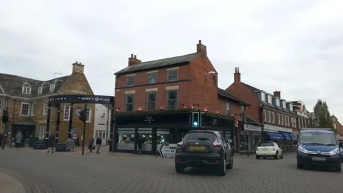
Costa
Cafe · Coffee Shop
8 St Mary's Place, Market Harborough
Mo-Sa 08:00-18:00; Su 09:00-17:00


The Settling Rooms
Restaurant
Springfield Retail Park, Market Harborough
Mo 09:00-17:00; Tu 09:00-17:00; Th-Sa 09:00-17:00; Su 09:30-16:00

Bowden Stores
Cafe · 1.2 mi
3 The Green, Market Harborough
Tu-Fr 08:00-17:00; Sa 08:00-15:00; Su 09:00-15:00

The Cherry Tree
Bar and pub · 0.4 mi
Church Walk, Market Harborough
Tu-Th 17:00-22:00; Fr-Sa 12:00-23:00; Su 12:00-19:00
72 more on the map.
History
Market Harborough was founded by the Saxons between 410 and 1066. Originally a small village, believed to have been called Hæfera-beorg (Harborough), meaning "oat hill".
In 1086 the Domesday Book records Bowden as a Royal Manor organised in 73 manors. The population lived in three villages, Great Bowden, Arden and Little Bowden. The Manor of Harborough is first mentioned in 1199 and 1227 when it was called "Haverberg". It is likely that Harborough was formed out of the Royal Manor with the intention of making it a place for tradesmen and a market when a new highway between Oxendon and Kibworth was established to help link Northampton and Leicester. A chapel dedicated to St Dionysius was built on the route, whilst St Mary in Arden retained Parish Church status.
A market was established by 1204 and has been held on a Tuesday ever since 1221. Eventually this market led to the modern name of Market Harborough. The tradespeople of Harborough had large tofts or farmyards at the rear of their properties where goods were made and stored. Many of these yards remain but have been subdivided down their length over the years to give frontage to the High Street.
Read more of the history
The steeple of Harborough Church was started in 1300 and completed in 1320. It is a broach spire, which rests on the walls of the tower, and are earlier than recessed spires which rise from behind a square tower as at Great Bowden. By 1382 the village of Arden had been abandoned, although the church remained in use for some years. In 1470 the main part of Harborough Church was completed. An open stream ran down the High Street. The Town Estate was created and managed by a body of Feoffees elected by the townspeople, to help manage among other things the open fields surrounding the town, the proceeds from which were used for a variety of purposes. In 1569 the town was briefly in the news as the Privy Council debated whether a local girl, Agnes Bowker, had given birth to a cat. From 1570 the Town Estate owned several properties within the town.
Harborough figured nationally in the English Civil War in June 1645, when it became the headquarters of the King's Army. In Harborough, the King decided to confront Parliamentary forces who were camped near Naseby, but the Battle of Naseby proved a decisive victory for Parliament led by Oliver Cromwell. Harborough Chapel became a temporary prison for the captured forces. Cromwell wrote a letter from "Haverbrowe, June 14, 1645" to the Speaker of the House of Commons, William Lenthall, announcing the victory.
An independent church was established in the Harborough area following the Act of Uniformity 1662, and a meeting house was built in Bowden Lane in 1694.
During the 18th century the timber mud and thatch buildings of the town were largely replaced with brick buildings. After roads were turnpiked and regularly repaired (making wheeled traffic easier all year round) Harborough became a staging point for coach travel on the road to London from the northwest and the Midlands. In 1776 the Open Fields of Great Bowden were allotted to individual owners and fenced with hedges planted, followed by those of Little Bowden in 1780.
In the 19th century, the increasing level of heavy goods traffic on the turnpike roads led to complaints. A plan for a canal from Leicester to join the London to Birmingham canal was mooted but it eventually bypassed the town and a branch canal was cut from Foxton to Harborough, with wharves at Gallow Hill and Great Bowden. Harborough wharf, to the north of the town, became a distribution centre for coal and corn. A gas company was formed in 1833 to make and distribute gas. John Clarke and Sons of London built a factory for spinning worsted and later making carpets. Other industries developed were a brickworks, brewery, wheelwright/coachworks and the British Glues and Chemicals works by the Canal at Gallow Hill. In the 1830s a union of parishes around Market Harborough was formed to look after the poor and a workhouse was built in 1836 on the site of St Luke's Hospital. In 1841 Thomas Cook who was a wood turner and cabinet maker in the town organised the first group travel by rail from Leicester to Loughborough and went on to found the travel agency bearing his name.
Market Harborough became a centre for fox hunting with hounds during the 19th century, when Mr Tailby of Skeffington Hall established a hunt in southeast Leicestershire in 1856. The country between Billesdon and Harborough was considered severe, involving jumping the specially designed ox fences. His hunting diary is recognised as an important document in the history of hunting. The Hunt was renamed the Fernie after a subsequent Master.
The Grand National Hunt Steeple Chase was held to the southwest of the town in 1860, 1861 and 1863. This race and the meeting eventually developed into the Cheltenham Festival and the organisers were part of the founding of organised steeplechasing through the Grand National Hunt Committee.
The building of the Leicester–Rugby railway in 1840 had a catastrophic effect on the coaching traffic through the town. A railway did not serve the town until 1850 with a link to Rugby, but this was quickly followed by links to Leicester and London in 1857, and to Northampton in 1859.
In 1850, William Symington, a grocer in the town established a factory to make pea-flour. His brother James developed a haberdashery and stay making business and in 1876 his sons acquired the old carpet factory to make corsets. They expanded it by three additional floors in 1881 and then built a new factory opposite Church Square in 1884 which still remains today as the Council offices, library and museum. In the 1890s the Harborough Rubber Company and Looms Wooden Heels works were established. A tannery was built on land adjoining the Commons.
From the History section of Market Harborough on Wikipedia, under CC BY-SA 4.0.
More about Market Harborough
Geography
Market Harborough is in a rural part of southeast Leicestershire, on the River Welland and close to the Northamptonshire border. The town is about 15 miles (24.1 km) south of Leicester via the A6, 17 miles (27.4 km) north of Northampton via the A508 and 10 miles (16.1 km) northwest of Kettering. The town is near the A14 road running from the M1/M6 motorway Catthorpe Interchange to Felixstowe. The M1 is about 11 miles (17.7 km) west via the A4304 road.
The Midland Main Line railway connects to London St Pancras. A branch of the Grand Union Canal terminates in the north part of the town and connects to the main canal near Foxton and the Foxton Locks. (see below)
Economy
There are 4,750 VAT or PAYE registered businesses in the Harborough district. Compared to the United Kingdom the Harborough district has a greater proportion of smaller organisations with fewer than 10 employees; 87.16% vs. 82.8% in the UK overall.
CDS Global have their UK office at Tower House on Sovereign Park, off the A508 – Northampton Road towards the leisure centre. They are a data management company, mostly dealing with magazine subscriptions. The company is owned by the Hearst Corporation who publish magazines such as Cosmopolitan and Esquire. Hearst Magazines UK have their UK address at the Market Harborough office. The worldwide head office is in Des Moines, Iowa, US.
Golden Wonder was based at Edinburgh House from 1970 until 2006 when it went into administration under Kroll. The former headquarters has become a Travelodge.
The Leicestershire, Northamptonshire and Rutland branch of the NFU was in the town from 1975.
Arts and culture
Market Harborough has an Orchestra and The Harborough Collective, a professional classical ensemble formed by violinist David le Page. BabyGigs is a local initiative bringing live classical music performed by professional players to babies and young children. The Great Bowden Recital Trust is a charitable music organisation.
The town's brass band, The Harborough Band, was formed in 1897 and Market Harborough Choral Society is also long established.
The town is home to The Harborough Singers, a chamber choir. Other choirs include The Dolly Mixtures, the Songbirds ladies' choir, the 90-strong choir of the Great Bowden Recital Trust and a Rock Choir.
Market Harborough Musical Theatre has been active since 1948. Its theatre is located close to St. Dionysius' Church. The theatre is also home to Parsnips Youth Theatre and Octagon films, a club where residents may view films. From 1939 until 1978 the town had a cinema known as the Ritz, now demolished and replaced with residential apartments and shops.
Live music gigs take place at a number of venues and pubs across the town including Joules Yard, The Nag's Head, the Congregational Hall and the Waterfront.
From the Wikipedia article Market Harborough, under CC BY-SA 4.0.
Notable people from Market Harborough
 Jeremy BullochEnglish actor (1945–2020)Photo: Luigi Novi, CC BY 4.0
 Anthony JenkinsonEnglish diplomat, traveller and explorer (1529-c.1611)Photo: Anthony Jenkinson, Public domain
 Jane Cunningham CrolyAmerican journalist (1829–1901)Photo: Photograph, Public domain
 John MooreEnglish cleric, scholar and book collector (1646-1714)Photo: Godfrey Kneller, Public domain
 William GillBritish surgeon and philanthropist in the Cape Colony (1795–1863)Photo: HistorianSemiAmateur, CC0
- Richard McCreeryBritish Army general (1898–1967)
- Dylan FletcherBritish sailor
- Peter H. JacksonBritish rower (1912-1983)
- Maria LawrenceEnglish cyclist
- Jack GardnerBritish boxing champion (1926–1978)
- Nicholas FerrabyEnglish cricketer (born 1983)
- David Staffprofessional footballer (born 1979)
Born in Market Harborough, according to Wikidata (CC0). Each name links to its Wikipedia article.
Where to stay2
Churches and places of worship17
Great Bowden: St Peter & St Paul
Church · Anglican · 1.3 mi
Dingley Road, Market Harborough
Shopping23
Time To Ride CC Ltd
Shop · 1.5 mi
Harborough Innovation Centre, Airfield Business Park, Leicester Road, Market Harborough
Gas and EV charging3
Schools, colleges and libraries12
Great Bowden Academy, A Church of England Primary School
School · Anglican · 1.1 mi
Gunnsbrook Close, Market Harborough
Healthcare7
Map of Market Harborough
167 places. The map loads OpenStreetMap tiles when you open it.
Getting there and nearby towns
Sywell Aerodrome (ORM) is the nearest airport with scheduled flights listed in OpenStreetMap, 13 miles away.
- Oadby 11 mi northwest, about 18 min by car
- Leicester 14 mi northwest, about 23 min by car
- Oakham 15 mi northeast, about 25 min by car
- Syston 15 mi northwest, about 25 min by car
- Northampton 16 mi south, about 25 min by car
- Mountsorrel 19 mi northwest, about 31 min by car
- Melton Mowbray 20 mi north, about 32 min by car
- Stamford 22 mi northeast, about 35 min by car
- Coventry 25 mi west, about 41 min by car
- Peterborough 29 mi east, about 47 min by car
Drive times are estimates from straight-line distance, not routes.
Towns near Market Harborough


Keep exploring
Local news
Headlines from INDB.
Reviews, tips and questions
Loading what members have shared...
Sources and licences
- GeoNames (CC BY 4.0): population, coordinates, regions and time zone
- Mapillary (see each image): photos
- OpenStreetMap contributors (ODbL 1.0): places, airports, map data
- Wikidata (CC0 1.0): elevation, founding date, time zone, website, landmarks and historic places
- Wikimedia Commons (see each image): photos
- Wikipedia (CC BY-SA 4.0): overview and history text
Photo credits
- Market Harborough Grammar School, G-Man at English Wikipedia, Public domain
- 5, The Square, Market Harborough and the surrounding area, Ed6767, CC BY-SA 4.0
- Market Harborough Church, saxon_sky, CC BY 2.0
- Robert smyth School, Rapidconfusion, Public domain
- St Dionysius Church, Market Harborough, Leicestershire, Roland Turner, CC BY-SA 2.0
- MarketHarboroughTown-5, Jim Smillie, CC BY-SA 2.0
- MarketHarboroughTown-3, Mat Fascione, CC BY-SA 2.0
- MarketHarboroughTown-7, Steve F, CC BY-SA 2.0
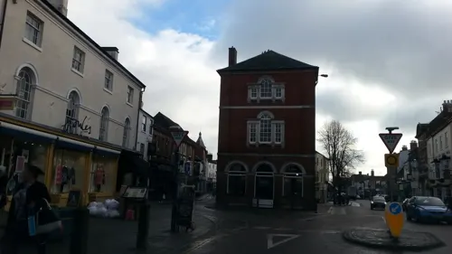
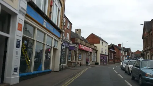
- Street-level photo, adam2, CC BY-SA 4.0
- Street-level photo, adam2, CC BY-SA 4.0
- Street-level photo, adam2, CC BY-SA 4.0
- Street-level photo, adam2, CC BY-SA 4.0
- Street-level photo, adam2, CC BY-SA 4.0
- Street-level photo, adam2, CC BY-SA 4.0
- Street-level photo, adam2, CC BY-SA 4.0
- Street-level photo, adam2, CC BY-SA 4.0
- Street-level photo, adam2, CC BY-SA 4.0
- Street-level photo, adam2, CC BY-SA 4.0
- Street-level photo, adam2, CC BY-SA 4.0
- Street-level photo, adam2, CC BY-SA 4.0
- Street-level photo, adam2, CC BY-SA 4.0
- Street-level photo, adam2, CC BY-SA 4.0
- Street-level photo, adam2, CC BY-SA 4.0
- Street-level photo, adam2, CC BY-SA 4.0
- Street-level photo, adam2, CC BY-SA 4.0
- Street-level photo, adam2, CC BY-SA 4.0
- Street-level photo, adam2, CC BY-SA 4.0
Page built November 10, 2026. Spotted a mistake? Tell us or suggest a place.