


Wells-next-the-Sea, United Kingdom
Wells-next-the-Sea is a town of 2,165 people in England, United Kingdom.
Why visit Wells-next-the-Sea
Townapedia lists 16 museums and landmarks, 6 parks and trails, 31 places to eat and 11 places to stay in and around town.
Highlights include Holkham Hall, Walsingham Priory and Holkham National Nature Reserve.
Weather in Wells-next-the-Sea
Forecast from MET Norway (CC BY 4.0). Full forecast
About Wells-next-the-Sea
Wells-next-the-Sea is a port town and civil parish in the North Norfolk district, in the county of Norfolk, England.
From the Wikipedia article Wells-next-the-Sea (this version), under CC BY-SA 4.0.
Travel tips from other travellers: Wells-next-the-Sea on Wikivoyage (CC BY-SA 4.0).
Museums and landmarks16

Holkham Hall
Monument and historic site · 2.0 mi
Large 18th-century Palladian country house in Norfolk, England, UK
Mar 24-Oct 31 Mo,Th,Su 10:00-16:00

Walsingham Priory
Monument and historic site · 4.1 mi
Grade I listed monastery in Walsingham, North Norfolk, England,UK
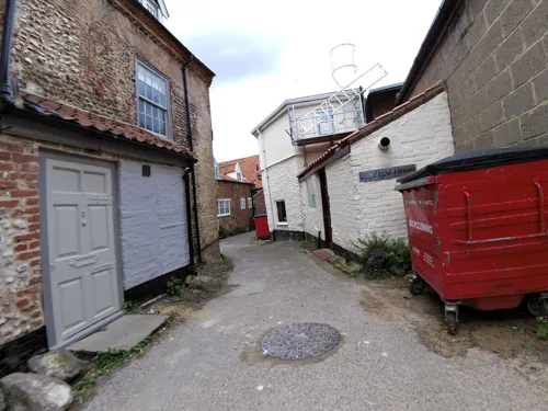


Eliza Adams Lifeboat Memorial
Monument and historic site · 0.4 mi
Memorial in Wells-Next-the-Sea, North Norfolk, England, UK
Egmere medieval settlement
Monument and historic site · 3.7 mi
Archaeological site in Norfolk, England, UK
Iron Age fort 900m north east of Dale Hole Cottage
Monument and historic site · 2.8 mi
Archaeological site in Norfolk, England, UK
Walsingham Friary
Monument and historic site · 4.2 mi
Former Franciscan friary in Norfolk, England, UK
Wells and Walsingham Light Railway
Monument and historic site · 0.6 mi
Stiffkey Road, Wells-next-the-Sea

4 more on the map.
Parks, trails and playgrounds6

Holkham National Nature Reserve
Park · 2.0 mi
Nature reserve in the United Kingdom


Restaurants and cafes31




19 more on the map.
Where to stay11


History
The town has been a seaport since before the 14th century, when it supplied grain to London and subsequently to the miners of the north east, in return for which Wells was supplied with coal. Until the 19th century, it was easier to carry bulk cargoes by sea than overland. It was a significant port in the 16th century, with 19 ships over 16 tons burden operating out of Wells in 1580, making it the major port in the area. It had been, since the beginning of the century, an exporter of grain and an importer of coal. Wells was also from early days a manufactory of malt. At its height, the town boasted up to twelve maltings which, in 1750, contributed a third of the exports of malt from the country, mostly to Holland, more than any other port save for Great Yarmouth.
Read more of the history
Wells was also a fishing port: in 1337, it is recorded as having had thirteen fishing boats and nearby Holkham had nine. Its mariners brought first herring and then cod from Iceland in quantity between the 15th and 17th centuries. The regulation of the harbour in order to preserve its use was by an act of Parliament, the Wells Harbour and Quay Act 1663 (15 Cha. 2. c. 5 Pr.); harbour commissioners were appointed by the Wells Harbour and Quay Act 1769 (9 Geo. 3. c. 8) with powers over vessels entering and leaving (as they still have today). The quay was substantially rebuilt in 1845, as part of attempts to improve the town. At the same time, improvement commissioners were appointed by the Wells (Norfolk) Improvement Act 1844 (7 & 8 Vict. c. xciv) with the task of making the town commodious and attractive to residents and the burgeoning tourist trade. As a small port, it built ships until the late 19th century; it never transferred to building motor vessels or to steel hulls. The coming of the railway in 1857 reduced the harbour trade, but it revived briefly after the Second World War for the import of fertiliser and animal feed. In 1982, there were 258 ship movements into the harbour.
Wells relies on the tides to scour the harbour because the town does not have a river running through it. The problem of siltation had preoccupied the merchants of the town for hundreds of years and occupied the attentions of various engineers, leading eventually to disputes which came to court in the 18th century. Sir John Coode, who had been knighted for his work on the completion of Portland Harbour, was recruited to solve its siltation problems in the 1880s; no attempted solution proved permanent. The growth of faster marine traffic, whose wake washes at the banks of the marshes, has widened the channel and reduced tidal flow further.
The North Sea is now a mile from the town; the main channel which once wandered through marshes, grazed by sheep for hundreds of years, was confined by earthworks to the west in 1859 when Holkham Estate reclaimed some 800 hectares of saltmarsh north-west of Wells with the building of a mile-long bank. This reclamation was claimed to have reduced the tidal scour though the West Fleet, which provided much of the water entered the channel to its north.
In the 19th century, malting assumed an industrial character dominated by merchants rather than hands-on maltsters. Eventually, the entire estate was acquired by F. & G. Smith who had maltings in Dereham and Great Ryburgh; they latterly bought out the competition becoming one of the biggest maltsters in the country. Following the First World War, demand began to fall and new methods of production were being used. After a local dispute, they closed the Wells operation down in 1929. Other agriculture-related enterprises, such as the local flour mill and the Ipswich-based Eastern Counties Farmers Cooperative, were, over the following years, bought out or closed. The post-war revival of the harbour trade made the quay a busy place from the 1960s to the 1990s. Small coasters, mostly from across the English Channel, brought in fertiliser and animal feed, latterly mostly soya beans until 1992 when changes in government regulations and the increasing size of vessels made the port uneconomic. Wind-farm support began in 2009, with the building of the Sheringham Shoal Offshore Wind Farm. The transfer of operations to Yarmouth, on the closure of the facility in Wells in 2021, repeated the long-term pattern of opportunity and reversal in the town.
Tourism, which had begun on a small scale a century before, became a major draw; it was based on the Pinewoods Caravan site much expanded post-war first by the Town Council and subsequently by Holkham Estates. As with many coastal towns, the number of second homes resultant on the tourist trade has increased dramatically over the last few years, reaching over 34% in 2019.
From the History section of Wells-next-the-Sea on Wikipedia, under CC BY-SA 4.0.
More about Wells-next-the-Sea
Geography
The town has long thrived as a seaport and is now also a seaside resort with a popular beach that can be reached on foot or by car. (The narrow-gauge railway, built in 1976, that ran partway alongside the mile-long sea wall north of the harbour closed in 2021). The beach is known for its long flat terrain, abstract sand dunes, varied beach huts and a naturist area situated to the west at Holkham. A landlocked brackish pool called Abraham's Bosom was for many years used for pleasure boating and canoeing; it is all that remains of the West Fleet which once drained the Holkham marshes. The beach is backed by dense pine woods which are part of the Holkham National Nature Reserve. The woods comprise Scots pine, Maritime pine and Corsican Pine growing on sand.
More pinewoods exist to the east of the beach over the shipping channel at an area called the East Hills. This can be accessed on foot at low tide though all of the tidal sands in the area are extremely dangerous due to the speed and currents of the rising tide. It is not advisable to cross the channel without detailed local knowledge.
Education
Various charity schools in the town included that set up by Christopher Ringer in 1678 when he left £600 in his will for the education of thirty boys and thirty girls in the town. A number of academies were established in the nineteenth century; none of these survive. A National School was set up following the closure of the town workhouse. A British School was set up in 1938 which became a Board School in 1875. A secondary school was built in 1929 when the original school became the primary school. In 1963 the Alderman Peel secondary modern school was built in a different part of town adjacent to the old Heacham railway line. The old school buildings were used for some years as a field studies centre but have now been converted to social housing units administered by Homes for Wells, a community led housing association. Wells schools are now part of the Wensum Trust which administers 24 schools in Norfolk.
From the Wikipedia article Wells-next-the-Sea, under CC BY-SA 4.0.
Notable people from Wells-next-the-Sea
 Elizabeth Murray Campbell Smith InmanAmerican philanthropistPhoto: John Singleton Copley, Public domain
 Robert RansomeEnglish agricultural machinery makerPhoto: Unknown author Unknown author, Public domain
- John FryerEnglish sailing master
- David ChapmanBritish chemist (1869-1958)
- Henry JicklingAustralian judge
- William Ashwell ShenstoneEnglish chemist, schoolmaster and author (1850–1908)
Born in Wells-next-the-Sea, according to Wikidata (CC0). Each name links to its Wikipedia article.
Churches and places of worship12
Catholic Church of Our Lady Star of the Sea
Church · Roman Catholic
The Buttlands, Wells-next-the-Sea
Shopping31
Gas and EV charging1
Schools, colleges and libraries3
Healthcare1
Map of Wells-next-the-Sea
112 places. The map loads OpenStreetMap tiles when you open it.
Getting there and nearby towns
RAF Marham (KNF) is the nearest airport with scheduled flights listed in OpenStreetMap, 24 miles away.
- Foulsham 13 mi southeast, about 22 min by car
- North Elmham 15 mi south, about 24 min by car
- Cawston 18 mi southeast, about 30 min by car
- East Dereham 19 mi south, about 30 min by car
- Overstrand 20 mi east, about 33 min by car
- Necton 21 mi south, about 34 min by car
- Shipdham 22 mi south, about 36 min by car
- King's Lynn 24 mi southwest, about 38 min by car
- North Walsham 24 mi east, about 39 min by car
- Skegness 25 mi northwest, about 40 min by car
Drive times are estimates from straight-line distance, not routes.
Towns near Wells-next-the-Sea


Keep exploring
Local news
Headlines from INDB.
Reviews, tips and questions
Loading what members have shared...
Sources and licences
- GeoNames (CC BY 4.0): population, coordinates, regions and time zone
- Mapillary (see each image): photos
- OpenStreetMap contributors (ODbL 1.0): places, airports, map data
- Wikidata (CC0 1.0): elevation, founding date, time zone, website, landmarks and historic places
- Wikimedia Commons (see each image): photos
- Wikipedia (CC BY-SA 4.0): overview and history text
Photo credits
- Wells-next-the-Sea Quayside Aug 2013, MOTORAL1987, CC BY-SA 3.0
- Holkham from across the park, Rev Stan, CC BY 2.0
- WalsinghamAbbeyRemains, David P Orman, CC BY 2.5
- Stiffkey, St John the Baptist from south, Poliphilo, CC0
- Crown Hotel, Wells next the Sea, 19 05 2010, stavros1, CC BY 3.0
- Globe Inn, Wells-next-the-Sea, Nigel Jones, CC BY-SA 2.0
- Golden Fleece public house, Wells-next-the-Sea, 13th April 2009, Stavros1, CC BY 3.0
- Walled Garden (48091500996), Amanda Slater from Coventry, West Midlands, UK, CC BY-SA 2.0
- Street-level photo, smsm1, CC BY-SA 4.0
- Street-level photo, IpswichEdits, CC BY-SA 4.0
- Street-level photo, smsm1, CC BY-SA 4.0
- Street-level photo, smsm1, CC BY-SA 4.0
- Street-level photo, smsm1, CC BY-SA 4.0
- Street-level photo, IpswichEdits, CC BY-SA 4.0
- Street-level photo, smsm1, CC BY-SA 4.0
- Street-level photo, IpswichEdits, CC BY-SA 4.0
- Street-level photo, smsm1, CC BY-SA 4.0
- Street-level photo, IpswichEdits, CC BY-SA 4.0
- Street-level photo, IpswichEdits, CC BY-SA 4.0
- Street-level photo, smsm1, CC BY-SA 4.0
- Street-level photo, IpswichEdits, CC BY-SA 4.0
- Street-level photo, IpswichEdits, CC BY-SA 4.0
Page built November 10, 2026. Spotted a mistake? Tell us or suggest a place.