


Why visit Welwyn
Townapedia lists 6 museums and landmarks, 10 parks and trails, 27 places to eat, 1 place to stay and 1 attraction in and around town.
Highlights include Barn Theatre, Welwyn Garden City, Welwyn Roman Baths, Knebworth House and Danesbury Park.
Weather in Welwyn
Forecast from MET Norway (CC BY 4.0). Full forecast
About Welwyn
Welwyn is a village and civil parish in Hertfordshire, England. The parish also includes the nearby villages and settlements of Digswell, Mardley Heath and Oaklands. The village is sometimes referred to as Old Welwyn or Welwyn Village, to distinguish it from the much newer and larger settlement of Welwyn Garden City, about a mile to the south. Welwyn Garden City residents often refer to their town as Welwyn, causing them to call the village by the name of Old Welwyn to make a distinction.
From the Wikipedia article Welwyn (this version), under CC BY-SA 4.0.
Things to do1

Barn Theatre, Welwyn Garden City
Cinema and theater · 2.4 mi
Theatre in Welwyn Garden City, Hertfordshire, England, UK
Museums and landmarks6
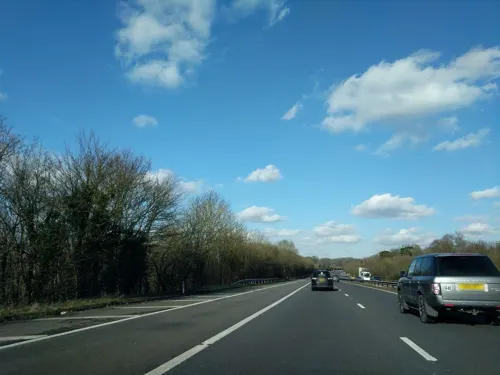
Welwyn Roman Baths
Monument and historic site · 0.4 mi
Thermae in Welwyn, Welwyn Hatfield, England, UK
Welwyn By-Pass Road, Welwyn
Sa 10:00-16:00

Knebworth House
Museum · 2.7 mi
Country house in Knebworth, Hertfordshire, England, UK

Shaw's Corner
Museum · 2.3 mi
Writer's house museum in Ayot St Lawrence, Hertfordshire, England, UK


Lytton Mausoleum
Monument and historic site · 2.9 mi
Mausoleum in Knebworth, North Hertfordshire, England, UK
Parks, trails and playgrounds10


Lemsford Springs
Park · 2.6 mi
Nature reserve in Hertfordshire, England, UK

Stocking Springs Wood
Park · 1.8 mi
Nature reserve in Hertfordshire, England


Concerts at Knebworth House
Park · 2.9 mi
Open-air rock and pop concert

Restaurants and cafes27
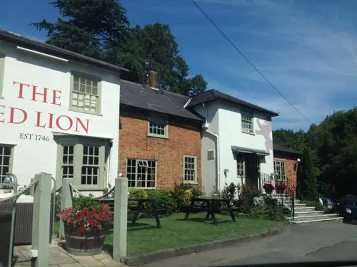



15 more on the map.
History
Situated in the valley of the River Mimram, Welwyn has hosted human activity since the Palaeolithic with stone tools from that era having been found alongside the river and further inland across the area. Settlement across the area seems to have become established during the Bronze Age according to various recovered artefacts and crop marks left by round barrows and burial mounds from that period.
Iron Age remnants have not been detected until the Late Iron Age, with various local chieftain burials dated to the 1st Century BC gaining national prominence.
The Belgae Celtic culture colonised much of South-Eastern England in the 1st century BC, with Welwyn in the area believed to have been settled by the Catuvellauni tribe.
Following the Roman invasion, Welwyn was settled by the Romans. The area was marshy, and the settlement of Welwyn was a known fording point across the river since at least Roman times when the Roman road through the village was laid out, leading to the establishment of the settlement around the road and the ford. Many Roman artifacts have been found in and around the village, including the remains of several Roman villas close by.
Read more of the history
The Welwyn Roman Baths (the remains of a third-century Roman bath house) have been preserved and are open to the public. One particular excavation revealed a large Roman cemetery very close to the site of the current church, which itself is known to date back to at least Saxon times (see below). The church lies directly alongside the route of the Roman road.
The archaeological record in Welwyn is nearly continuous from the late Iron Age (Celtic) through to recorded times, lacking proof of occupation only in the early Anglo-Saxon period. It is therefore likely that Welwyn has been continuously occupied for over 2000 years.
Welwyn was at the heart of the territory of the Anglo-Saxon Tewingas tribe and was the site of an early minster church. In 1990, a proposal was made to rename the village as "Welwyn Minster" to shake off the unpopular "Old" name.
The massacre on St. Brice's day on 13 November 1002, when the Saxons turned on their newly settled Danish neighbours, is said to have commenced near Welwyn. The only known source for this claim is Robert Fabyan's eponymous chronicle, which states it to be "common fame" (ie widespread popular belief) - with Fabyan writing 500 years after the massacre, and with no earlier sources, historians believe it is not possible to rely on this one statement.
A Norman church was built on the site of the Saxon church about 1190. The nave of the present church (St Mary's), was built in the 13th century, the chancel arch being the most obvious early structure. There are two medieval corbels at the east end of the south aisle. Patronage of the church passed through several hands until in 1549 it was sold to the Wilshere family, who lived at The Frythe until relatively recently.
Much later, in the 17th century, as it lies on the old Great North Road, it became an important staging post and a number of coaching inns remain as public houses. After the Great Northern Railway by-passed the village due to the objections of local landowners, Welwyn became less important. Having previously been seen as a town on par with Hatfield and Stevenage, it gradually was seen as a village. The 20th century brought major expansion to the area, as estates to the south, west and north of the village were built up.
From the History section of Welwyn on Wikipedia, under CC BY-SA 4.0.
More about Welwyn
Education
There are two state schools in Welwyn and one independent school.
The larger state school is Welwyn St. Mary's Church of England Primary School, situated off London Road which takes children aged between 4 and 11 years of age (Reception to Year 6). Originally built in 1940 as a secondary school, the school was later converted to a primary school.
The second is Oaklands Primary School, which incorporates Acorns Preschool and Playgroup.
There is also Tenterfield Nursery School which is situated on London Road close to the primary school. It takes children aged 3 to 4 years of age.
Secondary state education is provided through schools in nearby towns, such as Monks Walk School and Stanborough School, in Welwyn Garden city.
There is an independent all-ages (nursery through to sixth form) coeducational school on the eastern outskirts of Welwyn called Sherrardswood School.
From the Wikipedia article Welwyn, under CC BY-SA 4.0.
Notable people from Welwyn
 Matthew MarshBritish racing driverPhoto: Mailboxck, CC BY-SA 4.0
 Lee SallowsEnglish recreational mathematicianPhoto: Lee Sallows, CC BY-SA 3.0
- Adrian ReynardBritish businessman
- John WenkBritish middle-distance runner
Born in Welwyn, according to Wikidata (CC0). Each name links to its Wikipedia article.
Where to stay1
Churches and places of worship10
Shopping2
Gas and EV charging1
Schools, colleges and libraries11
Welwyn St Mary's Church of England Voluntary Aided Primary School
School · Anglican · 0.5 mi
15 London Road, Welwyn
Harwood Hill Junior Mixed Infant and Nursery School
School · 1.3 mi
Harwood Close, Welwyn Garden City
Healthcare3
Map of Welwyn
72 places. The map loads OpenStreetMap tiles when you open it.
Getting there and nearby towns
London Luton Airport (LTN) is the nearest airport with scheduled flights listed in OpenStreetMap, 7 miles away.
- Codicote 2 mi northwest, about 3 min by car
- Welwyn Garden City 2 mi south, about 4 min by car
- Datchworth 3 mi northeast, about 4 min by car
- Kimpton 4 mi west, about 6 min by car
- Stevenage 5 mi north, about 8 min by car
- Hatfield 5 mi south, about 8 min by car
- Watton at Stone 5 mi east, about 7 min by car
- Sandridge 5 mi southwest, about 9 min by car
- Harpenden 6 mi west, about 10 min by car
- Hertford 6 mi southeast, about 10 min by car
Drive times are estimates from straight-line distance, not routes.
Towns near Welwyn


Keep exploring
Local news
Headlines from INDB.
Reviews, tips and questions
Loading what members have shared...
Sources and licences
- GeoNames (CC BY 4.0): population, coordinates, regions and time zone
- Mapillary (see each image): photos
- OpenStreetMap contributors (ODbL 1.0): places, airports, map data
- Wikidata (CC0 1.0): elevation, founding date, time zone, website, landmarks and historic places
- Wikimedia Commons (see each image): photos
- Wikipedia (CC BY-SA 4.0): overview and history text
Photo credits
- Knebworth W front, Heron2 (Heron on en.wikipedia.org), CC BY-SA 3.0
- Shaw's Corner1, PaulSkin from UK, CC BY 2.0
- Danesbury Park 2, Dudley Miles, CC BY-SA 4.0
- Stocking Springs Wood 7, Dudley Miles, CC BY-SA 4.0
- Cat Survival Trust Neofelis nebulosa, Graham Dean from Rayleigh, England, CC BY 2.0
- PalladianChurchAyotStLawrenceMay04, The original uploader was David Edgar at English Wikipedia ., CC BY-SA 3.0
- The ruined church at Ayot St Lawrence, Allan Engelhardt, CC BY-SA 2.0
- The Frythe, Welwyn, Hertfordshire, Hogweard, Public domain
- Lemsford Springs 10, Dudley Miles, CC BY-SA 4.0
- Street-level photo, adam2, CC BY-SA 4.0
- Street-level photo, domdomegg, CC BY-SA 4.0
- Street-level photo, domdomegg, CC BY-SA 4.0

Page built November 10, 2026. Spotted a mistake? Tell us or suggest a place.