


Sandridge, United Kingdom
Sandridge is a town of 1,500 people in England, United Kingdom.
Why visit Sandridge
Townapedia lists 59 museums and landmarks, 38 parks and trails, 141 places to eat, 5 places to stay and 7 attractions in and around town.
Highlights include Southdown Road Skew Bridge, The Alban Arena, St Albans South Signal Box Museum and Belgic Oppidum. Ancient British town.
Weather in Sandridge
Forecast from MET Norway (CC BY 4.0). Full forecast
About Sandridge
Sandridge is a village and civil parish between the city centre of St Albans (2.5 miles (4.0 km) to the south-west) and Wheathampstead, in the St Albans district, in Hertfordshire, England, forming part of the contiguous built-up area of St Albans.
From the Wikipedia article Sandridge (this version), under CC BY-SA 4.0.
Photos of Sandridge


Things to do7

Southdown Road Skew Bridge
Bridge · 2.6 mi
Arch bridge in Harpenden, St. Albans, Hertfordshire, England, UK

The Alban Arena
Cinema and theater · 2.3 mi
This building is a Talking Building
Civic Centre St Peter's Street, St Albans
Alban Arena
Cinema and theater · 2.4 mi
Theatre and music venue in St Albans, England
Barn Theatre, Welwyn Garden City
Cinema and theater · 4.0 mi
Theatre in Welwyn Garden City, Hertfordshire, England, UK

Museums and landmarks59

St Albans South Signal Box Museum
Museum · 2.4 mi
Ridgmont Road
"Every second Sunday, 2-5pm. Specific Sundays posted 3 months in...

Belgic Oppidum. Ancient British town
Monument and historic site · 2.1 mi

Hatfield War Memorial
Monument and historic site · 4.0 mi
War memorial in Hertfordshire, England, UK

Hypocaust Museum
Museum · 3.1 mi
Museum in the Roman city of Verulamium displaying a mosaic floor heated by a hypocaust

Old Gorhambury House
Museum · 4.1 mi
Country house in St Michael, Hertfordshire, England, UK

Roman Theatre of Verulamium
Monument and historic site · 3.0 mi
Ancient Roman theatre in St Albans, England


Shaw's Corner
Museum · 4.0 mi
Writer's house museum in Ayot St Lawrence, Hertfordshire, England, UK

Sopwell Priory
Monument and historic site · 2.8 mi
Monastery in Hertfordshire, England, UK

Beech Bottom Dyke
Monument and historic site · 1.4 mi
Iron Age ditch in St Albans, Hertfordshire, England, UK

Verlamion
Monument and historic site · 3.4 mi
Capital of the Catuvellauni tribe
47 more on the map.
Parks, trails and playgrounds38


Lemsford Springs
Park · 3.4 mi
Nature reserve in Hertfordshire, England, UK

Lydekker Park
Park · 3.5 mi
Park in Harpenden, Hertfordshire, England

Oxleys Wood
Park · 4.1 mi
Nature reserve in Hatfield, Hertfordshire, England, UK

Rothamsted Park
Park · 3.2 mi
Public park in Harpenden, Hertfordshire

Stanborough Park
Park · 3.8 mi
Park in Welwyn Garden City, Hertfordshire, England

Stocking Springs Wood
Park · 3.7 mi
Nature reserve in Hertfordshire, England


Verulamium Park
Park · 3.0 mi
Park in St Albans, Hertfordshire, England

Clarence Park, St Albans
Park · 2.1 mi
Sports venue and park in St Albans, UK
26 more on the map.
Restaurants and cafes141

King William IV
Bar and pub · Pub · 1.3 mi
185 Sandridge Road, St Albans
Mo-We, Su 11:00-23:00; Th-Sa 11:00-24:00

Blacksmith's Arms
Bar and pub · 2.2 mi
56 St Peter's Street, St Albans
Mo-We 10:30-23:00; Th 10:30-00:00; Fr-Sa 10:00-01:00; Su 12:00-23:00
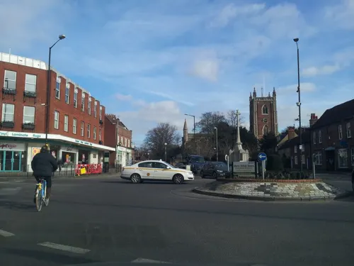
The Beech House
Bar and pub · 2.3 mi
81 St Peter's Street, St Albans
Su-We 08:00-23:00; Th-Sa 08:00-01:00

The Cock Inn
Bar and pub · 2.3 mi
48 St Peter's Street, St Albans
Su-Th 11:00-00:00; Fr-Sa 11:00-01:00

The Saint & Sinner
Bar and pub · 2.4 mi
16 St Peter's Street, St Albans
Mo-Sa 10:00-00:00, Su 10:00-22:00
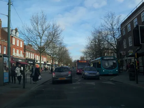
Waterend Barn
Bar and pub · 2.4 mi
St Peter's Street, St Albans
Mo-Th 08:00-00:00; Fr-Sa 08:00-01:00; Su 08:00-23:00


John Bunyan
Bar and pub · 1.8 mi
Coleman Green, St Albans
Tu-Th 11:30-14:30,18:00-23:30; Fr,Sa 11:30-15:00,18:00-23:30; Su...
The Swan
Bar and pub · 2.2 mi
56 High Street, St Albans
Mo-Th 12:00-22:30; Fr-Sa 12:00-23:00; Su 12:00-22:30
129 more on the map.
History
The original name was "Saundruage" meaning a place of sandy soil serviced by bond tenants.
The earliest recorded mention of Sandridge is in the year 796 the parish being part of the revenue of the Mercian Kings. It was given by Egfrith son of Offa in the first year of his reign to abbot Eadric second abbot of St Alban's Monastery and to the monks of St Albans.
Part of the parish of Sandridge was added to the Municipal Borough of St Albans in 1887. The remainder of the parish was renamed Sandridge Rural in 1894 when Sandridge Rural Parish Council was formed. In 1913 a further 241 acres were transferred to St Albans. The parish name reverted to Sandridge in 1957.
From the History section of Sandridge on Wikipedia, under CC BY-SA 4.0.
Notable people from Sandridge
- John DavisEnglish explorer and navigator (1550–1605)
Born in Sandridge, according to Wikidata (CC0). Each name links to its Wikipedia article.
Where to stay5
Churches and places of worship34
Shopping19
Gas and EV charging5
Schools, colleges and libraries42
Healthcare10
Map of Sandridge
250 places. The map loads OpenStreetMap tiles when you open it.
Getting there and nearby towns
London Luton Airport (LTN) is the nearest airport with scheduled flights listed in OpenStreetMap, 7 miles away.
- St Albans 2 mi southwest, about 4 min by car
- Harpenden 3 mi northwest, about 5 min by car
- Hatfield 4 mi east, about 6 min by car
- Welwyn Garden City 4 mi east, about 7 min by car
- Codicote 6 mi northeast, about 9 min by car
- Hemel Hempstead 6 mi west, about 10 min by car
- Luton 8 mi northwest, about 13 min by car
- North Watford 8 mi southwest, about 13 min by car
- Potters Bar 8 mi southeast, about 13 min by car
- Borehamwood 9 mi south, about 14 min by car
Drive times are estimates from straight-line distance, not routes.
Towns near Sandridge


Keep exploring
Local news
Headlines from INDB.
Reviews, tips and questions
Loading what members have shared...
Sources and licences
- GeoNames (CC BY 4.0): population, coordinates, regions and time zone
- Mapillary (see each image): photos
- OpenStreetMap contributors (ODbL 1.0): places, airports, map data
- Wikidata (CC0 1.0): elevation, founding date, time zone, website, landmarks and historic places
- Wikimedia Commons (see each image): photos
- Wikipedia (CC BY-SA 4.0): overview and history text
Photo credits
- Lych gate at St Leonard's Church, Sandridge (8249648291), Peter O'Connor aka anemoneprojectors, CC BY-SA 2.0
- 20 and 22 High Street, Sandridge (34631016556), Peter O'Connor aka anemoneprojectors, CC BY-SA 2.0
- Rose & Crown, Sandridge (34631015346), Peter O'Connor aka anemoneprojectors, CC BY-SA 2.0
- GOC Sandridge to Harpenden 191 Green Man (8248987491), Peter O'Connor aka anemoneprojectors, CC BY-SA 2.0
- GOC Sandridge to Harpenden 190 Green Man (8248985333), Peter O'Connor aka anemoneprojectors, CC BY-SA 2.0
- Pound Farmhouse, Sandridge (34631014686), Peter O'Connor aka anemoneprojectors, CC BY-SA 2.0
- St Leonard's Church, Sandridge (8250713490), Peter O'Connor aka anemoneprojectors, CC BY-SA 2.0
- Memorial at St Leonard's Church, Sandridge (8250720232), Peter O'Connor aka anemoneprojectors, CC BY-SA 2.0
- Pound Farmhouse, Sandridge (34631013816), Peter O'Connor aka anemoneprojectors, CC BY-SA 2.0
- St Leonard's Church, Sandridge (8249654771), Peter O'Connor aka anemoneprojectors, CC BY-SA 2.0
- St Leonards Church, Sandridge, UKgeofan ( talk ) / UKgeofan at en.wikipedia, CC BY-SA 3.0
- Railway Bridge Harpenden, Alistairirvine, CC BY-SA 3.0
- Hatfield War Memorial, AnemoneProjectors, CC BY-SA 4.0
- At Verulamium 2025 021, Photograph by Mike Peel ( www.mikepeel.net )., CC BY-SA 4.0
- Old-Gorhambury-House-20051002-034, Gary Houston, CC0
- Verulamium Roman Theatre 2, Rob Hinkley, CC BY-SA 2.0
- Shaw's Corner1, PaulSkin from UK, CC BY 2.0
- Sopwell Nunnery - St Albans, Przemysław Sakrajda, CC BY-SA 3.0
- Oxleys Wood 5, Dudley Miles, CC BY-SA 4.0
- Rothamstead Park Entance 001, Forscher scs, CC BY-SA 4.0
- Stanborough park 01, Legis at English Wikipedia, Public domain
- Stocking Springs Wood 7, Dudley Miles, CC BY-SA 4.0
- PalladianChurchAyotStLawrenceMay04, The original uploader was David Edgar at English Wikipedia ., CC BY-SA 3.0
- The ruined church at Ayot St Lawrence, Allan Engelhardt, CC BY-SA 2.0
- Hatfield St Etheldreda, Cmglee, CC BY-SA 3.0
- St Helen's Church, Wheathampstead, Colin Riegels / Legis at en.wikipedia, Public domain
- St Albans - St Michael's Church, Przemysław Sakrajda, CC BY-SA 3.0
- St Peter's Church, St Albans, Legis at English Wikipedia, Public domain
- Wheathampstead Town Centre, Colin Riegels / Legis at en.wikipedia, Public domain
- Aldwickbury School, Legis at English Wikipedia, Public domain
- The Grange, St Albans, December 2021, No Swan So Fine, CC BY-SA 4.0
- Cock-St-Albans-20040801-005, Gary Houston, CC0
- Sandridge- St Leonard's church, Queen's Head Pub and Lychgate War Memorial, Rob Hinkley, CC BY-SA 2.0
- St Albans signal box, Matthew Black from London, UK, CC BY-SA 2.0
- Blacksmiths Arms St. Albans 01, Philafrenzy, CC BY-SA 4.0
- King-William-IV-St-Albans-20050920-004, Gary Houston, CC0
- Church of SS Alban and Stephen, St. Alban's, GualdimG, CC BY-SA 4.0
- Manor Pharmacy Wheathampstead, LordGarySugar, CC BY-SA 4.0
- High Street, Wheathampstead, Richard Kelly, CC BY 4.0
- Lydekker Park, Colin Riegels / Legis at en.wikipedia, Public domain
- Colney Heath Local Nature Reserve 7, Dudley Miles, CC BY-SA 4.0
- The Wick LNR 2, Dudley Miles, CC BY-SA 4.0
- Lemsford Springs 10, Dudley Miles, CC BY-SA 4.0
- Hop trefoil (Trifolium campestre), Heartwood Forest (28529822083), Peter O'Connor aka anemoneprojectors from Stevenage, United Kingdom, CC BY-SA 2.0
- Verulamium-Park-lake-20040313-002, Gary Houston, CC0
- Street-level photo, adam2, CC BY-SA 4.0
- Street-level photo, adam2, CC BY-SA 4.0
- Street-level photo, adam2, CC BY-SA 4.0
- Street-level photo, adam2, CC BY-SA 4.0
- Street-level photo, adam2, CC BY-SA 4.0
- Street-level photo, adam2, CC BY-SA 4.0
- Street-level photo, adam2, CC BY-SA 4.0
- Street-level photo, adam2, CC BY-SA 4.0
- Street-level photo, adam2, CC BY-SA 4.0
- Street-level photo, adam2, CC BY-SA 4.0
- Street-level photo, adam2, CC BY-SA 4.0
- Street-level photo, adam2, CC BY-SA 4.0
- Street-level photo, adam2, CC BY-SA 4.0
- Street-level photo, adam2, CC BY-SA 4.0
- Street-level photo, adam2, CC BY-SA 4.0


Page built November 10, 2026. Spotted a mistake? Tell us or suggest a place.