




Why visit Whiston
Townapedia lists 7 museums and landmarks, 33 parks and trails, 95 places to eat, 2 places to stay and 5 attractions in and around town.
Highlights include Shakespeare North Playhouse, Shakespeare North, Prescot Museum and World of Glass.
Weather in Whiston
Forecast from MET Norway (CC BY 4.0). Full forecast
About Whiston
Whiston is a town and civil parish within the Metropolitan Borough of Knowsley in Merseyside, England. It is located 8 miles (10 km) east of Liverpool. The population was 13,629 in 2001, increasing to 14,263 in 2011.
From the Wikipedia article Whiston, Merseyside (this version), under CC BY-SA 4.0.
Photos of Whiston


Things to do5

Shakespeare North
Cinema and theater · 0.9 mi
Auditorium in Merseyside, England

Citadel Arts Centre
Cinema and theater · 3.1 mi
Arts and community centre in St Helens, England
Prescot Playhouse
Cinema and theater · 0.8 mi
Elizabethan theater in Prescot

Museums and landmarks7

Prescot Museum
Museum · 0.8 mi
Local museum in Prescot, Knowsley, Merseyside, England, UK
Aspinal Street, Prescot
Mo-Fr 10:00-17:00; Sa 10:00-13:00
World of Glass
Museum · 3.1 mi
Museum and visitor centre in St Helens, Merseyside, United Kingdom

Rainhill
Monument and historic site · 1.1 mi
LNWR type 4 wooden top box on a brick base
St Ann's Well
Monument and historic site · 1.4 mi
A medieval well that was once believed to heal eye diseases and wash away sins: excavation works by Historic England. On private land.
Parks, trails and playgrounds33


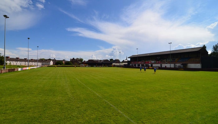
Valerie Park (Prescot Cables FC)
Sports field and stadium · 1.0 mi
Eaton Street



21 more on the map.
Restaurants and cafes95

Brunch at No 10
Cafe · Breakfast · 0.8 mi
10 Greenes Road
Mo-Tu 09:00-13:00; We-Sa 09:00-14:30; Su 09:00-14:00


Ho's Restaurant
Restaurant · Vietnamese · 0.9 mi
4 Warrington Road
Su-Th 17:00-23:00; Fr-Sa 17:00-00:00
Maturo, Prescot
Restaurant · Steak House · 0.9 mi
79-81 Eccleston Street
Mo-Th 15:00-22:30; Fr-Sa 12:00-23:30; Su 12:00-22:00
Mermaid Tavern Prescot
Bar and pub · Local · 0.9 mi
21 Market Place
Mo-Th 15:00-23:00; Fr-Sa 12:00-00:00; Su 12:00-23:00
Poco Bar & Cafe
Cafe · Coffee Shop · 0.9 mi
30 Eccleston Street, Prescot
We-Sa 09:00-16:30; Mo-Tu 09:00-15:30; Su 16:00-21:00
Quick & Tasty
Restaurant · Burger, Chicken, Friture, Kebab, Pizza · 0.9 mi
67 Eccleston Street
Su-Th 16:00-00:00; Fr-Sa 16:00-00:30
83 more on the map.
History
The first record of Whiston comes in 1245, being rendered as "Quistan" and being within the West Derby Hundred in Lancashire. Archeological evidence such as a Neolithic polished hand-axe and mesolithic tool fragments suggest that the region was host to pre-historic settlement up to 12,000 years, ago while other archaeological finds include remnants of a Roman tile workshop in nearby Tarbock and a medieval shovel head.
The main industry of Whiston's earlier documented history is agriculture, with the first recorded mill in the area being held by local lord Henry Travers from 1190. By 1521, the first documentation of coal mining is made, which would in time become Whiston's primary industry. By 1700, the coalfields of Whiston, Prescot, and Sutton were producing 25,000-50,000 tonnes of coal annually, and this would only increase as the Industrial Revolution progressed and the Whiston area became host to tens of collieries over the 18th and 19th Centuries. By 1901, the population of Whiston was 3,430.
The Church of St. Nicholas on Windy Arbor Road was consecrated on 30 July 1868, replacing a chapel dating from 1846. It hosts a war memorial, designed by Sir Giles Gilbert Scott, which was struck by lightning in 1928. The memorial was replaced in 1932. The stone-built Methodist Church on the High Street dates from the 19th century.
Read more of the history
Following World War II, Liverpool faced a housing crisis due to extensive bomb damage and the poor conditions of many inner-city districts. To accommodate displaced families, large-scale developments were planned in surrounding areas, including Whiston, as part of a broader strategy to relocate thousands of residents to new, modern housing estates. This period saw a dramatic expansion of Whiston’s population as families from Liverpool moved into newly built council estates, bringing with them a strong cultural identity rooted in the city's working-class traditions.
The influx of Liverpool residents shaped Whiston’s social and cultural character, with many retaining strong ties to their former communities. Liverpool’s distinct sense of community, dialect, and traditions became deeply embedded in Whiston, influencing local life, from the way people spoke to the shared connection with Liverpool’s football culture, music scene, and working-class values. Despite being administratively separate from Liverpool, Whiston has remained culturally aligned with the city, with many residents continuing to work, shop, and socialise there.
Even as housing developments expanded and private homes were introduced in later decades, Whiston’s identity as a Liverpool overspill town has endured. Generations of families with Liverpool roots have remained in the area, reinforcing its connection to the city. Today, Whiston continues to serve as a residential hub for those seeking proximity to Liverpool while maintaining a local community that reflects its historical role in the city's post-war expansion.
Whiston had a sanatorium, an isolation hospital, and a workhouse, part of the Prescot Union workhouses.
Whiston was previously host to Halsnead Hall, a neoclassical manor that housed the Willis family, chief landholders in Whiston from 1684 until the auctioning of their estate in 1929. Halsnead Hall, demolished in 1932 and now the site of Halsnead static caravan park, was designed by the renowned architect Sir John Soane. Before its demolition, it was the sole example of Soane's work in either Lancashire or Cheshire.
From the History section of Whiston, Merseyside on Wikipedia, under CC BY-SA 4.0.
More about Whiston
Education
In 2010, two of Whiston's secondary schools were closed and redeveloped under the Brown ministry's "Building Schools for the Future" scheme. This £150 million programme created seven new "Centres for Learning" to replace the 10 existing secondary schools within the Knowsley borough.
Constructed in 1964, Knowsley Higher Side Comprehensive School was one of the first comprehensive schools in the local area, purpose built under the Labour Party's education reforms to formally abolish the tripartite system of education; to amalgamate grammar, technical and secondary modern schools into one appropriately named Comprehensive System.
In March 2010, after serving the local area for 46 years, Higher Side Comprehensive School was permanently closed and subsequently demolished to make way for the new St Edmund Arrowsmith Catholic Centre for Learning which was constructed on vacant land behind Higher Side's main buildings. The land on which Higher Side once stood now serves as a car park and recreational area for staff and pupils of the new St Edmund Arrowsmith.
From the Wikipedia article Whiston, Merseyside, under CC BY-SA 4.0.
Notable people from Whiston
 Melanie CBritish pop singer (born 1974)Photo: Raimond Spekking, CC BY-SA 4.0
 Martin KellyEnglish association football player (born 1990)Photo: https://www.flickr.com/photos/cfcunofficial/, CC BY-SA 2.0
 Kym MarshEnglish actress and former singerPhoto: Sophie Tagg, CC BY 2.0
 Lewis TravisEnglish association football player (born 1997)Photo: ITFC1234, CC0
 Lucy MartinBritish cyclistPhoto: André Karwath aka Aka, CC BY-SA 2.5
 Ian FosterEnglish football player and managerPhoto: Purplehornet1973, CC BY-SA 4.0
 James RobyEnglish rugby league footballerPhoto: Gerard Barrau, CC BY-SA 3.0
 Stuart MaconieEnglish radio presenter, television presenter, journalist and authorPhoto: Bryan Ledgard from Yorkshire, UK, CC BY 2.0
 Kelly McDougallEnglish footballerPhoto: Clavdia chauchat, CC0
- Steven GerrardEnglish association football player and manager (born 1980)
- Callum McManamanEnglish association football player (born 1991)
- Willy RussellBritish dramatist, lyricist and composer
Born in Whiston, according to Wikidata (CC0). Each name links to its Wikipedia article.
Where to stay2
Churches and places of worship31
Prescot Pentecostal Fellowship - Malayalam Worship (Prescot, Whiston, St Helens, Liverpool)
Church · 0.6 mi
Old Colliery Road
Shopping12
Gas and EV charging4
Schools, colleges and libraries20
St Leo's and Southmead Catholic Primary School
School · Roman Catholic · 0.7 mi
Lickers Lane, Prescot
Healthcare15
Whiston Primary Care Resource Centre
Clinic and pharmacy · 0.6 mi
Old Colliery Road
Map of Whiston
224 places. The map loads OpenStreetMap tiles when you open it.
Getting there and nearby towns
Liverpool John Lennon Airport (LPL) is the nearest airport with scheduled flights listed in OpenStreetMap, 6 miles away.
- Rainhill 1 mi east, about 2 min by car
- St Helens 3 mi northeast, about 5 min by car
- Halewood 5 mi southwest, about 7 min by car
- Woolton 5 mi southwest, about 7 min by car
- Childwall 5 mi west, about 8 min by car
- West Derby 5 mi west, about 8 min by car
- Haydock 5 mi northeast, about 9 min by car
- Speke 6 mi south, about 9 min by car
- Fazakerley 6 mi northwest, about 10 min by car
- Liverpool 8 mi west, about 13 min by car
Drive times are estimates from straight-line distance, not routes.
Towns near Whiston


Keep exploring
Local news
Headlines from INDB.
Reviews, tips and questions
Loading what members have shared...
Sources and licences
- GeoNames (CC BY 4.0): population, coordinates, regions and time zone
- OpenStreetMap contributors (ODbL 1.0): places, airports, map data
- Wikidata (CC0 1.0): elevation, founding date, time zone, website, landmarks and historic places
- Wikimedia Commons (see each image): photos
- Wikipedia (CC BY-SA 4.0): overview and history text
Photo credits
- Stadt Moers Park, Frombowen, CC BY-SA 4.0
- Holy Cross & St Helen Church 1, Rodhullandemu, CC BY-SA 4.0
- North west view of Loyola Hall, Rainhill, Pjposullivan, CC BY-SA 3.0
- Improvements plaque at Prescot railway station, Rodhullandemu, CC BY-SA 4.0
- Valerie Park Stadium Prescot, Gb100000, CC BY-SA 3.0
- St Mary's Church, Prescot 2, Rodhullandemu, CC BY-SA 4.0
- Whiston Hospital, Merseyside, Rept0n1x, CC BY-SA 3.0
- St Mary's Church, Prescot, Sue Adair, CC BY-SA 2.0
- Candelariella vitellina 121815862, Stephen James McWilliam, CC BY 4.0
- Tortella tortuosa 50864841, Stephen James McWilliam, CC BY 4.0
- Meripilus giganteus 50867683, Stephen James McWilliam, CC BY 4.0
- Meripilus giganteus 50865251, Susan Marley, CC BY 4.0
- Meripilus giganteus 50865269, Susan Marley, CC BY 4.0
- The Golden Arrow at Rocket 150, jimd2007, CC BY 2.0
- 0-6-0 Saddle Tank at Rocket 150, jimd2007, CC BY 2.0
- Flying Scotsman at Rocket 150, jimd2007, CC BY 2.0
- Princess Elizabeth at Rocket 150, jimd2007, CC BY 2.0
- Evening Star at Rocket 150, jimd2007, CC BY 2.0
- GWR 0-6-0 Loco at Rocket 150, jimd2007, CC BY 2.0


Page built November 10, 2026. Spotted a mistake? Tell us or suggest a place.