


Why visit Whitby
Townapedia lists 29 museums and landmarks, 15 parks and trails, 130 places to eat, 31 places to stay and 9 attractions in and around town.
Highlights include Whitby East Pier Lighthouse, Whitby Swing Bridge, Whitby Museum and Captain Cook Memorial Museum.
Weather in Whitby
Forecast from MET Norway (CC BY 4.0). Full forecast
About Whitby
Whitby is a seaside town, port and civil parish in North Yorkshire, England. It is located at the mouth of the River Esk, where the North York Moors meet the Yorkshire Coast, and has a maritime, mineral and tourist economy. It is 47 miles (76 km) from York and 22 miles (35 km) from Middlesbrough.
From the Wikipedia article Whitby (this version), under CC BY-SA 4.0.
Travel tips from other travellers: Whitby on Wikivoyage (CC BY-SA 4.0).
Photos of Whitby


Things to do9

Whitby East Pier Lighthouse
Lighthouse · 0.4 mi
Lighthouse in Whitby, Scarborough, North Yorkshire, England, UK


Whitby East Pier beacon
Lighthouse · 0.5 mi
Lighthouse built 1914 in Whitby
Whitby Lighthouse
Lighthouse · 2.0 mi
Grade II listed lighthouse in Hawsker-cum-Stainsacre, Scarborough, North Yorkshire, England, UK
Whitby West Pier beacon
Lighthouse · 0.5 mi
Lighthouse built 1914 in Whitby
Whitby West Pier Lighthouse
Lighthouse · 0.4 mi
Lighthouse in Whitby, Scarborough, North Yorkshire, England, UK


Museums and landmarks29

Whitby Museum
Museum
Museum in North Yorkshire, England, United Kingdom
Pannett Park, Whitby
Tu-Su 10:00-16:30


Captain Cook Museum Whitby
Museum
Grade I listed historic house museum in Whitby, United Kingdom



Pannett Art Gallery
Museum
Art gallery and museum in Whitby, North Yorkshire, England, United Kingdom
Tu-Su 09:30-16:30

Whale Bone Arch
Monument and historic site
Arch in Whitby, North Yorkshire, England, UK
17 more on the map.
Parks, trails and playgrounds15





3 more on the map.
Restaurants and cafes130


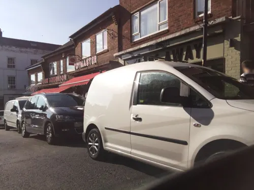
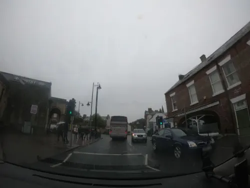
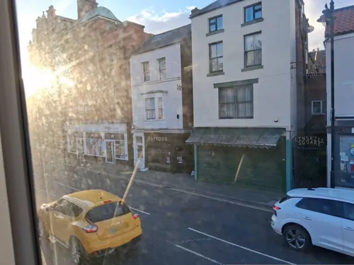


118 more on the map.
History
Whitby was known in the Anglo-Saxon period as Streoneshalh, meaning "Streon's nook of land". The modern name, which first appears in the Domesday Book, means "Hvíta's farmstead", from Old Norse Hvítabýr.
A monastery was founded at Streoneshalh in 657 AD by King Oswiu or Oswy of Northumbria, as an act of thanksgiving, after defeating Penda, the pagan king of Mercia. At its foundation, the abbey was an Anglo-Saxon "double monastery" for men and women. Its first abbess, the royal princess Hild, was later venerated as a saint. The abbey became a centre of learning, and here Cædmon the cowherd was "miraculously" transformed into an inspired poet whose poetry is an example of Anglo-Saxon literature. The abbey became the leading royal nunnery of the kingdom of Deira, and the burial-place of its royal family. The Synod of Whitby, in 664, established the Roman date of Easter in Northumbria at the expense of the Celtic one.
Read more of the history
The monastery was destroyed between 867 and 870 in a series of raids by Vikings from Denmark under their leaders Ingwar and Ubba. Its site remained desolate for more than 200 years until after the Norman Conquest of England in 1066. After the Conquest, the area was granted to William de Percy who, in 1078 donated land to found a Benedictine monastery dedicated to St Peter and St Hilda. William de Percy's gift included land for the monastery, the town and port of Whitby and St Mary's Church and dependent chapels at Fyling, Hawsker, Sneaton, Ugglebarnby, Dunsley, and Aislaby, five mills including Ruswarp, Hackness with two mills and two churches.
When the Domesday Book was compiled in 1086, Whitby was recorded being partially waste and a small settlement lying within the Langbaurgh Wapentake of Yorkshire. Further details reveal the state of Whitby's economic and agricultural decline (when compared with its pre-Conquest state under Earl Siward) which were due to the depredations of William the Conqueror's army during the Harrying of the North in 1069–70.
In about 1128 Henry I granted the abbey burgage in Whitby and permission to hold a fair at the feast of St Hilda on 25 August. A second fair was held close to St Hilda's winter feast at Martinmas. Market rights were granted to the abbey and descended with the liberty.
Whitby Abbey surrendered in December 1539 when Henry VIII dissolved the monasteries. By 1540 the town had between 20 and 30 houses and a population of about 200.
The burgesses, who had little independence under the abbey, tried to obtain self-government after the dissolution of the monasteries. The king ordered Letters Patent to be drawn up granting their requests, but it was not implemented. In 1550 the Liberty of Whitby Strand, except for Hackness, was granted to the Earl of Warwick who in 1551 conveyed it to Sir John York and his wife Anne who sold the lease to the Cholmleys. In the reign of Elizabeth I, Whitby was a small fishing port. In 1635 the owners of the liberty governed the port and town where 24 burgesses had the privilege of buying and selling goods brought in by sea. Burgage tenure continued until the Whitby (Yorkshire) Improvement Act 1837 (7 Will. 4 & 1 Vict. c. x) entrusted government of the town to a board of improvement commissioners, elected by the ratepayers.
At the end of the 16th century Thomas Chaloner visited alum works in the Papal States, where he observed that the rock being processed was similar to that under his Guisborough estate. At that time alum was important for medicinal uses, in curing leather and for fixing dyed cloths and the Papal States and Spain maintained monopolies on its production and sale. Chaloner secretly brought workmen to develop the industry in Yorkshire, and alum was produced near Sandsend Ness 3 miles (5 km) from Whitby in the reign of James I. Once the industry was established, imports were banned and although the methods in its production were laborious, England became self-sufficient.
Whitby grew significantly as a port as a result of the alum trade and by importing coal from the Durham coalfield to process it.
Whitby grew in size and wealth, extending its activities to include shipbuilding using local oak timber. In 1790–91 Whitby built 11,754 tons of shipping, making it the third largest shipbuilder in England, after London and Newcastle. Taxes on imports entering the port raised money to improve and extend the town's twin piers, improving the harbour and permitting further increases in trade. In 1753 the first whaling ship set sail to Greenland and by 1795 Whitby had become a major whaling port. The most successful year was 1814 when eight ships caught 172 whales, and the whaler, the Resolution's catch produced 230 tons of oil. The carcases yielded 42 tons of whalebone used for 'stays' which were used in the corsetry trade until changes in fashion made them redundant. Blubber was boiled to produce oil for use in lamps in four oil houses on the harbourside. Oil was used for street lighting until the spread of gas lighting reduced demand and the Whitby Whale Oil and Gas Company changed into the Whitby Coal and Gas Company. As the market for whale products fell, catches became too small to be economic and by 1831 only one whaling ship, the Phoenix, remained.
Whitby benefited from trade between the Newcastle coalfield and London, both by shipbuilding and supplying transport. In his youth the explorer James Cook learned his trade on colliers, shipping coal from the port. HMS Endeavour, the ship commanded by Cook on his voyage to Australia and New Zealand, was built in Whitby in 1764 by Thomas Fishburn as a coal carrier named Earl of Pembroke. She was bought by the Royal Navy 1768, refitted and renamed.
Whitby developed as a spa town in Georgian times when three chalybeate springs were in demand for their medicinal and tonic qualities. Visitors were attracted to the town leading to the building of "lodging-houses" and hotels, particularly on the West Cliff.
From the History section of Whitby on Wikipedia, under CC BY-SA 4.0.
More about Whitby
Geography
Whitby is situated on the east coast of Yorkshire facing the North Sea in a deep valley at the mouth of the River Esk. It has been a bridging point since at least medieval times and several bridges have spanned the river. The current bridge, built in 1908, is a swing bridge with a 75-foot (23 m) span that separates the upper and lower harbours which have a total area of around 80.1 acres (32.40 ha). The houses are built of brick or stone, often with red pantiled roofs, in narrow, steep streets, on both sides of the river.
The town is surrounded on its landward sides by the moorland of the North York Moors National Park and the North Sea abuts it on the seaward side. The coastal areas are designated part of the North Yorkshire and Cleveland Heritage Coast.
The harbour and the mouth of the River Esk are on a geological fault. On the east side the cliff is tall, 187 feet (57 m), and consists of alternating layers of shale, sandstone and clay. On the west side the cliff is much lower and has a deep capping of boulder clay over a sandstone base making it less stable and liable to slippage. Both cliffs are being eroded quite rapidly.
Economy
Tourism supported by fishing is the mainstay of Whitby's economy in an isolated community with poor transport infrastructure and restricted by building constraints in the surrounding North York Moors National Park. The economy is governed by the changing fortunes of fishing, tourism and to some extent, manufacturing. Structural changes have led to concentrations of deprivation, unemployment and benefit dependence. A narrowing employment base and dependence on low wage and low skill sectors has resulted in younger age groups leaving the area. There are few business start-ups and small and medium-sized enterprises. Older people who make increasing demands on the area's health and social care capacity have moved into the area. Demographic changes, Whitby's relative isolation from the region's main growth areas and decline in traditional employment sectors pose an economic challenge.
The town has a variety of self-catering accommodation, holiday cottages, caravans and campsites, and guest houses, inns, bed & breakfast establishments and hotels. The jet industry declined at the end of the 19th century, but eight shops sell jet jewellery, mainly as souvenirs to tourists. In 1996, Whitby West Cliff qualified for a 'Tidy Britain Group Seaside Award'. The town was awarded "Best Seaside Resort 2006", by Which? Holiday magazine.
Arts and culture
Frank Meadow Sutcliffe left a photographic record of the town, harbour, fishing and residents in late-Victorian times. His most famous photograph entitled "Water Rats" was taken in 1886. He became famous internationally as a great exponent of pictorial photography. He exhibited his work in Tokyo, Vienna, France, the US and Great Britain winning over 60 gold, silver and bronze medals. He retired in 1922 and became curator of Whitby Museum. The Royal Photographic Society made him an honorary member in 1935. Sutcliffe's photograph archive and collection are now at Whitby Museum.
Pannett Park was built on land purchased by a local philanthropist and politician Alderman Robert Pannett in 1902. After his death in 1928, the trust he set up created a public park and art gallery. In 1931 Whitby Museum was built behind the gallery by the Whitby Literary and Philosophical Society. It holds a collection of the archaeological and social history of jet and has on display a "Hand of Glory". The Friends of Pannett Park, formed in 2005, successfully bid for a Heritage Lottery Fund grant to refurbish the park.
There has been a lifeboat in Whitby since 1802 and the old boathouse, built in 1895 and used until 1957, is a museum displaying the Robert and Ellen Robson lifeboat, built in 1919.
Education
Whitby has a three-tier school system, primary, middle (11–14) and Caedmon College (11–19), the latter formed in 2014 from the merger of Caedmon School (11–14) and Whitby Community College (14–19). Eskdale School continues to operate as a middle school, but is currently consulting on raising its age range to 16. In February 2018 Caedmon College and Eskdale School agreed to federate and plan to provide a joint sixth form in the town.
The primary schools are St Hilda's Roman Catholic Primary School, Stakesby Community Primary School, West Cliff Primary School, Airy Hill Community Primary School and East Whitby Community Primary School. North Yorkshire County Council provides education services.
The Whitby and District Fishing Industry Training School offers training for new entrants to the fishing industry, and experienced fishermen.
From the Wikipedia article Whitby, under CC BY-SA 4.0.
Notable people from Whitby
 Beth MeadEnglish footballerPhoto: James Boyes from UK, CC BY 2.0
 Arthur BrownEnglish singer (born 1942)Photo: MarvinSLemon, CC BY 4.0
 Samuel BarnettBritish actorPhoto: Gage Skidmore, CC BY-SA 3.0
 Adam LythEnglish county cricketer (born 1987)Photo: Dave Morton, Public domain
 John Shipley, Baron ShipleyBritish politician (born 1946)Photo: Roger Harris, CC BY 3.0
 Richard JacksonEnglish footballer, born 1980Photo: en:user:TuborgLight, CC BY-SA 3.0
 George ChambersEnglish painter (1803-1840)Photo: George Chambers, Sen. (1803-1840)..., Public domain
- William BatesonBritish geneticist and biologist (1861-1926)
- Dorothy RipleyBritish missionary
- Storm JamesonBritish writer (1891-1986)
- John BeecroftBritish explorer
- Arthur DunnEnglish footballer (1860–1902)
Born in Whitby, according to Wikidata (CC0). Each name links to its Wikipedia article.
Where to stay31
Churches and places of worship25
Shopping36
Gas and EV charging4
Schools, colleges and libraries10
Ruswarp Church of England Voluntary Controlled Primary School
School · Anglican · 1.3 mi
High Street, Whitby
Healthcare5
Map of Whitby
250 places. The map loads OpenStreetMap tiles when you open it.
Getting there and nearby towns
Teesside International Airport (MME) is the nearest airport with scheduled flights listed in OpenStreetMap, 33 miles away.
- Sleights 3 mi southwest, about 5 min by car
- Hinderwell 7 mi northwest, about 12 min by car
- Staithes 9 mi northwest, about 14 min by car
- Easington 10 mi northwest, about 17 min by car
- Middlesbrough 26 mi west, about 41 min by car
- Yarm 30 mi west, about 48 min by car
- York 41 mi southwest, about 1 h by car
- Sunderland 42 mi northwest, about 1 h 15 min by car
- Newcastle upon Tyne 52 mi northwest, about 1 h 30 min by car
- Kingston upon Hull 53 mi south, about 1 h 30 min by car
Drive times are estimates from straight-line distance, not routes.
Towns near Whitby


Keep exploring
Local news
Headlines from INDB.
Reviews, tips and questions
Loading what members have shared...
Sources and licences
- GeoNames (CC BY 4.0): population, coordinates, regions and time zone
- Mapillary (see each image): photos
- OpenStreetMap contributors (ODbL 1.0): places, airports, map data
- Wikidata (CC0 1.0): elevation, founding date, time zone, website, landmarks and historic places
- Wikimedia Commons (see each image): photos
- Wikipedia (CC BY-SA 4.0): overview and history text
Photo credits
- Rj whitby, Mr R Jordan ( Mr R Jordan ), CC BY-SA 3.0
- Whitby Swing Bridge July 2026, Barmeise, CC BY 4.0
- Whitby - East Pier Lighthouse, Benjamin Smith, CC BY-SA 4.0
- Whitby museum, Geni, CC BY-SA 4.0
- Whitby Abbey (ruins) 2013-09-04 11-25-09, aude, CC BY-SA 3.0
- Whitby - St Mary's Church - 1, Benjamin Smith, CC BY-SA 4.0
- St Hildas Church Sneaton 1 (Nigel Coates), Nigel Coates ( talk ), CC BY-SA 3.0
- Church of St Hilda 2013-09-05 08-39-05, aude, CC BY-SA 3.0
- St Johns Church Sleights 1 (Nigel Coates), Nigel Coates ( talk ), CC BY-SA 3.0
- St Ninian's Church, Whitby, The joy of all things, CC BY-SA 4.0
- Whitby - Captain Cook Memorial Museum, Benjamin Smith, CC BY-SA 4.0
- Magpie Café, Whitby, Clare Wilkinson, CC BY 2.0
- Whitby - 199 Steps, Benjamin Smith, CC BY-SA 4.0
- Whitby - Old Town Hall, Benjamin Smith, CC BY-SA 4.0
- The Quirky Den, Whitby, England, Ridiculopathy, CC0
- Whitby Library, Simon Cobb, CC0
- YHA Whitby and Abbey, Crimson Caribou, CC BY-SA 4.0
- Captain Cook Statue, Whitby., Benjamin Shaw, CC BY-SA 3.0
- Whitby - Abbey House - 2, Benjamin Smith, CC BY-SA 4.0
- Four and twenty seagulls - (1231731149), Bryan Ledgard, CC BY 2.0
- Goth weekends (2992842146), Bryan Ledgard, CC BY 2.0
- Falling for a gothbike (5137458296), Bryan Ledgard, CC BY 2.0
- A family of legal aliens. (5136886715), Bryan Ledgard, CC BY 2.0
- Street-level photo, lamaar639, CC BY-SA 4.0
- Street-level photo, usingsogiving, CC BY-SA 4.0
- Street-level photo, southglos, CC BY-SA 4.0
- Street-level photo, usingsogiving, CC BY-SA 4.0
- Street-level photo, southglos, CC BY-SA 4.0
- Street-level photo, southglos, CC BY-SA 4.0
- Street-level photo, usingsogiving, CC BY-SA 4.0
- Street-level photo, southglos, CC BY-SA 4.0
- Street-level photo, southglos, CC BY-SA 4.0
- Street-level photo, southglos, CC BY-SA 4.0
- Street-level photo, lamaar639, CC BY-SA 4.0
- Street-level photo, Lapscle, CC BY-SA 4.0
- Street-level photo, lamaar639, CC BY-SA 4.0
- Street-level photo, lamaar639, CC BY-SA 4.0
- Street-level photo, usingsogiving, CC BY-SA 4.0
- Street-level photo, southglos, CC BY-SA 4.0
- Street-level photo, southglos, CC BY-SA 4.0
- Street-level photo, lamaar639, CC BY-SA 4.0
- Street-level photo, southglos, CC BY-SA 4.0


Page built November 10, 2026. Spotted a mistake? Tell us or suggest a place.