


Bicester, United Kingdom
Bicester is a town of 33,846 people in England, United Kingdom.
Why visit Bicester
Townapedia lists 11 museums and landmarks, 28 parks and trails, 112 places to eat, 8 places to stay and 2 attractions in and around town.
Highlights include Graven Hill, Vue, Building Nos 129, 130 And 131 (Motor Transport Sheds) and Buildings 108 and 113 (Type C Hangars).
Weather in Bicester
Forecast from MET Norway (CC BY 4.0). Full forecast
About Bicester
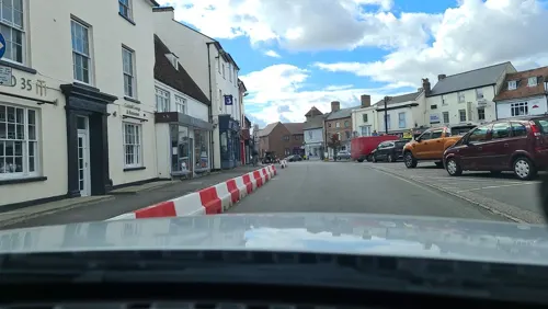
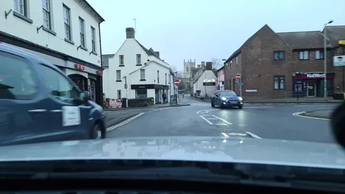
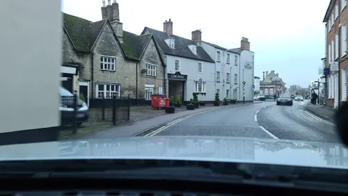
Bicester is a market town and civil parish in the Cherwell district of Oxfordshire, England, 11 miles (18 km) north-east of Oxford. The town is a notable tourist attraction due to the Bicester Village shopping centre. The historical town centre – designated as a conservation area – has a local market and numerous independent shops and restaurants. Bicester also has a town council and a mayor.
From the Wikipedia article Bicester (this version), under CC BY-SA 4.0.
Travel tips from other travellers: Bicester on Wikivoyage (CC BY-SA 4.0).
Photos of Bicester

Things to do2


Museums and landmarks11

Building Nos 129, 130 And 131 (Motor Transport Sheds)
Monument and historic site · 1.1 mi
Parks, trails and playgrounds28




16 more on the map.
Restaurants and cafes112




Denis Restaurant
Restaurant · Turkish, Mediterranean
Turkish & Mediterranean Food
92 Sheep Street, Bicester
Betsy The Bus Cafe
Cafe · Breakfast, Sandwich, Cafe, Burger · 0.6 mi
Launton Road, Bicester
Mo-Sa 07:00-15:00, Su 09:00-15:00
100 more on the map.
History
Bicester lies close to the junction of two Roman roads – Akeman Street, an east–west route between St Albans and Cirencester, and a north–south route between Dorchester and Towcester, which lies under Queen's Avenue. A Roman fort at Alchester lies 2 miles (3 km) southwest of the town. The West Saxons established a settlement in the 6th century at a nodal point of these ancient routes.
St. Edburg’s Church in Bicester was founded as a minster, perhaps in the mid-7th century after St. Birinus converted Cynegils, King of Wessex, following their meeting near Blewbury. The site was just east of the old Roman road between Dorchester and Towcester that passed through the former Roman town Alchester. The earliest church was probably a timber structure serving the inhabitants of the growing Saxon settlements on either side of the River Bure, and as a mission centre for the surrounding countryside. Archaeological excavations at Procter's Yard identified the ecclesiastical enclosure boundary, and a large cemetery of Saxon graves suggesting a much larger churchyard has been excavated on the site of the Catholic Church car park almost opposite St. Edburg's.
Read more of the history
The first documentary reference is the Domesday Book of 1086 which records it as Berencestra, its two manors of Bicester and Wretchwick being held by Robert D'Oyly who built Oxford Castle. The town became established as twin settlements on opposite banks of the River Bure, a tributary of the Ray, Cherwell, and ultimately the River Thames.
By the end of the 13th century, Bicester was the centre of a deanery of 33 churches. The remains of an Augustinian priory founded between 1182 and 1185 survive in the town centre. It is unclear when St. Edburg's Church was rebuilt in stone, but the 12th-century church seems to have had an aisleless cruciform plan. The earliest surviving material includes parts of the nave's north wall, parts of an originally external zigzag string course, the north and south transepts, and the external clasping buttresses of the chancel. The triangular-headed opening at the end of the north wall of the nave was probably an external door of the early church. Three round-headed Norman arches at the end of the nave mark the position of a 13th-century tower.
The Augustinian Priory was founded by Gilbert Bassett around 1183 and endowed with land and buildings around the town and other parishes, including 180 acres (73 ha) and the quarry at Kirtlington, 300 acres (120 ha) at what is now called Wretchwick, 135 acres (55 ha) at Stratton Audley, and on Gravenhill and Arncott. It also held the mill at Clifton and had farms let to tenants at Deddington, Grimsbury, Waddesdon, and Fringford. Although these holdings were extensive and close to the market at Bicester, they appear to have been poorly managed and did not produce much income for the priory.
The priory appropriated the church in the early 13th century. A south aisle was added, and arches were opened in the nave and south transept walls to connect the new aisle with the main body of the church.
A further extension was made in the 14th century when the north aisle was built. The arched openings in the north wall of the nave are supported by octagonal columns. The Perpendicular Gothic north chapel (now vestry) is of a similar date, and on the east wall are two windows. The chapel originally had an upper chamber used later for the vicars' grammar school, accessed from an external staircase which forms part of the north eastern buttress.
In the 15th century, the upper walls of the nave were raised to form a clerestory with square-headed Perpendicular Gothic windows. The earlier central tower and its nave arch were taken down and the nave roof was rebuilt (the present roof is a copy of this design built in 1803). The columns of the north arcade were undercut, making them appear very slim and the capitals top heavy. In the east bay of the nave, there are carved decorations probably forming part of a canopied tomb originally set between the columns. The west tower was built in three stages, each stage marked by a horizontal string course running around the outside. The construction would have taken several years to complete. The battlements and crockets on the top of the tower were replaced in the mid 19th century.
The priory church was built around 1200 and enlarged around 1300 in association with the construction of the Purbeck marble tomb of St. Eadburh. This may have been the gift of the priory's patron Henry de Lacy, 3rd Earl of Lincoln. The walled rectangular enclosure of the priory lay just south of the church. The gatehouse was on the site of 'Chapter and Verse' Guesthouse in Church Lane. The dovecote and houses in Old Place Yard lie within the central precinct. St. Edburg's House is built partly over the site of the large priory church. This was linked by a cloister to a quadrangle containing the refectory, kitchens, dormitory, and prior's lodging. The priory farm buildings lay in the area of the present church hall, and these had direct access along Piggy Lane to land in what is now the King's End estate.
Early charters promoted Bicester's development as a trading centre, with a market and fair established by the mid 13th century. By this time two further manors are mentioned, Bury End and Nuns Place, later known as Market End and King's End respectively.
The town has a long-standing connection with the military. Ward Lock & Co's 'Guide to Oxford and District' suggests that Alchester was 'a kind of Roman Aldershot'. During the English Civil War (1642–49) Bicester was used as the headquarters of parliamentary forces. Following the outbreak of the French Revolutionary Wars from 1793, John Coker, the manorial lord of Bicester King's End, formed an 'Association for the Protection of Property against Levellers and Jacobins' as an anti-Painite loyalist band providing local militia and volunteer drafts for the army. When Oxford University formed a regiment in 1798, John Coker was elected Colonel.
From the History section of Bicester on Wikipedia, under CC BY-SA 4.0.
More about Bicester
Geography
Bicester is in north Oxfordshire, 11 miles (18 km) east-northeast of Oxford, near the Buckinghamshire and Northamptonshire boundaries.
There are 5 electoral wards, North, East, South, West, and Town as defined by the town council. The areas of Bicester include:
Bicester experiences an oceanic climate (Köppen climate classification Cfb) similar to almost all of the United Kingdom.
From the Wikipedia article Bicester, under CC BY-SA 4.0.
Notable people from Bicester
 Millie CouzensBritish cyclistPhoto: Cs-wolves, CC BY-SA 4.0
 Andrew WatsonBritish Anglican bishop (1961–2026)Photo: Edn575, CC BY-SA 4.0
 Maud FranklinBritish artist (1857-1941)Photo: James McNeill Whistler, Public domain
 Chloe BurrowsEnglish television personality (born 1995)Photo: Gymshark, CC BY 3.0
- Kieran BirdBritish swimmer
- George RoseEnglish actor and singer (1920–1988)
- Tim BreackerEnglish footballer (born 1965)
- Joy GregoryBritish artist
- Kevin Brockprofessional footballer (born 1962)
- Sue WrightEnglish squash player
- Peter FoleyFootballer (born 1956)
- Colin HarringtonEnglish footballer (born 1943)
Born in Bicester, according to Wikidata (CC0). Each name links to its Wikipedia article.
Where to stay8
Churches and places of worship10
Shopping28
Bicester Village Outlet Shopping
Shopping center · 0.6 mi
50, Bicester
Gas and EV charging9
Schools, colleges and libraries19
Chesterton Church of England Voluntary Aided Primary School
School · Anglican · 1.6 mi
Alchester Road, Bicester
Healthcare8
Map of Bicester
235 places. The map loads OpenStreetMap tiles when you open it.
Getting there and nearby towns
Oxford Airport (OXF) is the nearest airport with scheduled flights listed in OpenStreetMap, 8 miles away.
- Kidlington 8 mi southwest, about 13 min by car
- Brackley 9 mi north, about 15 min by car
- Buckingham 10 mi northeast, about 16 min by car
- Oxford 11 mi southwest, about 18 min by car
- Cowley 12 mi south, about 19 min by car
- Thame 13 mi southeast, about 21 min by car
- Witney 16 mi southwest, about 26 min by car
- Bletchley 19 mi east, about 31 min by car
- Milton Keynes 20 mi northeast, about 31 min by car
- Didcot 20 mi south, about 33 min by car
Drive times are estimates from straight-line distance, not routes.
Towns near Bicester


Keep exploring
Local news
Headlines from INDB.
Reviews, tips and questions
Loading what members have shared...
Sources and licences
- GeoNames (CC BY 4.0): population, coordinates, regions and time zone
- Mapillary (see each image): photos
- OpenStreetMap contributors (ODbL 1.0): places, airports, map data
- Wikidata (CC0 1.0): elevation, founding date, time zone, website, landmarks and historic places
- Wikimedia Commons (see each image): photos
- Wikipedia (CC BY-SA 4.0): overview and history text
Photo credits
- Bicester library (28090590365), Libraries Taskforce, CC BY 2.0
- 90-94 Sheep Street, Bicester, Oxfordshire, Mertbiol, CC0
- The Bell, Sheep Street, Bicester, Oxfordshire, Mertbiol, CC0
- Woodsides Meadow (2), Dudley Miles, CC BY-SA 4.0
- Caversfield St Lawrence north 2011-03-25, Motacilla, CC BY-SA 3.0
- St. Mary's, Chesterton, Tony Grist, Public domain
- Bicester SheepSt 73–75, Motacilla, CC BY-SA 4.0
- LMS Stanier Class "8P" or "Coronation" 4-6-2 No.46229 - 8757830755, hugh llewelyn, CC BY-SA 2.0
- Street-level photo, alexanderar, CC BY-SA 4.0
- Street-level photo, fabing, CC BY-SA 4.0
- Street-level photo, alexanderar, CC BY-SA 4.0
- Street-level photo, alexanderar, CC BY-SA 4.0
- Street-level photo, alexanderar, CC BY-SA 4.0
- Street-level photo, alexanderar, CC BY-SA 4.0
- Street-level photo, alexanderar, CC BY-SA 4.0
- Street-level photo, alexanderar, CC BY-SA 4.0
- Street-level photo, alexanderar, CC BY-SA 4.0
- Street-level photo, alexanderar, CC BY-SA 4.0
- Street-level photo, alexanderar, CC BY-SA 4.0
- Street-level photo, alexanderar, CC BY-SA 4.0
- Street-level photo, alexanderar, CC BY-SA 4.0
- Street-level photo, alexanderar, CC BY-SA 4.0
- Street-level photo, alexanderar, CC BY-SA 4.0
- Street-level photo, fabing, CC BY-SA 4.0
- Street-level photo, fabing, CC BY-SA 4.0
- Street-level photo, alexanderar, CC BY-SA 4.0
- Street-level photo, alexanderar, CC BY-SA 4.0
- Street-level photo, alexanderar, CC BY-SA 4.0
- Street-level photo, alexanderar, CC BY-SA 4.0
Page built November 10, 2026. Spotted a mistake? Tell us or suggest a place.