
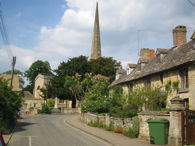



Kidlington, United Kingdom
Kidlington is a town of 13,600 people in England, United Kingdom.
Why visit Kidlington
Townapedia lists 10 museums and landmarks, 11 parks and trails, 41 places to eat, 3 places to stay and 5 attractions in and around town.
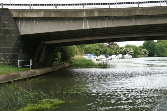
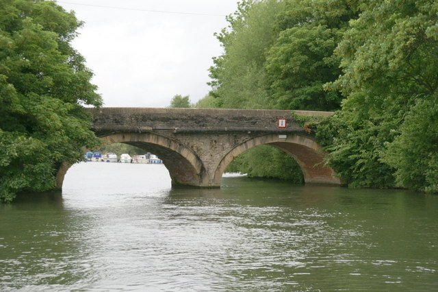
Highlights include A34 Road Bridge, Godstow Bridge, Blenheim Palace and Oxford Bus Museum.
Weather in Kidlington
Forecast from MET Norway (CC BY 4.0). Full forecast
About Kidlington
Kidlington is a town in the Cherwell district of Oxfordshire, England (as of the 19th February 2026). In February 2026, Kidlington Parish Council voted unanimously to change its status from a village to a town.
From the Wikipedia article Kidlington (this version), under CC BY-SA 4.0.
Travel tips from other travellers: Kidlington on Wikivoyage (CC BY-SA 4.0).
Things to do5


Godstow Bridge
Bridge · 3.0 mi
Grade II listed bridge in Oxford, Oxfordshire, England, UK

King's Lock
Bridge · 2.4 mi
Lock on the River Thames in Oxfordshire, England


Museums and landmarks10

Blenheim Palace
Museum · 3.4 mi
Country house near Woodstock, Oxfordshire, England, UK
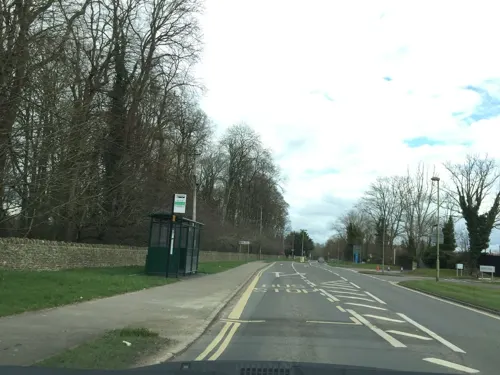
Oxford Bus Museum
Museum · 3.6 mi
Transport museum in Oxfordshire, England, United Kingdom

Soldiers of Oxfordshire Museum
Museum · 3.5 mi
Military museum in Woodstock, England, United Kingdom



Oxfordshire Museum
Museum · 3.4 mi
Museum in Woodstock, Oxfordshire, United Kingdom

Parks, trails and playgrounds11

Hook Meadow and The Trap Grounds
Park · 3.1 mi
Site of Special Scientific Interest, Oxford, England


Restaurants and cafes41

Mayflower
Restaurant · Chinese · 0.8 mi
25-28 Fairfax Centre, Oxford Road, Kidlington
Mo-Su 12:00-13:45, Mo-Th,Su 17:10-22:00, Fr-Sa 17:10-22:15
The Jolly Boatman
Bar and pub · 1.2 mi
216 Banbury Road, Shipton On Cherwell
Mo-Sa 12:00-22:00; Su 12:00-20:00
Oxford House Cafe
Cafe · 0.4 mi
144 Oxford Road
Mo-Fr 07:00-18:00; Sa-Su 07:00-16:00




29 more on the map.
History
Kidlington's toponym derives from the Old English Cudelinga tun: the tun (settlement) of the "Kidlings" (sons) of Cydel-hence. The Domesday Book in 1086 records Chedelintone. By 1214 the spelling Kedelinton appears in a Calendar of Bodleian Charters. The Church of England parish church of St Mary the Virgin dates from 1220, but there is evidence of a church on the site since 1073. St Mary's has fine medieval stained glass and a 165-foot (50 m) spire known as "Our Lady's Needle". It is a Grade I listed building. The tower has a ring of eight bells. Richard III Chandler of Drayton Parslow, Buckinghamshire, cast the seventh bell in 1700. Abraham I Rudhall of Gloucester cast the tenor bell in 1708 and the fifth bell in 1715. Mears and Stainbank of the Whitechapel Bell Foundry cast the treble, second, third, fourth and sixth bells in 1897, the year of Queen Victoria's Diamond Jubilee.
Read more of the history
Behind the church are archaeological remains of a three-sided moat. St Mary's Rectory is Tudor. Beside the church are almshouses built by Sir William Morton in 1671 in memory of his wife and children, whose names are inscribed above the windows. Sir William was a Royalist Commander in the Civil War and lived in nearby Hampden Manor in Mill Street. Other residents of Hampden Manor have included Sir John Vanbrugh, during the building of Blenheim Palace in Woodstock. The square tower-water closet in the front garden of Hampden Manor was built by Vanbrugh. It drains into a brook that now runs underground along Mill Street into the nearby Cherwell. Thomas Beecham formulated his pills while living in a cottage near the manor and worked for a time as a gardener for John Sydenham.
The settlement listed in Domesday grew from an ancient village close to the church. It has as many 18th-century Georgian buildings as modern houses. Until the Kidlington Inclosure Act 1810 (50 Geo. 3. c. clviii) was implemented in 1818, a large area south of it was unenclosed common land and the village widely known as Kidlington-on-the-Green. The land was built up as a garden city just before the Second World War. In the 1920s and 1930s, Kidlington was subject to ribbon development along the main (now A4260) road through the village. Since 1945 many housing estates have been built behind this on both sides. Oxford Zoo was once located in Kidlington, where the Thames Valley Police headquarters now stands. It was open only from 1931 to 1937, when the animals were transferred to Dudley Zoo. In 2018, an elephant sculpture was installed on a roundabout at the southern end of Kidlington to commemorate the zoo and an elephant that lived there.
In the 20th century, Kidlington grew to be a contender for largest village in England (even in Europe), with a population of 13,723, compared with 1,300 in 1901. Its residents previously resisted efforts to change its official status to a town. After a peremptory change by the Parish Council to town status in November 1987, this was voted down by 83 per cent three months later in a ballot of the local electorate. In February 2026, Kidlington officially became a town.
From the History section of Kidlington on Wikipedia, under CC BY-SA 4.0.
More about Kidlington
Economy
The headquarters of Oxfordshire Fire and Rescue Service, Thames Valley Police and the county St. John Ambulance are in Kidlington, as is Oxford Airport, renamed London Oxford Airport in 2009. Since 1962 the airport has had a pilot training school for thousands from airlines in more than 40 countries. It is also home to one of the bases for the Children's Air Ambulance.
There are several industrial and business parks and a motor park in the north of the village. Opposite is Langford Locks industrial estate and Oxford Motor Park, with showrooms for Honda, Nissan, Toyota and other makes. Other businesses include Essentra Components, Eurocopter and Guylian Chocolates. Campsfield House, an immigration detention centre run for the UK government, is near the industrial area and the airport.
Arts and culture
In June 2016, the BBC reported that weekly coachloads of sightseers from China were arriving on Benmead Road, Kidlington, and seen posing for photos in front gardens and against parked cars, with no apparent reason for their interest. The story attracted worldwide interest, with Kidlington locals offering interviews about their experience. In November 2016, after analysing results of a Chinese-language questionnaire given to some tourists, the BBC found that "looking for the true sense" of Britain was one reason for the visits. An investigative journalist found that in fact Chinese tour operators charge £50 (US$68) extra for Chinese-language tours of nearby Blenheim Palace. Tourists who do not want to pay to visit Blenheim are dropped off in Kidlington, which they find charming, but which tour operators select because it is too far from Blenheim to enable tourists to walk to the Palace and pay the cheaper £13 (US$25) price for public tours in English.
From the Wikipedia article Kidlington, under CC BY-SA 4.0.
Notable people from Kidlington
 Callum O'DowdaIrish footballerPhoto: Timmy96, CC0
 Callum SlatteryEnglish footballerPhoto: Timmy96, CC0
- Jimmy GilesEnglish footballer and manager (born 1946)
- Elizabeth Montgomery WilmotEnglish theatre and opera costume and scenic designer (1902-1993)
Born in Kidlington, according to Wikidata (CC0). Each name links to its Wikipedia article.
Where to stay3
Churches and places of worship15
Shopping11
Gas and EV charging4
Schools, colleges and libraries9
West Kidlington Primary and Nursery School
School · 0.4 mi
Oxford Road, Kidlington
Healthcare3
Map of Kidlington
112 places. The map loads OpenStreetMap tiles when you open it.
Getting there and nearby towns
Oxford Airport (OXF) is the nearest airport with scheduled flights listed in OpenStreetMap, 2 miles away.
- Oxford 5 mi south, about 8 min by car
- Witney 9 mi west, about 14 min by car
- Thame 14 mi east, about 23 min by car
- Wallingford 17 mi southeast, about 27 min by car
- Wantage 17 mi south, about 28 min by car
- Milton Keynes 27 mi northeast, about 44 min by car
- High Wycombe 27 mi southeast, about 43 min by car
- Tring 27 mi east, about 43 min by car
- Swindon 28 mi southwest, about 45 min by car
- Reading 29 mi southeast, about 46 min by car
Drive times are estimates from straight-line distance, not routes.
Towns near Kidlington


Keep exploring
Local news
Headlines from INDB.
Reviews, tips and questions
Loading what members have shared...
Sources and licences
- GeoNames (CC BY 4.0): population, coordinates, regions and time zone
- Mapillary (see each image): photos
- OpenStreetMap contributors (ODbL 1.0): places, airports, map data
- Wikidata (CC0 1.0): elevation, founding date, time zone, website, landmarks and historic places
- Wikimedia Commons (see each image): photos
- Wikipedia (CC BY-SA 4.0): overview and history text
Photo credits
- Kidlington old village, Andrew Chapman, CC BY-SA 2.0
- Exeter House, Crown Road, Kidlington, Oxfordshire, Mertbiol, CC0
- A34 Thames Bridge 909053 db01759e-by-Pierre-Terre, Pierre Terre, CC BY-SA 2.0
- Godstow Bridge, Pierre Terre, CC BY-SA 2.0
- Blenheim Palace 6-2008 4, Jvhertum, Public domain
- St Andrews Church Oxford, User:Mtcv, CC BY-SA 4.0
- St. Martin's Church, Bladon 11, Simon Burchell, CC BY-SA 4.0
- Islip StNicholasTheConfessor E, Motacilla, CC BY-SA 3.0
- Yarnton StBartholomew southeast, Motacilla, CC BY-SA 3.0
- WaterEaton ManorHouse closeup, Motacilla, CC BY-SA 4.0
- HamptonPoyle StMary northeast, Motacilla, CC BY-SA 4.0
- Yarnton Manor east, Motacilla, CC BY-SA 3.0
- HamptonGay StGiles SE 01, Motacilla, CC BY-SA 3.0
- Gosford KingsArms SE, Motacilla, CC BY-SA 4.0
- Shipton-on-Cherwell HolyCross, Motacilla, CC BY-SA 3.0
- St. Bartholomew's Church, Yarnton 05, Simon Burchell, CC BY-SA 4.0
- Waterloo Medal - Charles Rowan, DilletantiAnonymous, CC BY-SA 4.0
- Street-level photo, southglos, CC BY-SA 4.0
- Street-level photo, southglos, CC BY-SA 4.0
- Street-level photo, alexanderar, CC BY-SA 4.0
- Street-level photo, jerome_pietri, CC BY-SA 4.0
- Street-level photo, alexanderar, CC BY-SA 4.0
- Street-level photo, trigpoint, CC BY-SA 4.0
- Street-level photo, laye, CC BY-SA 4.0
- Street-level photo, adam2, CC BY-SA 4.0
- Street-level photo, trigpoint, CC BY-SA 4.0
- Street-level photo, southglos, CC BY-SA 4.0
- Street-level photo, alexanderar, CC BY-SA 4.0
- Street-level photo, southglos, CC BY-SA 4.0
- Street-level photo, southglos, CC BY-SA 4.0
- Street-level photo, southglos, CC BY-SA 4.0
- Street-level photo, alexanderar, CC BY-SA 4.0
- Street-level photo, alexanderar, CC BY-SA 4.0
- Street-level photo, alexanderar, CC BY-SA 4.0


Page built November 10, 2026. Spotted a mistake? Tell us or suggest a place.