


Why visit Kūdlu
Townapedia lists 2 parks and trails, 6 places to eat, 1 place to stay and 2 attractions in and around town.
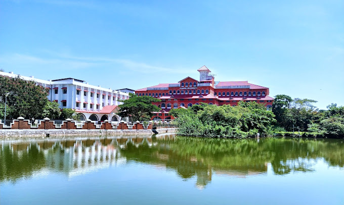
Highlights include Kannur University.
Weather in Kūdlu
Forecast from MET Norway (CC BY 4.0). Full forecast
Things to do2
Kannur University
School · 4.9 km
State public university in Kannur, Kerala, India

Parks, trails and playgrounds2

Restaurants and cafes6



Where to stay1

Churches and places of worship17
Shivamangalam Sadashiva Temple
Place of worship · 1.5 km
Gopalakrishna Temple road, kasaragod
kuthiyala gopalakrishna temple
Place of worship · 1.5 km
Gopalakrishna Temple road, kasaragod
kuthiyala Sri Gopalakrisha Temple
Place of worship · 1.5 km
Gopalakrishna Temple road, kasaragod
Shopping4
Gas and EV charging2
Schools, colleges and libraries9
Sri Gopalakrishna High School Kudlu
School · 1.8 km
Madhur -Kasaragod Road, kudlu
Government Lower Primary School Kudlu
School · 2.1 km
GLPS Kudlu Madhur -Kasaragod Road, Meepuguri
Healthcare3
Ayurvedic Government hospital
Clinic and pharmacy · 1.9 km
Madhur -Kasaragod Road, KUDLU, KASARAGOD
Map of Kūdlu
46 places. The map loads OpenStreetMap tiles when you open it.
Getting there and nearby towns
Mangalore International Airport (IXE) is the nearest airport with scheduled flights listed in OpenStreetMap, 48 km away.
- Shiravāgilu 2 km northeast, about 2 min by car
- Kāsaragod 4 km south, about 4 min by car
- Madhūru 4 km east, about 4 min by car
- Kanhangad 28 km southeast, about 28 min by car
- Nīlēshwar 35 km southeast, about 35 min by car
- Mangaluru 45 km north, about 45 min by car
- Taliparamba 68 km southeast, about 1 h 15 min by car
- Pāppinisshēri 75 km southeast, about 1 h 15 min by car
- Kannur 84 km southeast, about 1 h 30 min by car
- Irikkūr 87 km southeast, about 1 h 30 min by car
Drive times are estimates from straight-line distance, not routes.
Local news
Headlines from INDB.
Reviews, tips and questions
Loading what members have shared...
Sources and licences
- GeoNames (CC BY 4.0): population, coordinates, regions and time zone
- OpenStreetMap contributors (ODbL 1.0): places, airports, map data
- Wikidata (CC0 1.0): elevation, founding date, time zone, website, landmarks and historic places
- Wikimedia Commons (see each image): photos
Photo credits
- Kannur Univerisity Thavakkara Campus, Rahul B Ashok, CC0
- Violetkandhari, ARUNKUMAR P.R, CC BY-SA 3.0
- Bhagavathi Temple, Kasargod, Shareef Taliparamba, CC BY-SA 2.0
- Thekkil Bridge, Kasargod (4804987002), Shareef Taliparamba, CC BY-SA 2.0
- Olayam Masjidh, Kasargod, Kerala, India. (4804983754), Shareef Taliparamba, CC BY-SA 2.0
- Ranipuram, Bibu Raj from THRISSUR, INDIA, CC BY 2.0
- Yakshagana on stage, Sandeep Kasaragod, CC BY-SA 4.0
- Ananthapura (6327138029), jinnibaba, CC BY 2.0
- Yakshgana, Sandeepkdeepu, CC BY-SA 4.0
- Nellikkunnu Mosque (4472451684), Shareef Taliparamba, CC BY-SA 2.0
- Neena Kurup in 2026, DwarakaDwaraka2026, CC BY 4.0
- Malik Deenar 2, Adilakv, CC BY-SA 4.0
- Sunni Mosque on Madhur Road, Prof tpms, CC BY-SA 4.0
- PMS Road. Nullippady. Kasaragod, Prof tpms, CC BY-SA 4.0


Page built November 3, 2026. Spotted a mistake? Tell us or suggest a place.