


Ajigasawa, Japan
鰺ヶ沢町
Ajigasawa is a town of 9,613 people in Aomori, Japan, founded in April 1, 1889.
Why visit Ajigasawa
Townapedia lists 16 museums and landmarks, 7 parks and trails, 16 places to eat, 7 places to stay and 17 attractions in and around town.
Highlights include Aomori Spring Resort, Kamegaoka Stone Age Site and Ōmori Katsuyama Site.
Weather in Ajigasawa
Forecast from MET Norway (CC BY 4.0). Full forecast
About Ajigasawa
Ajigasawa (鰺ヶ沢町, Ajigasawa-machi) is a town located in Aomori Prefecture, Japan. As of 31 December 2025, the town had an estimated population of 8,250 in 4282 households, and a population density of 24 persons per km2. The total area of the town is 343.08 square kilometres (132.46 sq mi).
From the Wikipedia article Ajigasawa, Aomori (this version), under CC BY-SA 4.0.
Things to do17


5 more on the map.
Museums and landmarks16

Kamegaoka Stone Age Site
Monument and historic site · 16.8 km
Settlement site of Jomon period Japan
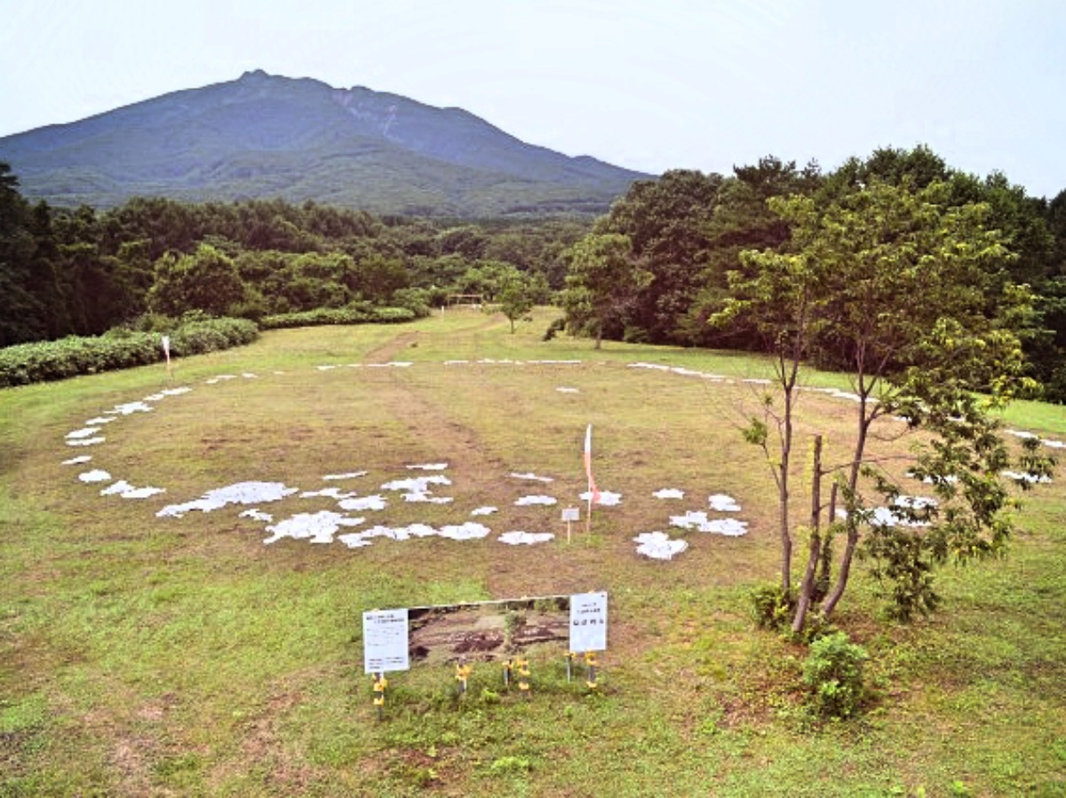
Ōmori Katsuyama Site
Monument and historic site · 15.5 km
Stone circle, settlement in Aomori, Japan


Tagoyano Shell Mound
Monument and historic site · 17.0 km
Archaeological site in Tsugaru, Tohoku, Japan


4 more on the map.
Parks, trails and playgrounds7



Restaurants and cafes16



4 more on the map.
History
Oura Mitsunobu, the founder of the Tsugaru clan, settled in Tanesato (now part of Ajigasawa) in 1491, which developed into a port for the Tsugaru region. The area around Ajigasawa was controlled by the Tsugaru clan of Hirosaki Domain during the Edo period, and Ajigasawa was a thriving port on the kitamaebune coastal trading route, and after the Meiji restoration, was one of the main commercial fishing centers in Aomori. Ajigasawa became a village in Nishitsugaru District, Aomori with the establishment of the modern municipalities system on April 1, 1889, and was elevated to town status on March 31, 1955, by annexing the neighboring villages of Akaishi, Nakamura, Narusawa and Maido.
From the History section of Ajigasawa, Aomori on Wikipedia, under CC BY-SA 4.0.
Where to stay7
Churches and places of worship7
Shopping6
Gas and EV charging5
Schools, colleges and libraries8
Healthcare6
Map of Ajigasawa
95 places. The map loads OpenStreetMap tiles when you open it.
Getting there and nearby towns
Aomori Airport (AOJ) is the nearest airport with scheduled flights listed in OpenStreetMap, 41 km away.
- Tsugaru 17 km east, about 17 min by car
- Tsuruta 19 km east, about 19 min by car
- Goshogawara 20 km east, about 20 min by car
- Itayanagi 23 km east, about 23 min by car
- Fukaura 27 km southwest, about 27 min by car
- Fujisaki 28 km southeast, about 28 min by car
- Nakasato 29 km northeast, about 29 min by car
- Hirosaki 30 km southeast, about 30 min by car
- Namioka 33 km east, about 33 min by car
- Kuroishi 35 km southeast, about 35 min by car
Drive times are estimates from straight-line distance, not routes.
Local news
Headlines from INDB.
Reviews, tips and questions
Loading what members have shared...
Sources and licences
- GeoNames (CC BY 4.0): population, coordinates, regions and time zone
- OpenStreetMap contributors (ODbL 1.0): places, airports, map data
- Wikidata (CC0 1.0): elevation, founding date, time zone, website, landmarks and historic places
- Wikimedia Commons (see each image): photos
- Wikipedia (CC BY-SA 4.0): overview and history text
Photo credits
- Ajigasawa1, Bouldernavigator, CC BY-SA 3.0
- Aomori Prefectural Ajigasawa High School, 掬茶, CC BY-SA 4.0
- Ajigasawa town Ajigasawa junior high school, 掬茶, CC BY-SA 4.0
- Ajigasawa town Maito elementary school, 掬茶, CC BY-SA 4.0
- Aomori prefectural Ajigasawa high school 20210724, 掬茶, CC BY-SA 4.0
- Ajigasawa municipal swimming pool, 掬茶, CC BY-SA 4.0
- Ajigasawa town Saikai elementary school, 掬茶, CC BY-SA 4.0
- Ajigasawa Summary Court, 掬茶, CC BY-SA 4.0
- Ajigasawa Police Station 20190908, 掬茶, CC BY-SA 4.0
- Ajigasawa Town Hall 20190908, 掬茶, CC BY-SA 4.0
- Ajigasawa town Chuo community centre, 掬茶, CC BY-SA 4.0
- NTT Ajigasawa building, 掬茶, CC BY-SA 4.0
- Aomori Bank Ajigasawa branch, 掬茶, CC BY-SA 4.0
- Ajigasawa Post Office 20190908, 掬茶, CC BY-SA 4.0
- Ajigasawa Town Beach Crocodile Sand Art 20200710a, ワニの製作者不明 / 撮影者 あおもりくま, Public domain
- Ajigasawa Shopping Center PAL, 掬茶, CC BY-SA 4.0
- Resort Shirakami Aoike (I) at Ajigasawa Station 2008-06-04, sodai gomi, CC BY 2.0
- Nihonkai Kyotenkan Ajigasawa, 掬茶, CC BY-SA 4.0
- Maitomachi, Ajigasawa, Nishitsugaru District, Aomori Prefecture 038-2761, Japan - panoramio (1), torakiti, CC BY 3.0
- Ajigasawa Town Hall 20210724c, 掬茶, CC BY-SA 4.0
- Ajigasawa Town Hall 20210724b, 掬茶, CC BY-SA 4.0
- Ajigasawa Town Hall 20210724a, 掬茶, CC BY-SA 4.0
- Ajigasawa Fire Station, 掬茶, CC BY-SA 4.0
- Kamegaoka2, MChew, CC BY-SA 4.0
- Omori-Katsuyama Stone Circle, MChew, CC BY-SA 4.0
- Tagoyano Shell Mound 02, Indiana jo, CC BY-SA 4.0
- Naqua Shirakami Ski Resort, Ski Mania, Public domain
- Fukaura town Shudo elementary school, 掬茶, CC BY-SA 4.0
- Azigasawa gyôkô1, らんで, CC BY 4.0
- Japanese-national-railways-48640-20110614, LERK, CC BY 3.0
- Azigasawa gyôkô2, らんで, CC BY 4.0
- Resort-shirakami-buna-20110614-172014, LERK, CC BY-SA 4.0
- RAPID TRAIN SHIRAKAMI - panoramio, tsushima, CC BY 3.0
- Gono line 20221230161003 (52646496246), inunami, CC BY 2.0
- 鰺ヶ沢付近の風景 - panoramio, くろふね, CC BY 3.0
- 鰺ヶ沢駅 - panoramio, くろふね, CC BY 3.0
- Maito Post Office, 掬茶, CC BY-SA 4.0
- Azigasawa gyôkô3, らんで, CC BY 4.0
- Tsugaru Shirakami branch, JA Tsugaru-Nishikita, 掬茶, CC BY-SA 4.0
- Dried Cuttlefish Curtain - panoramio, Ryuetsu Kato, CC BY 3.0


Page built November 5, 2026. Spotted a mistake? Tell us or suggest a place.