
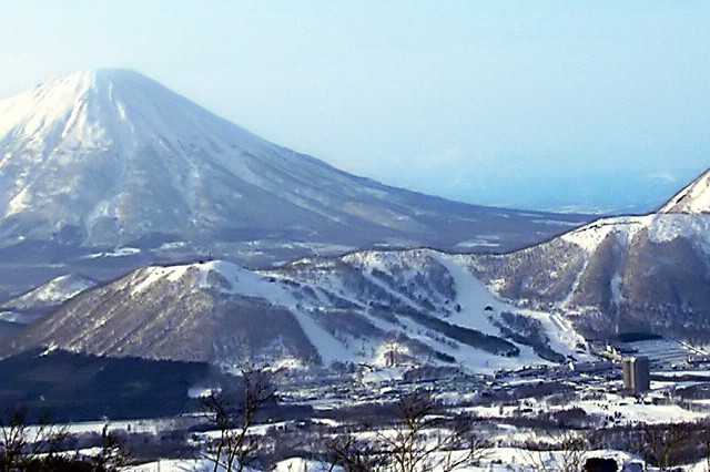


Why visit Kimobetsu
Townapedia lists 15 museums and landmarks, 15 parks and trails, 7 places to eat and 3 attractions in and around town.
Highlights include Satonoeki Hot Kimobetsu and Rusutsu Resort.
Weather in Kimobetsu
Forecast from MET Norway (CC BY 4.0). Full forecast
Things to do3

Satonoeki Hot Kimobetsu
Farm and orchard
営業時間 10:00~16:00(月により変動あり),定休日 無休(冬季は不定休)
3, 喜茂別町
Mo-Su 10:00-16:00
Rusutsu Resort
Ski area · 5.2 km
Resort in Rusutsu, Hokkaido Prefecture, Japan

Museums and landmarks15


3 more on the map.
Parks, trails and playgrounds15


3 more on the map.
Restaurants and cafes7


Churches and places of worship8
Shopping1
Gas and EV charging1
Schools, colleges and libraries1
Map of Kimobetsu
51 places. The map loads OpenStreetMap tiles when you open it.
Getting there and nearby towns
Sapporo Okadama Airport (OKD) is the nearest airport with scheduled flights listed in OpenStreetMap, 51 km away.
- Rusutsu 8 km southwest, about 8 min by car
- Kyōgoku 8 km north, about 8 min by car
- Makkari 11 km west, about 11 min by car
- Kutchan 20 km northwest, about 20 min by car
- Rankoshimachi 32 km west, about 32 min by car
- Date 36 km south, about 36 min by car
- Noboribetsu 43 km southeast, about 43 min by car
- Niki 42 km north, about 42 min by car
- Shiraoi 43 km southeast, about 43 min by car
- Sapporo 46 km northeast, about 46 min by car
Drive times are estimates from straight-line distance, not routes.
Local news
Headlines from INDB.
Reviews, tips and questions
Loading what members have shared...
Sources and licences
- GeoNames (CC BY 4.0): population, coordinates, regions and time zone
- OpenStreetMap contributors (ODbL 1.0): places, airports, map data
- Wikidata (CC0 1.0): elevation, founding date, time zone, website, landmarks and historic places
- Wikimedia Commons (see each image): photos
Photo credits
- Rusutsu WestMt(200703), E-190, CC BY-SA 3.0
- Mt.youtei 羊蹄山 - panoramio, taku-k, CC BY 3.0
- 尻別岳, Wakimasa, Public domain
Page built November 5, 2026. Spotted a mistake? Tell us or suggest a place.