


Shimonita, Japan
下仁田町
Shimonita is a town of 7,058 people in Gunma, Japan, founded in April 1, 1889.
Why visit Shimonita
Townapedia lists 31 museums and landmarks, 22 parks and trails, 68 places to eat, 5 places to stay and 27 attractions in and around town.
Highlights include Gunma Safari Park, Mt Myogi, Tomioka Silk Mill and 富岡市立美術博物館・福沢一郎記念美術館.
Weather in Shimonita
Forecast from MET Norway (CC BY 4.0). Full forecast
About Shimonita
Shimonita (下仁田町, Shimonita-machi) is a town located in Gunma Prefecture, Japan. As of 31 August 2020, the town had an estimated population of 7,058 in 3,292 households, and a population density of 37 persons per km2. The total area of the town is 188.38 square kilometres (72.73 sq mi). Shimonita is famous for its konjac and Welsh onion.
From the Wikipedia article Shimonita, Gunma (this version), under CC BY-SA 4.0.
Things to do27




15 more on the map.
Museums and landmarks31

Tomioka Silk Mill
Monument and historic site · 10.3 km
Silk reeling factory in Tomioka, Gunma prefecture, Japan




19 more on the map.
Parks, trails and playgrounds22


10 more on the map.
Restaurants and cafes68


東陽軒
Restaurant · Chinese · 0.7 km
毎週月曜日定休日 他、不定休
366-22 下仁田, 甘楽郡下仁田町
17:00-21:00
白雲亭
Restaurant · Barbecue, Korean · 10.9 km
Mo off; Tu-Fr 11:00-14:00,15:30-21:00; Sa-Su 11:00-14:00,16:30-21:00
56 more on the map.
History
During the Edo period, the area of present-day Shimonita was largely part of the tenryō territory held directly by Tokugawa shogunate within Kōzuke Province. The town of Shimonita was created within Kitakanra District of Gunma Prefecture on April 1, 1889, with the creation of the modern municipalities system after the Meiji Restoration. In 1950, Kitakanra District was renamed Kanra District. Shimonita annexed the neighboring villages of Osaka, Saimoku, Aokura and Mayama on March 10, 1955.
From the History section of Shimonita, Gunma on Wikipedia, under CC BY-SA 4.0.
Where to stay5
Churches and places of worship32
Shopping14
Gas and EV charging7
Schools, colleges and libraries35
Healthcare9
Map of Shimonita
250 places. The map loads OpenStreetMap tiles when you open it.
Getting there and nearby towns
Yokota Air Base (OKO) is the nearest airport with scheduled flights listed in OpenStreetMap, 73 km away.
- Tomioka 11 km east, about 11 min by car
- Annaka 16 km northeast, about 16 min by car
- Yoshii 18 km east, about 18 min by car
- Karuizawa 20 km northwest, about 20 min by car
- Takasaki 25 km northeast, about 25 min by car
- Fujioka 26 km east, about 26 min by car
- Saku 27 km west, about 27 min by car
- Miyota 28 km northwest, about 28 min by car
- Kanekomachi 29 km northeast, about 29 min by car
- Ogano 29 km southeast, about 29 min by car
Drive times are estimates from straight-line distance, not routes.
Local news
Headlines from INDB.
Reviews, tips and questions
Loading what members have shared...
Sources and licences
- GeoNames (CC BY 4.0): population, coordinates, regions and time zone
- OpenStreetMap contributors (ODbL 1.0): places, airports, map data
- Wikidata (CC0 1.0): elevation, founding date, time zone, website
- Wikimedia Commons (see each image): photos
- Wikipedia (CC BY-SA 4.0): overview and history text
Photo credits
- Shimonita town office 1, Qurren ( talk ) Taken with Canon IXY 10S (Digital IXUS 210), CC BY-SA 3.0
- Shimonita Post office, Suikotei, CC BY 4.0
- Gunmaken Shinyoukumiai Shimonita Branch & Nanmoku Branch & Saimoku Branch, Suikotei, CC BY 4.0
- Shimonita Bus 02, Suikotei, CC BY 4.0
- Shimonitakosei Hospital, Suikotei, CC BY 4.0
- Maruhei Shimonita, photo: Qurren Taken with Canon IXY 430F (Digital IXUS 245 HS), CC BY-SA 3.0
- Suwa-jinja (Shimonita, Gunma) torii, photo: Qurren Taken with Canon IXY 430F (Digital IXUS 245 HS), CC BY-SA 3.0
- Suwa-jinja (Shimonita, Gunma), photo: Qurren Taken with Canon IXY 430F (Digital IXUS 245 HS), CC BY-SA 3.0
- Shimonita town office 2, Qurren ( talk ) Taken with Canon IXY 10S (Digital IXUS 210), CC BY-SA 3.0
- Shimonita warehouse, photo: Qurren Taken with Canon IXY 430F (Digital IXUS 245 HS), CC BY-SA 3.0
- Shimonita head works, photo: Qurren ( talk ) Taken with Canon IXY 10S (Digital IXUS 210), CC BY-SA 3.0
- Shimonita Town Natural History Museum, photo: Qurren Taken with Canon IXY 430F (Digital IXUS 245 HS), CC BY-SA 3.0
- Joshin-etsu Expressway Shimonita Interchange, Yasu ( talk ), CC BY-SA 3.0
- Tomioka Silk Mill East Cocoon Warehouse05, Hasec, Public domain
- Mt-myogi-in-summer, Jesse Fuller, CC BY-SA 3.0
- Ichinomiya Nukisaki-jinja, shaden-1, Saigen Jiro, CC0
- Uge-jinja, haiden, Saigen Jiro, CC0
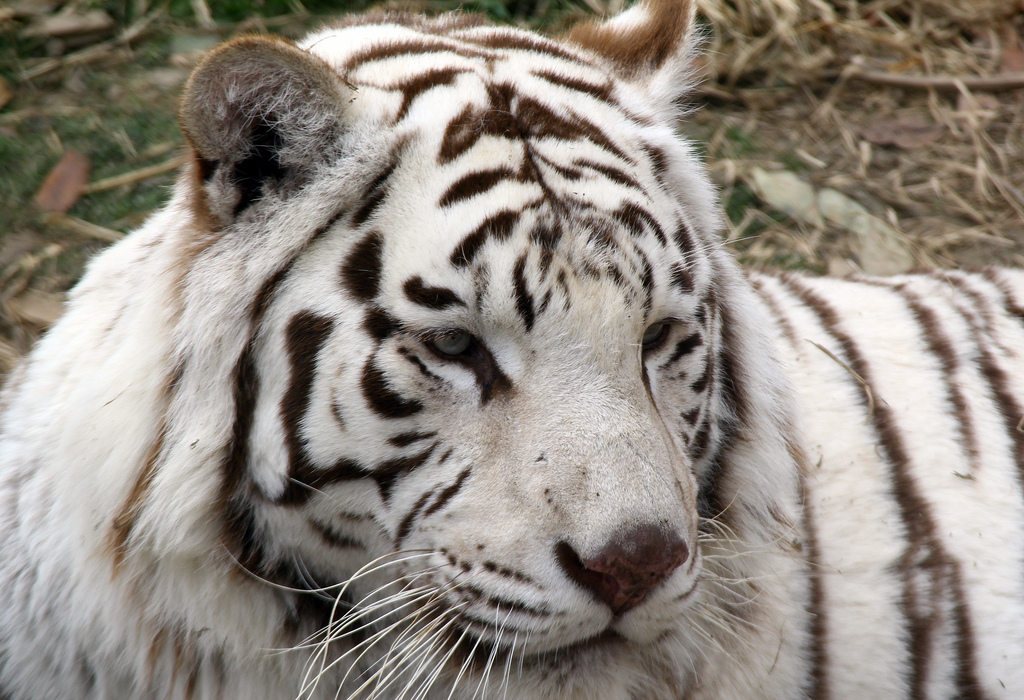
- White tiger2, diloz さん https://www.flickr.com/photos/diloz/, CC BY 2.0
- Shimonita high school, Altomarina, CC BY-SA 3.0
- Matsuida High School, M yanagisawa, CC BY 3.0
- Gunma Museum Of Natural History and Tomioka Kabura Bunka Hall, photo: Qurren ( talk ) Taken with Canon IXY 10S (Digital IXUS 210), CC BY-SA 3.0
- Mt.akaguna peak, Tatsuo TANABE, CC BY 3.0
- Tomioka city auditorium, photo: Qurren ( talk ) Taken with Samsung Galaxy J (NTT docomo SC-02F), CC BY-SA 3.0
- Tomioka Art Museum, photo: Qurren ( talk ) Taken with Canon IXY 10S (Digital IXUS 210), CC BY-SA 3.0
- 黒瀧山不動寺, 足利うじうじ, CC0
- 林道(甘楽町方面)から見た稲含山, Koda6029, CC0
- Jyoushin deki1+2 side, まも(Mamo), Public domain
- Jyoushin deki1, まも(Mamo), Public domain
- Aoiwa park, photo: Qurren ( talk ) Taken with Canon IXY 10S (Digital IXUS 210), CC BY-SA 3.0
- Kabura River from Torazu Bridge, photo: Qurren ( talk ) Taken with Canon IXY 10S (Digital IXUS 210), CC BY-SA 3.0
- Kabura River banner, photo: Qurren ( talk ) Taken with Canon IXY 10S (Digital IXUS 210) , cropped by Tmv, CC BY-SA 3.0
- Torazu Gorge, photo: Qurren ( talk ) Taken with Canon IXY 10S (Digital IXUS 210), CC BY-SA 3.0
- 千平駅 - Sendaira Stacio - Sendaira Station - panoramio, takeshi yagi, CC BY-SA 3.0
- ISS045-E-90177 - View of Earth, Earth Science and Remote Sensing Unit , Lyndon B. Johnson Space Center, Public domain
- ISS050-E-39380 - View of Earth, Earth Science and Remote Sensing Unit , Lyndon B. Johnson Space Center, Public domain
- ISS050-E-39379 - View of Earth, Earth Science and Remote Sensing Unit , Lyndon B. Johnson Space Center, Public domain
- ISS045-E-90176 - View of Earth, Earth Science and Remote Sensing Unit , Lyndon B. Johnson Space Center, Public domain
- ISS045-E-90178 - View of Earth, Earth Science and Remote Sensing Unit , Lyndon B. Johnson Space Center, Public domain
- 鍬柄岳 2011-11-23 - Mount Kuwagara - panoramio, takeshi yagi, CC BY-SA 3.0
- Nanmoku head works, photo: Qurren ( talk ) Taken with Canon IXY 10S (Digital IXUS 210), CC BY-SA 3.0


Page built November 5, 2026. Spotted a mistake? Tell us or suggest a place.