


Tachikawa, Japan
立川市
Tachikawa is a town of 183,581 people in Tokyo, Japan, founded in April 1, 1889.
Why visit Tachikawa
Townapedia lists 11 museums and landmarks, 77 parks and trails, 286 places to eat, 16 places to stay and 20 attractions in and around town.
Highlights include Hitotsubashi University, Jissen Women's University, Emperor Shōwa Memorial Museum and National Institute of Polar Research.
Weather in Tachikawa
Forecast from MET Norway (CC BY 4.0). Full forecast
About Tachikawa
Tachikawa (立川市, Tachikawa-shi; Japanese pronunciation: [tä̀.c̟͡ɕi̥.kä̀.β̞ä̀, -kä́.β̞ä̀, -kä́.β̞ä́.ɕì]) is a city located in the western portion of the Tokyo Metropolis, Japan. As of 1 March 2021, the city had an estimated population of 184,383 in 93,428 households, and a population density of 7,600 persons per km2. The total area of the city is 24.36 square kilometres (9.41 sq mi).
From the Wikipedia article Tachikawa, Tokyo (this version), under CC BY-SA 4.0.
Travel tips from other travellers: Tachikawa on Wikivoyage (CC BY-SA 4.0).
Things to do20

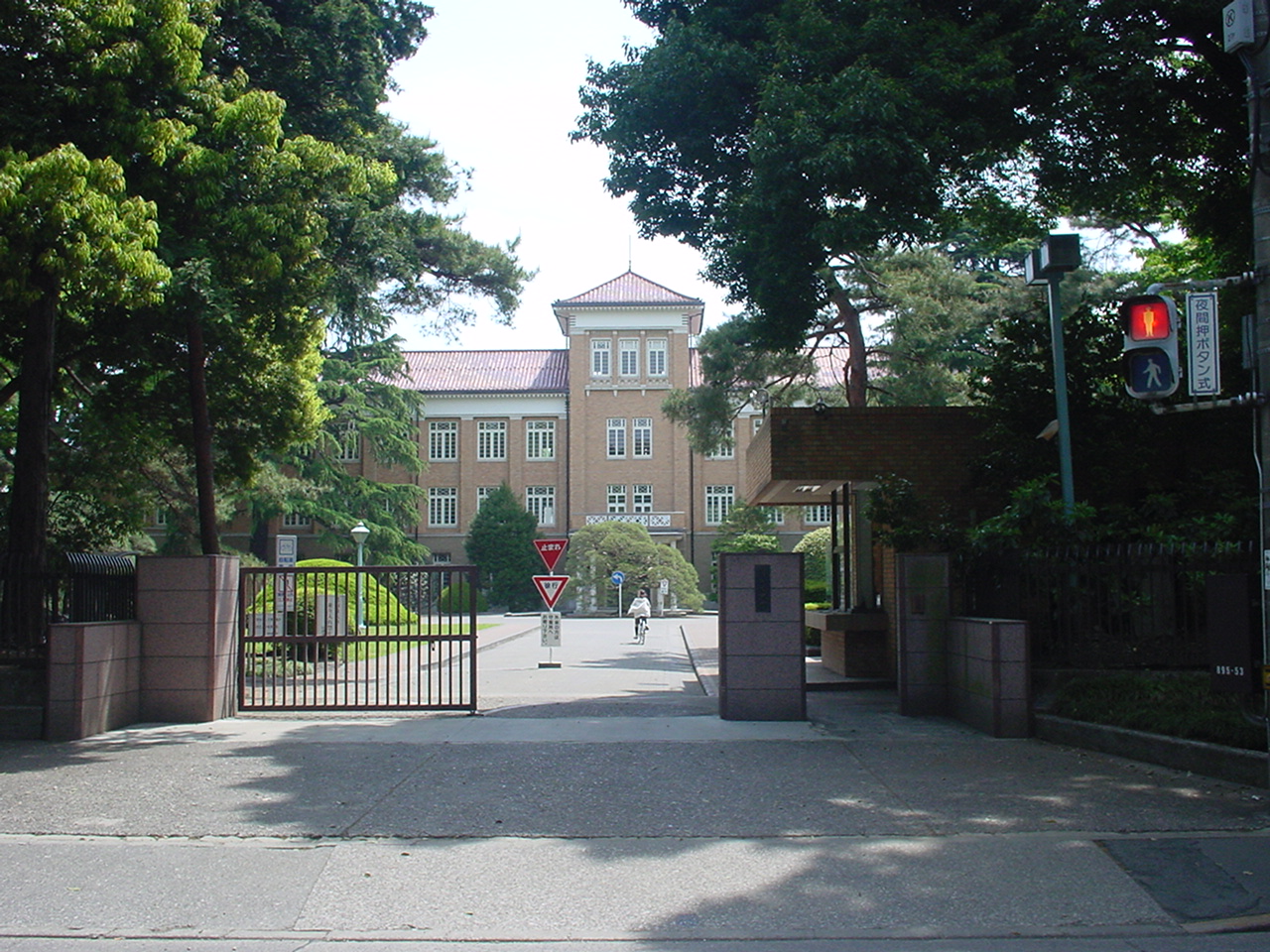
Hitotsubashi University
School · 2.9 km
National university in Kunitachi, Tokyo, Japan

Jissen Women's University
School · 4.9 km
Japanese women's university

Kunitachi College of Music
School · 2.7 km
Private University in Tokyo


Musashino Art University
School · 3.2 km
University in Kodaira, western Tokyo

Seibu-en
Monument and historic site · 6.9 km
Amusement park in Tokorozawa, Japan


Sugino Fashion College
School · 7.0 km
Private college in Shinagawa, Tokyo, Japan


Tokyo University of Agriculture and Technology
School · 6.1 km
Universities and colleges in Tokyo

8 more on the map.
Museums and landmarks11


Kodaira Hirakushi Denchu Art Museum
Museum · 5.2 km
Art museum in Tokyo, Japan

Suzuki Site
Monument and historic site · 7.1 km
Archaeological site in Kodaira, Japan




Parks, trails and playgrounds77

Shōwa Memorial Park
Park · 1.7 km
Mar 01-Oct 31 Mo-Su 09:00-17:30; Nov 01-Feb 29 Mo-Su 09:30-16:30;...



65 more on the map.
Restaurants and cafes286



Doutor Coffee Shop
Cafe · Coffee Shop · 1.4 km
2, 立川市
Mo-Fr 07:00-22:00; Sa 07:30-22:00; Su,PH 07:30-21:30


274 more on the map.
History
The area of present-day Tachikawa was part of ancient Musashi Province and was controlled from the Heian period through the Sengoku period by the Tachikawa clan. In the Edo period, it was little more than a village along the Koshu Kaido. In the post-Meiji Restoration cadastral reform of July 22, 1878, the area became part of Kitatama District in Kanagawa Prefecture In the Meiji period, the opening of what would later become the Chuo Main Line in 1889 led to a large-scale land development and on April 1, 1889, with the establishment of the modern municipalities law, the village of Tachikawa was created. Kitatama District was transferred to the administrative control of Tokyo Metropolis on April 1, 1893. Tachikawa Airfield was established in 1922 by the Imperial Japanese Army, and Tachikawa was elevated to town status the following year. On December 1, 1940, Tachikawa was elevated to city status. Before the war, Tachikawa was a military town centered on Tachikawa Airfield, and even after the war, it was a major base for the U.S. military until 1977.
From the History section of Tachikawa, Tokyo on Wikipedia, under CC BY-SA 4.0.
Where to stay16
Churches and places of worship25
Shopping54
Gas and EV charging4
Schools, colleges and libraries49
Healthcare38
Map of Tachikawa
250 places. The map loads OpenStreetMap tiles when you open it.
Getting there and nearby towns
Yokota Air Base (OKO) is the nearest airport with scheduled flights listed in OpenStreetMap, 7 km away.
- Akishima 4 km west, about 4 min by car
- Kokubunji 5 km east, about 5 min by car
- Higashimurayama 7 km northeast, about 7 min by car
- Hachiōji 10 km southwest, about 10 min by car
- Higashikurume 10 km northeast, about 10 min by car
- Tokorozawa 11 km northeast, about 11 min by car
- Nishi-Tokyo-shi 11 km east, about 11 min by car
- Musashino 13 km east, about 13 min by car
- Iruma 13 km north, about 13 min by car
- Aihara 15 km southwest, about 15 min by car
Drive times are estimates from straight-line distance, not routes.
Local news
Headlines from INDB.
Reviews, tips and questions
Loading what members have shared...
Sources and licences
- GeoNames (CC BY 4.0): population, coordinates, regions and time zone
- OpenStreetMap contributors (ODbL 1.0): places, airports, map data
- Wikidata (CC0 1.0): elevation, founding date, time zone, website, landmarks and historic places
- Wikimedia Commons (see each image): photos
- Wikipedia (CC BY-SA 4.0): overview and history text
Photo credits
- 2018 Showa Memorial Park 02, Kakidai, CC BY-SA 4.0
- Tachikawa-City-Tokyo---2026-06-14 016, RuinDig/Yuki Uchida, CC BY 4.0
- Tachikawa-City-Tokyo---2026-06-14 019, RuinDig/Yuki Uchida, CC BY 4.0
- Tachikawa-City-Tokyo---2026-06-14 020, RuinDig/Yuki Uchida, CC BY 4.0
- Tachikawa-City-Tokyo---2026-06-14 014, RuinDig/Yuki Uchida, CC BY 4.0
- Tachikawa-City-Tokyo---2026-06-14 005, RuinDig/Yuki Uchida, CC BY 4.0
- Tachikawa-City-Tokyo---2026-06-14 006, RuinDig/Yuki Uchida, CC BY 4.0
- Tachikawa-City-Tokyo---2026-06-14 007, RuinDig/Yuki Uchida, CC BY 4.0
- Tachikawa-City-Tokyo---2026-06-14 011, RuinDig/Yuki Uchida, CC BY 4.0
- Tachikawa-City-Tokyo---2026-06-14 013, RuinDig/Yuki Uchida, CC BY 4.0
- Tachikawa TakamatsuStation, Ludvig14, CC BY-SA 3.0
- Tachikawa-City-Tokyo---2026-06-14 328, RuinDig/Yuki Uchida, CC BY 4.0
- Tachikawa-City-Tokyo---2026-06-14 008, RuinDig/Yuki Uchida, CC BY 4.0
- Tachikawa-City-Tokyo---2026-06-14 009, RuinDig/Yuki Uchida, CC BY 4.0
- Tachikawa-City-Tokyo---2026-06-14 330, RuinDig/Yuki Uchida, CC BY 4.0
- Kanematsu auditorium, Wiiii, CC BY-SA 3.0
- Jissen Women's University Osakaue Campus02, Jinn0306, CC BY-SA 3.0
- Kunitachiondai2, The original uploader was Hykw-a4 at Japanese Wikipedia ., CC BY-SA 3.0
- Musashino Art University, The original uploader was Hykw-a4 at Japanese Wikipedia ., CC BY-SA 3.0
- Seibuen Amusement Park (11152952796), Tomohiro Ohtake from Kawasaki, Japan, CC BY 2.0
- Tokyokeizaiuniv, Original uploader was Hykw-a4 at ja.wikipedia, CC BY-SA 3.0
- Tokyo University of Agriculture and Technology Main Hall, Wiiii, CC BY-SA 3.0
- Tsudajukuuniv, The original uploader was Hykw-a4 at Japanese Wikipedia ., CC BY-SA 3.0
- Kodaira Hirakushi Denchu Art Museum front, Calton, CC BY-SA 4.0
- Suzuki Remains Museum, Nyao148, CC BY-SA 3.0
- Fuchunomorikoen, っ, CC BY-SA 3.0
- Satoyamaminkah, four horsemen, CC BY-SA 3.0
- Tama-zoo, Dddeco at Japanese Wikipedia, CC BY-SA 3.0
- Tonogayato1, Irina Gelbukh, CC BY-SA 3.0
- Showa Commemorative National Government Park 1, Kakidai, CC BY-SA 4.0
- Tachikawakeirinjounai, ウェルワィ at Japanese Wikipedia, CC BY-SA 3.0
- Emperor Showa Memorial Museum 20051213, al-hayat, CC BY 2.0
- Tachikawa Hospital 20180617, Waka77, Public domain
- Local Autonomy College, Altomarina, CC BY-SA 3.0
- Isetan Tachikawa 0804, User:ITA-ATU, CC BY-SA 3.0
- Suwa Shrine 20190513(2), 白田太郎, CC BY-SA 4.0
- AzusamiTenjinsha 2019-12-01 sa(1), Araisyohei, CC BY 4.0
- Tokyo Metropolitan Tachikawamidori HS-1, Nyao148, CC BY-SA 4.0
- National Institute of Japanese Literature, Tamago915 ( talk ), CC BY-SA 3.0
- Meisei University Hino Campus, Abasaa, Public domain
- Sugino Fashion College, Shinagawa, Tokyo, Japan, Hykw-a4 at ja.wikipedia., CC BY-SA 3.0
- Siraumegakuen, The original uploader was Hykw-a4 at Japanese Wikipedia ., CC BY-SA 3.0
- Takashimaya Tachikawa, ITA-ATU, CC BY-SA 3.0
- Itoen Kagurazaka building, Mochizuki1018, CC BY 4.0
- Disaster Medical Center, osekkai, CC BY-SA 3.0
- Polar Science Museum in Jan 2016, Sho Kuroda, CC BY-SA 4.0
- Hachikokuyama Taiken no Sato 2023-09-10, Asanagi, CC0


Page built November 4, 2026. Spotted a mistake? Tell us or suggest a place.