


Takizawa, Japan
滝沢市
Takizawa is a town of 55,579 people in Iwate, Japan, founded in January 1, 2014.
Why visit Takizawa
Townapedia lists 21 museums and landmarks, 223 parks and trails, 91 places to eat, 8 places to stay and 29 attractions in and around town.
Highlights include Iwate Medical University, Iwate Prefectural University, Iwate Museum of Art and Yubunezawa Stone Circle.
Weather in Takizawa
Forecast from MET Norway (CC BY 4.0). Full forecast
About Takizawa
Takizawa (滝沢市, Takizawa-shi) is a city located in Iwate Prefecture, Japan. As of 31 March 2020, the city had an estimated population of 55,325 in 23,270 households, and a population density of 300 persons per km2. The total area of the city is 182.46 square kilometres (70.45 sq mi).
From the Wikipedia article Takizawa, Iwate (this version), under CC BY-SA 4.0.
Things to do29

Iwate Medical University
School · 10.9 km
Higher education institution in Iwate Prefecture, Japan

Iwate Prefectural University
School
Higher education institution in Iwate Prefecture, Japan



17 more on the map.
Museums and landmarks21

Iwate Museum of Art
Museum · 12.2 km
Art museum in Morioka, Iwate, Japan

Yubunezawa Stone Circle
Monument and historic site · 4.0 km
Archaeological site in Takizawa, Iwate, Japan




9 more on the map.
Parks, trails and playgrounds223
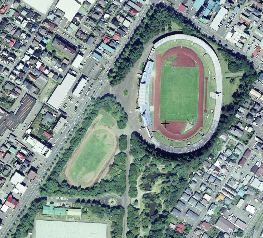


Iwate Morioka Stadium
Park · 7.2 km
Multi-use stadium in Morioka, Iwate, Japan


青山児童公園
Park · 8.7 km
参考URL http://www.city.morioka.iwate.jp/_res/projects/default_project/_page_/001/010/489/gaiku_zidou.pdf
4-1
211 more on the map.
Restaurants and cafes91



79 more on the map.
History
The area of present-day Takizawa was part of ancient Mutsu Province. During the Heian period, it was ruled by the Abe clan. During the Sengoku period, the area came under the control of the Nambu clan during the Edo period, who ruled Morioka Domain under the Tokugawa shogunate.
In the Meiji period, the village of Takizawa was established within Iwate District on April 1, 1889, with the establishment of the modern municipalities system. Takizawa was promoted directly from a village to a city on January 1, 2014.
From the History section of Takizawa, Iwate on Wikipedia, under CC BY-SA 4.0.
Where to stay8
Churches and places of worship43
Shopping32
Gas and EV charging9
Schools, colleges and libraries66
Healthcare44
Map of Takizawa
250 places. The map loads OpenStreetMap tiles when you open it.
Getting there and nearby towns
Hanamaki Airport (HNA) is the nearest airport with scheduled flights listed in OpenStreetMap, 42 km away.
- Morioka 12 km south, about 12 min by car
- Hachimantai 11 km north, about 11 min by car
- Shizukuishi 18 km southwest, about 18 min by car
- Yahaba 21 km south, about 21 min by car
- Semboku 35 km west, about 35 min by car
- Ichinohe 48 km north, about 48 min by car
- Hanawa 52 km northwest, about 52 min by car
- Kakunodatemachi 54 km southwest, about 54 min by car
- Ninohe 56 km north, about 56 min by car
- Kitakami 58 km south, about 58 min by car
Drive times are estimates from straight-line distance, not routes.
Local news
Headlines from INDB.
Reviews, tips and questions
Loading what members have shared...
Sources and licences
- GeoNames (CC BY 4.0): population, coordinates, regions and time zone
- OpenStreetMap contributors (ODbL 1.0): places, airports, map data
- Wikidata (CC0 1.0): elevation, founding date, time zone, website, landmarks and historic places
- Wikimedia Commons (see each image): photos
- Wikipedia (CC BY-SA 4.0): overview and history text
Photo credits
- Takizawa city Ippongi junior high school, 掬茶, CC BY-SA 4.0
- Takizawa City Hokubu Community Center, 掬茶, CC BY-SA 4.0
- Mount Iwate seen from Takizawa City in autumn 2022, 掬茶, CC BY-SA 4.0
- Takizawa city Yanagisawa elementary and junior high school, 掬茶, CC BY-SA 4.0
- Iwate-Medical-Univ-yahaba-20140426, Yskika, CC BY-SA 3.0
- Iwate Museum of Art, yisris / Yuichi, CC BY-SA 2.0
- 171103 Iwate University Morioka Iwate pref Japan19s3, 663highland, CC BY-SA 4.0
- 湯舟沢環状列石全景, 小池 隆, CC BY 3.0
- Iwate Prefectural Athletic Stadium, 国土地理院, CC BY 4.0
- Morioka Third High School, GENMEI Japan, CC BY-SA 3.0
- AEON Supercenter Morioka-Shibutami, 掬茶, CC BY-SA 4.0
- Iwate junior high school & iwate high school, 7t5w93tr, CC BY-SA 4.0
- Morioka ichiko, Tomo suzuki, Public domain
- Morioka Municipal Library 1, Ebiebi2, CC BY-SA 4.0
- Gangyo-ji (Morioka), 掬茶, CC BY-SA 4.0
- Onikoshi-Sozen-jinja, 掬茶, CC BY-SA 4.0
- Sakakiyama-Inari-jinja (1), 掬茶, CC BY-SA 4.0
- Honseiji Temple - Morioka, Iwate - DSC04220, Daderot, CC0
- Ryukokuji Temple - Morioka, Iwate - DSC04236, Daderot, CC0
- Iwate Prefectural Toryo High School 1, Ebiebi2, CC BY-SA 4.0
- Iwatepref-AthleticStadium20170423, Hyperbrain-OK, CC BY-SA 4.0
- Iwate Prefectural Central Hospital 1, Ebiebi2, CC BY-SA 4.0
- Sakakiyama-Inari-jinja (3), 掬茶, CC BY-SA 4.0
- Campus scenery of Iwate Prefectural University 20220525a, 掬茶, CC BY-SA 4.0
- Exterior of Iwate Prefectural Museum 20231103a, 掬茶, CC BY-SA 4.0
- Ishikawa Takuboku Memorial Museum 20250516b, 掬茶, CC BY-SA 4.0
- Campus scenery of Iwate Prefectural University 20220525c, 掬茶, CC BY-SA 4.0
- Exterior of Iwate Prefectural Museum 20231103b, 掬茶, CC BY-SA 4.0
- Media Center, Iwate Prefectural University, 掬茶, CC BY-SA 4.0
- Campus scenery of Iwate Prefectural University 20220525b, 掬茶, CC BY-SA 4.0
- Administration building, Iwate Prefectural University, 掬茶, CC BY-SA 4.0
- Iwateken Kotsu Sugo Depot, Yasu ( talk ), CC BY-SA 3.0
- IGR Iwate Galaxy Railway Sugo Station, Yasu ( talk ), CC BY-SA 3.0
- Iwate 20180309154304 (43657476682), inunami, CC BY 2.0
- 玉山からの岩手山と八幡平 Mt. Iwate ^ Hachimantai Plateau from Tamayama - panoramio, Tomofumi Sato, CC BY-SA 3.0
- ISS065-E-380880 - View of Earth, Earth Science and Remote Sensing Unit , Lyndon B. Johnson Space Center, Public domain
- ISS065-E-380879 - View of Earth, Earth Science and Remote Sensing Unit , Lyndon B. Johnson Space Center, Public domain
- 171103 Shibutami Station Morioka Iwate pref Japan09n, 663highland, CC BY-SA 4.0
- 171103 Shibutami Station Morioka Iwate pref Japan08n, 663highland, CC BY-SA 4.0
- 171103 Shibutami Station Morioka Iwate pref Japan07n, 663highland, CC BY-SA 4.0


Page built November 5, 2026. Spotted a mistake? Tell us or suggest a place.