


Menlo Park Terrace, New Jersey
Menlo Park Terrace is a community of 3,062 people in Middlesex County, New Jersey.
Why visit Menlo Park Terrace
Townapedia lists 13 museums and landmarks, 13 parks and trails, 67 places to eat, 4 places to stay and 6 attractions in and around town.
Highlights include AMC Dine-In Menlo Park 12, Driscoll Bridge, Ayers-Allen House and Barron Library.
July is the warmest month, with average highs of 88°F; January lows average 24°F, and about 21 inches of snow fall in a normal year.
Weather in Menlo Park Terrace
Forecast from the National Weather Service. Full forecast
About Menlo Park Terrace
Menlo Park Terrace is an unincorporated community and census-designated place (CDP) in Woodbridge Township, Middlesex County, New Jersey, United States. As of the 2020 census, its population was 2,806.
From the Wikipedia article Menlo Park Terrace, New Jersey (this version), under CC BY-SA 4.0.
Things to do6


Driscoll Bridge
Bridge · 3.3 mi
Toll bridge in New Jersey carrying the Garden State Parkway
Stephen J. Capestro Theatre
Cinema and theater · 1.1 mi
Outdoor theater in Edison, New Jersey

Museums and landmarks13

Ayers-Allen House
Monument and historic site · National Register of Historic Places · 2.2 mi
Historic home in Metuchen, New Jersey
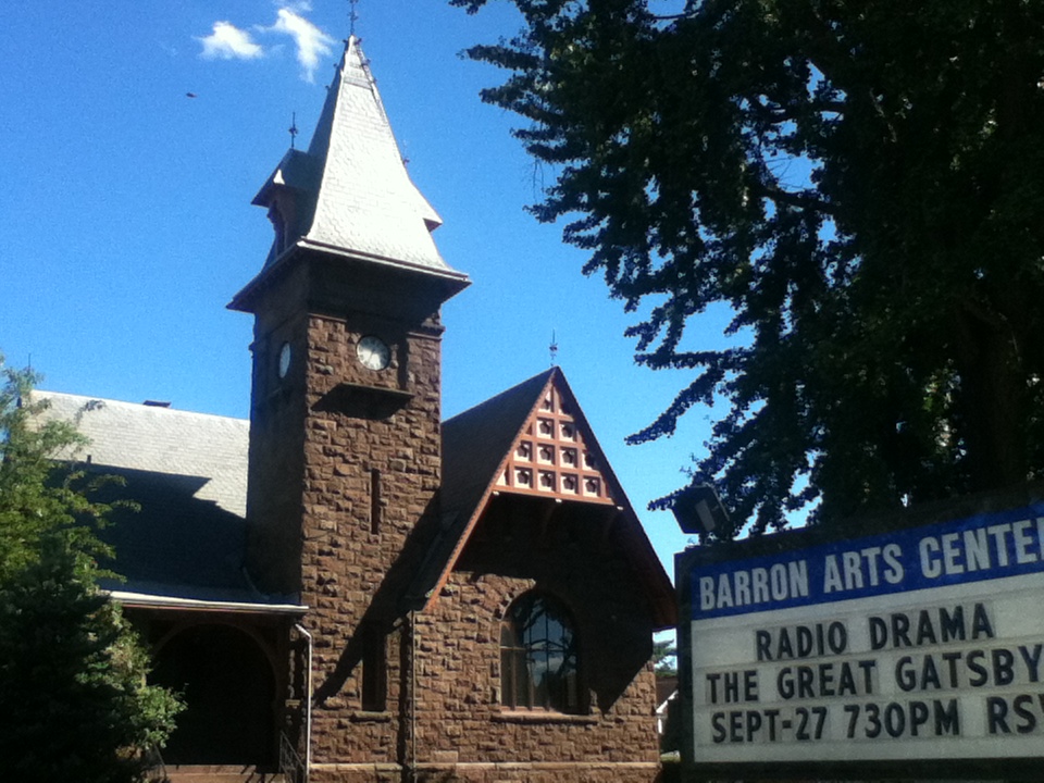
Barron Library
Monument and historic site · National Register of Historic Places · 2.7 mi
Historic building in Woodbridge, New Jersey
Mary Wilkins Freeman House
Monument and historic site · National Register of Historic Places · 2.4 mi
Historic house in Middlesex County, New Jersey

Metuchen Borough Hall
Monument and historic site · National Register of Historic Places · 2.1 mi
City hall of Metuchen, New Jersey

Metuchen Post Office
Monument and historic site · National Register of Historic Places · 2.1 mi
Historic building in Metuchen, New Jersey

Middlesex Avenue–Woodwild Park Historic District
Monument and historic site · National Register of Historic Places · 1.9 mi
Historic district in Metuchen, New Jersey


Roosevelt Hospital
Monument and historic site · National Register of Historic Places · 0.7 mi
Historic building in Edison, New Jersey

Thomas Edison Center at Menlo Park
Museum · 1.1 mi
37 Christie Street, Edison
Th,Fr,Sa 10:00-16:00
Eagleswood Military Academy
Monument and historic site · National Register of Historic Places · 3.3 mi
Thomas Alva Edison Memorial Tower and Museum
Museum · National Register of Historic Places · 1.0 mi
1 more on the map.
Parks, trails and playgrounds13

1 more on the map.
Restaurants and cafes67

Anthony's Coal Fired Pizza
Restaurant · Pizza, Wings · 0.6 mi
80 Parsonage Road, Edison
Mo-Th,Su 11:00-22:00; Fr-Sa 11:00-23:00

Baked Bouquet
Bakery · Cupcake · 0.8 mi
180 Lafayette Avenue, Edison
Tu-Fr 09:00-17:00; Sa-Su 10:00-16:00
Benihana
Restaurant · Japanese, Teppanyaki, Steak · 0.6 mi
60 Parsonage Road, Edison
Mo-Th,Su 11:30-22:00; Fr-Sa 11:30-23:00
Bombay Talk
Restaurant · Indian · 1.4 mi
1358 Oak Tree Road, Iselin
Mo-Th,Su 11:30-21:30; Fr-Sa 11:30-22:00
Brooklyn Boys Pizza & Deli
Restaurant · Pizza · 1.1 mi
9 Lincoln Highway, Edison
Mo-Th 10:00-21:30; Fr-Sa 10:00-22:00

Dave & Buster's
Diner · American · 1.3 mi
274 Woodbridge Center Drive, Woodbridge
Mo-Th 11:00-24:00; Fr 11:00-01:00, Sa 10:00-01:00, Su 10:00-24:00
Egg Mania
Restaurant · Indian · 1.4 mi
1546 Oak Tree Road, Iselin
Mo-Th 12:00-22:30; Fr 12:00-23:30; Sa 11:00-23:30; Su 11:00-22:30
IHOP
Restaurant · Breakfast, Pancake · 0.6 mi
50 Parsonage Road, Edison
Mo-Sa 07:00-22:00; Su 07:00-20:00
Kandahar
Restaurant · Turkish, Afghan · 1.4 mi
1380 Oak Tree Road, Iselin
Mo-Th,Su 11:00-21:30; Fr-Sa 11:00-22:30
LouCás
Restaurant · Italian · 1.1 mi
9 Lincoln Highway, Edison
Mo off; Tu-Th 12:00-15:00,15:00-21:30; Fr 12:00-15:00,15:00-22:00;...
Margaritas Mexican Restaurant
Restaurant · Mexican · 0.4 mi
53 US Route 1, Metuchen
Mo-Th 11:30-22:00; Fr 11:30-23:00; Sa 10:30-23:00; Su 10:30-22:00
Mee Mah
Restaurant · Chinese · 1.1 mi
9 Lincoln Highway, Edison
Mo off; Tu-Th 11:00-21:30; Fr-Sa 11:00-22:30; Su 12:00-21:30
55 more on the map.
Where to stay4
Churches and places of worship7
First Presbyterian Church
Church · National Register of Historic Places · 2.7 mi
Trinity Episcopal Church
Church · National Register of Historic Places · 2.7 mi
Shopping28
Gas and EV charging8
Schools, colleges and libraries46
Academy For Urban Leadership Charter School
School · 3.4 mi
612 Amboy Ave, Perth Amboy
Benjamin Franklin Elementary School
School · 4.4 mi
2485 Woodbridge Avenue, Edison
Healthcare8
Hackensack Meridian Health and Wellness Center at Metropark
Clinic and pharmacy · 1.0 mi
1 Wellbrook Place, Iselin
Map of Menlo Park Terrace
200 places. The map loads OpenStreetMap tiles when you open it.
Climate by month
Monthly table
| Month | High | Low | Rain | Snow |
|---|---|---|---|---|
| Jan | 41°F | 24°F | 3.8 in | 5.1 in |
| Feb | 44°F | 26°F | 3.1 in | 8.3 in |
| Mar | 53°F | 32°F | 4.3 in | 5.3 in |
| Apr | 66°F | 42°F | 3.6 in | 0.1 in |
| May | 75°F | 51°F | 4.0 in | 0.0 in |
| Jun | 84°F | 60°F | 4.3 in | 0.0 in |
| Jul | 88°F | 66°F | 5.3 in | 0.0 in |
| Aug | 86°F | 64°F | 4.0 in | 0.0 in |
| Sep | 79°F | 58°F | 4.3 in | 0.0 in |
| Oct | 66°F | 46°F | 4.3 in | 0.0 in |
| Nov | 56°F | 36°F | 3.5 in | 0.2 in |
| Dec | 46°F | 29°F | 4.2 in | 2.4 in |
U.S. Climate Normals 1991-2020 for Plainfield Hcn (5 mi away), NOAA NCEI.
People and cost of living
American Community Survey 5-year estimates, 2020-2024, U.S. Census Bureau. Estimates have margins of error, larger for small towns.
Disaster history
Middlesex County has had 17 federal disaster declarations since 2000, most often for hurricanes.
- 2021-09-05: Remnants Of Hurricane Ida (Hurricane)
- 2021-09-02: Remnants Of Hurricane Ida (Hurricane)
- 2020-03-25: Covid-19 Pandemic (Biological)
- 2020-03-13: Covid-19 (Biological)
- 2016-03-14: Severe Winter Storm And Snowstorm (Severe Storm)
- 2012-10-30: Hurricane Sandy (Hurricane)
OpenFEMA disaster declarations summaries.
Getting there and nearby towns
Linden Airport (LDJ) is the nearest airport with scheduled flights listed in OpenStreetMap, 6 miles away.
- Iselin 1 mi north, about 2 min by car
- Fords 1 mi southeast, about 2 min by car
- Woodbridge 2 mi east, about 3 min by car
- Metuchen 2 mi west, about 3 min by car
- Hopelawn 2 mi southeast, about 4 min by car
- Colonia 3 mi north, about 4 min by car
- Keasbey 3 mi south, about 4 min by car
- Avenel 3 mi northeast, about 6 min by car
- Perth Amboy 4 mi southeast, about 6 min by car
- Rahway 4 mi northeast, about 7 min by car
Drive times are estimates from straight-line distance, not routes.
Local news
Headlines from INDB, the NEMICO news database.
Reviews, tips and questions
Loading what members have shared...
Sources and licences
- NCES EDGE (Public domain): public schools
- NOAA NCEI U.S. Climate Normals 1991-2020 (Public domain): climate by month
- OpenFEMA (Public domain): disaster declarations
- OpenStreetMap contributors (ODbL 1.0): places, airports, map data
- U.S. Census Bureau (Public domain): population, income, housing, education, commute
- Wikidata (CC0 1.0): elevation, founding date, time zone, website, landmarks and historic places
- Wikimedia Commons (see each image): photos
- Wikipedia (CC BY-SA 4.0): overview and history text
Photo credits
- 300 Middlesex Avenue, Metuchen, NJ - Corbin House, Zeete, CC BY-SA 4.0
- Roosevelt Hospital, Edison, NJ - north view, Zeete, CC BY-SA 3.0
- First Presbyterian Church of Woodbridge, Perrycart, CC BY-SA 3.0
- Trinity Episcopal Church, Woodbridge, NJ - south west view, Zeete, CC BY-SA 4.0
- MetuchenNJ MaryWilkinsFreemanHouse, Magicpiano, CC BY-SA 4.0
- Barron Arts Center-Barron Library, Perrycart, CC BY-SA 3.0
- MetuchenPostOffice, KForce, CC BY-SA 3.0
- Ayers-Allen House, Metuchen, NJ, Zeete, CC BY-SA 3.0
- 2018-05-18 15 11 35 View north along U.S. Route 1 just south of the Garden State Parkway in Woodbridge Township, Middlesex County, New Jersey, Famartin, CC BY-SA 4.0
- 2020-07-16 10 41 31 View south along New Jersey State Route 444 (Garden State Parkway) at Exit 130 (U.S. Route 1, Newark, Trenton) in Woodbridge Township, Middlesex County, New Jersey, Famartin, CC BY-SA 4.0
- 2021-07-16 15 41 34 View south along U.S. Route 1 from the overpass for the ramp from New Jersey State Route 444 (Garden State Parkway) in Woodbridge Township, Middlesex County, New Jersey, Famartin, CC BY-SA 4.0
- 2021-07-16 15 43 09 View north along U.S. Route 1 from the overpass for the ramp from New Jersey State Route 444 (Garden State Parkway) in Woodbridge Township, Middlesex County, New Jersey, Famartin, CC BY-SA 4.0
- 2021-07-16 15 51 42 View north along U.S. Route 1 from the overpass for New Jersey State Route 444 (Garden State Parkway) in Woodbridge Township, Middlesex County, New Jersey, Famartin, CC BY-SA 4.0
- 2021-07-16 15 48 39 View south along U.S. Route 1 from the overpass for New Jersey State Route 444 (Garden State Parkway) in Woodbridge Township, Middlesex County, New Jersey, Famartin, CC BY-SA 4.0
- 2020-07-24 15 44 48 View north along U.S. Route 1 at the exit for the Garden State Parkway NORTH in Woodbridge Township, Middlesex County, New Jersey, Famartin, CC BY-SA 4.0
- 2021-06-05 09 57 26 View north along the southbound lanes of New Jersey State Route 444 (Garden State Parkway) from the overpass for the rail line just south of County Route 649 (Wood Avenue) in..., Famartin, CC BY-SA 4.0
- 2021-06-05 09 55 35 View south along the southbound lanes of New Jersey State Route 444 (Garden State Parkway) from the overpass for the rail line just south of County Route 649 (Wood Avenue) in..., Famartin, CC BY-SA 4.0
- 2021-06-05 09 56 22 View south along the northbound lanes of New Jersey State Route 444 (Garden State Parkway) from the overpass for the rail line just south of County Route 649 (Wood Avenue) in..., Famartin, CC BY-SA 4.0
- 2021-06-05 09 56 37 View north along the northbound lanes of New Jersey State Route 444 (Garden State Parkway) from the overpass for the rail line just south of County Route 649 (Wood Avenue) in..., Famartin, CC BY-SA 4.0
- 2020-07-24 09 37 27 View south along U.S. Route 1 at the exit for the Garden State Parkway NORTH in Woodbridge Township, Middlesex County, New Jersey, Famartin, CC BY-SA 4.0
- 2018-05-20 09 55 28 View south along New Jersey State Route 444 (Garden State Parkway) just north of Exit 129 (Interstate 95-New Jersey Turnpike, U.S. Route 9, New Jersey State Route 440, Interstate..., Famartin, CC BY-SA 4.0
- 2021-07-22 18 17 38 Onion rings at the White Castle on U.S. Route 1 in Edison Township, Middlesex County, New Jersey, Famartin, CC BY-SA 4.0
- 2021-07-22 18 16 45 A slider at the White Castle on U.S. Route 1 in Edison Township, Middlesex County, New Jersey, Famartin, CC BY-SA 4.0
- 2021-07-22 18 16 32 A slider at the White Castle on U.S. Route 1 in Edison Township, Middlesex County, New Jersey, Famartin, CC BY-SA 4.0
- Red lobster menu (6983708679), Krista, CC BY 2.0
- 2021-06-05 10 08 18 View south along the southbound lanes of New Jersey State Route 444 (Garden State Parkway) from the overpass for Middlesex County Route 649 (Wood Avenue) in Woodbridge Township..., Famartin, CC BY-SA 4.0
- 2020-07-11 15 45 05 View north along New Jersey State Route 444 (Garden State Parkway) at Exit 131A (Wood Avenue SOUTH) in Woodbridge Township, Middlesex County, New Jersey, Famartin, CC BY-SA 4.0
- 2021-06-05 10 10 33 View north along the southbound lanes of New Jersey State Route 444 (Garden State Parkway) from the overpass for Middlesex County Route 649 (Wood Avenue) in Woodbridge Township..., Famartin, CC BY-SA 4.0
- Menlo Park Noth Parking Lot Entrance, Curlyrnd, CC BY-SA 4.0
- Menlo Park Noth Parking Lot Road 1, Curlyrnd, CC BY-SA 4.0
- Menlo Park Noth Parking Lot Aisle 1 (2), Curlyrnd, CC BY-SA 4.0
- Menlo Park - Plegcy, Curlyrnd, CC BY-SA 4.0
- Menlo Park - Cacique, Curlyrnd, CC BY-SA 4.0
- Menlo Park Noth Parking Lot Aisle 2, Curlyrnd, CC BY-SA 4.0
- Menlo Park - Coca Cola 1, Curlyrnd, CC BY-SA 4.0
- Menlo Park Noth Parking Lot Aisle 1, Curlyrnd, CC BY-SA 4.0
- Menlo Park Noth Parking Lot Aisle 1 (4), Curlyrnd, CC BY-SA 4.0
- Menlo Park - Coca Cola 2, Curlyrnd, CC BY-SA 4.0
- 2021-06-05 10 09 05 View south along the northbound lanes of New Jersey State Route 444 (Garden State Parkway) from the overpass for Middlesex County Route 649 (Wood Avenue) in Woodbridge Township..., Famartin, CC BY-SA 4.0
- Mall Menlo Park Mall 11, Curlyrnd, CC BY-SA 4.0


Page built October 30, 2026. Spotted a mistake? Tell us or suggest a place.