


St. Louis Park, Minnesota
St. Louis Park is a city of 49,594 people in Hennepin County, Minnesota, founded in 1852.
Why visit St. Louis Park
Townapedia lists 90 museums and landmarks, 142 parks and trails, 185 places to eat, 9 places to stay and 7 attractions in and around town.
Highlights include Emagine Willow Creek, Bryant-Lake Bowl, Dr. Oscar Owre House and Frieda and Henry J. Neils House.
July is the warmest month, with average highs of 82°F; January lows average 7°F, and about 54 inches of snow fall in a normal year.
Weather in St. Louis Park
Forecast from the National Weather Service. Full forecast
About St. Louis Park
St. Louis Park is a city in Hennepin County, Minnesota, United States. The population was 50,010 recorded in the 2020 census. It is a first-ring suburb immediately west of Minneapolis. Other adjacent cities include Edina, Golden Valley, Minnetonka, Plymouth, and Hopkins.
From the Wikipedia article St. Louis Park, Minnesota (this version), under CC BY-SA 4.0.
Things to do7

Bryant-Lake Bowl
Cinema and theater · 3.7 mi
Bowling alley, restaurant, bar, and theatre in Minnesota

Dunwoody College of Technology
School · 4.0 mi
Private technology school in Minneapolis, Minnesota
Pantages Theatre
Cinema and theater · 4.8 mi
Theater in Minneapolis, Minnesota
Showplace ICON
Cinema and theater · 1.5 mi
1625 West End Boulevard, Saint Louis Park
Museums and landmarks90

Dr. Oscar Owre House
Monument and historic site · National Register of Historic Places · 3.0 mi
Historic house in Minneapolis, Minnesota
2625 Newton Avenue South, Minneapolis

Frieda and Henry J. Neils House
Monument and historic site · National Register of Historic Places · 2.4 mi
Historic house in Minnesota, United States
2801 Burnham Boulevard, Minneapolis

Loren L. Chadwick Cottages
Monument and historic site · National Register of Historic Places · 2.8 mi
Historic house in Minnesota, United States
2617 West 40th Street, Minneapolis

Minnehaha Grange Hall
Monument and historic site · National Register of Historic Places · 2.7 mi
Building in Edina, Minnesota, United States
Th 09:00-12:00; Sa 10:00-12:00
Peavey–Haglin Experimental Concrete Grain Elevator
Monument and historic site · National Register of Historic Places · 1.1 mi
United States historic place

The Bakken Museum
Museum · 2.3 mi
Zenith Avenue South, Minneapolis
Tu-Th 12:00-16:00; Fr-Su 10:00-16:00

Abbott Hospital
Monument and historic site · National Register of Historic Places · 4.5 mi
Apartment building and former hospital in Minneapolis, Minnesota, USA
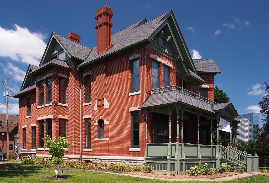
Amos B. Coe House
Monument and historic site · National Register of Historic Places · 4.7 mi
House in Minneapolis, Minnesota

Anne C. and Frank B. Semple House
Monument and historic site · National Register of Historic Places · 4.3 mi
Historic house in Minneapolis, Minnesota, United States

Architects and Engineers Building
Monument and historic site · National Register of Historic Places · 4.7 mi
Office building in downtown Minneapolis, Minnesota, United States


Bennett–McBride House
Monument and historic site · National Register of Historic Places · 4.5 mi
Minneapolis, Minnesota, NRHP-listed in Hennepin County

Bridge No. 90646
Monument and historic site · National Register of Historic Places · 3.0 mi
Road bridge over Minnehaha Creek in Edina, Minnesota
78 more on the map.
Parks, trails and playgrounds142

Cedar Lake East Beach
Beach · 2.4 mi
Beach in Minneapolis, Minnesota, United States
2000 Upton Avenue South, Minneapolis

Eloise Butler Wildflower Garden
Park · 2.8 mi
1 Theodore Wirth Parkway, Minneapolis
Apr 15-Oct 15: Tu-Su 07:30-18:00; Apr 15-Aug 31: Th 07:30-20:00;...
Lyndale Park
Park · 3.7 mi
City park in Minneapolis, Minnesota, United States
Theodore Wirth Park
Park · 2.9 mi
Park in Hennepin County, Minnesota, United States

Breck School Anderson Ice Arena
Sports field and stadium · 3.0 mi
4210 Olson Memorial Highway, Golden Valley
130 more on the map.
Restaurants and cafes185

Starbucks
Cafe · Coffee Shop · 2.6 mi
5121 Gus Young Lane, Vernon Shops
Mo-Fr 05:30-20:00; Sa,Su 06:00-19:30

Applebee's
Diner · American · 1.3 mi
8312 Minnesota State Highway 7, Saint Louis Park
Su-Th 11:00-24:00, Fr,Sa 11:00-01:00

Blaze Pizza
Restaurant · Pizza · 1.2 mi
8126 Minnesota State Highway 7, Saint Louis Park
Mo-Su 11:00-22:00
Brito's Burrito
Restaurant · Mexican · 0.9 mi
8114 Minnetonka Boulevard, Saint Louis Park
Mo-Fr 10:00-21:00; Sa 09:00-21:00; Su 09:00-20:00
Caribou Coffee
Cafe · Coffee Shop · 1.2 mi
8208 Minnesota State Highway 7, Saint Louis Park
Mo-Fr 06:30-18:00; Sa,Su 07:00-18:00
Coconut Thai
Restaurant · Thai · 3.0 mi
3948 West 50th Street, Edina
Mo-Sa 11:00-21:00; Su 16:00-20:00
Crave
Restaurant · 1.6 mi
Bustling contemporary haungout featuring an eclectic mix of American fare & sushi.
1603 West End Blvd, St Louis Park, MN 55416
Mo-Th 11:00-22:00; Su 11:00-21:00; Fr, Sa 11:00-23:00
D'Amico & Sons
Restaurant · Italian · 3.0 mi
3948 West 50th Street, Edina
Su-We 11:00-20:00; Th-Sa 11:00-21:00
Great Wall Chinese Restaurant
Restaurant · Chinese · 2.6 mi
4515 France Avenue South, Edina
Su-Th 11:00-21:30; Fr,Sa 11:00-22:00
Green and the Grain
Restaurant · 1.7 mi
A quick service eatery serving premium salads + wraps, organic frozen yogurt and acai bowls.
1601 Utica Avenue South
Mo-Th 09:00-20:00; Fr 09:00-15:00; Sa 10:00-15:00
173 more on the map.
Where to stay9
AC Hotel by Marriott Minneapolis West End
Motel and hotel · 1.8 mi
5075 Wayzata Boulevard, Saint Louis Park
DoubleTree by Hilton Hotel Minneapolis - Park Place
Motel and hotel · 1.5 mi
1500 Park Place Boulevard, Saint Louis Park
Churches and places of worship41
Basilica of Saint Mary
Church · National Register of Historic Places · 4.2 mi
Wesley United Methodist Church
Church · National Register of Historic Places · 4.6 mi
Speak the Word Church International
Church · Pentecostal · 1.8 mi
515 Jersey Avenue South, Golden Valley
Shopping41
Gas and EV charging31
Schools, colleges and libraries72
Linden Hills Library
Library · National Register of Historic Places · 2.9 mi
2900 West 43rd Street, Minneapolis
Benilde-St. Margaret's
School · Catholic · 1.2 mi
2501 Highway 100, Saint Louis Park
Healthcare38
Park Nicollet Specialty Center at Methodist Hospital
Clinic and pharmacy · 1.3 mi
3931 Louisiana Avenue South
Park Nicollet Struthers Parkinson's Center
Clinic and pharmacy · 2.5 mi
6701 Country Club Drive, Golden Valley
Aesthetica Skin Health & Wellness Clinic, Inc.
Clinic and pharmacy · 1.6 mi
4725 Excelsior Boulevard, Saint Louis Park
Map of St. Louis Park
250 places. The map loads OpenStreetMap tiles when you open it.
Climate by month
Monthly table
| Month | High | Low | Rain | Snow |
|---|---|---|---|---|
| Jan | 24°F | 7°F | 0.9 in | 10.1 in |
| Feb | 29°F | 11°F | 1.0 in | 10.1 in |
| Mar | 42°F | 23°F | 1.9 in | 9.0 in |
| Apr | 57°F | 35°F | 3.3 in | 5.1 in |
| May | 69°F | 48°F | 4.5 in | 0.0 in |
| Jun | 78°F | 58°F | 4.6 in | 0.0 in |
| Jul | 82°F | 63°F | 4.5 in | 0.0 in |
| Aug | 80°F | 61°F | 4.2 in | 0.0 in |
| Sep | 72°F | 52°F | 3.5 in | 0.0 in |
| Oct | 57°F | 39°F | 3.0 in | 0.8 in |
| Nov | 41°F | 26°F | 1.9 in | 6.9 in |
| Dec | 28°F | 14°F | 1.4 in | 12.3 in |
U.S. Climate Normals 1991-2020 for New Hope (4 mi away), NOAA NCEI.
People and cost of living
American Community Survey 5-year estimates, 2020-2024, U.S. Census Bureau. Estimates have margins of error, larger for small towns.
Disaster history
Hennepin County has had 10 federal disaster declarations since 2000, most often for floods.
- 2020-04-07: Covid-19 Pandemic (Biological)
- 2020-03-13: Covid-19 (Biological)
- 2016-11-02: Severe Storms And Flooding (Flood)
- 2014-07-21: Severe Storms, Straight-Line Winds, Flooding, Landslides, And Mudslides (Flood)
- 2013-07-25: Severe Storms, Straight-Line Winds, And Flooding (Severe Storm)
- 2011-06-07: Severe Storms And Tornadoes (Severe Storm)
OpenFEMA disaster declarations summaries.
Getting there and nearby towns
Crystal Airport (MIC) is the nearest airport with scheduled flights listed in OpenStreetMap, 8 miles away.
- Hopkins 3 mi southwest, about 4 min by car
- Golden Valley 3 mi north, about 5 min by car
- Edina 4 mi south, about 6 min by car
- Minneapolis 5 mi east, about 8 min by car
- Minnetonka 5 mi west, about 8 min by car
- Robbinsdale 6 mi north, about 9 min by car
- Crystal 6 mi north, about 10 min by car
- New Hope 6 mi north, about 10 min by car
- Richfield 7 mi southeast, about 11 min by car
- Plymouth 7 mi northwest, about 11 min by car
Drive times are estimates from straight-line distance, not routes.
Local news
Headlines from INDB, the NEMICO news database.
Reviews, tips and questions
Loading what members have shared...
Sources and licences
- NCES EDGE (Public domain): public schools
- NOAA NCEI U.S. Climate Normals 1991-2020 (Public domain): climate by month
- OpenFEMA (Public domain): disaster declarations
- OpenStreetMap contributors (ODbL 1.0): places, airports, map data
- U.S. Census Bureau (Public domain): population, income, housing, education, commute
- Wikidata (CC0 1.0): elevation, founding date, time zone, website, landmarks and historic places
- Wikimedia Commons (see each image): photos
- Wikipedia (CC BY-SA 4.0): overview and history text
Photo credits
- SLPCH, William Wesen ( Appraiser at English Wikipedia ), Public domain
- Linden Hills Branch Library, Teemu008, CC BY-SA 2.0
- Loren L. Chadwick Cottages, McGhiever, CC BY-SA 4.0
- Minnehaha Grange 4, Elkman, CC BY-SA 3.0
- Peavey–Haglin Experimental Concrete Grain Elevator crop, McGhiever, CC BY-SA 4.0
- Oscar Owre, Elkman, CC BY-SA 4.0
- Frieda and Henry J. Neils House, McGhiever, CC BY 4.0
- Charles H. Burwell House, McGhiever, CC BY-SA 4.0
- Cahill School, McGhiever, CC BY-SA 4.0
- Church of Saint Stephen from Washburn Fair Oaks Park, Alvintrusty, CC BY-SA 3.0
- Elizabeth C. Quinlan House, McGhiever, CC BY-SA 4.0
- Hopkins MN Mainstreet, Tim Kiser ( w:User:Malepheasant ), CC BY-SA 2.5
- Floyd B. Olson House 2, Elkman, CC BY-SA 4.0
- Interlachen Bridge 1, Elkman, CC BY-SA 4.0
- Grimes House 3, Elkman, CC BY-SA 4.0
- Bennett-McBride 1, Elkman, CC BY-SA 4.0
- Scottish Rite Temple 5, Elkman, CC BY-SA 4.0
- Fountain-Peavey Plaza-Minneapolis-20050927, Jim Winstead Jr. from los angeles, usa, Web: http://trainedmonkey.com, CC BY 2.0
- Washburn-Fair Oaks Mansion District, McGhiever, CC BY-SA 4.0
- Healy Block Residential HD, McGhiever, CC BY-SA 4.0
- Country Club HD 02, McGhiever, CC BY-SA 4.0
- Elisha-Lizzie Morse House 4, Elkman, CC BY-SA 4.0
- White Castle Building No. 8, McGhiever, CC BY-SA 3.0
- Pence Automobile Company Building, McGhiever, CC BY-SA 3.0
- Midtown Greenway, Michael Hicks, CC BY 2.0
- 2015StateTheatreMPLS, Jonathunder, GFDL 1.2
- Charles J. Martin House, McGhiever, CC BY-SA 4.0
- Washburn Park Water Tower 01, McGhiever, CC BY-SA 4.0
- Lincoln Bank Building, McGhiever, CC BY-SA 3.0
- Elbert L. Carpenter House, McGhiever, CC BY-SA 4.0
- 2008-0705-BasilicaStMary, Bobak Ha'Eri, CC BY 3.0
- Amos B. Coe House, McGhiever, CC BY-SA 3.0
- Architects & Engineers Building, McGhiever, CC BY 4.0
- Abbott Hospital, McGhiever, CC BY-SA 4.0
- Semple House, McGhiever, CC BY-SA 4.0
- Ripley Memorial Hospital 1, McGhiever, CC BY-SA 4.0
- Van Dusen Mansion, McGhiever, CC BY-SA 3.0
- Northwestern Knitting Company Factory, McGhiever, CC BY-SA 3.0
- H Alden Smith 1, Elkman, CC BY-SA 4.0
- Swinford Townhouses & Apartments, McGhiever, CC BY-SA 4.0


Page built October 30, 2026. Spotted a mistake? Tell us or suggest a place.