


Ban Bang Kadi, Thailand
Ban Bang Kadi is a town of 27,911 people in Pathum Thani, Thailand.
Why visit Ban Bang Kadi
Townapedia lists 1 museum or landmark, 1 park or trail, 9 places to eat and 1 place to stay in and around town.
Highlights include Rare Stone Museum.
Weather in Ban Bang Kadi
Forecast from MET Norway (CC BY 4.0). Full forecast
Photos of Ban Bang Kadi


Museums and landmarks1
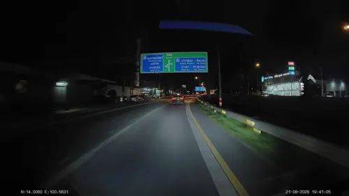
Rare Stone Museum
Museum · 1.7 km
Museum of stones, minerals, fossils in Thailand
Parks, trails and playgrounds1

Restaurants and cafes9
After 5 pm.
Restaurant · Fine Dining, Steak, Thai, Fusion · 1.7 km
29/9 หมู่1 ถนนรังสิต-ปทุมธานี, บ้านกลาง
Mo-Su 17:00 - 00:00



Where to stay1

Shopping1
Gas and EV charging6
Schools, colleges and libraries3
Healthcare1
Map of Ban Bang Kadi
23 places. The map loads OpenStreetMap tiles when you open it.
Getting there and nearby towns
Don Mueang International Airport (DMK) is the nearest airport with scheduled flights listed in OpenStreetMap, 11 km away.
- Pak Kret 11 km southwest, about 11 min by car
- Lak Si 13 km south, about 13 min by car
- Sai Mai 14 km southeast, about 14 min by car
- Mueang Nonthaburi 16 km south, about 16 min by car
- Chatuchak 19 km south, about 19 min by car
- Bang Sue 21 km south, about 21 min by car
- Lat Phrao 23 km south, about 23 min by car
- Din Daeng 23 km south, about 23 min by car
- Bang Phlat 23 km south, about 23 min by car
- Bangkok 28 km south, about 28 min by car
Drive times are estimates from straight-line distance, not routes.
Towns near Ban Bang Kadi


Keep exploring
Local news
Headlines from INDB.
Reviews, tips and questions
Loading what members have shared...
Sources and licences
- GeoNames (CC BY 4.0): population, coordinates, regions and time zone
- Mapillary (see each image): photos
- OpenStreetMap contributors (ODbL 1.0): places, airports, map data
- Wikidata (CC0 1.0): elevation, founding date, time zone, website, landmarks and historic places
- Wikimedia Commons (see each image): photos
Photo credits
- วัดมะขาม อ.เมือง จ.ปทุมธานี (10), กสิณธร ราชโอรส, CC BY-SA 4.0
- วัดมะขาม อ.เมือง จ.ปทุมธานี (9), กสิณธร ราชโอรส, CC BY-SA 4.0
- วัดมะขาม3, Akarapon123456, CC BY-SA 3.0
- วัดมะขาม อ.เมือง จ.ปทุมธานี (7), กสิณธร ราชโอรส, CC BY-SA 4.0
- วัดมะขาม อ.เมือง จ.ปทุมธานี (14), กสิณธร ราชโอรส, CC BY-SA 4.0
- วัดมะขาม4, Akarapon123456, CC BY-SA 3.0
- วัดมะขาม อ.เมือง จ.ปทุมธานี (15), กสิณธร ราชโอรส, CC BY-SA 4.0
- วัดมะขาม อ.เมือง จ.ปทุมธานี (3), กสิณธร ราชโอรส, CC BY-SA 4.0
- วัดมะขาม., Akarapon123456, CC BY-SA 3.0
- วัดมะขาม อ.เมือง จ.ปทุมธานี (13), กสิณธร ราชโอรส, CC BY-SA 4.0
- วัดมะขาม2, Akarapon123456, CC BY-SA 3.0
- วัดมะขาม5, Akarapon123456, CC BY-SA 3.0
- วัดมะขาม อ.เมือง จ.ปทุมธานี (12), กสิณธร ราชโอรส, CC BY-SA 4.0
- วัดมะขาม อ.เมือง จ.ปทุมธานี (1), กสิณธร ราชโอรส, CC BY-SA 4.0
- วัดมะขาม อ.เมือง จ.ปทุมธานี (4), กสิณธร ราชโอรส, CC BY-SA 4.0
- วัดมะขาม อ.เมือง จ.ปทุมธานี (5), กสิณธร ราชโอรส, CC BY-SA 4.0
- วัดมะขาม อ.เมือง จ.ปทุมธานี (11), กสิณธร ราชโอรส, CC BY-SA 4.0
- วัดมะขาม อ.เมือง จ.ปทุมธานี (8), กสิณธร ราชโอรส, CC BY-SA 4.0
- วัดมะขาม อ.เมือง จ.ปทุมธานี (6), กสิณธร ราชโอรส, CC BY-SA 4.0
- วัดมะขาม1, Akarapon123456, CC BY-SA 3.0
- วัดมะขาม อ.เมือง จ.ปทุมธานี (2), กสิณธร ราชโอรส, CC BY-SA 4.0
- วัดศาลเจ้า ปทุมธานี Wat San Chao Pathum Thani December 2020 แปะกงโรงสี 06, Chainwit., CC BY-SA 4.0
- วัดศาลเจ้า ปทุมธานี Wat San Chao Pathum Thani December 2020 แปะกงโรงสี 02, Chainwit., CC BY-SA 4.0
- วัดศาลเจ้า ปทุมธานี Wat San Chao Pathum Thani December 2020 แปะกงโรงสี 01, Chainwit., CC BY-SA 4.0
- วัดศาลเจ้า ปทุมธานี Wat San Chao Pathum Thani December 2020 แปะกงโรงสี 07, Chainwit., CC BY-SA 4.0
- วัดศาลเจ้า ปทุมธานี Wat San Chao Pathum Thani December 2020 แปะกงโรงสี 05, Chainwit., CC BY-SA 4.0
- วัดศาลเจ้า ปทุมธานี Wat San Chao Pathum Thani December 2020 แปะกงโรงสี 03, Chainwit., CC BY-SA 4.0
- วัดศาลเจ้า ปทุมธานี Wat San Chao Pathum Thani December 2020 แปะกงโรงสี 04, Chainwit., CC BY-SA 4.0
- Khāo Khā Mū, User:Bi89, CC BY-SA 3.0
- Street-level photo, ThailandCambodia, CC BY-SA 4.0
- Street-level photo, ThailandCambodia, CC BY-SA 4.0
- Street-level photo, ThailandCambodia, CC BY-SA 4.0
- Street-level photo, ThailandCambodia, CC BY-SA 4.0
- Street-level photo, ThailandCambodia, CC BY-SA 4.0
- Street-level photo, ThailandCambodia, CC BY-SA 4.0
- Street-level photo, ThailandCambodia, CC BY-SA 4.0


Page built November 10, 2026. Spotted a mistake? Tell us or suggest a place.