


Ban Sam Chuk, Thailand
Ban Sam Chuk is a town of 13,438 people in Suphan Buri, Thailand.
Loading the weather...
Population13,438
GeoNames
RegionSuphan Buri
Elevation13 m
43 ft
Time zoneAsia/Bangkok
Nearest airportKhok Kathiam Airforce Base (KKM)
63 km
Why visit Ban Sam Chuk
Townapedia lists 2 museums and landmarks and 2 places to eat in and around town.
Highlights include Old Market Sam Chuk.
Weather in Ban Sam Chuk
Forecast from MET Norway (CC BY 4.0). Full forecast
Photos of Ban Sam Chuk


Museums and landmarks2
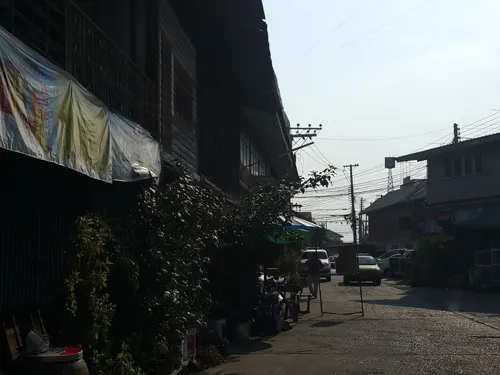
Old Market Sam Chuk
Monument and historic site · 1.5 km
ซอย เทศบาลซอย 9
Mo-Su 08:00-18:00

Restaurants and cafes2

Churches and places of worship3

Shopping1

Gas and EV charging5
Schools, colleges and libraries3
Healthcare1
Map of Ban Sam Chuk
17 places. The map loads OpenStreetMap tiles when you open it.
Getting there and nearby towns
Khok Kathiam Airforce Base (KKM) is the nearest airport with scheduled flights listed in OpenStreetMap, 63 km away.
- Doembang Nangbuat 10 km north, about 10 min by car
- Bang Racham 29 km northeast, about 29 min by car
- Suphan Buri 30 km south, about 30 min by car
- Wiset Chaichan 31 km southeast, about 31 min by car
- Pho Thong 35 km east, about 35 min by car
- Sing Buri 37 km northeast, about 37 min by car
- In Buri 38 km northeast, about 38 min by car
- Chaiyo 41 km east, about 41 min by car
- Lop Buri 60 km east, about 1 h by car
- Phra Nakhon Si Ayutthaya 68 km southeast, about 1 h 15 min by car
Drive times are estimates from straight-line distance, not routes.
Towns near Ban Sam Chuk


Keep exploring
Local news
Headlines from INDB.
Reviews, tips and questions
Loading what members have shared...
Sources and licences
- GeoNames (CC BY 4.0): population, coordinates, regions and time zone
- Mapillary (see each image): photos
- OpenStreetMap contributors (ODbL 1.0): places, airports, map data
- Wikidata (CC0 1.0): elevation, founding date, time zone, website
- Wikimedia Commons (see each image): photos
Photo credits
- ศาลเจ้าพ่อหลักเมือง03 ต.รั้วใหญ่ อ.เมือง สุพรรณบุรี, Yutthana Jarernsawat, CC BY-SA 4.0
- วัดสามชุก03, Yutthana Jarernsawat, CC BY-SA 4.0
- 03วักลาดสิงห์01, Yutthana Jarernsawat, CC BY-SA 4.0
- Bridge at the 100-year old market in Surap Buri, PumpkinSky, CC BY-SA 4.0
- Sam chuk - panoramio, Boonchai C, CC BY 3.0
- Sam chuk - panoramio - Boonchai C, Boonchai C, CC BY 3.0
- Sam chuk Supanburi - panoramio, Boonchai C, CC BY 3.0
- Sam Chuk water fountain, PumpkinSky, CC BY-SA 4.0
- ต้นโพธิ์(sacred fig) ที่ตลาดสามชุก,Samchuk market,Sam Chuk District,Suphanburi Province,Thailand - panoramio, ::::=UT=::::, CC BY-SA 3.0
- Fighter - panoramio - Boonchai C, Boonchai C, CC BY 3.0
- So fresh - panoramio, Boonchai C, CC BY 3.0
- วัดภูมินทร์ ต.ในเวียง อ.เมืองน่าน, Yutthana Jarernsawat, CC BY-SA 4.0
- Street-level photo, jrcarlsen, CC BY-SA 4.0
- Street-level photo, ThailandCambodia, CC BY-SA 4.0
- Street-level photo, ThailandCambodia, CC BY-SA 4.0
- Street-level photo, ThailandCambodia, CC BY-SA 4.0
- Street-level photo, ThailandCambodia, CC BY-SA 4.0
- Street-level photo, ThailandCambodia, CC BY-SA 4.0
Page built November 10, 2026. Spotted a mistake? Tell us or suggest a place.